webshop.nl
Categorieën
  Sluiten

Meer Cicerone

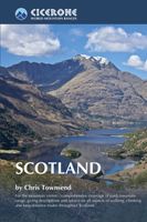
Wandelgids Scotland | Cicerone

0
Als je wilt wandelen in Schotland is dit het ultieme naslagwerk. A resource book covering the finest walks and climbs in Scotland, with its variety of wild landscapes ranging from the Southern Uplands to the great granite plateaus of the Cairngorms to the jagged arêtes of the Cuillin hills on the Isle of Skye. Whatever activity you are planning thi...

Webshops met dit product

Webshop
Bezorging
Prijs

Anderen bekeken ook

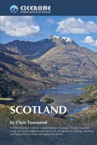
Wandelgids Scotland | Cicerone
Als je wilt wandelen in Schotland is dit het ultieme naslagwerk. A resource book covering the finest walks and climbs in Scotland, with its variety of wild landscapes ranging from the Southern Uplands to the great granite plateaus of the Cairngorms to the jagged arêtes of the Cuillin hills on the Isle of Skye. Whatever activity you are planning this guide has the information the independent mountain lover needs. Scotland is a mountainous country with a wide variety of wild landscapes: there are the rolling hills of the Southern Uplands, the great granite plateaus of the Cairngorms, the steep castellated rock peaks of Torridon and the jagged narrow aretes and spires of the Cuillin hills on the Isle of Skye. Of the many majestic summits, 284 reach 3000ft or more; these are the Munros, the ascent of which is the aim of many walkers. Below them lie splendid pine forests, beautiful lochs, deep glens, rushing rivers; a magnificent northern landscape. Whether you are planning a day scramble o…
35,95
Wandelgids Walking The Munros Vol 1 Southern, Central and Western High
Uitstekende wandelgids van het zuiden, midden en westen van de Schotse Hooglanden. Goed beschreven met veel praktische informatie om de route te kunnen lopen, inclusief redelijke kaarten. Guidebook to walking the Munros in southern, central and western Highlands. Describes 69 challenging routes across 139 of the iconic 3000ft+ mountains covering areas such as Glencoe, Bridge of Orchy and Mull. Includes routes up Ben More, Ben Alder, Ben Lomond and Ben Nevis, the highest mountain in the British Isles. Volume 1 of two guidebooks.   Seasons The guide is intended for summer hillwalkers (usually April/May to October in Scotland). In winter conditions the routes become more serious mountaineering expeditions requiring appropriate skills, equipment and experience.   Centres Arrochar, Crianlarich, Killin, Pitlochry, Tyndrum, Glencoe, Fort William, Spean Bridge, Dalwhinnie, Braemar, Glenshee   Difficulty Most of the Munros are straightforward walks but some involve ridge walking, scr…
20,95
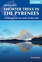
Wandelgids Shorter Treks in the Pyrenees | Cicerone
Uitstekende wandelgids van dit geweldige gebied. Goed beschreven met veel praktische informatie om de route te kunnen lopen, inclusief redelijke kaarten. A guidebook to seven circular treks exploring the Pyrenees of France and Spain. Seven 1 or 2 week routes in dramatic mountain scenery, including the Pic du Midi d'Ossau, Vignemale, Ordesa Canyon, Gavernie, Puigmal and Canigou. Using mostly waymarked mountain paths, with some boulderfield or easy scrambling, the treks are designed with accommodation in mountain refuges or mountain villages at the end of each stage, though there are plenty of options to camp for those who prefer to backpack. Detailed descriptions for each stage of the route are accompanied by sketch maps and elevation profiles, and there are notes on planning, equipment and access. The Pyrenees stretch 400km from Atlantic to Mediterranean, forming a barrier rising to over 3000m between France and Spain. The steep rolling hills of the Basque Country give way to the spe…
23,95
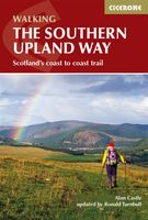
Wandelgids The Southern Upland Way | Cicerone
Uitstekende wandelgids van de Southern Upland Way, waarbij naast alle noodzakelijke informatie ook gebruik gemaakt wordt van de echte topografische kaart.   The Southern Upland Way is Scotland's coast-to-coast walk and the longest of the nation's Great Trails. 215 miles long, it links the pretty harbour village of Portpatrick on the west coast with Cockburnspath, a little south of Dunbar, in the east. The walk is at times a strenuous one, crossing the remote high moorland of the Galloway Hills, Carsphairn range, Lowthers, Ettrick Hills and Lammermuirs, calling for competence, fitness and self-reliance.    This guide presents advice on how best to plan and tackle this challenging but highly rewarding journey. The waymarked trail is presented in fourteen stages of 9–19 miles and suggestions for a rest day exploring Moffat and its environs are also included. It is possible either to backpack, taking advantage of five bothies and unlimited wild camping possibilities, or to stay in towns…
20,95
Wandelgids Skye's Cuillin Ridge Traverse | Cicerone
A guidebook to the Isle of Skye’s Cuillin Ridge Traverse. This 2-volume set is a comprehensive guide to planning and completing this challenging and technical 12km scramble. With a route that includes scrambling sections to Grade 3, technical climbs to Severe and a handful of abseils, a head for heights, technical skill and mental and physical stamina are needed.   Volume 1 contains planning and logistics information, training notes, recommended gear list and safety tips. This volume also includes in-depth route description and advice for completing the traverse in winter Volume 2 focuses on the traverse itself, across 10 sections a step-by-step guide to traversing the ridge is given with full route description, Harvey mapping and photo topos. This volume is the perfect size to carry with you during the traverse The traverse is typically completed over 1-2 days 10 classic Cuillin scrambles are also included that can be used as practice routes Easier climbing alternatives (Cuillin Ridge…
27,95
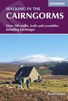
Wandelgids Walking in the Cairngorms | Cicerone
Uitstekende wandelgids, sommige meerdaags, voor dit uitdagende wandelgebied in Schotland. This guidebook contains over 100 routes for walking in the Scottish Cairngorms. It includes 18 Munro summits and smaller viewpoint hills. Walks range in length from 1 to 26 miles and are graded for difficulty.    For the adventurous there are the best of the area's rocky scrambles, and the classic through-routes including the Lairig Ghru. For those looking for a more gentle alternative, there are easy, sandy trails wandering among the tall pines and along the banks of the great rivers Spey, Nethy and Dee.    Britain's biggest mountain range is home to exceptional and varied scenery - from the ancient Caledonian forest to the granite plateau, the glacial glens and high corries where green lochans lie below great crags of the plateau rim.  Along with the main Cairngorm range between Speyside and Deeside, the guidebook covers Lochnagar. It includes practical information on snack stops, public t…
20,95

Klanten-reviews van Wandelgids Scotland | Cicerone

Er zijn nog geen beoordelingen voor dit productBen jij de eerste die een review plaatst?

Meer over Wandelgids Scotland | Cicerone

Productomschrijving

Als je wilt wandelen in Schotland is dit het ultieme naslagwerk. A resource book covering the finest walks and climbs in Scotland, with its variety of wild landscapes ranging from the Southern Uplands to the great granite plateaus of the Cairngorms to the jagged arêtes of the Cuillin hills on the Isle of Skye. Whatever activity you are planning this guide has the information the independent mountain lover needs. Scotland is a mountainous country with a wide variety of wild landscapes: there are the rolling hills of the Southern Uplands, the great granite plateaus of the Cairngorms, the steep castellated rock peaks of Torridon and the jagged narrow aretes and spires of the Cuillin hills on the Isle of Skye. Of the many majestic summits, 284 reach 3000ft or more; these are the Munros, the ascent of which is the aim of many walkers. Below them lie splendid pine forests, beautiful lochs, deep glens, rushing rivers; a magnificent northern landscape. Whether you are planning a day scramble or a long-distance walk, Scotland World’s Mountain Range guide has the information the independent mountain lover needs. • area-by-area descriptions of the Scottish mountains from south to north to help you identify the best locations for hill walking, mountaineering and ski touring • classic ascents and walks described, from scrambles up Ben Nevis to ski tours in the Cairngorms • information on accommodation, maps and guides • a planning tool for long-distance treks in Scotland

Productspecificaties

Artikelnummer(s)
Brand
Cicerone
Webshop.nl maakt gebruik van cookies. Ga je verder op onze website, ga dan akkoord met het plaatsen van cookies en de verwerking van deze data door ons en vermelde partners.