webshop.nl
Categorieën
  Sluiten

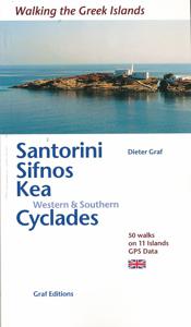
Wandelgids Santorini, Sifnos, Kea - Western and Southern Cyclades | Graf editions

Wandelen op de Griekse Eilanden met deze klein formaat Engelstalige wandelgids Anafi, Folegandros, Ios, Kea, Kimolos, Kithnos, Milos, Santorini, Thirassia, Serifos, Sifnos, Sikinos, bij elke uitgebreid beschreven dagwandeltocht is een gedetailleerde routekaart afgebeeld en foto's ter orientering van de moeilijke, verwarrende trajecten. Van de uitge...
19,50

Webshops met dit product

Webshop
Bezorging
Prijs

Anderen bekeken ook

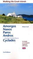
Wandelgids Amorgos, Naxos, Paro, Andros & eastern and northern Cycladen | Graf editions
Wandelgids met 56 wandelingen op 12 eilanden. Het boekje beschrijft de mooiste oude wandelroutes. Met gedetaileerde kaartjes, looptijden, GPS points en foto's van standpunten voor een betere orientatie. Met : Amorgós Ándros Antíparos Donoússa Irakliá Koufonísi Mýkonos Náxos Páros Schinoússa Sýros Tínos Van de uitgever This book describes the loveliest old walking trails. With precise descriptions, detailed maps, exact times, GPS points and photos of outstanding places for better orientation. And lots of useful knowledge about the "Islands of Light." It is made for island hoppers who want to drift through the island world by ship and who would also like to hike and swim in this ancient cultural landscape.   For the update of this new edition all the tracks and paths have been newly walked along and rechecked. All extensions, some of them also changed routes, are recorded. And 12 new hikes have been added.   White, cubical houses in front of infinitely blue sea – that is how we know Gree…
19,50
Wandelgids Naxos and the Small Cyclades | Graf editions
Handig klein formaat engelstalige wandelgids Naxos, Donoussa, Iraklia, Koufonissia, Schinoussa bij elke uitgebreid beschreven dagwandeltocht is een gedetailleerde routekaart afgebeeld en foto's ter orientering van de moeilijke, verwarrende trajecten: Van de uitgever This book describes the loveliest old walking trails. With detailed maps, GPS data and route photos of outstanding points for better orientation. And lots of interesting facts worth knowing about the Islands of Dionysos.   Already when you sail into the harbour, you can sense the island's tremendous cultural diversity. On the left, you peer up at the enormous portal of a classical temple; on the right, you glide past a small Byzantine chapel and, towering above the huddled Cycladic city, a Venetian kástro from the Middle Ages. The city, dating back 5000 years, is one of the oldest inhabited places in the world.   When you penetrate further in to the island, you are surprised by the diversity of the fertile landscapes. An en…
19,50
Wandelgids Rhodos, Karpathos, Kos and southern Dodecanese | Graf editions
Engelstaige wandelgids. Rhodos, Karpathos, Kos en de zuidelijke Dodekanesos. van de uitgever   This book describes the loveliest old walking trails. With precise descriptions and route photos of outstanding points for better orientation. And lots of interesting facts worth knowing about the Dodecanese Islands. It is made for island hoppers who want to drift through the island world by ship and who would also like to hike and swim in this ancient cultural landscape. Ten to twelve islands, among them very small ones, are described in each book, except for Walking on Naxos and Walking on Samos with only one island respectively.   The walks are carefully selected so that places of cultural significance as well as lonesome beaches can be found along the way. Exploring the remaining ancient mule tracks and marble plated roads make the walks especially enjoyable. Each walk is characterized by a precise and plain text as well as a detailed map. Six to four photos of distinctive places al…
19,50
Fotoboek Cyclades | teNeues
- The first and only comprehensive illustrated book on the Cyclades Islands, portraying all the islands in all seasons - Not your typical travel book capturing only the tourist hotspots of the islands, but a book that captures the land and people, the soul of the archipelago The first comprehensive illustrated book on the Cyclades archipelago, which also includes the well-known islands of Santorini, Naxos, Paros and Mykonos. The islands are currently among the trendiest travel destinations in the world. There is no Hollywood or Instagram star who has not been photographed in front of the white cities of the Greek islands. This illustrated book attempts to capture the islands' attitude to life in an undisguised way. In doing so, the volume does not aim at the big tourist hotspots and Instagram shots that can be seen everywhere else, but would like to capture the Greek island world as a whole - with all its discrepancies. Lonely bays and half-ruined towns stand next to the glossy world o…
44,95
Wandelkaart 312 Minor Cyclades | Terrain maps
Gedetailleerde wegenkaart en wandelkaart met alle kleine wegen, wandelpaden, hoogtelijnen en toeristische informatie aangegeven. Alle tekst is tweetalig in Engels en Grieks en de waterproof kaart is geschikt voor gebruik met GPS. Why this is a great map: For one thing, it is the most accurate map of the Minor Cyclades! This is the first GIS precision map on the market for the Minor Cyclades, namely Irakleia, Pano and Kato Koufonisi, Schinousa, Donousa and Keros.  It is waterproof and rip-proof. You can fold and unfold it a thousand times, fold it in irregular ways, dunk it in the sea or leave it out in the rain. This map is indestructible!  It is the first time the island’s entire coastline is mapped. Cartography was done with TERRAIN’s specially equipped and staffed cartographic vessel. This means that you can locate all beaches of the island, down to the tiniest cove! In fact, the special features of every single beach are recorded: whether it is sandy or pebbled, whether it featu…
11,95
Wegenkaart - landkaart 105 Tzia - Kea | Road Editions
Gedetailleerde wegenkaart met aanduiding van de wandelwegen, lijst van hotels en toeristische informatie. Voor alle doeleinden een zeer geschikte kaart. Scheur- en watervast! The features that make this and every other ROAD island map unique are: *The coastline, hydrography and precision geophysical background based on data provided by the Hellenic Military Geographic Service and electronically processed by us for clarity and legibility. We have highlighted the mountain masses in shades of brown between the contour lines (at 100m intervals on this map) to outline clearly the relief of the island. *The beaches are indicated by a special symbol next to which we have noted their names, as well as all the roads and footpaths leading to them (since most people primarily visit the islands for the beaches!). We have even included a short text in which the island’s best beaches are concisely referred to, to save you going on a wild goose hunt in search of them. *The road network is mapped out …
8,95
Wegenkaart - landkaart Jersey - Guernsey - Sark - Alderney (Kanaaleilanden) | ITMB
Goede detailkaart van alle kanaaleilanden. Het is zo gedetailleerd dat zelfs straatnamen er op staan. De kaart is ook nog eens geplastificeerd en daarmee scheur- en watervast.  ITMB is pleased to re-introduce the Channel Islands map area after a lengthy hiatus of preparing new artwork. The first version of this part of Europe was licensed artwork by a local firm in Jersey, and upon running out of copies of the printed map, we opted to prepare fresh artwork of our own to continue this interesting corner of the continent to continue to be available. The islands, collectively known in English as the Channel Islands, are one of those anomalies that make Europe so attractive. They are part of Great Britain, but not part of the UK; hence, they are not part of the EU. They are self-governing entities ‘owned’ by the Queen in her role of being Duchess of Normandy. This is, of course, merely a hereditary situation, but the islands were the personal possessions of William the Conqueror in 1066, a…
13,95
Wegenkaart - landkaart 107 Serifos | Road Editions
Gedetailleerde wegenkaart met aanduiding van de wandelwegen, lijst van hotels en toeristische informatie. Voor alle doeleinden een zeer geschikte kaart. The features that make this and every other ROAD island map unique are: *The coastline, hydrography and precision geophysical background based on data provided by the Hellenic Military Geographic Service and electronically processed by us for clarity and legibility. We have highlighted the mountain masses in shades of brown between the contour lines (at 20m intervals on this map) to outline clearly the relief of the island. *The beaches are indicated by a special symbol next to which we have noted their names, as well as all the roads and footpaths leading to them (since most people primarily visit the islands for the beaches!). We have even included a short text in which the island’s best beaches are concisely referred to, to save you going on a wild goose hunt in search of them. *The road network is mapped out with impressive and exe…
8,25
Wandelgids Walking in Sicily - Sicilie | Cicerone
Uitstekende wandelgids van Abruzzo. Goed beschreven met veel praktische informatie om de routes te kunnen lopen, inclusief redelijke kaarten. Exploring this breathtaking island on foot is a journey through time. Sicily offers wild valleys pitted with Greek and Roman temples and ancient ruins - reminders of long-gone peoples. Mule tracks and age-old pathways have survived and reserve a wealth of surprises, starting with the carpets of brilliant wildflowers. Landscapes are grandiose. Olive groves thrive alongside citrus orchards, never far from snow-clad mountain ranges presided over by imposing volcanoes - ranging from extinct and visitable, through to placidly smoking, and to constantly active giants Etna and Stromboli from which fiery rivers of lava issue. In dramatic contrast is the string of peaceful offshore islands set in turquoise waters, which are pure Mediterranean in character.Sicily's stunning range of scenery, combined with its mild winters and hot dry summers, make rewardin…
20,95
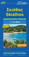
Wandelkaart 217 Skiathos | Road Editions
Gedetailleerde wegenkaart met aanduiding van de wandelwegen, lijst van hotels en toeristische informatie. Voor alle doeleinden een zeer geschikte kaart.   The features that make this and every other ROAD island map unique are: *The coastline, hydrography and precision geophysical background based on data provided by the Hellenic Military Geographic Service and electronically processed by us for clarity and legibility. We have highlighted the mountain masses in shades of brown between the contour lines (at 20m intervals on this map) to outline clearly the relief of the island. *The beaches are indicated by a special symbol next to which we have noted their names, as well as all the roads and footpaths leading to them (since most people primarily visit the islands for the beaches!). We have even included a short text in which the island’s best beaches are concisely referred to, to save you going on a wild goose hunt in search of them. *The road network is mapped out with impressive and e…
8,95

Klanten-reviews van Wandelgids Santorini, Sifnos, Kea - Western and Southern Cyclades | Graf editions

Er zijn nog geen beoordelingen voor dit productBen jij de eerste die een review plaatst?

Meer over Wandelgids Santorini, Sifnos, Kea - Western and Southern Cyclades | Graf editions

Productomschrijving

Wandelen op de Griekse Eilanden met deze klein formaat Engelstalige wandelgids Anafi, Folegandros, Ios, Kea, Kimolos, Kithnos, Milos, Santorini, Thirassia, Serifos, Sifnos, Sikinos, bij elke uitgebreid beschreven dagwandeltocht is een gedetailleerde routekaart afgebeeld en foto's ter orientering van de moeilijke, verwarrende trajecten. Van de uitgever This book describes the loveliest old walking trails. With precise descriptions, detailed maps, exact times, GPS points and photos of outstanding places for better orientation. And lots of useful knowledge about the "Islands of Light." It is made for island hoppers who want to drift through the island world by ship and who would also like to hike and swim in this ancient cultural landscape.   The concept „Greek Islands“ conjures up images of white cubical houses twined around with red bougainvillea, unevenly paved alleys below bright blue church domes, dilapidated windmills on top of stormy mountain ridges, shady groves with old gnarled olive trees. The Cyclades fit this picture perfectly. The name of this group of islands is derived from the classical Greek word kyklos, meaning “circle”. The ancient Greeks believed that the islands were gathered in a circle round the holy island of Délos.   The western and southern Cyclades described in this book used to be classed with the Sporades, the “scattered islands”, but nowadays they are considered part of the Cyclades on account of their many common features in terms of history and culture.   Cycladic culture in the early Bronze Age was the first very advanced civilisation in Europe. During the subsequent classical period the first stone temples were also built here. One of the aims of this book is to discover these on walks. Along the trails described here are old Byzantine fortified monasteries as well as tightly clustered villages and long since deserted, solitary farmhouses. Readers are also led to long sandy beaches and concealed rocky bays which can only be reached on foot.   The Cyclades offer a wonderful, tranquil landscape. Even the barrenness has a peculiar charm. While the walker may miss the forests, his eye is rewarded with distant views of the blue sea from almost every point along the way. Moreover, his nose is tickled by the sweet smells of the Mediterranean kitchen herbs which thrive everywhere. In the villages, finally, his heart warms to the filoxénia, the generous hospitality of the Greeks which makes one forget that one is a foreigner.   The islands are still criss-crossed by many of the old mule tracks, which connect the traditional settlements and now frequently abandoned monasteries. Fences are rare, too, so trekkers are more or less free to roam wherever they want. Although each of the islands has its own specific characterisitcs, Sífnos and Kéa are particularly suitable for walking, closely followed by Síkinos and Sérifos. But each trekker can decide that for himself; sooner or later everyone finds his or her “favourite” island. Have a good trip! Kaló taxídi!  
Verken gerelateerde categorieën

Webshop.nl maakt gebruik van cookies. Ga je verder op onze website, ga dan akkoord met het plaatsen van cookies en de verwerking van deze data door ons en vermelde partners.