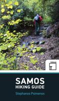
Wandelgids Samos Hiking Guide | Terrain maps

0
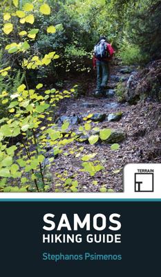
Engelstalige wandeligds voor het Griekse eiland Samos. Met 32 wandelingen voor zowel de beginnende als gevorderde wandelaars. Samos island is a hiker’s paradise! Hundreds of kilometres of forest trails and cobbled paths crossing through a beautiful countryside link many of the most interesting places of the island: traditional villages and monaste...

Verkopers met dit product

Verkoper
Bezorging
Prijs
DeZwerver.nl logo
DeZwerver.nl
2,95
20,95

Anderen bekeken ook

Wandelgids Canadian Rockies Trail Guide | Summerthought
The best loved and most detailed Canadian Rockies hiking guidebook is now in full color.   First published in 1971 and now in its 10th edition, the Canadian Rockies Trail Guide was the original guidebook with accurate distances and detailed descriptions to the trails of the Canadian Rockies.   Whether you’re a Canadian Rockies local or a visitor, the Canadian Rockies Trail Guide provides the best resource for hiking in the region, with everything from short interpretive trails to week-long backcountry treks. Now in its 10th edition and known affectionately as the “Bible” by outdoor enthusiasts, the popular tome is the most comprehensive and well-known guidebook to hiking in the region.   Having spent their entire adult lives hiking in the Canadian Rockies and writing about their experiences, authors Brian Patton and Bart Robinson are regarded as the ultimate authority on hiking in the Canadian Rockies. The Canadian Rockies Trail Guide is the only hiking guide to the region recommended…
29,95
Wandelkaart 324 Samothrace - Samothraki | Terrain maps
Gedetailleerde wegenkaart en wandelkaart met alle kleine wegen, wandelpaden, hoogtelijnen en toeristische informatie aangegeven. Alle tekst is tweetalig in Engels en Grieks en de waterproof kaart is geschikt voor gebruik met GPS.   This is a great map because: It is the only existing GIS map of Samothrace, and the only one made with data collected 100% through field survey. This makes it the only truly accurate and GPS compatible map of the island, available to date.  It features the canyoning routes on the island, as well as the paths leading to the entry and exit points of gorges. Hiking trails are shown with great accuracy. The length of all trails has been measured in kilometres, so you can estimate the duration of your hike. You ‘ll find detailed descriptions of 4 of the island’s most rewarding hikes on the reverse side, also labeled on the map itself, so that you can easily locate them. Also, thanks to the detailed scale, the complete road network is featured.  It is printed…
11,95
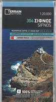
Wandelkaart 304 Sifnos | Terrain maps
Erg goede wandelkaart van Sifnos, weerbestendig en volledig. Bezienswaardigheden, campings en andere praktische zaken staan op de kaart aangegeven. GPS toepasbaar. This is a great map of Sifnos because: It is waterproof and rip-proof. You can fold and unfold it a thousand times, fold it in irregular ways, dunk it in the sea or leave it out in the rain. This map is indestructible!  It features more trails than any other map of Sifnos on the market. For example, take a look at the area between Apollonia and Kastro, which is where most visitors choose to hike. The trail from Plakoto and the chapel of Aghia Anastasia to Kastro, the trail ascending to Exambela and the branch leading to Apollonia, the trail to Kato Petali, the trail from Aghios Loukas to Kastro and so many more, appear on a map of Sifnos for the first time – in fact, the length of all trails is measured in kilometers so you can estimate the duration of your hike. Also, unlike other hiking maps, SKAI maps do not depict any…
11,95
Wandelgids New England Hiking | Moon Travel Guides
Goede, duidelijke wandelgids van New England met een beschrijving van de trail, een kaart en een hoogteprofiel.  Discover local adventures in Vermont, New Hampshire, Maine, Massachusetts, Rhode Island, and Connecticut with Moon New England Hiking. Inside you'll find:- 150 Outdoor Getaways including easy day hikes and multi-day backpacking trips- Diverse Hiking Options from breathtaking seaside walks in Coastal Maine to challenging backcountry treks in the Berkshires- Find Your Hike: Choose from strategic lists like the best spots for a swim, high-elevation vistas, New England oddities, and hikes with nearby breweries, plus a breakdown of the best hikes for each season- The Top Outdoor Experiences: Cool off under a cascading waterfall, pick wild blueberries from a meadow, and take in views of endless fall foliage. Take a dip in the ocean after scaling the cliffs in Acadia or meander through shorebird habitats in Rhode Island.   Visit a replica of Thoreau's cabin at historic Walden Pond…
27,95
Wandelkaart G1 Samos | Freytag & Berndt
Introducing the Samos Hiking and Leisure Map – your essential guide to exploring the stunning landscapes of Samos Island.   Discover detailed information on hiking trails across Samos, allowing you to plan your adventures with ease and learn about key attractions along the way.   Samos beckons hikers with its captivating diversity – from towering peaks like Mount Kerkis and deep gorges such as Kakoperato Gorge, to remote forests waiting to be explored. This Mediterranean hiking paradise boasts picturesque villages, hidden monasteries, ancient city walls, and medieval fortresses.   Key Features of the Samos Hiking and Leisure Map:   Scale 1:35,000 Extensive network of hiking trails Tourist information highlights Includes the Rother App for digital map access Waterproof and tear-resistant Dimensions: 99 x 61 cm Explore confidently with the linked free version of the Rother App, offering a digital map of Samos' complete hiking network and sample tours (free registration required).   Desi…
14,95
Wandelgids Hiking Lysefjord and Beyond | Koninx
Our hiking guide prints on demand: please disregard "out of stock" notices from online retailers. Explore world-famous hikes and discover hidden gems in Norway's western fjords. Trek up popular Pulpit Rock and Kjeragbolten, or the steep 4444-step staircase at Flørli. Then, continue hiking where others finish. Explore glacier-carved valleys, windswept coastlines and beaches, rugged peaks and thundering waterfalls. 'Hiking Lysefjord and Beyond: day trips in the Stavanger Region' sets you on the right track to explore this marvellous part of western Norway. Two double-sided area maps, marked with the locations of all hikes, make it easy to orient yourself in the area. Detailed descriptions to all 50 hikes help you navigate with confidence; they provide information on how to actually find the trail head, include sketch maps as well as height profiles. Tailor your hiking adventures to the season and weather, your interests, mood and personal needs; get ideas on where to go and how to hi…
34,95
Wandelgids Colorado Hiking | Moon
Colorado is a hiker’s paradise. With four national parks and a dozen national monuments, recreation areas and more, adventure is at every turn. Pack a lunch, lace up your boots, and hit the trails with Moon Colorado Hiking. Inside you'll find: Diverse Hiking Options: Whether you plan to hike to the crest of the Continental Divide, through thick fairytale aspen groves or to one of hundreds of iconic snow-capped peaks, enjoy outdoor getaways ranging from easy day hikes to multi-day backpacking trips Find Your Hike: Looking for something specific? Choose from strategic lists of the best hikes for wildflowers, waterfalls, or hiking with your dog, plus a breakdown of the best hikes by season The Top Outdoor Experiences: Climb the dunes at Great Sand Dunes National Park and Preserve or walk through golden aspen groves along Kenosha Pass. Gawk at red rock formations along the Garden of the Gods Loop or challenge yourself while you huff and puff to the top of Quandary Peak Nearby Fun: Spend a…
24,95
Wandelgids Hikes of Australia and New Zealand | Lonely Planet
Lace up your hiking boots for the next in Lonely Planet's highly successful Epic Hikes series, this time exploring 50 of Australia and New Zealand's most rewarding treks and trails. From the Routeburn Track in New Zealand's South Island to the Cape to Cape walk in Western Australia's Leeuwin-Naturaliste National Park, we cover a huge variety of themes and experiences across routes that range from one-day walks to multi-day treks. A vibrant cover once again illustrated by Ross Murray continues this collectible series. Each of the 50 featured hikes includes: First-person accounts from writers who have completed the hike Challenge level grading: easy / harder / epic Inspirational photography, maps and practical information to follow in the writer's footsteps Orientation toolkit: when is the best time of year to hike, how to get there, special equipment required Expert travel advice: where to stay, recommended tours, the best places to eat Suggestions for similar hikes Whether you'r…
34,95
Wandelkaart 328 Chios - Hios | Terrain maps
Gedetailleerde wegenkaart en wandelkaart met alle kleine wegen, wandelpaden, hoogtelijnen en toeristische informatie aangegeven. Alle tekst is tweetalig in Engels en Grieks en de waterproof kaart is geschikt voor gebruik met GPS. THIS IS THE BEST MAP OF CHIOS, BECAUSE: • It is the only GIS map of Chios made with data collected 100% through field survey. • All major trails of Chios are shown, with distances measured in kilometers, so that you can estimate the duration of your hike. On the reverse side you‘ll find detailed descriptions of 3 of the island’s best hikes. These are also distinctly labeled on the map, so you can easily locate them. • It includes a map of the neighboring island of Inousses, showing all beaches. • It includes a detailed town plan of the island’s capital, in the scale of 1:4.000, with all sites of interest clearly indicated. • It shows more roads and hiking trails than any other map of Chios, with scenic routes marked in green. • It is printed on Polyart plasti…
11,95
Wandelkaart 329 Psara | Terrain maps
Gedetailleerde wegenkaart en wandelkaart met alle kleine wegen, wandelpaden, hoogtelijnen en toeristische informatie aangegeven. Alle tekst is tweetalig in Engels en Grieks en de waterproof kaart is geschikt voor gebruik met GPS.   This is a great map because: First and foremost, it is the only available map of Psara! So far, no other cartographer had taken interest in this historical but forgotten corner of Greece. It is made with data collected 100% through field survey and comes in the detailed scale of 1:15,000, showing everything very clearly.  For the first time, all the trails of Psara are shown with absolute accuracy. The length of all trails has been measured in kilometres, so you can estimate the duration of your hike. On the back side of the map you ‘ll find detailed descriptions of the 3 best hikes on the island, also labeled on the map itself, so you easily locate them.  The nearby uninhabited island of Antipsara as well as all the surrounding islets are also included,…
11,95

Klanten-reviews van Wandelgids Samos Hiking Guide | Terrain maps

Er zijn nog geen beoordelingen voor dit productBen jij de eerste die een review plaatst?

Meer over Wandelgids Samos Hiking Guide | Terrain maps

Productomschrijving

Engelstalige wandeligds voor het Griekse eiland Samos. Met 32 wandelingen voor zowel de beginnende als gevorderde wandelaars.

Samos island is a hiker’s paradise! Hundreds of kilometres of forest trails and cobbled paths crossing through a beautiful countryside link many of the most interesting places of the island: traditional villages and monasteries, mountain tops and impressive ridges, remote beaches and ancient ruins. Lush landscapes and amazing ocean views alternate for a most rewarding experience. Through 32 well-designed hikes for both the casual stroller and the adventurous hiker, this hiking guidebook aims to help you discover the most authentic face of Samos island.    THIS GUIDEBOOK CONTAINS: 
  • Detailed step-by- step descriptions of a total of 32 hikes and walks
  • More than 150 color photos to inspire your trip
  • An introduction to the Samian landscape, flora and fauna
  • Maps based on the most up-to- date TERRAIN hiking map of Samos

Productinformatie

    Verken gerelateerde categorieën

    Webshop.nl maakt gebruik van cookies. Ga je verder op onze website, ga dan akkoord met het plaatsen van cookies en de verwerking van deze data door ons en vermelde partners.