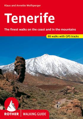
Wandelgids Tenerife (Engelstalig) | Rother Bergverlag

0
Uitstekende wandelgids met een groot aantal dagtochten in dal en hooggebergte. Met praktische informatie en beperkt kaartmateriaal! Wandelingen in verschillende zwaarte weergegeven in rood/blauw/zwart. Aanbevolen wandelkaarten bij deze gids:   Voor het hele eiland Wandelkaart WKE7 Tenerife hiking map | Freytag & Berndt 1:50.000   of    Wandelkaart...

Verkopers met dit product

Verkoper
Bezorging
Prijs
DeZwerver.nl logo
DeZwerver.nl
2,95
18,50

Anderen bekeken ook

Wandelgids Tenerife (Engelstalig) | Rother Bergverlag
Uitstekende wandelgids met een groot aantal dagtochten in dal en hooggebergte. Met praktische informatie en beperkt kaartmateriaal! Wandelingen in verschillende zwaarte weergegeven in rood/blauw/zwart. Aanbevolen wandelkaarten bij deze gids:   Voor het hele eiland Wandelkaart WKE7 Tenerife hiking map | Freytag & Berndt 1:50.000   of    Wandelkaart 233 Teneriffa | Kompass 1:50.000   Voor Nationaal Park El Teide Wandelkaart Tenerife - Teide - Anaga - Teno | Editorial Alpina 1:25.000   of   Wandelkaart 4 Parques Nacionales El Teide Red de Senderos -T enerife | CNIG - Instituto Geográfico Nacional 1:25.000     Tenerife can easily be described as the most versatile hiking paradise of the Canary Islands. The »Island of Bliss« not only offers the highest peak of the Canary archipelago and the whole of Spain – the Pico del Teide measuring 3718m – it also unites countless, completely different types of landscape: the extremely bare, almost desert-like south, holiday destination of sun aficion…
18,50
Wandelgids Mallorca (Engelstalig) | Rother Bergverlag
Uitstekende wandelgids met een groot aantal dagtochten in dal en hooggebergte. Met praktische informatie en beperkt kaartmateriaal! Wandelingen in verschillende zwaarte weergegeven in rood/blauw/zwart. Mallorca is not only a primary holiday destination for sun-lovers, but also a true hiking paradise, with lovely valleys, wild, romantic gorges and countless panoramic summits, all in the serene hinterland, tucked away from the seasonally overcrowded coasts. The "other" Mallorca surprises the visitor with a well-developed network of trails, and offers a variety of tours for all demands and levels of difficulty, starting from simple beach walks, to adventurous cliff tours and challenging mountain hikes, up to a spectacular canyon crossing. Rolf Goetz, the author of this Rother hiking guide, is one of the best experts on the Spanish Islands, and, through his various publications, has already made an excellent name for himself. He presents hikers with a wide variety of entertaining tour sug…
17,95
Wandelgids Azores (Engelstalig) | Rother Bergverlag
Rother Wandelgids Azoren – 105 wandelingen op 9 eilanden in het midden van de Atlantische Oceaan Van kratermeren en kustpaden tot vulkaantoppen en thermale bronnen De Azoren, een Portugese eilandengroep in het midden van de Atlantische Oceaan, vormen een paradijs voor wandelaars en natuurliefhebbers. Deze Rother Wandelgids biedt een selectie van 105 wandelroutes op alle negen eilanden: São Miguel, Santa Maria, Terceira, Graciosa, São Jorge, Pico, Faial, Flores en Corvo. Van korte wandelingen langs de kust tot uitdagende beklimmingen van vulkanen zoals Pico – de hoogste berg van Portugal. De gids is samengesteld door Roman Martin, die de eilanden vele malen doorkruiste. Elke route is voorzien van een gedetailleerde beschrijving, kaartfragment, hoogteprofiel én GPS-track die je eenvoudig kunt downloaden. Voordelen 105 wandelingen op alle 9 eilanden Compleet overzicht van de wandelmogelijkheden op elk eiland, van eenvoudig tot uitdagend. Met GPS-tracks, kaarten en hoogteprofielen Du…
22,95
Wandelkaart Tour & Trail Tenerife | Discovery Walking Guides
Uitstekende wandelkaart, met ingetekende wandelroutes, voor specifieke wandelgebieden van Tenerife. Let op: dit is niet een kaart van het hele eiland, maar puur en alleen voor de wandelgebieden > daar is deze kaart de beste in! Our latest hiking research on Tenerife has resulted in new editions of Walk! Tenerife and Tenerife Hikers' Super-Durable Maps. Thanks to Jan Kostura's research we have several new hiking adventures described in detail in Walk! Tenerife. Jan's gps records of his research for new routes and updating of current routes has provided the detailed information to produce our new fourth edition of Tenerife Hiker's Super-Durable Maps. Note that Tenerife Hikers' Super-Durable Maps is a collection of four 30k scale map sections on a double sided sheet of 840mm by 600mm which folds up to 220mm by 120mm. It is not a map of all of Tenerife.  In this edition you will find 30k scale maps covering Valle de Orotava, West, Anaga and Adeje/Arona - Teide printed on a double sided…
17,95
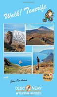
Wandelgids Walk! Tenerife | Discovery Walking Guides
Engelstalige wandelgids Tenerife, met uitgebreide beschrijvingen van wandelroutes, routekaartjes, praktische informatie zoals bussen en accommodatie.   Walking guide with walking routes with summary of the route, fully detailed walk description including frequent timings, full colour map sections for each route, compass directions, GPS Waypoints, accommodation information ranging from luxury hotels down to more modest hostels, bus timetables, ferry information and general travel information   Walking routes are grouped into North ( Orotava Valley), Central High Altitude (Las Canadas and Paisaje Lunar), West (Masca/Santiago del Teide) and South Includes the routes in Walk Tenerife South. Full GPS information for Waypoint navigation with 'pin-point' accuracy. Large scale map sections for every walking route adapted from Tenerife Hiking Map. Walking routes cover the North (Orotava Valley), Central High Altitude (Las Canadas and Paisaje Lunar), West (Masca/Santiago del Teide), South (Adej…
18,95
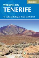
Wandelgids Walking on Tenerife | Cicerone
  From easy strolls to hands-on scrambling and from simple day walks to long-distance routes along the GR131, Tenerife offers a variety of year round walking routes, all set in stunning natural scenery. Paddy Dillon's latest book in his Canary Islands series features 45 of the best - suitable for a wide range of abilities and easily combined to form longer expeditions.   The largest of the Canary Islands, Tenerife is dominated by the highest mountain on Spanish territory, El Teide, which rises up dramatically right in the centre of the island. The whole central area surrounding it is protected as a national park and packed with diverse and interesting trails. The altitude on these routes is generally above 2000m and the island's central high-altitude region is often blessed with blue skies and sunny conditions, even when other areas are covered in cloud or experiencing rain.   Terrain includes volcanic cones, lava flows and ash slopes, while the landscape ranges from semi-desert to lu…
24,95
Reisgids Marco Polo ENG Tenerife (Engels) | MairDumont
Let op: Engeltalige versie Het is een handige en overzichtelijke, kleine reisgids voor een  goede kennismaking met de vakantiebestemming. Globale uitklapkaart achterin, makkelijk binnenzakformaat. Toch best veel aandacht voor de toeristische hoogtepunten en leuke tips van en door de schrijvers die er vaker geweest zijn.  Explore Tenerife with this handy, pocket-sized, authoritative guide, packed with Insider Tips. Discover boutique hotels, authentic restaurants, the island's trendiest places, and get tips on shopping and what to do on a limited budget. There are plenty of ideas for travel with kids, and a summary of all the festivals and events that take place. Let Marco Polo show you all the largest of Spain's Canary Islands has to offer... Discover the deep blue Atlantic fringed by fine beaches, rugged coastlines and gorges, dense forests and Badlands, all crowned by the mighty volcano of Mount Teide soaring above its bizarre lava field. This practical, pocket-sized Tenerife guide t…
14,95

Klanten-reviews van Wandelgids Tenerife (Engelstalig) | Rother Bergverlag

Er zijn nog geen beoordelingen voor dit productBen jij de eerste die een review plaatst?

Meer over Wandelgids Tenerife (Engelstalig) | Rother Bergverlag

Productomschrijving

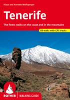
Uitstekende wandelgids met een groot aantal dagtochten in dal en hooggebergte. Met praktische informatie en beperkt kaartmateriaal! Wandelingen in verschillende zwaarte weergegeven in rood/blauw/zwart.

Aanbevolen wandelkaarten bij deze gids:   Voor het hele eiland Wandelkaart WKE7 Tenerife hiking map | Freytag & Berndt 1:50.000   of    Wandelkaart 233 Teneriffa | Kompass 1:50.000   Voor Nationaal Park El Teide Wandelkaart Tenerife - Teide - Anaga - Teno | Editorial Alpina 1:25.000   of   Wandelkaart 4 Parques Nacionales El Teide Red de Senderos -T enerife | CNIG - Instituto Geográfico Nacional 1:25.000     Tenerife can easily be described as the most versatile hiking paradise of the Canary Islands. The »Island of Bliss« not only offers the highest peak of the Canary archipelago and the whole of Spain – the Pico del Teide measuring 3718m – it also unites countless, completely different types of landscape: the extremely bare, almost desert-like south, holiday destination of sun aficionados, is in strict contrast to the picture landscape of the fertile north with its sumptuous nature. The mountain regions are covered in evergreen laurel and heathered forests as well as extensive woods of pine tree. A scenic highlight is bound to be the moon landscape of the Cañadas del Teide National Park. As a result, Tenerife is not only a refuge for central Europeans who shy away from winter, but mainly an ideal island for hiking. With the wide ocean at all times in sight, the range of the 80 hiking tours presented in this guide includes easy paths over rough cliffs and picturesque trips to heights as well as ascents to peaks that offer a fabulous view – hiking paths through fairytale-like nebulous primeval forests are also included, such as the partially paved Caminos, which in the early days where the main connecting routes between villages. Many tour suggestions in this hiking guide are suitable for less experienced hikers. Skilled mountaineers who do not fear »tours of the drastic kind« and who are in for a touch of adventure and a bit of a kick will also find a rich offering: daring cliff tours, spectacular ravine excursions and extensive mountain trips whose highlight must be the parade summit of the National Park. Atmospheric pictures and excellent hiking maps at an ideal scale of 1:50,000/1:75,000 and informative height profiles round off the picture and ignite curiosity for ever new tours into this bizarre and charming world of mountains. An overall successful guide brought up to date, which leaves nothing to desire!
 

Productinformatie

    Verken gerelateerde categorieën

    Webshop.nl maakt gebruik van cookies. Ga je verder op onze website, ga dan akkoord met het plaatsen van cookies en de verwerking van deze data door ons en vermelde partners.