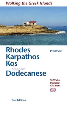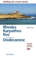
Wandelgids Rhodos, Karpathos, Kos and southern Dodecanese | Graf editions

0
Engelstaige wandelgids. Rhodos, Karpathos, Kos en de zuidelijke Dodekanesos. van de uitgever   This book describes the loveliest old walking trails. With precise descriptions and route photos of outstanding points for better orientation. And lots of interesting facts worth knowing about the Dodecanese Islands. It is made for island hoppers who ...

Verkopers met dit product

Verkoper
Bezorging
Prijs
DeZwerver.nl logo
DeZwerver.nl
niet bekend
2,95
19,50

Anderen bekeken ook

Wandelgids Rhodos, Karpathos, Kos and southern Dodecanese | Graf editions
Engelstaige wandelgids. Rhodos, Karpathos, Kos en de zuidelijke Dodekanesos. van de uitgever   This book describes the loveliest old walking trails. With precise descriptions and route photos of outstanding points for better orientation. And lots of interesting facts worth knowing about the Dodecanese Islands. It is made for island hoppers who want to drift through the island world by ship and who would also like to hike and swim in this ancient cultural landscape. Ten to twelve islands, among them very small ones, are described in each book, except for Walking on Naxos and Walking on Samos with only one island respectively.   The walks are carefully selected so that places of cultural significance as well as lonesome beaches can be found along the way. Exploring the remaining ancient mule tracks and marble plated roads make the walks especially enjoyable. Each walk is characterized by a precise and plain text as well as a detailed map. Six to four photos of distinctive places a…
19,50
Wandelgids Rhodos, Karpathos, Kos, südlicher Dodekanes | Graf editions
In dieser aktualisierten Zweitauflage von 2011 sind 50 Wanderwege auf 11 Inseln des südlichen Dodekanes beschrieben. Neben den Schwierigkeitsgraden sind Alternativen und Abkürzungen angegeben. Mit detaillierten Karten, exakten Gehzeiten, GPS-Punkten und 160 Fotos von markanten Stellen zur besseren Orientierung.   Die Inselgruppe des Dodekánes erstreckt sich über 160 km entlang der türkischen Westküste. Pátmos ist die nördlichste, Rhódos die südlichste Insel. Der Name ist zusammengesetzt aus den Wörtern »dodéka«, zwölf, und »nísos«, die Insel: die zwölf Inseln. Zu diesen zwölf wurden mit der Zeit noch weitere kleinere Inseln addiert, so dass es mittlerweile 25 bewohnte »Zwölfer-Inseln« gibt, alle Inseln und Eilande zusammengezählt sind es sogar 163. In diesem Buch werden die zehn südlichen der bewohnten Inseln beschrieben.   Diese Inseln zeichnen sich durch eine enorme Vielfalt aus, sowohl landschaftlich als auch kulturell. Man findet weite Stranddünen, kleine Felsbuchten, schattige Ki…
19,50
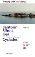
Wandelgids Santorini, Sifnos, Kea - Western and Southern Cyclades | Graf editions
Wandelen op de Griekse Eilanden met deze klein formaat Engelstalige wandelgids Anafi, Folegandros, Ios, Kea, Kimolos, Kithnos, Milos, Santorini, Thirassia, Serifos, Sifnos, Sikinos, bij elke uitgebreid beschreven dagwandeltocht is een gedetailleerde routekaart afgebeeld en foto's ter orientering van de moeilijke, verwarrende trajecten. Van de uitgever This book describes the loveliest old walking trails. With precise descriptions, detailed maps, exact times, GPS points and photos of outstanding places for better orientation. And lots of useful knowledge about the "Islands of Light." It is made for island hoppers who want to drift through the island world by ship and who would also like to hike and swim in this ancient cultural landscape.   The concept „Greek Islands“ conjures up images of white cubical houses twined around with red bougainvillea, unevenly paved alleys below bright blue church domes, dilapidated windmills on top of stormy mountain ridges, shady groves with old gnarl…
19,50
Wegenkaart - landkaart - Fietskaart 9 Touring Map Dodekanesos - Dodecanese | Terrain maps
Gedetailleerde wegenkaart met toeristische informatie aangegeven. Alle tekst is tweetalig in Engels en Grieks en de waterproof kaart is geschikt voor gebruik met GPS, scheur- en watervast papier. Detailed and updated map of the Dodecanese islands using G.I.S. technology and the WGS84 reference system, supplemented by a ΕΓΣΑ87 grid.    This is the ideal map for planning your visit to the Dodecanese islands, especially if you’re sailing or island-hopping. Based on field research completed in 2017, this double-sided map features all the islands of the Dodecanese complex in their relative positions. It features all beaches, ports, sea connections, airports, and major sights.  Like all of TERRAIN’s large maps, the map of Dodecanese is printed on polyart, which is extremely durable against folding and unfolding, does not rip, and is 100% waterproof.
13,50
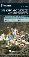
Wandelkaart 345 Karpathos - Kasos | Terrain maps
Gedetailleerde wegenkaart en wandelkaart met alle kleine wegen, wandelpaden, hoogtelijnen en toeristische informatie aangegeven. Alle tekst is tweetalig in Engels en Grieks en de waterproof kaart is geschikt voor gebruik met GPS. This is a great map because: • It is the first GIS map of the island, meaning that this is the first time Karpathos and Kasos are mapped with a topographic precision in proportion to the map scale. • It is waterproof and rip-proof. You can fold and unfold it a thousand times, fold it in irregular ways, dunk it in the sea or leave it out in the rain. This map is indestructible! • It features the most complete road network. No matter which corner of the island on the SKAI map of Karpathos you compare with any other map on the market, you will see that it features many more roads –most importantly, they are depicted with accuracy. • It features the trails of Karpathos and Kasos for the first time, with total precision since the cartographers of TERRAIN walked th…
11,95
Wandelgids Amorgos, Naxos, Paro, Andros & eastern and northern Cycladen | Graf editions
Wandelgids met 56 wandelingen op 12 eilanden. Het boekje beschrijft de mooiste oude wandelroutes. Met gedetaileerde kaartjes, looptijden, GPS points en foto's van standpunten voor een betere orientatie. Met : Amorgós Ándros Antíparos Donoússa Irakliá Koufonísi Mýkonos Náxos Páros Schinoússa Sýros Tínos Van de uitgever This book describes the loveliest old walking trails. With precise descriptions, detailed maps, exact times, GPS points and photos of outstanding places for better orientation. And lots of useful knowledge about the "Islands of Light." It is made for island hoppers who want to drift through the island world by ship and who would also like to hike and swim in this ancient cultural landscape.   For the update of this new edition all the tracks and paths have been newly walked along and rechecked. All extensions, some of them also changed routes, are recorded. And 12 new hikes have been added.   White, cubical houses in front of infinitely blue sea – that is how we know Gre…
19,50
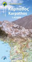
Wandelkaart 10.50 Karpathos | Anavasi
Zeer goede kaart van Karpathos. Topografische details zijn goed uitgewerkt, zeer leesbare kaart met ook nog eens alle toeristisch interessante punten. Karpathos, a mountainous island with rugged terrain and magnificent landscapes, is one of the most authentic places in Greece. It has endless sandy beaches in the south and secluded coves with emerald-blue waters in the north. The more developped south of the island is popular to surfers while the north still keeps folkways alive especially in the magical village of Olymbos, perched on a saddle between two mountains and two seas. Off the northern tip of Kárpathos, separated from it by a narrow channel is the uninhabited island of Sariá with old agricultural settlements and remains of medieval houses at Palatia. This new detailed map of Anavasi proposes 12 hiking trails in the north and 6 in the south and presents the major highlights of the island.
9,95
Reisverhaal Wild Abandon - Dodecanesos | Jennifer Barclay
'There's something about abandoned places which moves me and captures the imagination.' So says seasoned travel writer Jennifer Barclay as she walks with her dog and her backpack through the deserted spaces of the Dodecanese, islands that were once bustling but are now half forgotten and reclaimed by the wild due to a mix of misfortune and the lure of opportunity elsewhere. Join her on a journey through abandoned villages and farms, cave-houses and captains' mansions, the homes of displaced Muslim fishermen and poets, as she discovers beauty in the ruins, emptiness and silence, and inspiration in the stories of people's lives.A long-term resident of Greece, Jennifer Barclay spent more than four years researching Wild Abandon, visiting islands multiple times and hearing the stories of local people. She travels from the very west to the very east of the Dodecanese, from the very south almost to the very north, taking in some of the smallest and the biggest islands, and highlighting diff…
14,95
Wandelgids Naxos and the Small Cyclades | Graf editions
Handig klein formaat engelstalige wandelgids Naxos, Donoussa, Iraklia, Koufonissia, Schinoussa bij elke uitgebreid beschreven dagwandeltocht is een gedetailleerde routekaart afgebeeld en foto's ter orientering van de moeilijke, verwarrende trajecten: Van de uitgever This book describes the loveliest old walking trails. With detailed maps, GPS data and route photos of outstanding points for better orientation. And lots of interesting facts worth knowing about the Islands of Dionysos.   Already when you sail into the harbour, you can sense the island's tremendous cultural diversity. On the left, you peer up at the enormous portal of a classical temple; on the right, you glide past a small Byzantine chapel and, towering above the huddled Cycladic city, a Venetian kástro from the Middle Ages. The city, dating back 5000 years, is one of the oldest inhabited places in the world.   When you penetrate further in to the island, you are surprised by the diversity of the fertile landscapes. An e…
19,50
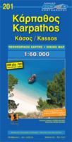
Wegenkaart - landkaart 201 Karpathos - Kassos | Road Editions
Gedetailleerde wegenkaart met aanduiding van de wandelwegen, lijst van hotels en toeristische informatie. Voor alle soorten vakanties, ook als wandel- en fietskaart goed te gebruiken. Easy to read map for Karpathos and Kassos with touristic information churches, monasteries, archaeological sites and castles as well as all the beaches, the altitudes of mountain peaks, the complete network of trails (footpaths), the lighthouses, the airport of course, and much more.
9,95

Klanten-reviews van Wandelgids Rhodos, Karpathos, Kos and southern Dodecanese | Graf editions

Er zijn nog geen beoordelingen voor dit productBen jij de eerste die een review plaatst?

Meer over Wandelgids Rhodos, Karpathos, Kos and southern Dodecanese | Graf editions

Productomschrijving

Engelstaige wandelgids. Rhodos, Karpathos, Kos en de zuidelijke Dodekanesos.

van de uitgever   This book describes the loveliest old walking trails. With precise descriptions and route photos of outstanding points for better orientation. And lots of interesting facts worth knowing about the Dodecanese Islands. It is made for island hoppers who want to drift through the island world by ship and who would also like to hike and swim in this ancient cultural landscape. Ten to twelve islands, among them very small ones, are described in each book, except for Walking on Naxos and Walking on Samos with only one island respectively.   The walks are carefully selected so that places of cultural significance as well as lonesome beaches can be found along the way. Exploring the remaining ancient mule tracks and marble plated roads make the walks especially enjoyable. Each walk is characterized by a precise and plain text as well as a detailed map. Six to four photos of distinctive places allow for orientation along the way, precise split times are given to check. Cultural information complete the picture of each walk. Shortcuts of longer walks and alternative routes for a second hike are described.


Productinformatie

    Verken gerelateerde categorieën

    Webshop.nl maakt gebruik van cookies. Ga je verder op onze website, ga dan akkoord met het plaatsen van cookies en de verwerking van deze data door ons en vermelde partners.