webshop.nl
Categorieën
  Sluiten

Meer Cicerone
Meer Cicerone in Reisgidsen & talen boeken

Wandelgids Pyrenean Haute Route - a high level trail, Pyreneeën HRP |

0
Beschrijving van de klassieke HRP, Haute Randonnee Pyreneen. Goede beschrijving van de route met hoogteprofielen en andere praktische informatie. Kaartmateriaal is voor deze zware route onvoldoende aanwezig in de gids.  Aanbevolen wandelkaarten voor de hele of een deel van de route: Wandelkaarten van Rando Editions op Schaal 1:50.000 There are thre...

Webshops met dit product

Webshop
Bezorging
Prijs

Anderen bekeken ook

Wandelgids Pyrenean Haute Route - a high level trail, Pyreneeën HRP |
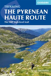
Beschrijving van de klassieke HRP, Haute Randonnee Pyreneen. Goede beschrijving van de route met hoogteprofielen en andere praktische informatie. Kaartmateriaal is voor deze zware route onvoldoende aanwezig in de gids.  Aanbevolen wandelkaarten voor de hele of een deel van de route: Wandelkaarten van Rando Editions op Schaal 1:50.000 There are three main trekking routes across the Pyrenees from coast to coast: of these, the Pyrenean Haute Route (or HRP for Haute Route Pyrénéenne) is the most challenging - and arguably, the most spectacular. Unlike the GR10 and GR11, it is not waymarked and borders on mountaineering at times, sticking as closely as possible to the main ridge. It stretches 750km from the Atlantic resort of Hendaye to Banyuls-sur-Mer on the Mediterranean, crossing the French-Spanish border many times on its traverse. The hike calls for experience, navigational competence and self-reliance, but offers rich rewards as you pass through some of the most stunning landscapes th…
24,95
Wandelgids GR10 trail, Pyrenees - Pyreneeen | Cicerone
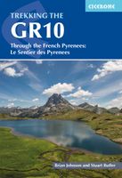
Engelstalige beschrijving van de mooiste wandeltocht in de Pyreneeen. De gids voldoet aan alle verwachtingen die je kunt hebben. Wel heb je voor de zwaardere gedeelte voor de zekerheid goede kaarten nodig ...... Guidebook to the GR10, a 955km trek across the French Pyrenees from Hendaye on the Atlantic Coast to the Mediterranean coast at Banyuls-sur-Mer. Described in 55-day stages, the route can be completed in its entirety, or in shorter sections using the bus and rail links found throughout the Pyrenees.   Step by step route descriptions are accompanied by 1:100,000 mapping and gradient profiles. Useful practical information is also included such as when to go, getting there and back, camping, accessing fuel and water, plus handy equipment tips and more.   The easiest, oldest and most popular of the three long-distance routes that traverse the mountain range, the GR10 is well waymarked and follows good mountain paths. For many walkers, the highlight of the route is the magnificent wi…
26,50
Wandelatlas 4001 Topographic Map Guide Haute Route Chamonix to Zermatt
- Waterproof - Tear-Resistant - Topographic Map The Haute Route--aka the High Route or Mountaineers' Route--traverses the French and Swiss Alps. It was conceived as a summer mountaineering route in the mid-nineteenth century by members of the English Alpine Club. Though originally called The High-Level Route by members of the Alpine Club, in 1911, a group first successfully established a winter route from Bourg St. Pierre to Zermatt on skis and afterwards the name of the route was translated into French. As a result of their success, the French term stuck, and the journey gained a reputation amid skiers and ski mountaineers as a classic must-do winter/spring tour. There is also a non-technical Walker's Haute Route that has gained in popularity and become a classic in and of itself. This Topographic Map Guide outlines two different variations of the Haute Route from Chamonix, France to Zermatt, Switzerland: one for hikers and one for skiers. The northernmost route or, Walker's Route, de…
16,95
Wandelgids Walker's Haute Route: Chamonix to Zermatt | Knife Edge Outd
Overzichtelijke routegids van deze prachtige wandelroute. Per etappe vind je een hoogteprofiel, goede beschrijvingen van de wandelroute, een topografische kaart op gedetailleerde schaal. Voor en achterin de gids staat aanvullende praktische informatie zoals adressen van campings, andere accommodaties en bijvoorbeeld een paar pagina's over de flora en fauna.  The only guidebook for the Walker's Haute Route with Real Maps: 1:25,000/1:50,000 mapping included for each stage. This makes navigation easy and saves you money: no need to buy additional maps. Also includes:* Unique Itinerary Planner: plan a bespoke itinerary to match your ability and vacation schedule. All difficult calculations of time, distance and altitude gain are done for you* 6 Proposed Itineraries of between 10 and 14 days* Everything the trekker needs to know to plan the route: route descriptions, costs, budget, difficulty, weather, how to get there, and more* Full accommodation listings: spectacularly situated mountain …
20,95
Fietsgids A Cyclist's Guide to the Pyrenees | Great Northern Books
Where do you turn when you want to ride in the mountains, to follow in the wheeltracks of professional racers by climbing the famous passes of the Tour de France? There are several books and websites that highlight these renowned ascents, detailing their location, length and every little change in gradient. But how do you go about finding a route that links these passes together, that describes not only where they are and what they're like to ride, but highlights which is the best side to tackle them from and which roads to avoid?Award-winning author Peter Cossins's new series of guides to riding in the Western Europe's high mountains will provide these details - and much more. Inspired by Alfred Wainwright's walking guides to the Lake District, they are intended as the bible for any cyclist riding in Europe's most stunning terrain.   The first in the series is The Roads, Cols and Passes of the Pyrenees, which is duefor publication by Great Northern Books in June 2020. Featuring 120 ro…
23,95
Wandelgids Via Francigena Pilgrim Route Part 1 | Cicerone
The 2000km Via Francigena from Canterbury to Rome is one of the world's great pilgrim routes, with a history spanning well over a millennium. This guide describes the first section, from Canterbury to Lausanne on the shores of Lake Geneva, a journey of 1090km passing through England, France and Switzerland. The route is suitable for walkers of all levels of ability, and the section from Canterbury to Besancon is also suitable for cyclists (mountain or hybrid/gravel bike).   There are various options for accommodation, ranging from hotels and B&Bs to camping (although it is not essential to carry a tent), and the French section offers a unique opportunity to lodge with host families in welcoming chambres d'hotes. The guide has all the information you need to plan and prepare for a journey on the Via Francigena. You'll find a wealth of detail about facilities on route and accommodation, as well as tips on training, kit, travel and pilgrim credentials.   The route is presented in 52 stage…
26,50

Klanten-reviews van Wandelgids Pyrenean Haute Route - a high level trail, Pyreneeën HRP |

Er zijn nog geen beoordelingen voor dit productBen jij de eerste die een review plaatst?

Meer over Wandelgids Pyrenean Haute Route - a high level trail, Pyreneeën HRP |

Productomschrijving

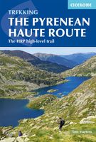
Beschrijving van de klassieke HRP, Haute Randonnee Pyreneen. Goede beschrijving van de route met hoogteprofielen en andere praktische informatie. Kaartmateriaal is voor deze zware route onvoldoende aanwezig in de gids.  Aanbevolen wandelkaarten voor de hele of een deel van de route: Wandelkaarten van Rando Editions op Schaal 1:50.000 There are three main trekking routes across the Pyrenees from coast to coast: of these, the Pyrenean Haute Route (or HRP for Haute Route Pyrénéenne) is the most challenging - and arguably, the most spectacular. Unlike the GR10 and GR11, it is not waymarked and borders on mountaineering at times, sticking as closely as possible to the main ridge. It stretches 750km from the Atlantic resort of Hendaye to Banyuls-sur-Mer on the Mediterranean, crossing the French-Spanish border many times on its traverse. The hike calls for experience, navigational competence and self-reliance, but offers rich rewards as you pass through some of the most stunning landscapes the region has to offer.   This guide presents the Pyrenean Haute Route in 44 day stages, which are divided between five sections: since each section starts and finishes at a location accessible by public transport, they can be walked individually if you don't have a spare month-and-a-half for a complete thru-hike. Although the route offers excellent opportunities for wild camping, each stage finishes at a mountain hut or village, meaning that you can sleep under a roof every night if you prefer. Clear route description is accompanied by 1:100,000 mapping. There are bad weather variants and alternatives to avoid the most technical sections, and the guide also includes optional ascents of 10 classic summits, including Vignemale, Pic du Taillon and the highest peak in the Pyrenees, Pico de Aneto. You'll also find helpful advice on travel to and from the route, equipment and safety.   From the rolling green foothills of the Basque Country to High Pyrenean landscapes of aquamarine lakes nestled among 3000m peaks, the scenery is as varied as it is beautiful. Highlights include the karst terrain of Pic d'Anie, the Ossoue glacier, Lac de Mar in the picturesque Val d'Aran and the dramatic Cirque de Gavarnie with its towering cascade   Steden en Dorpen Hendaye, Lescun, Gavarnie, Benasque, Vielha e Mijaran, Tavascan, l'Hospitalet-près-l'Andorre, Banyuls-sur-Mer
Productspecificaties

Artikelnummer(s)
Brand
Cicerone

Verken gerelateerde categorieën

Webshop.nl maakt gebruik van cookies. Ga je verder op onze website, ga dan akkoord met het plaatsen van cookies en de verwerking van deze data door ons en vermelde partners.