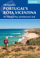
Wandelgids Portugal's Rota Vicentina | Cicerone

0
This guidebook follows the Rota Vicentina, a 224km walking route along the marvellous Atlantic coastline in the Alentejo and Algarve regions of Portugal. The 12-stage trek combines two well-marked routes, the Caminho Histórico (the Historical Way) and the Trilho dos Pescadores (the Fishermen's Trail), to create a hike starting in Santiago do Cacém...

Verkopers met dit product

Verkoper
Bezorging
Prijs
DeZwerver.nl logo
DeZwerver.nl
2,95
24,95

Anderen bekeken ook

Wandelgids - Pelgrimsroute The Camino Portugués | Cicerone
A guidebook to walking the Camino Portugués (Portuguese Way), 620km from Lisbon in Portugal to Santiago in Spain. The book gives stage-by-stage directions for the Central Camino, starting from Lisbon, Porto or Tui, the Coastal Camino between Porto or Vigo, and the Spiritual Variant route from Pontevedra to Redondela. It also describes link routes that can be used to swap from one route to another. Detailed route guidance and maps are accompanied by fascinating information about historic and religious sites passed along the way. It is packed with essential information for pilgrims, with advice on getting there, when to go, where to stay and equipment. An indispensable facilities table showing the availability of accommodation, refreshments, supermarkets, ATMs and pharmacies along the route, and a handy glossary, make this the complete guide to the Camino. Since 1211 Santiago de Compostela has been a place of holy pilgrimage and the Camino Portugues is the second most travelled pilgri…
26,50
Wandelgids Rota Vicentina SW Portugal (deutsche Ausgabe) | Rota vicentina
Dies ist ein Wanderführer für die Rota Vicentina zwischen Santiago do Cacem und Cabo de S. Vicente. Er deckt zusätzlich auch Varianten ab und bietet vier Tagestouren außerhalb der Route. Das Wanderbuch für die Rota Vicentina beginnt mit praktischen Informationen und Hintergundwissen zur Strecke, folgt den einzelnen Etappen mit Übersicht, Beschreibung und Abschnittskarte und bietet so alle wichtigen Informationen.   Die Rota Vicentina ist ein Wanderwegenetz (insgesamt 450 km) im Südwesten von Portugal, entlang einer der schönsten Küsten der Welt. Sie besteht aus dem "Fischerpfad", dem "Historischen Weg" und einigen Rundwegen, die wilde Küste liegt direkt am Naturpark Südwest-Alentejo und Costa Vicentina (Parque Natural do Sudoeste Alentejano e Costa Vicentina). Der gesamte Fernwanderweg ist in beide Richtungen ausgeschildert und kann selbstständig begangen werden, empfohlen sind die Monate September bis Juni. 2016 wurde der "Historische Weg" der Rota Vicentina mit dem europaweiten Qual…
24,95
Wandelgids 5896 Rota Vicentina, Portugal Süd | Kompass
Goede Duitstalige wandelgids met heldere beschrijvingen van de wandeltochten. Met hoogteprofiel, kaartje en de benodigde praktische informatie als bijvoorbeeld de startlocatie met GPS coordinaten. De wandelingen zijn ingedeeld in zwaarte en dan op verschillende kleuren weergegeven. Beschreven worden eenvoudige wandelingen tot pittige (berg)tochten, voor getrainde en ongetrainde wandelaars, een aantal wandelingen zijn geschikt om met kinderen te doen. Belangrijke toevoeging bij de Kompass wandelgidsen is een bijgevoegde losse wandelkaart van het betreffende gebied waarop de wandelingen uit de gids op de kaart heel duidelijk zijn ingetekend.    KOMPASS Wanderführer Rota Vicentina, Portugal Süd: Von Santiago do Cacém zum Cabo de Sao Vicente, 26 Etappen und 14 Rundwege, gesamt 40 Touren mit Extra-Tourenkarte Die Rota Vicentina im Süden Portugals führt von Santiago do Cacém zum Cabo de São Vicente. Diese Wanderroute bietet atemberaubende Küstenlandschaften mit steilen Klippen, einsamen Str…
19,95
Wandelgids Spain's Sendero Historico: the GR1 | Cicerone
A step by step guide to walking the 1250km long Sendero Historico (the GR1) across northern Spain. Travelling from west to east, the GR1 starts at the Puerto de Tarna, on the border of Asturias and Castilla y Leon, heads east along the southern flank of the Cantabrian Mountains and the foothills of the Pyrenees before finishing on the Mediterranean coast near L'Escala. Arguably one of Spain's best long-distance paths, it follows gently graded paths, making a long but easy walk suitable for a reasonably fit walker. The complete trail requires around 53 days to complete end to end, but the guidebook splits the route into 7 sections, each with a start or endpoint that can be easily reached by train or bus, allowing walkers to explore the route in manageable chunks. The guidebook also describes how to extend the route to Finisterre and the Atlantic using GR routes. As well as extensive notes on the history of modern Spain, from medieval times to more recent events such as the Civil War, t…
26,50
Wandelgids Camino Inglés and Ruta Do Mar | Cicerone
Guidebook to walking the Camino Inglés and Ruta do Mar pilgrim routes in northwest Spain. Describes the 116km Camino Inglés from Ferrol or A Coruña to Santiago de Compostela and the of the 190km Ruta do Mar linking Ribadeo with the Inglés at Ferrol. Includes the 120km Camino Finisterre from Santiago to Finisterre or Muxia. THE CAMINO INGLÉS Stage 1 Ferrol to Pontedeume Stage 2 Pontedeume to Betanzos Stage 3 Betanzos to Hospital de Bruma Stage 4 Hospital de Bruma to Sigüeiro Stage 5 Sigüeiro to Santiago de Compostela Alternative start A Coruña to Hospital de Bruma   THE RUTA DO MAR Stage 1 Ribadeo to Praia das Catedrais Stage 2 Praia das Catedrais to Foz Stage 3 Foz to San Cibrao Stage 4 San Cibrao to Viveiro Stage 5 Viveiro to Cuiña Stage 6 Cuiña to Teixido Stage 7 Teixido to Xubia   THE CAMINO FINISTERRE Stage 1 Santiago de Compostela to Negreira Stage 2 Negreira to Olveiroa Stage 3 Olveiroa to Finisterre
20,95
Wandelgids The Westweg | Cicerone
Uitstekende wandelgids van een meerdaagse tocht in het Zwarte Woud in Duitsland. Goede beschrijvingen, veel praktische informatie en redelijke kaarten al zullen deze niet helemaal voldoende zijn. Guidebook to the Westweg (Westway), a 285km walk across Germany's Black Forest from Pforzheim to Basel. This classic route, which includes Feldberg, Black Forest's highest peak, takes 13 to 14 days, each day stage ranging from 15 to 28km. Two variants are described, both well way-marked and suitable for those new to long distance walking. This guidebook is all you need to discover The Westweg, a 285km walk along the length Germany's Black Forest from Pforzheim to Basel. This classic long-distance trail takes around two weeks to walk, in stages of 15-28km. The route is well way-marked and suitable for experienced hikers and those new to long distance walking, though some sections are steep. The Westweg incorporates many of the region's highlights, such the Schwarzwald National Park, the source…
23,95
Wandelgids The Cleveland way and the Yorkshire Wolds way | Cicerone
Uitstekende wandelgids van de Cotswolds Way, waarbij naast alle noodzakelijke informatie ook gebruik gemaakt wordt van de echte topografische kaart. Inclusief gidsje met routekaarten van 1:25000 Guidebook to the Cleveland Way and Yorkshire Wolds Way National Trails, plus the Tabular Hills Walk link route. The guidebook also contains a 1:25,000 scale OS route map booklet of the Cleveland Way.   The Cleveland Way National Trail, described in seven day stages, is a fine 177km (110 miles) walk around the North York Moors National Park from Helmsley to Filey. The Yorkshire Wolds Way is one of the quietest of Britain's National Trails and wanders for 130km (80 miles) through gentle, cultivated and sparsely populated countryside. Described here in nine day stages, from Hessle near Redcar to Filey, it links end-to-end with the Cleveland Way on the coast. Also described is the three-day, 80km (50 mile) Tabular Hills Walk, a Regional Trail that allows walkers to close the loop of the Cleveland …
25,95
Wandelgids - Pelgrimsroute Camino de Santiago - Camino Frances | Cicerone
Voor diegenen die de klassieke Camino Frances gaan lopen (als één van de vele wegen dienaar Santiago de Compostela leiden) is dit één van de beste wandelgidsen die er zijn. Zowel de beschrijvingen van de routes en etappes, de kaarten in een losse set en de hoeveelheid praktische informatie is bijzonder goed te noemen.  This two-volume set of guidebook and map book makes an indispensable companion to planning and walking the 784km Camino Frances pilgrim route from St-Jean-Pied-de-Port across northern Spain to Santiago de Compostela. Divided into 6 sections, the guidebook includes an additional section from Santiago de Compostela to Finisterre and Muxia on the Galician coast. Each section is broken down into detailed stages with easily customisable start and finish points due to the amount of accommodation available en route. Over 500 of these pilgrim lodgings are listed within this guidebook, including all public and private albergues, with contact details and a description of faciliti…
24,95
Wandelgids Walking the Via Francigena part 3 Lucca to Rome | Cicerone
Guidebook to the final 400km of the Via Francigena pilgrim route from Lucca to Rome. Crossing Tuscany in the heartland of Italy, the route goes through two of the region's most important cities, Lucca and Siena, and visits San Gimignano, Monteriggioni, and Radicofani. Described in 18 stages, with information on facilities and pilgrim hostels. Certified by the Council of Europe as an official Cultural Route, the Via Francigena from Canterbury to Rome brings to the modern pilgrim the cultural heritage of four nations--England, France, Switzerland, and Italy--and highlights their natural beauty and their history. Each stage has route directions and 1:100,000 mapping, which shows the route line and the facilities available at different locations. The book details accommodation along the route, including invaluable information on low-cost pilgrim hostels. There are city maps for Lucca, Siena, Rome, and Viterbi, and a stage planning guide that lists intermediate distances between pilgrim ac…
24,95
Wandelgids Camino Sanabrés & Camino Invierno | Camino Guides Brierley
140 pages paperback in full colour including:   Overview route planners Daily stage maps Contour guides Alternative routes & detours Detailed town plans List of all pilgrim hostels & hotels Historical notes Myths and Legends…   This guidebook combines two ancient routes into Santiago that remain largely undiscovered despite their historic significance. Each route offers a very different camino experience but are combined in one volume as they join in A Laxe for the final stages. Each provides the minimum distance required for a pilgrim to apply for a Compostela; but that is not the purpose of this guidebook which seeks to off er alternatives to the busy routes through Sarria and Tui which account for over 80% of all pilgrims to Santiago; by contrast the Camino Invierno currently carries less than 1%.    Camino Sanabrés offers a link from the Via de le Plata. This guide offers the last 5 stages of that itinerary commencing in Ourense with its rich Roman heritage and extant thermal bath…
21,50

Klanten-reviews van Wandelgids Portugal's Rota Vicentina | Cicerone

Er zijn nog geen beoordelingen voor dit productBen jij de eerste die een review plaatst?

Meer over Wandelgids Portugal's Rota Vicentina | Cicerone

Productomschrijving

This guidebook follows the Rota Vicentina, a 224km walking route along the marvellous Atlantic coastline in the Alentejo and Algarve regions of Portugal. The 12-stage trek combines two well-marked routes, the Caminho Histórico (the Historical Way) and the Trilho dos Pescadores (the Fishermen's Trail), to create a hike starting in Santiago do Cacém and ending at Cabo de São Vicente. The guide also describes an alternative circular route for those who would prefer an 11-stage loop, moving inland from Odeceixe and back up to Santiago de Cacém.

Whichever route is chosen, the Rota Vicentina is ideal for a two-week holiday in spring or late summer to autumn, offering walkers a remarkable range of landscapes from coastal fishing villages to wooded river valleys. The guidebook includes advice about accommodation options along the route, information about the surrounding area, and a glossary of Portuguese terms to aid with reading signs and maps.

Along the Rota Vicentina are many delights for walkers. This stunning coastal region is home to a variety of rare birdlife, including white storks that nest precariously on sea stacks. Another treat is the mouth-watering Portuguese cuisine, whether the famous custard tarts or less well-known goose barnacles. With its vibrant cultural traditions and rich history displayed in Arab-era castles and 15th-century Age of Discovery sites, this route offers pleasant surprises at every stage along the Portuguese Atlantic coast.

Steden en Dorpen

Santiago do Cacém, Cercal do Alentejo, Porto Covo, Vila Nova de Milfontes, Almograve, Zambujeira do Mar, Odeceixe, Aljezur, Arrifana, Carrapateira, Vila do Bispo, Cabo de São Vicente, Sagres, Odemira

Productinformatie

    Verken gerelateerde categorieën

    Webshop.nl maakt gebruik van cookies. Ga je verder op onze website, ga dan akkoord met het plaatsen van cookies en de verwerking van deze data door ons en vermelde partners.