webshop.nl
Categorieën
  Sluiten

Meer Hallewell Publications
Meer Hallewell Publications in Reisgidsen & talen boeken

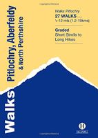
Wandelgids Pitlochry, Aberfeldy & North Perthshire | Hallewell Publica

0
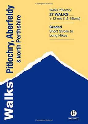
Walks Pitlochry, Aberfeldy & North Perthshire covers the northern part of the county of Perthshire: from the wilderness of Rannoch Moor to the popular holiday town of Pitlochry. Formerly published as Walks North Perthshire the book has been rewalked and updated (2016) to reflect changes on the ground and the splendid riverside walk from Aberfeldy t...

Webshops met dit product

Webshop
Bezorging
Prijs

Anderen bekeken ook

Wandelgids Pitlochry, Aberfeldy & North Perthshire | Hallewell Publica
Walks Pitlochry, Aberfeldy & North Perthshire covers the northern part of the county of Perthshire: from the wilderness of Rannoch Moor to the popular holiday town of Pitlochry. Formerly published as Walks North Perthshire the book has been rewalked and updated (2016) to reflect changes on the ground and the splendid riverside walk from Aberfeldy to Grandtully has been added. The walking is varied, with fine moorland walks, hill climbs and a great low-level path network around Pitlochry. The 27 walks featured range from 0.5 miles to 12 miles (1.2-19km). Routes include: Corrour to Rannoch Station, Schiehallion, Ben Lawers, Loch Faskally and The Birks of Aberfeldy. Part of a popular series of A6 pocket walking guides which describe routes which are suitable for walkers of all abilities and to suit all tastes. Route descriptions are accompanied by 2-colour sketch maps. The guides are illustrated with line illustrations, and will provide walkers with a good introduction to what the area co…
5,95
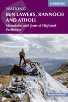
Wandelgids Walking Ben Lawers, Rannoch and Atholl | Cicerone
Wandelgids met 80 wandelingen van verschillende niveaus in het gebied van de Perthshire Highlands.  The south-eastern Grampians of the former county of Perthshire may be grassier and less rugged than other Scottish mountains, but they are just as big. The routes in this guide take you to the summits of these 'jolly green giants' - covering all of the region's Munros, often by unconventional routes, as well as several Corbetts and smaller hills - and also over the Atholl passes, along rivers and through the woods of Perthshire's 'Big Tree Country'. The 80 walks comprise a mixture of low-level, mid-level and mountain routes and are graded by both length and difficulty. Many are demanding, crossing remote, uneven, steep and/or pathless terrain, but also included are gentler walks on clear paths taking in local features of interest.   The route description is illustrated with clear mapping (a mixture of OS 1:50,000 and smaller-scale maps for the longer routes) and the route summary table a…
19,95
Wandelgids Perth, Dunkeld & Blairgowrie | Hallewell Publications
Walks Perth, Dunkeld & Blairgowrie (previously published as Walks East Perthshire) has been completely rewalked and revised. The guide covers the eastern part of the county of Perthshire, with a number of walks in and around the city of Perth, plus hill walks on the edge of the Highlands and the marvellous Dunkeld path network. The 28 walks featured range from 0.75 miles to 8 miles (1.25-13km). Routes include: River Ericht, Birnam Hill, Perth to Kinnoull Hill and Abernethy Glen. Part of a popular series of A6 pocket walking guides which describe routes which are suitable for walkers of all abilities and to suit all tastes. Route descriptions are accompanied by 2-colour sketch maps. The guides are illustrated with line illustrations, and will provide walkers with a good introduction to what the area covered has to offer.
5,95
Wandelgids Crieff, Comrie & Kinross | Hallewell Publications
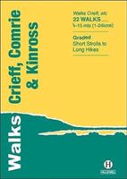
Walks Crieff, Comrie & Kinross includes walks in the south Perthshire hills, around Loch Earn and Loch Tay, and the Ochils, as well as the path network around Crieff. The 22 walks featured range from 0.5 miles to 15 miles (1-24km). Routes include: The Knock (Crieff), Ben Vorlich, Comrie to Callander and a fine circuit of Loch Leven. Previously published as Walks South Perthshire, the book has been rewalked and updated in 2016 to reflect changes on the ground. Part of a popular series of A6 pocket walking guides which describe routes which are suitable for walkers of all abilities and to suit all tastes. Route descriptions are accompanied by 2-colour sketch maps. The guides are illustrated with line illustrations, and will provide walkers with a good introduction to what each area covered has to offer.
5,95
Wandelgids North Dartmoor | Hallewell Publications
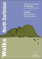
Rewalked and updated in 2020, Walks North Dartmoor features walks in and around the northern half of the Dartmoor National Park - an area famous for its rolling moorland, ponies and dramatic tors (weathered granite outcrops rising from the moorland). This guide covers the area between the town of Okehampton, in the north, and an east-west line just north of Tavistock. (For the southern half of the area, see Walks South Dartmoor.) The 21 walks in the guide range from 1.75 to 7 miles (2.8 11km). There are some fine low-level and woodland walks (notably the walk by the River Teign to Castle Drogo), but the bulk of the routes lead onto the moor, passing splendid features such as Hound Tor and Haytor Rocks. Walks North Dartmoor is part of a popular series of A6 pocket walking guides which describe routes which are suitable for walkers of all abilities and to suit all tastes. Route descriptions are accompanied by 2-colour sketch maps. The guides are illustrated with line illustrations, and w…
5,95
Wandelkaart - Topografische kaart OL49 OS Explorer Map Pitlochry & Loc
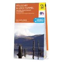
Met zijn 4cm voor 1 km (2 ½ cm voor 1 mijl) schaal, is de OS Explorer kaartenserie de ideale en meest gedetailleerde kaartenreeks voor mensen die graag outdoor-activiteiten zoals fietsen, wandelen, paardrijden, klimmen en watersporten. Deze kaart is nog gedetailleerder dan de 'gewone' Landranger maps. Voor- en achterzijde bedrukt! Zeker op de moors en andere natuurgebieden van onschatbare waarden met echt alle aspecten van het landschap op de kaart ingetekend. Zeer goede detailkaart met topografische ondergrond. Hierop zijn toeristische symbolen van bezienswaardigheden ingetekend, daarnaast staan bijvoorbeeld campings en jeugdherbergen vermeld en - voor wandelaars het belangrijkst - alle right of way paden en Lange afstands Wandelpaden zijn er op te vinden. De ideale kaart voor het wandelen in Engeland, Wales of Schotland.   OS Explorer Map OL 49 shows Loch Tummel, eastern Loch Rannoch and the surrounding towns of Pitlochry, Aberfeldy and Kinloch Rannoch. Loch Tummel (and the Clunie D…
19,50

Klanten-reviews van Wandelgids Pitlochry, Aberfeldy & North Perthshire | Hallewell Publica

Er zijn nog geen beoordelingen voor dit productBen jij de eerste die een review plaatst?

Meer over Wandelgids Pitlochry, Aberfeldy & North Perthshire | Hallewell Publica

Productomschrijving

Walks Pitlochry, Aberfeldy & North Perthshire covers the northern part of the county of Perthshire: from the wilderness of Rannoch Moor to the popular holiday town of Pitlochry. Formerly published as Walks North Perthshire the book has been rewalked and updated (2016) to reflect changes on the ground and the splendid riverside walk from Aberfeldy to Grandtully has been added. The walking is varied, with fine moorland walks, hill climbs and a great low-level path network around Pitlochry. The 27 walks featured range from 0.5 miles to 12 miles (1.2-19km). Routes include: Corrour to Rannoch Station, Schiehallion, Ben Lawers, Loch Faskally and The Birks of Aberfeldy. Part of a popular series of A6 pocket walking guides which describe routes which are suitable for walkers of all abilities and to suit all tastes. Route descriptions are accompanied by 2-colour sketch maps. The guides are illustrated with line illustrations, and will provide walkers with a good introduction to what the area covered has to offer.

Productspecificaties

Artikelnummer(s)
Brand
Hallewell Publications

Verken gerelateerde categorieën

Webshop.nl maakt gebruik van cookies. Ga je verder op onze website, ga dan akkoord met het plaatsen van cookies en de verwerking van deze data door ons en vermelde partners.