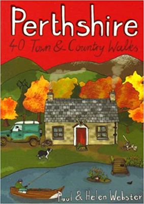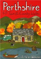
Wandelgids Perthshire : 40 Town and Country Walks | Pocket Mountains

0
Handige compacte wandelgids met 40 dagwandelingen. Deze gids bevat kleine kaartjes en leuke uitgebreide informatie over wat er langs de route te zien is. Goede wandelkaarten zijn echter we noodzakelijk voor deze tochten: de Ordnance Survey explorer maps of Landanger maps zijn zeer geschikt.     Perthshire is at the very heart of Scotland and one...

Verkopers met dit product

Verkoper
Bezorging
Prijs
DeZwerver.nl logo
DeZwerver.nl
2,95
10,95

Anderen bekeken ook

Wandelgids Perthshire : 40 Town and Country Walks | Pocket Mountains
Handige compacte wandelgids met 40 dagwandelingen. Deze gids bevat kleine kaartjes en leuke uitgebreide informatie over wat er langs de route te zien is. Goede wandelkaarten zijn echter we noodzakelijk voor deze tochten: de Ordnance Survey explorer maps of Landanger maps zijn zeer geschikt.     Perthshire is at the very heart of Scotland and one of the most popular regions for visitors, offering a variety of Highland and Lowland landscapes with some of the most scenic and accessible countryside for shorter walks as well as evidence of its rich history at every turn. "Perthshire 40 Town and Country Walks" features traditional tourist hubs, such as Pitlochry, Dunkeld and Killin (with its historical connections to the county), as well as countryside around Blairgowrie, Crieff and Aberfeldy, finishing up at the Fair City of Perth and nearby Kinross.  
10,95
Wandelgids Pitlochry, Aberfeldy & North Perthshire | Hallewell Publications
Walks Pitlochry, Aberfeldy & North Perthshire covers the northern part of the county of Perthshire: from the wilderness of Rannoch Moor to the popular holiday town of Pitlochry. Formerly published as Walks North Perthshire the book has been rewalked and updated (2016) to reflect changes on the ground and the splendid riverside walk from Aberfeldy to Grandtully has been added. The walking is varied, with fine moorland walks, hill climbs and a great low-level path network around Pitlochry. The 27 walks featured range from 0.5 miles to 12 miles (1.2-19km). Routes include: Corrour to Rannoch Station, Schiehallion, Ben Lawers, Loch Faskally and The Birks of Aberfeldy. Part of a popular series of A6 pocket walking guides which describe routes which are suitable for walkers of all abilities and to suit all tastes. Route descriptions are accompanied by 2-colour sketch maps. The guides are illustrated with line illustrations, and will provide walkers with a good introduction to what the area c…
5,95
Wandelgids 027 Pathfinder Guides Perthshire, Angus & Fife | Ordnance Survey
Wandelgids van een deel van Engeland, Schotland of Wales. Deze gids bevat 28 dagwandelingen, variërend van korte tochten tot pittige dagtochten. De bijbehorende kaarten zijn uitstekend: men heeft de topografische kaarten van Ordnance Survey gebruikt waarop de route is ingetekend. Daarnaast praktische informatie over de wandeling en wat beschrijvingen van het gebied. Each of the Jarrold Pathfinder titles features 28 circular routes, all tried and tested by seasoned walkers. The routes range from extended strolls to exhilarating hikes, so there is something for everyone. They also contain: -Ordnance Survey mapping; -background details of each area; -details of refreshment stops and parking; -walking safety advice; and -information about walkers and the law Approaching the eastern part of central Scotland, where the Grampians dominate the horizon, it appears at first glance to be mountain country. In fact much of the area is low-lying, with flat woodland and agricultural land bordered by…
18,50
Wandelgids Pembrokeshire : 40 Coast and Country Walks | Pocket Mountains
Handige compacte wandelgids met 40 dagwandelingen. Deze gids bevat kleine kaartjes en leuke uitgebreide informatie over wat er langs de route te zien is. Goede wandelkaarten zijn echter we noodzakelijk voor deze tochten: de Ordnance Survey explorer maps of Landanger maps zijn zeer geschikt.     As the home of Britain's one and only national coastal park, Pembrokeshire is rightly famed for its marine wildlife, unspoilt beaches, towering cliffs and charming harbours. Inland, however, you will also find ancient woodlands and rolling hills, as well as archaeological mysteries and crumbling castles which suggest that this peaceful part of Wales has a far more turbulent past.The 40 moderate walks in this volume from award winning publisher Pocket Mountains, explore the stunning coastline as well as the heartland of the county, with several routes making use of sections of established long-distance walking trails.  
10,95
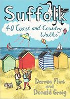
Wandelgids Suffolk : 40 Coast and Country Walks | Pocket Mountains
Handige compacte wandelgids met 40 dagwandelingen. Deze gids bevat kleine kaartjes en leuke uitgebreide informatie over wat er langs de route te zien is. Goede wandelkaarten zijn echter we noodzakelijk voor deze tochten: de Ordnance Survey explorer maps of Landanger maps zijn zeer geschikt.     Suffolk has long been a place of retreat, somewhere to escape to, far from everyday life. It may have its busier town centres, but in the main Suffolk remains a rural area of enormous variety , from heather covered heathland to softly rolling hills, long shingle spits to genteel coastal enclaves and kiss-me-quick seaside resorts. Whether you are looking for a morning hike or an afternoon stroll, Darren Flint and Donald Grieg's hand picked selection of 40 walks is guaranteed to fit the bill - or the boot.   Suffolk boasts 5,600km of public rights of way; take your pick, put your best foot forward and discover this most gentle of English counties.
10,95
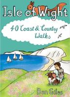
Wandelgids Isle of Wight : 40 Coast and Country Walks | Pocket Mountains
The Isle of Wight in the English Channel is England's largest island, separated from the mainland by the Solent but easily and quickly accessible from the south coast. Designated a UNESCO Biosphere Reserve, the mild climate and slower pace of life has long attracted holiday-makers and curious walkers who come to explore the island's rolling chalkland hills, peaceful woodland paths and sandy beaches and coves. The 40 walks in this volume make the most of the island's well-maintained trails - which include some of the most celebrated clifftop walks in southern England - as well as many lesser-known gems waiting to be discovered on this Treasure Island.  
9,95
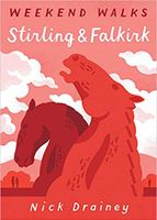
Wandelgids Stirling & Falkirk : Weekend Walks | Pocket Mountains
Handige compacte wandelgids met 40 dagwandelingen. Deze gids bevat kleine kaartjes en leuke uitgebreide informatie over wat er langs de route te zien is. Goede wandelkaarten zijn echter we noodzakelijk voor deze tochten: de Ordnance Survey explorer maps of Landanger maps zijn zeer geschikt.     Between Edinurgh and Glasgow is an area resonant in romance, history and invention. The moors above Stirling and the carseland surrounding its magnificent castle set the scene for a number of landmark battles, while Falkirk played a leading role in Scotland's Industrial Revolution and is today the home of some of the country's most innovative and popular attractions. These 25 walks explore the picturesque places round Stirling and Falkirk, from the windswept drama of bare hills to the tranquill setting of canals, lochs, reservoirs and riversides.  
10,95
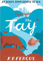
Wandelgids The Tay | Pocket Mountains
Handige compacte wandelgids met 40 dagwandelingen. Deze gids bevat kleine kaartjes en leuke uitgebreide informatie over wat er langs de route te zien is. Goede wandelkaarten zijn echter we noodzakelijk voor deze tochten: de Ordnance Survey explorer maps of Landanger maps zijn zeer geschikt.     As well as being Scotland's longest river, the Tay also carries the largest volume of water of any river in the UK more than the Thames and Severn combined when it reaches the Firth of Tay. From its source high up the slopes of Ben Lui near Tyndrum, the Tay makes its way through Stirlingshire and Perthshire to meet the North Sea near Dundee. As one of the best salmon rivers in Europe, every year it lures anglers from around the world and countless more come to explore the glorious hills and glens it passes.   There is no better way to discover the wildlife, architecture and history of this area of Scotland than to walk. Whatever your ability walking at high or low level, following tough terra…
10,95
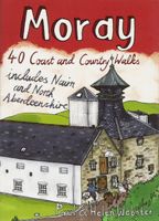
Wandelgids Weekend Walks Moray | Pocket Mountains
The Moray coastline has a string of superb sandy beaches, and towns such as Buckie, Lossiemouth and Nairn (historically part of Morayshire) have long been popular for family holidays.   For the walker there are cliffs, arches and stacks as well as sand and dunes, whilst offshore it may be possible to glimpse the famous Moray Firth dolphins. Set back from the coast are fine stone-built towns such as Forres and the small Cathedral city of Elgin.   From here heading southwards the character of the countryside changes to one of wide, spacious glens and sweeping, purple heather moors and hills. This is Speyside - Malt whisky country par excellence. The main centres here are Keith, Aberlour and attractive Dufftown, as the hills slowly merge into the Cairngorms National Park.   This latest pocket guide features 40 of the best walks in this popular area in an attractive and accessible format.
10,95
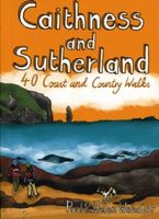
Wandelgids Caithness and Sutherland | Pocket Mountains
Handige compacte wandelgids met 40 dagwandelingen. Deze gids bevat kleine kaartjes en leuke uitgebreide informatie over wat er langs de route te zien is. Goede wandelkaarten zijn echter we noodzakelijk voor deze tochten: de Ordnance Survey explorer maps of Landanger maps zijn zeer geschikt. The county of Ayrshire is located on the Firth of Clyde on the beautiful West Coast of Scotland and is known as one of the most fertile areas of the country, famed for its cattle and crops. Although more industrial to the north, it is in the main a landscape made for walking with an abundance of open countryside and rugged little hills, golden sandy beaches and beautiful sunsets. This guide features 40 mostly moderate walks full of interest which explore all aspects of the region, from craggy cliffs and caves to historic castles, ancient forests to sandy shorelines. Sutherland and Caithness are the most northerly parts of mainland Britain. Northwest Sutherland is a landscape of sandy beaches and …
10,95

Klanten-reviews van Wandelgids Perthshire : 40 Town and Country Walks | Pocket Mountains

Er zijn nog geen beoordelingen voor dit productBen jij de eerste die een review plaatst?

Meer over Wandelgids Perthshire : 40 Town and Country Walks | Pocket Mountains

Productomschrijving

Handige compacte wandelgids met 40 dagwandelingen. Deze gids bevat kleine kaartjes en leuke uitgebreide informatie over wat er langs de route te zien is. Goede wandelkaarten zijn echter we noodzakelijk voor deze tochten: de Ordnance Survey explorer maps of Landanger maps zijn zeer geschikt.     Perthshire is at the very heart of Scotland and one of the most popular regions for visitors, offering a variety of Highland and Lowland landscapes with some of the most scenic and accessible countryside for shorter walks as well as evidence of its rich history at every turn. "Perthshire 40 Town and Country Walks" features traditional tourist hubs, such as Pitlochry, Dunkeld and Killin (with its historical connections to the county), as well as countryside around Blairgowrie, Crieff and Aberfeldy, finishing up at the Fair City of Perth and nearby Kinross.  

Productinformatie

    Verken gerelateerde categorieën

    Webshop.nl maakt gebruik van cookies. Ga je verder op onze website, ga dan akkoord met het plaatsen van cookies en de verwerking van deze data door ons en vermelde partners.