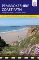
Wandelgids Pembrokeshire Coast Path | Trailblazer Guides

0
🄾 Pembrokeshire Coast Path – Wandelgids van Trailblazer (Engelstalig) Volg een van de mooiste kustpaden van Groot-BrittanniĆ« met deze uitgebreide Trailblazer-gids voor het Pembrokeshire Coast Path. Deze National Trail van 299 km (186 mijl) voert je langs de ruige kustlijn van het Pembrokeshire Coast National Park in Zuidwest-Wales – bekend om zij...

Verkopers met dit product

Verkoper
Bezorging
Prijs
DeZwerver.nl logo
DeZwerver.nl
€2,95
€21,95

Anderen bekeken ook

Wandelgids Pembrokeshire Coast Path | Trailblazer Guides
Goede wandelgids waarin met veel details alle etappes zijn beschreven. Tevens informatie over overnachtingen en openbaar vervoer. Practical guidebook to walking the Pembrokeshire Coast Path. The walk follows a National Trail around the coastline in south-west Wales. Includes maps, accommodation, pubs and restaurants, and what to see along the coastal path. 102 maps: 96 large-scale walking maps, 6 town plans, 10 stage with trail profiles and 2 overview maps. Detailed accommodation: B&Bs, campsites, pubs, hotels, bunkhouses. Where to eat: cafes, pubs and restaurants. Detailed public transport information with frequency of services. Downloadable GPS waypoints. Itineraries for all walkers, whether hiking the entire route or sampling highlights on day walks, weekends or short breaks. Ā  Ā  96 walking maps – 1:20,000 (3-1/8 inches to 1 mile) – the largest-scale maps available. Ā  10 stage maps with trail profiles and 2 overview maps Unique mapping features – walking times, directions, tricky j…
19,95
Wandelgids Gllyndwr's Way | Trailblazer Guides
This title in our British Walking Guides series covers the 135-mile National Trail in Wales following in the footsteps of Owain Glyndŵr, the Welsh prince who led a rebellion against the English in 1400. Traversing a range of open farmland and forest, it links with another National Trail, Offa's Dyke Path, at its start in Knighton and end in Welshpool. 10 town plans and 58 large-scale walking maps - at just under 1:20,000 - showing route times, places to stay, points of interest and much more Plus 10 overview maps Itineraries for all walkers - whether walking the route in its entirety over seven to eight days or sampling the highlights on day walks and short breaks Practical information for all budgets - camping, bunkhouses, hostels, B&Bs, pubs and hotels - where to stay, where to eat, what to see, plus detailed street plans Comprehensive public transport information - for all access points on the path. Flora and fauna - four page full color flower guide, plus an illustrated sect…
20,95
Wandelgids Thames Path | Trailblazer Guides
This book follows the Thames Path National Trail from the river's source in Gloucestershire to the Thames Barrier in London. Officially 184 miles (294km) in length (although the actual distance you walk will depend on a number of decisions you make en route), the path meanders, accompanied by its watery muse, through pristine and tranquil countryside, past historic sites and buildings, via pub, lock, weir, and the occasional scattering of waterfowl, to a city, once the fulcrum of an empire, and now the heart of modern day England. The river, responsible for the metropolis' very being, tells tales, inspires artists, accommodates swans, geese, and water voles, reflects the silhouettes of red kites and kingfishers, provides employment, entices adventure, and allows time for carefree pilgrims to procrastinate and think. Following its banks is a grand way to go for a ramble. The path begins, as the river does, in a meadow in the Cotswolds; its upper reaches lonely and wild, the meadows and…
19,95
Reisgids Pocket Helsinki | Lonely Planet
šŸ“˜ Lonely Planet Pocket Helsinki – De ideale stadsgids voor een korte trip Ontdek het beste van Helsinki in korte tijd met deze compacte en actuele reisgids van Lonely Planet. Perfect voor reizigers die in 1 tot 7 dagen de Finse hoofdstad willen verkennen – mĆ©t lokale tips, duidelijke kaarten en kant-en-klare routes. 🧭 Wat vind je in deze gids? Drie perfecte-dagen routes – slim geplande dagindelingen vol hoogtepunten Bezoek klassiekers als Suomenlinna, de Oodi-bibliotheek en Vanha Kauppahalli Insideradvies over waar te eten, drinken, shoppen en ontspannen als een local Wandelroutes per wijk – ontdek Helsinki te voet, wijk voor wijk Inclusief losse uitneembare stadskaart en handige plattegronden per buurt Vol met tips over openbaar vervoer, lokale etiquette, geldzaken, taal, toegankelijkheid en LGBTIQ+-vriendelijk reizen āœ… Voordelen Speciaal ontworpen voor korte trips (1–7 dagen) Overzichtelijk formaat – makkelijk mee te nemen onderweg Boordevol actuele lokal…
14,95
Wandelgids Cornwall Coast Path | Trailblazer Guides
Wandelgids met uitgebreide beschrijvingen wandelingen en praktische informatie met eenvoudige kaarten van de wandelroutes. Practical, complete hiking route guide, with maps and accommodation for the 288-mile footpath that runs around the entire coastline of Cornwall, from Bude to Plymouth; Part 2 of the South-West-Coast Path, a 630-mile National Trail from Minehead to Poole. Includes * 142 large-scale walking maps in TWO-COLOUR style (3 1/8inches to 1 mile), 15 town plans, guides to 81 towns and villages, 24 stage maps and overview map. * Itineraries for all walkers - whether walking the route in its entirety over a week to 10 days or sampling the highlights on day walks and short breaks * GPS waypoints * Practical information for all budgets - camping, bunkhouses, hostels, B&Bs, pubs and hotels; where to stay, where to eat, what to see. Ā  * Comprehensive public transport information - for all access points on the coast path * Flora and fauna - 6 page full colour, flower, butterfly, b…
20,95
Nieuw
Reisgids Italy | Insight Guides
Insight Guides ItaliĆ« – Complete en geĆÆllustreerde reisgids Ontdek ItaliĆ« in al zijn veelzijdigheidĀ met deze rijk geĆÆllustreerde reisgids vanĀ Insight Guides. Perfect voor wie een langere reis plant en niet alleen de bekende highlights wil zien, maar ook de cultuur, geschiedenis en het lokale leven Ć©cht wil begrijpen. 🧭 Wat vind je in deze gids? Topattracties en Editors’ Choice-tips – van hetĀ Comomeer, de Dolomieten en FlorenceĀ totĀ truffels in Alba,Ā Cinque Terre,Ā Rome,Ā Venetië en deĀ Amalfikust Diepgaande beschrijvingen van bezienswaardigheden – inclusief verborgen parels, per regio georganiseerd Wanneer te gaan? – overzicht van de beste reisperiodes, seizoenen, klimaat en festivals Praktische reistips – over vervoer, budget, eten, drinken, winkelen en logeren Insidertips – hoe vermijd je de drukte, waar bespaar je geld en waar vind je lokale hotspots? Achtergrondartikelen – over de Italiaanse cultuur, geschiedenis, politiek en het moderne leven Gedetailleerde…
27,50
Wandelgids Coast to Coast Path: St Bees to Robin Hood's Bay | Trailblazer Guides
Goede wandelgids van de hele route van kust naar kust. Met veel details zijn alle etappes beschreven. Tevens informatie over overnachtingen en openbaar vervoer. All the information you need to enjoy your hiking adventure from Coast to Coast in this updated 10th edition. Fully re-walked and revised 10th edition of this classic 191-mile walk from the Irish Sea to the North Sea. Crossing three national parks - the Lake District, the Yorkshire Dales, and the North York Moors - it samples the very best of the English countryside - rugged mountains and lakes, gentle dales and stone-built villages; wild moorland; sea cliffs and fishing villages. Ā  The guide includes:109 large-scale walking maps - at just under 1:20,000 - showing route times, places to stay, places to eat, points of interest, and 9 town plans14 colour stage maps to help plan your walk, including hills and descentsPlaces to stay with reviews - campsites, bunkhouses, hostels, B&Bs, pubs and hotelsPlaces to eat with reviews -…
19,95
Wandelgids South Downs Way | Trailblazer Guides
The South Downs Way is a 100-mile footpath which follows the line of chalk hills stretching from Winchester to Eastbourne. Walking the length of the Downs is the best way to experience this beautiful landscape with its mixture of rolling hills, steep hanging woodland and windswept fields. You'll also pass through picture-postcard villages with welcoming pubs, thatched cottages and country gardens. 1. Unique mapping features - In many walking guides the reader has to read a route description then try to relate it to the map. Our guides are easier to use because walking directions, tricky junctions, places to stay and eat, points of interest and walking times are all written onto the maps themselves in the places to which they apply. With their uncluttered clarity, these are not general-purpose maps but fully-edited maps drawn by walkers for walkers. Downloadable GPS waypoints also included. 2. The largest scale walking maps available - At just under 1:20,000 (8cm or 31/8 inches to 1 mi…
20,95
Nieuw
Wandelgids Walking the Pembrokeshire Coast Path map booklet | Cicerone
A booklet of all the mapping needed to walk the Pembrokeshire Coast Path National Trail between Amroth near Tenby and St Dogmaels by Cardigan. Covering 290km (180 miles) and over 10,500m of ascent, this trail takes around 2 weeks to complete. The full route is shown on 1:25,000 OS maps The map booklet can be used to walk the trail in either direction Sized to easily fit in a jacket pocket or rucksack The relevant extract from the OS Explorer map legend is includedHigh tide and military range closure alternate routes are providedAn accompanying Cicerone guidebook – Walking the Pembrokeshire Coast Path is also available, which includes a copy of this map booklet Ā  Both native Lancastrians, Dennis and Jan Kelsall have long held a passion for countryside and hill walking. Since their first Cicerone title was published in 1995, they have written and illustrated around 35 guides covering some of Britain’s most popular walking areas and have become regular contributors to various outdoor ma…
15,95
Reisgids Montana - Wyoming | Moon Travel Guides
🤠 Moon Montana & Wyoming – Reisgids voor het Wilde Westen van de VS Ontdek de uitgestrekte prairies, berglandschappen en historische stadjes van het oude Westen met deze gedetailleerde Moon Montana & Wyoming reisgids. Of je nu droomt van een roadtrip door Yellowstone, wilt wandelen bij Glacier National Park of de cowboycultuur wilt ervaren in Jackson Hole – deze gids helpt je om het maximale uit je reis te halen. 🧭 Wat vind je in deze gids? Flexibele reisroutes voor zowel Montana als Wyoming – inclusief Yellowstone, Glacier en Grand Teton National Park De beste roadtrips, van een 14-daagse Yellowstone-lus tot een 7-daagse Glacier-tour Tips voor het spotten van wildlife: wolven, elanden, bizons, beren en meer Actieve tips: whitewater raften, kajakken, wandelen naar watervallen en bergmeren Verhalen over de Native American geschiedenis en authentieke cowboycultuur Eet- en slaaptips van lokale expert Carter G. Walker, voormalig wildernisgids en inwoner van Montana F…
24,95

Klanten-reviews van Wandelgids Pembrokeshire Coast Path | Trailblazer Guides

Er zijn nog geen beoordelingen voor dit productBen jij de eerste die een review plaatst?

Meer over Wandelgids Pembrokeshire Coast Path | Trailblazer Guides

Productomschrijving

🄾 Pembrokeshire Coast Path – Wandelgids van Trailblazer (Engelstalig)

Volg een van de mooiste kustpaden van Groot-BrittanniĆ« met deze uitgebreide Trailblazer-gids voor het Pembrokeshire Coast Path. Deze National Trail van 299 km (186 mijl) voert je langs de ruige kustlijn van het Pembrokeshire Coast National Park in Zuidwest-Wales – bekend om zijn zandstranden, vissersdorpen, vogelrijke kliffen en verborgen baaien.

🧭 Wat biedt deze gids?

  • 236 pagina’s boordevol informatie

  • 96 trailkaarten en 15 stadsplattegronden – met routeaanwijzingen direct op de kaart

  • 60 kleurenfoto’s en een kleurrijke 4 pagina’s tellende bloemenherkenningsgids

  • 14 etappekaarten en 2 overzichtskaarten

  • Volledige informatie over accommodaties, eetgelegenheden en openbaar vervoer langs het pad

  • GPS-waypoints te downloaden voor digitale navigatie

De unieke cartografie van Trailblazer maakt het verschil: de kaarten bevatten niet alleen het pad, maar ook wandelinstructies, bezienswaardigheden, horeca en wandelduur – alles op de juiste plek op de kaart zelf.

āœ… Voordelen

  • Kaarten en routebeschrijvingen in ƩƩn – geen gesleep met aparte gids en kaart

  • Grootste schaal onder wandelgidsen: bijna 1:20.000 voor maximale detail

  • Uitgebreide info over overnachtingen, eten, bezienswaardigheden en OV

āš ļø Aandachtspunten

  • Engelstalige gids – overzichtelijk en helder, maar niet in het Nederlands

  • Niet waterbestendig – bescherming aanbevolen bij regenachtig weer

  • Geen losse kaarten – alles is geĆÆntegreerd in de gids

Ā 

The Pembrokeshire Coast Path follows a National Trail for 186 miles (299km) around the magnificent coastline of the Pembrokeshire Coast National Park in south-west Wales. Renowned for its unspoilt sandy beaches, secluded coves, tiny fishing villages and off-shore islands rich in bird and marine life, this National Trail provides some of the best coastal walking in Britain. Ā  Features: 1. Unique mapping features – In many walking guides the reader has to read a route description then try to relate it to the map. Our guides are easier to use because walking directions, tricky junctions, places to stay and eat, points of interest and walking times are all written onto the maps themselves in the places to which they apply. With their uncluttered clarity, these are not general-purpose maps but fullyedited maps drawn by walkers for walkers. Downloadable GPS waypoints also included. 2. The largest scale walking maps available – At just under 1:20,000 (8cm or 31/8 inches to 1 mile) our maps are bigger than even the most detailed walking maps currently available in the shops. 3. An all-in-one guide – Trailblazer guides include practical information not usually found in walking guides to the UK: reviews of places to stay, places to eat, attractions along the way and detailed public transport information showing all access points on the path, for weekend and day walkers.

Verken gerelateerde categorieƫn

Webshop.nl maakt gebruik van cookies. Ga je verder op onze website, ga dan akkoord met het plaatsen van cookies en de verwerking van deze data door ons en vermelde partners.