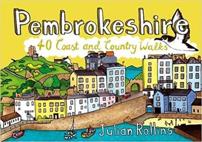
Wandelgids Pembrokeshire : 40 Coast and Country Walks | Pocket Mountains

0
Handige compacte wandelgids met 40 dagwandelingen. Deze gids bevat kleine kaartjes en leuke uitgebreide informatie over wat er langs de route te zien is. Goede wandelkaarten zijn echter we noodzakelijk voor deze tochten: de Ordnance Survey explorer maps of Landanger maps zijn zeer geschikt.     As the home of Britain's one and only national coas...

Verkopers met dit product

Webshop
Bezorging
Prijs
DeZwerver.nl logo
DeZwerver.nl
niet bekend
10,95

Anderen bekeken ook

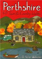
Wandelgids Perthshire : 40 Town and Country Walks | Pocket Mountains
Handige compacte wandelgids met 40 dagwandelingen. Deze gids bevat kleine kaartjes en leuke uitgebreide informatie over wat er langs de route te zien is. Goede wandelkaarten zijn echter we noodzakelijk voor deze tochten: de Ordnance Survey explorer maps of Landanger maps zijn zeer geschikt.     Perthshire is at the very heart of Scotland and one of the most popular regions for visitors, offering a variety of Highland and Lowland landscapes with some of the most scenic and accessible countryside for shorter walks as well as evidence of its rich history at every turn. "Perthshire 40 Town and Country Walks" features traditional tourist hubs, such as Pitlochry, Dunkeld and Killin (with its historical connections to the county), as well as countryside around Blairgowrie, Crieff and Aberfeldy, finishing up at the Fair City of Perth and nearby Kinross.  
10,95
Wandelgids Suffolk : 40 Coast and Country Walks | Pocket Mountains
Handige compacte wandelgids met 40 dagwandelingen. Deze gids bevat kleine kaartjes en leuke uitgebreide informatie over wat er langs de route te zien is. Goede wandelkaarten zijn echter we noodzakelijk voor deze tochten: de Ordnance Survey explorer maps of Landanger maps zijn zeer geschikt.     Suffolk has long been a place of retreat, somewhere to escape to, far from everyday life. It may have its busier town centres, but in the main Suffolk remains a rural area of enormous variety , from heather covered heathland to softly rolling hills, long shingle spits to genteel coastal enclaves and kiss-me-quick seaside resorts. Whether you are looking for a morning hike or an afternoon stroll, Darren Flint and Donald Grieg's hand picked selection of 40 walks is guaranteed to fit the bill - or the boot.   Suffolk boasts 5,600km of public rights of way; take your pick, put your best foot forward and discover this most gentle of English counties.
10,95
Wandelgids Wester Ross and Lochalsh | Pocket Mountains
Handige compacte wandelgids met 40 dagwandelingen. Deze gids bevat kleine kaartjes en leuke uitgebreide informatie over wat er langs de route te zien is. Goede wandelkaarten zijn echter we noodzakelijk voor deze tochten: de Ordnance Survey explorer maps of Landanger maps zijn zeer geschikt.     Wester Ross and Lochalsh are amongst the most popular areas for walks in the Scottish Highlands. The Lochalsh peninsula between the shores of Loch Duich and Loch Carron offers varied walking from villages such as Plockton as well as the region's main town at Kyle of Lochalsh. Across the dramatic Mam Ratagan pass is the remote and secluded Glenelg peninsula, a tranquil and peaceful haven far from busy routes.   Further north are Applecross and Lochcarron, with mountains that yield nothing in ruggedness to their more famous counterparts in Torridon, as well as attractive fishing villages and forest walks. Finally around Gairloch is an area that has long been famous for its fine sandy beaches, m…
10,95
Wandelgids Weekend Walks Edinburgh | Pocket Mountains
Edinburgh is one of the most richly layered historical cities in Europe, with the medieval layout of the Old Town and the neoclassicism of the Georgian New Town attracting visitors from all over the world. Like Rome, Edinburgh has its Seven Hills, while two waterways slip unseen through the capital. These 25 walks feature the best of the city, as well as the harbours, beaches and nature reserves of the Firth of Forth, the hills and glens of the Pentlands and the parkland of some of the finest nearby country estates.  
10,95
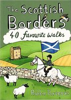
Wandelgids The Scottish Borders | Pocket Mountains
Handige compacte wandelgids met 40 dagwandelingen. Deze gids bevat kleine kaartjes en leuke uitgebreide informatie over wat er langs de route te zien is. Goede wandelkaarten zijn echter we noodzakelijk voor deze tochten: de Ordnance Survey explorer maps of Landanger maps zijn zeer geschikt.   The Scottish Borders cover a vast area, stretching from the east coast to rural Dumfriesshire and from the more populous Lothians to the border with England. Although there are no very high mountains, the Borders have always attracted walkers keen to explore the quiet moorlands, rolling hills, ancient woodland and rugged coast, as well as the romantic ruins of abbeys and castles, grand estates and rich literary heritage of the area.Ancient native tribes and Roman legions left their mark on this landscape, as did years of fierce warfare with our southern neighbours and raiding by ruthless Border Reivers. These 40 walks will introduce you to some of the fascinating history which shaped this most in…
10,95
Wandelgids Weekend Walks Moray | Pocket Mountains
The Moray coastline has a string of superb sandy beaches, and towns such as Buckie, Lossiemouth and Nairn (historically part of Morayshire) have long been popular for family holidays.   For the walker there are cliffs, arches and stacks as well as sand and dunes, whilst offshore it may be possible to glimpse the famous Moray Firth dolphins. Set back from the coast are fine stone-built towns such as Forres and the small Cathedral city of Elgin.   From here heading southwards the character of the countryside changes to one of wide, spacious glens and sweeping, purple heather moors and hills. This is Speyside - Malt whisky country par excellence. The main centres here are Keith, Aberlour and attractive Dufftown, as the hills slowly merge into the Cairngorms National Park.   This latest pocket guide features 40 of the best walks in this popular area in an attractive and accessible format.
10,95
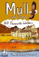
Wandelgids Mull and Iona | Pocket Mountains
Handige compacte wandelgids met 40 dagwandelingen. Deze gids bevat kleine kaartjes en leuke uitgebreide informatie over wat er langs de route te zien is. Goede wandelkaarten zijn echter we noodzakelijk voor deze tochten: de Ordnance Survey explorer maps of Landanger maps zijn zeer geschikt.   Mull is the second largest island of the Inner Hebrides. Perhaps best known for the colourful harbour of Tobermory at the northern end of the island, Mull has become very popular as a holiday destination, most particularly among wildlife enthusiasts.   In this volume you will find the best walking routes on Mull and the neighbouring islands of Iona and Ulva, both easily reached by short ferry journeys. Mull includes some of the wildest coastal scenery in the country as well as many grand mountains, pretty villages and stunning sandy beaches.
10,95
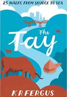
Wandelgids The Tay | Pocket Mountains
Handige compacte wandelgids met 40 dagwandelingen. Deze gids bevat kleine kaartjes en leuke uitgebreide informatie over wat er langs de route te zien is. Goede wandelkaarten zijn echter we noodzakelijk voor deze tochten: de Ordnance Survey explorer maps of Landanger maps zijn zeer geschikt.     As well as being Scotland's longest river, the Tay also carries the largest volume of water of any river in the UK more than the Thames and Severn combined when it reaches the Firth of Tay. From its source high up the slopes of Ben Lui near Tyndrum, the Tay makes its way through Stirlingshire and Perthshire to meet the North Sea near Dundee. As one of the best salmon rivers in Europe, every year it lures anglers from around the world and countless more come to explore the glorious hills and glens it passes.   There is no better way to discover the wildlife, architecture and history of this area of Scotland than to walk. Whatever your ability walking at high or low level, following tough terra…
10,95
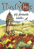
Wandelgids The Ochils | Pocket Mountains
Handige compacte wandelgids met 40 dagwandelingen. Deze gids bevat kleine kaartjes en leuke uitgebreide informatie over wat er langs de route te zien is. Goede wandelkaarten zijn echter we noodzakelijk voor deze tochten: de Ordnance Survey explorer maps of Landanger maps zijn zeer geschikt.   40 easy short walks with a very cute cartoonish style Known to the ancient people of Central Scotland as uchel – ‘the high place’ – the long upland massif of the Ochils rises between the River Forth and the Southern Highlands, with a dramatic escarpment running between the cities of Stirling and Perth. The high rounded hills are cleaved by steep-sided ravines and dotted with castles, standing stones, burial mounds, hillforts and battlesites, making the Ochils a walker’s paradise. This collection of 40 routes covers all the main summits, as well as the magnificent glens and the two rivers, the Allan and the Devon, which transect them.  
10,95
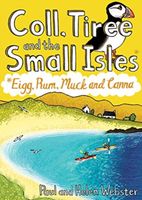
Wandelgids Coll, Tiree and the Small Isles | Pocket Mountains
Handige compacte wandelgids met 40 dagwandelingen. Deze gids bevat kleine kaartjes en leuke uitgebreide informatie over wat er langs de route te zien is. Goede wandelkaarten zijn echter we noodzakelijk voor deze tochten: de Ordnance Survey explorer maps of Landanger maps zijn zeer geschikt.     Off the west coast of Scotland, south of the Isle of Skye and north of Mull and Ardnamurchan, the islands' of Coll and Tiree are the most westerly of the Inner Hebrides and have a reputation as being amongst Scotland's sunniest places. Together with the Small Isles archipelago of Eigg, Rum, Muck and Canna to the north, these Hebridean gems provide a remarkable range and variety of walking. The 36 routes in this book explore these six magical islands rich histories and thriving wildlife as well as the fine sandy beaches, awe-inspiring cliffs and coves, wild interiors and dramatic mountain ranges which make them so special.    
10,95

Klanten-reviews van Wandelgids Pembrokeshire : 40 Coast and Country Walks | Pocket Mountains

Er zijn nog geen beoordelingen voor dit productBen jij de eerste die een review plaatst?

Meer over Wandelgids Pembrokeshire : 40 Coast and Country Walks | Pocket Mountains

Productomschrijving

Handige compacte wandelgids met 40 dagwandelingen. Deze gids bevat kleine kaartjes en leuke uitgebreide informatie over wat er langs de route te zien is. Goede wandelkaarten zijn echter we noodzakelijk voor deze tochten: de Ordnance Survey explorer maps of Landanger maps zijn zeer geschikt.     As the home of Britain's one and only national coastal park, Pembrokeshire is rightly famed for its marine wildlife, unspoilt beaches, towering cliffs and charming harbours. Inland, however, you will also find ancient woodlands and rolling hills, as well as archaeological mysteries and crumbling castles which suggest that this peaceful part of Wales has a far more turbulent past.The 40 moderate walks in this volume from award winning publisher Pocket Mountains, explore the stunning coastline as well as the heartland of the county, with several routes making use of sections of established long-distance walking trails.  

Verken gerelateerde categorieën

Webshop.nl maakt gebruik van cookies. Ga je verder op onze website, ga dan akkoord met het plaatsen van cookies en de verwerking van deze data door ons en vermelde partners.