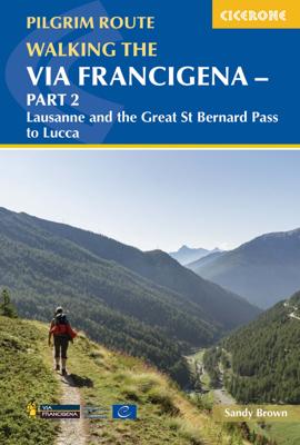
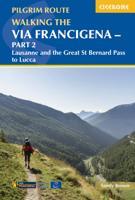
Wandelgids - Pelgrimsroute Via Francigena part 2 | Cicerone

0
Guidebook to the Via Francigena pilgrim route from Lausanne to Lucca. Starting at Lake Geneva (Lac Léman), the 725km route crosses the Alps at historic Great Saint Bernard Pass, descends the Po Valley, then climbs to cross the Cisa Pass into Tuscany. Described in 32 stages, with information on facilities and pilgrim hostels.   Seasons Suitable...

Verkopers met dit product

Verkoper
Bezorging
Prijs
DeZwerver.nl logo
DeZwerver.nl
2,95
24,95

Anderen bekeken ook

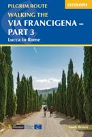
Wandelgids Walking the Via Francigena part 3 Lucca to Rome | Cicerone
Guidebook to the final 400km of the Via Francigena pilgrim route from Lucca to Rome. Crossing Tuscany in the heartland of Italy, the route goes through two of the region's most important cities, Lucca and Siena, and visits San Gimignano, Monteriggioni, and Radicofani. Described in 18 stages, with information on facilities and pilgrim hostels. Certified by the Council of Europe as an official Cultural Route, the Via Francigena from Canterbury to Rome brings to the modern pilgrim the cultural heritage of four nations--England, France, Switzerland, and Italy--and highlights their natural beauty and their history. Each stage has route directions and 1:100,000 mapping, which shows the route line and the facilities available at different locations. The book details accommodation along the route, including invaluable information on low-cost pilgrim hostels. There are city maps for Lucca, Siena, Rome, and Viterbi, and a stage planning guide that lists intermediate distances between pilgrim ac…
24,95
Wandelgids - Pelgrimsroute De weg van de Franken 2 | Anoda Publishing
Deze gids is onderdeel van een routebeschrijving die je vanaf Maastricht al wandelend de weg naar Rome laat ontdekken.  Abt Albert van de benedictijner abdij uit de Noord-Duitse stad Stade schreef in het midden van de dertiende eeuw in zijn dagboek ‘Annales Stadenses’ de beroemde zin: ‘Alle wegen leiden naar Rome’. In dit verslag van zijn Rome-reis gaf deze abt al aan dat Rome-pelgrims toen al de beschikking hadden over een groeiend aantal routes vanuit noordelijk Europa om naar de ‘Eeuwige stad’ te trekken en daar te bidden bij het graf van de apostel Petrus, de eerste paus.  Die routes leiden allen naar de voet van de Alpen, maar daar waren slechts enkele bruikbare overgangen over de dikwijls met sneeuw bedekte Alpentoppen. Eenmaal in Italië volgden zij daarbij dan vaak de al enkele eeuwen bekende Via Francigena. Pas in de veertiende eeuw kwamen er na de Alpen tal van alternatieve routes naar Rome tot ontwikkeling.  In deze wandelgids ‘De Weg van de Franken’ deel II vormt de route v…
24,95
Wandelgids Via Egnatia on Foot 2 | Via Egnatia Foundation
Via Egnatia on foot, Part 2, covers a distance of more than 550 kilometers. The book starts just as our first book with practical tips for travellers (chapter 1) and a description of the history of the Via Egnatia (chapter 2). In chapter 3 all relevant aspects of the trail are described in a general way. For instance conditions of the road, description of the landscape and the practical use of the maps. In chapter 4 you will find detailed information on the original Via Egnatia stages of the trail; long distances are cut up into separate walking sections. Each stage/section provides a description and a map of the track, interesting historical and cultural facts and monuments, illustrated with beautiful pictures. At the end we present the traveller two options to enter Turkey: one leads you to Edirne, the other one crosses the border to Ipsala.   In general this trail is not difficult for walkers, although after heavy rain it may be less easy and circumstances may differ considerably, …
22,95
Nieuw
Wandelgids Walking and Trekking in Iceland - IJsland | Cicerone
Wandelgids met beschrijvingen, kaarten en praktische informatie zoals bussen, overnachten, etc. voor meerdaagse wandelroutes en dagwandeltochten op IJsland. A country of extraordinary beauty, Iceland’s incredible variety of volcanic and glacial landscapes makes it a unique destination for walking and trekking holidays. Its three national parks include the mighty Vatnajökull, largest national park in Europe.   The wide range of routes in this book introduce walkers and backpackers to this ‘Land of Ice and Fire’. There are 100 days of walking in this guidebook, stretching over 1722km, split between 49 day walks and 10 multi-stage treks. They climb mountains, cross glaciers, pass lakes and explore coastlines and geothermal areas, and range from easy nature trails to challenging treks. So, there is enough variation to satisfy all kinds of walkers. The routes are spread all around Iceland, grouped into twelve regions. Detailed information is given at the start of each route or trekking sta…
26,95
Wandelgids Wales Coast Path: Snowdonia and Ceredigion | Northern Eye Books
Official Guide: Wales Coast Path: Snowdonia & Ceredigion Coast One of seven Official Guides to the Wales Coast Path This Official Guide to the Snowdonia & Ceredigion Coast section of the Wales Coast Path contains everything local and long-distance walkers need to enjoy the path.   Cardigan Bay probably offers a more diverse walking experience than any other section of the Wales Coast Path. The stretch covered in this book – from Porthmadog in the north to Cardigan in the south – largely covers two contrasting Welsh counties.   The first 97 kilometres pass through Gwynedd, along the western edge of the Snowdonia National Park. Here, just before the rivers that rise in the highest of the Welsh mountains reach the sea, they fan out to form broad estuaries that provide rich pickings for waders and other birdlife. The estuaries of the Dwyryd, the Mawddach and the Dyfi are the largest of these. Between them are some very large dune systems, including Morfa Harlech and Morfa Dyffryn – home t…
23,95
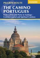
Pelgrimsroute - Wandelgids Camino Portugues | Camino Guides Brierley
2024 editionUpdated to include newer maps and photos and with an additional 16 pages, the latest edition in these comprehensive guidebooks to the Camino de Santiago (Portuguese Way) and its offshoots contains all the information needed by modern-day pilgrims wishing to walk the sacred Way of Saint James from Lisbon via Porto to Santiago. Overview route planners plus all 24 daily stage maps and detailed town plans help sojourners with as much advance preparation as they need. The maps feature contour guides to help distinguish the terrain that will be crossed each day, while full information on all pilgrim hostels, as well as details for alternative accommodation, allow travelers to plot adequate nightly stopping points.   All reference information is accompanied by helpful spiritual guidelines to support the seeker's inner journey as well as the outer pilgrimage. For travelers who wish to walk the coast of Portugal, this volume now includes a coastal option as well as a spiritual o…
27,95
Wandelgids Portugal's Rota Vicentina | Cicerone
This guidebook follows the Rota Vicentina, a 224km walking route along the marvellous Atlantic coastline in the Alentejo and Algarve regions of Portugal. The 12-stage trek combines two well-marked routes, the Caminho Histórico (the Historical Way) and the Trilho dos Pescadores (the Fishermen's Trail), to create a hike starting in Santiago do Cacém and ending at Cabo de São Vicente. The guide also describes an alternative circular route for those who would prefer an 11-stage loop, moving inland from Odeceixe and back up to Santiago de Cacém. Whichever route is chosen, the Rota Vicentina is ideal for a two-week holiday in spring or late summer to autumn, offering walkers a remarkable range of landscapes from coastal fishing villages to wooded river valleys. The guidebook includes advice about accommodation options along the route, information about the surrounding area, and a glossary of Portuguese terms to aid with reading signs and maps. Along the Rota Vicentina are many delights fo…
24,95
Wandelgids Trekking Gran Paradiso: Alta Via 2 : From Chardonney to Courmayeur in the Aosta Valley | Cicerone
A guidebook to trekking Alta Via 2, a route of 148km, from Chardonney and Courmayeur in the Gran Paradiso National Park. While not high on the difficulty scale, Alta Via 2 is strenuous, and best suited to trekkers with some alpine experience. Fittingly perfectly into a two-week time slot, the route is best undertaken between late June and late September.   The route is described across 12 stages (with a 4-stage extension option in place of Stages 6 and 7). Stages range from 5 to 18km, with stage ascent varying from 50m (Stage 8) to 1400m (Stage 9). Net ascent is 9630m. The route is described east to west so trekkers are rewarded with the beauty of Mont Blanc at the journey's end.   GPX files available to download Detailed information on travel logistics, the mountain hut network, as well as kit requirements Trek-specific Italian-English glossary included Information given on local alpine flora and wildlife Sized to easily fit in a jacket pocket
27,50
Nieuw
Wandelgids Camino Inglés and Ruta Do Mar | Cicerone
Guidebook to walking the Camino Inglés and Ruta do Mar pilgrim routes in northwest Spain. Describes the 116km Camino Inglés from Ferrol or A Coruña to Santiago de Compostela and the of the 190km Ruta do Mar linking Ribadeo with the Inglés at Ferrol. Includes the 120km Camino Finisterre from Santiago to Finisterre or Muxia. THE CAMINO INGLÉS Stage 1 Ferrol to Pontedeume Stage 2 Pontedeume to Betanzos Stage 3 Betanzos to Hospital de Bruma Stage 4 Hospital de Bruma to Sigüeiro Stage 5 Sigüeiro to Santiago de Compostela Alternative start A Coruña to Hospital de Bruma   THE RUTA DO MAR Stage 1 Ribadeo to Praia das Catedrais Stage 2 Praia das Catedrais to Foz Stage 3 Foz to San Cibrao Stage 4 San Cibrao to Viveiro Stage 5 Viveiro to Cuiña Stage 6 Cuiña to Teixido Stage 7 Teixido to Xubia   THE CAMINO FINISTERRE Stage 1 Santiago de Compostela to Negreira Stage 2 Negreira to Olveiroa Stage 3 Olveiroa to Finisterre
20,95
Fietsgids Bikepacking in the Lake District | Cicerone
Bikepacking is the off-road equivalent of cycle touring, often offering opportunities for wild camping in addition to the usual accommodation options for sleeping under a roof: it promises an unparalleled opportunity to immerse yourself in the environment as you explore the best of what the area has to offer on two wheels. This guide presents eight challenging 2-5 day rides in the Lake District, suitable for mountain bikes (some routes are also rideable on a gravel bike). All routes are accessible by public transport and many can be completed over a long weekend. They are graded from Moderate to Very Hard, although all involve considerable ascent and descent and sections where you may need to push or carry your bike - as such, they are suited to fit experienced riders. Clear route description, mapping and elevation profiles are supplemented with a wealth of planning information, including accommodation listings, notes on facilities, and summary details (including grades) for each indi…
23,95

Klanten-reviews van Wandelgids - Pelgrimsroute Via Francigena part 2 | Cicerone

Er zijn nog geen beoordelingen voor dit productBen jij de eerste die een review plaatst?

Meer over Wandelgids - Pelgrimsroute Via Francigena part 2 | Cicerone

Productomschrijving

Guidebook to the Via Francigena pilgrim route from Lausanne to Lucca. Starting at Lake Geneva (Lac Léman), the 725km route crosses the Alps at historic Great Saint Bernard Pass, descends the Po Valley, then climbs to cross the Cisa Pass into Tuscany. Described in 32 stages, with information on facilities and pilgrim hostels.   Seasons Suitable for walking in spring, summer and autumn. The Great Saint Bernard Pass is fully open to hikers only in August and September.   Centres Lausanne, Martigny, Great Saint Bernard Pass, Aosta, Ivrea, Vercelli, Pavia, Piacenza, Pontremoli, Pietrasanta, Lucca.   Difficulty Each stage is graded for difficulty (1-4). A few mountainous stages include steep and slippery slopes. No special gear is required to walk the Via Francigena in season, but off-season crossings of the Great Saint Bernard Pass require winter mountain gear and careful attention to changing mountain conditions.   Must See Dazzling Lake Geneva, the 1500-year-old Abbey of Saint-Maurice, the spectacular 2469m Great Saint Bernard Pass across the Alps, the emerald peaks of Italy's Aosta Valley, well-preserved medieval cities of Vercelli, Pavia and Piacenza, spectacular views from the Monte Valoria at the Cisa Pass, resorts of the Lunigiana coastline and the charming walled city of Lucca.   An indispensable guidebook to walking the Via Francigena between Lausanne and Lucca. This is the middle section of the pilgrim route connecting Canterbury to the Vatican City in Rome, and passes through some of the Via Francigena's most beautiful and dramatic scenery. Starting at Lake Geneva (Lac Léman) in Switzerland, the 725km route crosses the Alps into Italy at historic Great Saint Bernard Pass, descends through the Aosta Valley to the Po Valley, then climbs again to cross the Cisa Pass into Tuscany.   The route is described in 32 day stages averaging around 23km a day, but can easily be customised to other itineraries. It is suitable for any averagely fit walker, although there are a few steep mountainous stages. Relevant variants are described, including options to make use of boat, bus and train connections, and it is possible to cycle all or part of the Italian portion of the route.   In this guidebook, full stage directions are accompanied by maps showing the route line and the facilities available at different locations. Accommodation listings give invaluable information on low-cost pilgrim hostels and where to stay. There are useful city maps for Lausanne, Aosta, Ivrea, Pavia, Piacenza and Lucca, and a stage planning table lists intermediate distances between accommodation providers, so you can customise your own walking schedule. One of three volumes covering the complete Via Francigena.   Section 1: The Vaud and Valais Stage 1 Lausanne to Vevey Stage 2 Vevey to Aigle Stage 3 Aigle to Saint-Maurice Stage 4 Saint-Maurice to Martigny Stage 5 Martigny to Orsières Stage 6 Orsières to Bourg-Saint-Pierre Stage 7 Bourg-Saint-Pierre to Col du Grand-Saint-Bernard Section 2: Aosta Valley Stage 8 Col du Grand-Saint-Bernard to Aosta Stage 9 Aosta to Châtillon Stage 10 Châtillon to Verrès Stage 11 Verrès to Pont-Saint-Martin Section 3: Piemonte Stage 12 Pont-Saint-Martin to Ivrea Stage 13 Ivrea to Viverone Stage 14 Viverone to Santhià Stage 15 Santhià to Vercelli Variant Val di Susa to Vercelli Section 4: Lombardia Stage 16 Vercelli to Robbio Stage 17 Robbio to Mortara Stage 18 Mortara to Garlasco Stage 19 Garlasco to Pavia Stage 20 Pavia to Santa Cristina e Bissone Stage 21 Santa Cristina e Bissone to Orio Litta Stage 22 Orio Litta to Piacenza Section 5: Emilia-Romagna Stage 23 Piacenza to Fiorenzuola d’Arda Stage 24 Fiorenzuola d’Arda to Fidenza Stage 25 Fidenza to Fornovo di Taro Stage 26 Fornovo di Taro to Berceto Stage 27 Berceto to Pontremoli Section 6: Liguria and Tuscany Stage 28 Pontremoli to Aulla Stage 29 Aulla to Sarzana Stage 30 Sarzana to Massa Stage 31 Massa to Camaiore Stage 32 Camaiore to Lucca
 

Verken gerelateerde categorieën

Webshop.nl maakt gebruik van cookies. Ga je verder op onze website, ga dan akkoord met het plaatsen van cookies en de verwerking van deze data door ons en vermelde partners.