Wandelgids Peebles, Selkirk & Lanark | Hallewell Publications

0
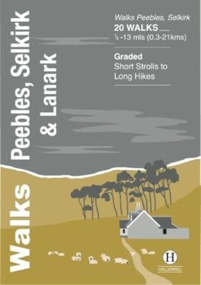
The latest in this popular series of pocket walking guides, including routes around the towns of Peebles, Selkirk and Lanark in the Scottish Borders. This guide covers the old counties of Peebles and Selkirk, as well as the the southern end of the old county of Lanark. The walks featured include a number of walks around the fine town of Peebles, o...

Verkopers met dit product

Verkoper
Bezorging
Prijs
DeZwerver.nl logo
DeZwerver.nl
2,95
5,95

Anderen bekeken ook

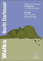
Wandelgids North Dartmoor | Hallewell Publications
Rewalked and updated in 2020, Walks North Dartmoor features walks in and around the northern half of the Dartmoor National Park - an area famous for its rolling moorland, ponies and dramatic tors (weathered granite outcrops rising from the moorland). This guide covers the area between the town of Okehampton, in the north, and an east-west line just north of Tavistock. (For the southern half of the area, see Walks South Dartmoor.) The 21 walks in the guide range from 1.75 to 7 miles (2.8 11km). There are some fine low-level and woodland walks (notably the walk by the River Teign to Castle Drogo), but the bulk of the routes lead onto the moor, passing splendid features such as Hound Tor and Haytor Rocks. Walks North Dartmoor is part of a popular series of A6 pocket walking guides which describe routes which are suitable for walkers of all abilities and to suit all tastes. Route descriptions are accompanied by 2-colour sketch maps. The guides are illustrated with line illustrations, and …
5,95
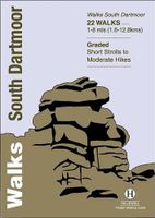
Wandelgids South Dartmoor | Hallewell Publications
Rewalked and revised in 2021, Walks South Dartmoor features walks in and around the southern half of the Dartmoor National Park - an area famous for its rolling moorland, ponies and dramatic tors (weathered granite outcrops rising from the moorland). This guide covers the area north of Ivybridge and south of an east-west line just north of Tavistock. (For the northern half of the area, see Walks North Dartmoor.) The 22 walks in the guide range from 1 to 8 miles (1.6 12.8km). The bulk of the high moorland walks are in the north of this area, passing such features as Great Mis Tor and Foxtor Mires (thought to be the inspiration for Grimpen Mire in The Hound of the Baskervilles). In the south there are more river and woodland walks, including paths from Burrator Reservoir and to the dramatic Dewterstone. Walks South Dartmoor is part of a popular series of A6 pocket walking guides which describe routes which are suitable for walkers of all abilities and to suit all tastes. Route descripti…
5,95
Wandelgids Coniston and the Southern Lakes | Hallewell Publications
Rewalked and revised in 2019, Walks Coniston & the Southern Lakes features walks in The Lake District - the famous area of spectacular peaks and lakes in the north-west of England. This guide covers the south-western part of the area, including walks in the hills around Coniston Water and on the south Cumbrian coast. The 21 walks featured range from 1 mile to 12 miles (1.5-19km). Routes include: The Old Man of Coniston, Grizedale, Dodgson Wood to High Nibthwaite and Grange-over-Sands to Cartmel. Now on its 4th edition, this guide is part of a popular series of A6 pocket walking guides which describe routes which are suitable for walkers of all abilities and to suit all tastes. Route descriptions are accompanied by 2-colour sketch maps. The guides are illustrated with line illustrations, and will provide walkers with a good introduction to what each area covered has to offer.  
5,95
Wandelgids Crieff, Comrie & Kinross | Hallewell Publications
Walks Crieff, Comrie & Kinross includes walks in the south Perthshire hills, around Loch Earn and Loch Tay, and the Ochils, as well as the path network around Crieff. The 22 walks featured range from 0.5 miles to 15 miles (1-24km). Routes include: The Knock (Crieff), Ben Vorlich, Comrie to Callander and a fine circuit of Loch Leven. Previously published as Walks South Perthshire, the book has been rewalked and updated in 2016 to reflect changes on the ground. Part of a popular series of A6 pocket walking guides which describe routes which are suitable for walkers of all abilities and to suit all tastes. Route descriptions are accompanied by 2-colour sketch maps. The guides are illustrated with line illustrations, and will provide walkers with a good introduction to what each area covered has to offer.  
5,95
Wandelgids Walking on Malta | Cicerone
Wandelgids met 33 dagtochten op Malta, Gozo en Comino. Goede omschrijvingen, veel praktische informatie. Redelijk kaartmateriaal. (goede wandelkaart Kompass / zie landkaarten) The Maltese Islands of Malta, Gozo and Comino bask in sunshine at the heart of the Mediterranean, between Europe and Africa. History has ensured that the islands have been colonised time and time again, leaving them with a colourful and complex history and heritage. The islands are a popular tourist destination. They offer plenty of historic walks, stunningly beautiful and dramatic architecture, and a good amount of excellent scenery, especially around the cliffs and coastlines. This guidebook describes 33 walks on Malta and its neighbouring islands of Gozo and Comino. Walks generally range from 3 to 17 km, and include Valetta, heritage trails, coastal walks and explorations inland, including the 30km 'Victoria Lines' route between Mgarr and Bahar ic-Caghaq. Malta offers year-round walking. This guidebook descri…
21,95
Wandelgids Stirling : Including Clackmannanshire & the Campsie Fells | Hallewell Publications
Rewalked and revised in 2021, Walks Stirling (a new edition of our previous guide to Stirling & District) features 24 walks, and now covers the Campsie Fells as well as the western Ochil Hills and the area around the head of the Forth Estuary. There are some fine hill walks, plus long distance paths and coastal walks. Walks range from 0.5 miles to 12 miles (1.2-20kms). Routes include: Dumyat, Ben Cleuch, Dollar to Auchterardar and Dumgoyne. Rewalked and revised 2010 this is part of a popular series of A6 pocket walking guides which describe routes which are suitable for walkers of all abilities and to suit all tastes. Route descriptions are accompanied by 2-colour sketch maps. The guides are illustrated with line illustrations, and will provide walkers with a good introduction to what each area covered has to offer.  
5,95
Wandelgids Ilfracombe to Padstow | Hallewell Publications
Walks Ilfracombe to Padstow features a selection of the best short walks from the section of South West Coast Path which runs between the towns of Ilfracombe in the north and Padstow in the south. The 24 walks featured range from 2 to 6 miles (3 - 10kms) and range from a short strolls to moderately testing hikes - along cliffs, through dunes, by sandy beaches and muddy creeks. Highlights of the book include cliff walks around the lovely villages of Clovelly and Tintagel, with its dramatic ruined castle, and the sandy beaches at Woolacombe and Rock on the Camel Estuary. This is a highly attractive area with a mass of good walks and the towns and villages along the coast make excellent bases for walking.  
5,95
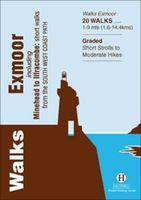
Wandelgids Exmoor | Hallewell Publications
Rewalked and revised in 2021, Walks Exmoor features walks in the Exmoor National Park - a beautiful area including moorland, farmland, wooded valleys and stunning coastal scenery. (The major settlements - Minehead, Ilfracombe and Barnstaple - are all just outside the area.) The 20 walks in the guide range from 1 to 9 miles (1.6 14.4km). The bulk of the routes are in the northern coastal strip (the guide contains a number of short walks from the South West Coast Path), including the path from Lynmouth to the stunning Valley of Rocks and a group of linked walks on Bossington Hill (by Minehead). Elsewhere there is a fine riverside walk to the ancient footbridge of Tarr Steps. Walks Exmoor is part of a popular series of A6 pocket walking guides which describe routes which are suitable for walkers of all abilities and to suit all tastes. Route descriptions are accompanied by 2-colour sketch maps. The guides are illustrated with line illustrations, and will provide walkers with a good intro…
5,95
Wandelgids Fife | Hallewell Publications
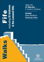
Rewalked and updated in 2021, Walks Fife including St Andrews & the Lomond Hills covers the county of Fife, which lies between the estuaries of the Rivers Forth and Tay. There are a lot of coastal walks (along sections of the Fife Coastal Path), plus walks in and around the historic town of St Andrews and some good hill walks in the Lomond Hills. The 27 walks featured range from 0.5 miles to 13 miles (1.5-21km). Routes include: West and East Lomond, Bishop Hill and St Andrews to Crail. Now on its 3rd edition, Walks Fife is part of a popular series of A6 pocket walking guides which describe routes which are suitable for walkers of all abilities and to suit all tastes. Route descriptions are accompanied by 2-colour sketch maps. The guides are illustrated with line illustrations, and will provide walkers with a good introduction to what each area covered has to offer.  
5,95
Wandelgids Pitlochry, Aberfeldy & North Perthshire | Hallewell Publications
Walks Pitlochry, Aberfeldy & North Perthshire covers the northern part of the county of Perthshire: from the wilderness of Rannoch Moor to the popular holiday town of Pitlochry. Formerly published as Walks North Perthshire the book has been rewalked and updated (2016) to reflect changes on the ground and the splendid riverside walk from Aberfeldy to Grandtully has been added. The walking is varied, with fine moorland walks, hill climbs and a great low-level path network around Pitlochry. The 27 walks featured range from 0.5 miles to 12 miles (1.2-19km). Routes include: Corrour to Rannoch Station, Schiehallion, Ben Lawers, Loch Faskally and The Birks of Aberfeldy. Part of a popular series of A6 pocket walking guides which describe routes which are suitable for walkers of all abilities and to suit all tastes. Route descriptions are accompanied by 2-colour sketch maps. The guides are illustrated with line illustrations, and will provide walkers with a good introduction to what the area c…
5,95

Klanten-reviews van Wandelgids Peebles, Selkirk & Lanark | Hallewell Publications

Er zijn nog geen beoordelingen voor dit productBen jij de eerste die een review plaatst?

Meer over Wandelgids Peebles, Selkirk & Lanark | Hallewell Publications

Productomschrijving

The latest in this popular series of pocket walking guides, including routes around the towns of Peebles, Selkirk and Lanark in the Scottish Borders.

This guide covers the old counties of Peebles and Selkirk, as well as the the southern end of the old county of Lanark. The walks featured include a number of walks around the fine town of Peebles, on the banks of the River Tweed, climbs up Broad Law and The Three Brethren, a circuit aroud St Mary’s Loch and an overview of the John Buchan Way. This is a fine area with a great variety of walks to suit all abilities.

Verken gerelateerde categorieën

Webshop.nl maakt gebruik van cookies. Ga je verder op onze website, ga dan akkoord met het plaatsen van cookies en de verwerking van deze data door ons en vermelde partners.