webshop.nl

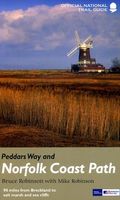
Wandelgids Peddars Way and Norfolk Coast Path | Aurum Press

0

Verkopers met dit product

Webshop
Bezorging
Prijs
DeZwerver.nl logo
DeZwerver.nl
niet bekend
19,95

Anderen bekeken ook

Wandelgids Northumberland Coast Path | Aurum Press
Goede beschrijving van de aantrekkelijke route. Kaartmateriaal van Ordnance Survey - de Engelse topografische dienst op een schaal van 1:25.000. Praktische info voor overnachten ed. niet altijd uitgebreid, maar die is op de site van de Ramblers (de engelse wandelorganisatie) te vinden. The Northumberland coastline stretches from the outskirts of Newcastle up to the Scottish border at Berwick-upon-Tweed – a popular holiday destination for its wild and sweeping landscape of endless beaches of pale sand, succession of spectacular castles like Bamburgh and Dunstanburgh, congenial resorts like Alnmouth, and unique offshore attractions like Holy Island and the Farne Islands. Now, Roland Tarr’s new Trail Guide maps out the walker’s route along the entire coast, starting from the centre of Newcastle and including an extension beyond Berwick to the seabird crags of St Abb’s Head.   Along the way the guide covers the remarkable industrial heritage of this coastline – the coalmining town of Ashi…
20,95
Wandelgids Norfolk Coast Path - Peddars Way | Trailblazer Guides
The Norfolk Coast Path & Peddars Way cover 130-miles of walking trails. The Peddars Way runs through East Anglia from Knettishall Heath on the Norfolk/Suffolk border and follows a Roman road to Holme-next-the-Sea. From here it becomes the Norfolk Coast Path, hugging the beautiful Norfolk coastline through Holkham, Wells, Blakeney and Cley to Cromer before it rounds the shoulder of the county and continues along the superb beaches and crumbling cliffs to Mundesley, Sea Palling and Great Yarmouth, finishing just before the Suffolk border.   Includes: 77 large-scale walking maps - at just under 1: 20,000 (8cm or 3 and one eighth inches to 1 mile) our maps are bigger than even the most detailed walking maps currently available, with walking directions, tricky junctions, places to stay and eat, points of interest and walking times written onto the maps Text and maps in clear TWO-COLOUR style All standards of accommodation with reviews - campsites, B&Bs, hostels, hotels, bunkhouses Where to…
20,95
Wandelgids Wales Coast Path: Tenby-Swansea | Aurum Press
Wales Coast Path National Trail Guide is een wandelgids voor meerdaagse wandeltochten - De opzet van deze gidsen is heel duidelijk met kaartmateriaal van Ordnance Survey waarop de tocht is ingetekend.   2012 saw the opening of the entire Welsh coastline as an official long-distance footpath. Now, to complement its existing National Trail Guide to the Pembrokeshire Coast Path, which makes up the section of the Path from Fishguard to just beyond Tenby, Aurum publishes a completely new guide to the other most scenic and popular stretch of the Wales coast – the section eastwards from Tenby to Swansea.   Starting in the superbly picturesque tourism centre of Tenby itself, Chris Moss’s guide follows the coast through Laugharne, famous as the birthplace of Dylan Thomas, Pendine Sands, whose vast level beach was the historic venue for the early attempts on the world land-speed record by buccaneering drivers like Parry-Thomas and Sir Henry Segrave, before winding right round the beautiful Gowe…
19,50
Wandelgids 8 The South West Coast Path | Aurum Press
Goede beschrijving van een deel van het beroemde South West Coast path in Cornwall. Men heeft gebruik gemaakt van zeer gedetailleerde kaarten van Ordnance Survey. Part one of the official four-part series covering Britain's longest National Trail in detail. Contains easy to follow Ordnance Survey mapping for individual sections, detailed route descriptions for the National Trail and shorter, circular walks off it. Full colour throughout. The South West Coast Path is the spectacular 630-mile (1008-km) National Trail around the tip of Britain. This volume features the section of the Path from Minehead to Padstow, a distance of 163 miles (262 km). The Trail traces the beautiful coastline, through Exmoor National Park, Clovelly and Tintagel, following Natural England's acorn waymarks. This is the complete, official guide for the long distance walker or the weekend stroller. All you need is this one book. National Trail Guides are the official guidebooks to the fifteen National Trails in E…
20,95
Wandelgids 11 The South West Coast Path | Aurum Press
Goede beschrijving van een deel van het beroemde South West Coast path in Cornwall. Men heeft gebruik gemaakt van zeer gedetailleerde kaarten van Ordnance Survey. The South West Coast Path is the spectacular 630-mile (1008-km) National Trail around the westmost tip of Britain. This volume covers the fourth and final section, 116 miles (186km) from Exmouth to Poole. It follows the stunning cliffs of the Jurassic Coast, visits the Cobb at Lyme Regis, famous in both Jane Austen andThe French Lieutenant's Woman, and offers superb views of Chesil Bank's remarkable shingle spit. Then, beyond Georgian Weymouth, Lulworth Cove's spectacular geology is followed by the pleasant resort of Swanage, with a finish overlooking Brownsea Island. Rich in wildife, this coastline offers spoonbills, puffins, and even red squirrels. For the holiday stroller or the long-distance walker, this official guide contains everything you'll need.  
20,95
Wandelgids Thames Path | Aurum Press
Een mooie wandelgids met een goede beschrijving en hele duidelijke kaarten met ingetekende route. The official guide to the riverside path from its Gloucestershire source all the way to the outskirts of London. With the London Thames now covered by Aurum's separate new guide, a companion volume can concentrate on the appeal of the full 150 miles of the country Thames, which winds all the way from its Gloucestershire source near Cirencester to Hampton Court on the edge of the London conurbation. This new edition has a wealth of new information about the many sights and places of interest along the way, from Wittenham Clumps that Paul Nash used to paint to Heston Blumenthal's Fat Duck restaurant at Bray, as well as full walking tours of historic Oxford and Windsor & Eton. There are sections on Stanley Spencer at Cookham, and Cliveden and the Cliveden Set, as well as on handsome and interesting towns like Henley and Abingdon. There is also a new section on the wildlife and natural histor…
20,95
Wandelgids Cleveland Way | Aurum Press
Uitstekend routeboek met goede kaarten van Ordnance Survey. Praktische info voor overnachten enigzins beperkt achterin. The beautifully varied Cleveland Way winds for over a hundred miles around the North York Moors National Park, from the ancient moorland town of Helmsley to the seafront at Filey, passing stunning historic sites like Helmsley Castle and Rievaulx Abbey along the way.  Attractive farmland, woods and heather moorland, a blaze of purple in late-summer, dominate the first half of the walk, later replaced by dramatic cliffs, secluded coves and sandy beaches.   This comprehensive, fully updated official guide is the only companion you need – whether you’re interested in the industrial history of ironstone mining, or a weekend stroller seeking a coastal walk out of the seaside resort of Scarborough.   Ordnance Survey maps for the whole route Background information on everything from archaeology to wildlife Comprehensive information on places of interest, public transport …
20,95
Wandelgids Hadrian's Wall Path | Aurum Press
Beschrijving van Hadrian's Wall Path. Historische en culturele aspecten komen vrij uitgebreid aan bod, praktische informatie is wel summier. Kaartmateriaal van Ordnance Survey is zonder meer uitstekend! Since it opened in 2003 Hadrian's Wall Path has become one of Britain's most popular long-distance paths. Its 84 miles are a convenient week's walking, shadowing for the most part the historic line of Hadrian's Wall in its spectacular progress across the superbly wild landscape of the north of England. Starting in what used to be Tyneside's shipbuilding heart, and joining Newcastle in the east with Carlisle in the west, it takes you via the extraordinary Roman forts of Vindolanda and Housesteads, close to handsome towns like Hexham and Corbridge, to finish on the lonely shores of the Solway Firth with views of Scotland. Comprehensive and engrossing, this official guide, published in conjunction with Natural England, is the only companion you need. Ordnance Survey mapping for the entire…
20,95
Wandelgids Pembrokeshire Coast Path Wales, St. Dogmaels to Amroth | Aurum Press
Beschrijving van de route langs de kust van Zuidwest Wales. Historische en culturele aspecten komen vrij uitgebreid aan bod, praktische informatie is wel summier. Kaartmateriaal zonder meer uitstekend! The Pembrokeshire Coast Path is one of the most popular of the fifteen National Trails in England and Wales. Running for 299km it follows the spectacular coast of the Pembrokehire National Park from St Dogmaels on the peninsula's northern coast, via the lovely town of St David's and Tenby, and the dramatic natural harbour of Milford Haven, to Amroth on the south coast. National Trail Guides are the official guidebooks to the fifteen National Trails in England and Wales and are published in association with Natural England, the official body charged with developing and maintaining the Trails.
20,95
Wandelgids The Cotswold Way | Aurum Press
Goede beschrijving van de aantrekkelijke route. Kaartmateriaal van Ordnance Survey - de Engelse topografische dienst op een schaal van 1:25.000. Praktische info voor overnachten ed. niet altijd uitgebreid, maar die is op de site van de Ramblers (de engelse wandelorganisatie) te vinden. Following the limestone escarpment on the Western edge of the Cotswolds, the 102 miles of the Cotswold Way take the walker through a quintessentially English landscape as varied as it is beautiful.    Starting and finishing among the golden Cotswold stone of Chipping Camden and Bath, and affording stunning prospects of the Malvern Hills, the Forest of Dean and even the Black Mountains in Wales, it winds through rolling farmland, magnificent beech woodlands, and up over the austerely beautiful Cleeve Hill with its panoramic views out over Cheltenham and far beyond.    With a wealth of historic interest, from Neolithic burial mounds to Roman villas and country houses, this is genuinely a walk through the …
20,95

Klanten-reviews van Wandelgids Peddars Way and Norfolk Coast Path | Aurum Press

Er zijn nog geen beoordelingen voor dit productBen jij de eerste die een review plaatst?

Meer over Wandelgids Peddars Way and Norfolk Coast Path | Aurum Press

Verken gerelateerde categorieën

Webshop.nl maakt gebruik van cookies. Ga je verder op onze website, ga dan akkoord met het plaatsen van cookies en de verwerking van deze data door ons en vermelde partners.