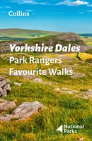
Wandelgids Park Rangers Favourite Walks Yorkshire Dales | Collins

0
Compacte wandelgids met 20 wandelingen geselecteerd door park rangers en met duidelijke beschrijvingen en routekaartjes.   Walking guide to the Yorkshire Dales National Park, with 20 best routes chosen by the park rangers. Each walk varies in length from 2 to 10 km and can be completed in less than 4 hours.   20 best routes chosen and written by N...

Verkopers met dit product

Verkoper
Bezorging
Prijs
DeZwerver.nl logo
DeZwerver.nl
2,95
11,50

Anderen bekeken ook

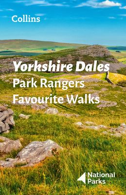
Wandelgids Park Rangers Favourite Walks Yorkshire Dales | Collins
Compacte wandelgids met 20 wandelingen geselecteerd door park rangers en met duidelijke beschrijvingen en routekaartjes.   Walking guide to the Yorkshire Dales National Park, with 20 best routes chosen by the park rangers. Each walk varies in length from 2 to 10 km and can be completed in less than 4 hours.   20 best routes chosen and written by National Park rangers   Walks from 2 to 10km Detailed description for each walk with highlights clearly marked on the map along with an accompanying map and photographs General information about the National Park plus basic advice on walking
11,50
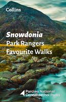
Wandelgids Park Rangers Favourite Walks Snowdonia | Collins
Compacte wandelgids met 20 wandelingen geselecteerd door park rangers en met duidelijke beschrijvingen en routekaartjes.   Walking guide to the Snowdonia National Park, with 20 best routes chosen by the park rangers. Each walk varies in length from 2 to 10 km and can be completed in less than 4 hours.   20 best routes chosen and written by National Park rangers   Walks from 2 to 10km Detailed description for each walk with highlights clearly marked on the map along with an accompanying map and photographs General information about the National Park plus basic advice on walking
11,50
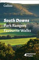
Wandelgids Park Rangers Favourite Walks South Downs | Collins
Compacte wandelgids met 20 wandelingen geselecteerd door park rangers en met duidelijke beschrijvingen en routekaartjes.   Walking guide to the South Downs National Park, with 20 best routes chosen by the park rangers. Each walk varies in length from 2 to 10 km and can be completed in less than 4 hours.   20 best routes chosen and written by National Park rangers   Walks from 2 to 10km Detailed description for each walk with highlights clearly marked on the map along with an accompanying map and photographs General information about the National Park plus basic advice on walking
11,50
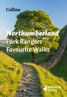
Wandelgids Park Rangers Favourite Walks Northumberland | Collins
The perfect companions for exploring the National Parks. Walking guide to the Northumberland National Park, with 20 best routes chosen by the park rangers. Each walk varies in length from 2 to 10 km and can be completed in less than 4 hours.   20 best routes chosen and written by National Park rangers Walks from 2 to 10kmDetailed description for each walk with highlights clearly marked on the map along with an accompanying map and photographsGeneral information about the National Park plus basic advice on walking This and the Northumberland National Park Pocket Map (ISBN: 9780008462703) are the perfect companions for exploring this superb walking area of the North East.  
11,50
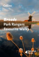
Wandelgids Park Rangers Favourite Walks Broads | Collins
The perfect companions for exploring the National Parks. Walking guide to the Broads National Park, with 20 best routes chosen by the park rangers. Each walk varies in length from 2 to 10 km and can be completed in less than 4 hours.   20 best routes chosen and written by National Park rangers Walks from 2 to 10kmDetailed description for each walk with highlights clearly marked on the map along with an accompanying map and photographsGeneral information about the National Park plus basic advice on walking This and the Broads National Park Pocket Map (ISBN: 9780008439156) are the perfect companions for exploring this superb walking area of East Anglia.
11,50
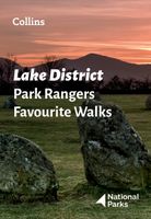
Wandelgids Park Rangers Favourite Walks Lake District | Collins
Walking guide to the Lake District National Park, with 20 best routes chosen by the park rangers. Each walk varies in length from 2 to 10 km and can be completed in less than 4 hours.   20 best routes chosen and written by National Park rangers   Walks from 2 to 10km Detailed description for each walk with highlights clearly marked on the map along with an accompanying map and photographs General information about the National Park plus basic advice on walking This and the Lake District National Park Pocket Map (ISBN: 9780008462673) are the perfect companions for exploring this superb walking area of Northwest England.
11,50
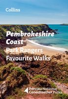
Wandelgids Park Rangers Favourite Walks Pembrokeshire Coast | Collins
The perfect companions for exploring the National Parks. Walking guide to the Pembrokeshire Coast National Park, with 20 best routes chosen by the park rangers. Each walk varies in length from 2 to 10 km and can be completed in less than 4 hours.   20 best routes chosen and written by National Park rangers Walks from 2 to 10kmDetailed description for each walk with highlights clearly marked on the map along with an accompanying map and photographsGeneral information about the National Park plus basic advice on walking This and the Pembrokeshire Coast National Park Pocket Map (ISBN: 9780008439163) are the perfect companions for exploring this superb walking area of West Wales.
11,50
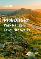
Wandelgids Park Rangers Favourite Walks Peak District | Collins
The perfect companions for exploring the National Parks. Walking guide to the Peak District National Park, with 20 best routes chosen by the park rangers. Each walk varies in length from 2 to 10 km and can be completed in less than 4 hours.   20 best routes chosen and written by National Park rangers Walks from 2 to 10kmDetailed description for each walk with highlights clearly marked on the map along with an accompanying map and photographsGeneral information about the National Park plus basic advice on walking This and the Peak District National Park Pocket Map (ISBN: 9780008439217) are the perfect companions for exploring this superb walking area of England.  
11,50
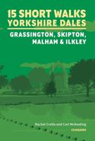
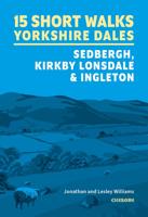
Wandelgids 15 Short Walks Yorkshire Dales | Cicerone
Would you like to explore the best of Grassington, Skipton, Malham and Ilkley? This guidebook covers 15 of the best short walks in the Yorkshire Dales (all under three hours), including Bolton Abbey, Malham Cove, Gordale Scar, Ilkley Moor, the Cow and Calf rocks, Grassington lead mines and Trollers Gill.   Why choose this guidebook?   Easy to moderate walks suitable for almost everyone Short climbs but no challenging terrain Numbered points which tie OS maps to clear route description Facilities, parking and highlights for every route Route Summary Table to help you choose your walk Cicerone’s Short Walks guidebooks contain everything you need to get outdoors and discover the best of an area. The routes are perfect if you’re new to walking or looking for something you can enjoy with the whole family. Let the adventures begin!
13,95
Wegenkaart - landkaart National Park Pocket Map Yorkshire Dales | Collins
Handige kleine kaart van dit Nationaal Park. De kaart geeft een goed en helder overzicht van het gebied met alle plaatsen, doorgaande wandelpaden (alhoewel grof van schaal), bezienswaardigheden etc. Met een register en aanvullende tekst onder de kaart is het een mooi overzicht wat je waar kunt gaan doen. Handy little full colour map of Yorkshire Dales National Park. Detailed mapping and visitor information to the National Park along with a selection of photographs. Map at a scale of 1:140 000 (1cm to 1.40km, 2.2 miles to 1 inch).The perfect way to explore this beautiful area of England. This small map gives a great overview of the Yorkshire Dales National Park.• Clear, detailed mapping• Key park, tourist and travel information• Ideal for planning visits to the National Park• Index to help locate and plan your trip
7,95

Klanten-reviews van Wandelgids Park Rangers Favourite Walks Yorkshire Dales | Collins

Er zijn nog geen beoordelingen voor dit productBen jij de eerste die een review plaatst?

Meer over Wandelgids Park Rangers Favourite Walks Yorkshire Dales | Collins

Productomschrijving

Compacte wandelgids met 20 wandelingen geselecteerd door park rangers en met duidelijke beschrijvingen en routekaartjes.   Walking guide to the Yorkshire Dales National Park, with 20 best routes chosen by the park rangers. Each walk varies in length from 2 to 10 km and can be completed in less than 4 hours.   20 best routes chosen and written by National Park rangers  
  • Walks from 2 to 10km
  • Detailed description for each walk with highlights clearly marked on the map along with an accompanying map and photographs
  • General information about the National Park plus basic advice on walking

Productinformatie

    Verken gerelateerde categorieën

    Webshop.nl maakt gebruik van cookies. Ga je verder op onze website, ga dan akkoord met het plaatsen van cookies en de verwerking van deze data door ons en vermelde partners.