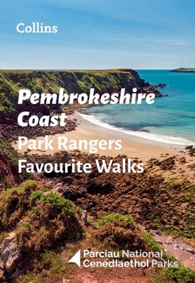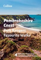
Wandelgids Park Rangers Favourite Walks Pembrokeshire Coast | Collins

0
The perfect companions for exploring the National Parks. Walking guide to the Pembrokeshire Coast National Park, with 20 best routes chosen by the park rangers. Each walk varies in length from 2 to 10 km and can be completed in less than 4 hours.   20 best routes chosen and written by National Park rangers Walks from 2 to 10kmDetailed description ...

Verkopers met dit product

Verkoper
Bezorging
Prijs
DeZwerver.nl logo
DeZwerver.nl
niet bekend
11,50

Anderen bekeken ook

Wandelgids Park Rangers Favourite Walks Northumberland | Collins
The perfect companions for exploring the National Parks. Walking guide to the Northumberland National Park, with 20 best routes chosen by the park rangers. Each walk varies in length from 2 to 10 km and can be completed in less than 4 hours.   20 best routes chosen and written by National Park rangers Walks from 2 to 10kmDetailed description for each walk with highlights clearly marked on the map along with an accompanying map and photographsGeneral information about the National Park plus basic advice on walking This and the Northumberland National Park Pocket Map (ISBN: 9780008462703) are the perfect companions for exploring this superb walking area of the North East.  
11,50
Wandelgids Park Rangers Favourite Walks Broads | Collins
The perfect companions for exploring the National Parks. Walking guide to the Broads National Park, with 20 best routes chosen by the park rangers. Each walk varies in length from 2 to 10 km and can be completed in less than 4 hours.   20 best routes chosen and written by National Park rangers Walks from 2 to 10kmDetailed description for each walk with highlights clearly marked on the map along with an accompanying map and photographsGeneral information about the National Park plus basic advice on walking This and the Broads National Park Pocket Map (ISBN: 9780008439156) are the perfect companions for exploring this superb walking area of East Anglia.
11,50
Wandelgids Park Rangers Favourite Walks Peak District | Collins
The perfect companions for exploring the National Parks. Walking guide to the Peak District National Park, with 20 best routes chosen by the park rangers. Each walk varies in length from 2 to 10 km and can be completed in less than 4 hours.   20 best routes chosen and written by National Park rangers Walks from 2 to 10kmDetailed description for each walk with highlights clearly marked on the map along with an accompanying map and photographsGeneral information about the National Park plus basic advice on walking This and the Peak District National Park Pocket Map (ISBN: 9780008439217) are the perfect companions for exploring this superb walking area of England.  
11,50
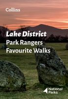
Wandelgids Park Rangers Favourite Walks Lake District | Collins
Walking guide to the Lake District National Park, with 20 best routes chosen by the park rangers. Each walk varies in length from 2 to 10 km and can be completed in less than 4 hours.   20 best routes chosen and written by National Park rangers   Walks from 2 to 10km Detailed description for each walk with highlights clearly marked on the map along with an accompanying map and photographs General information about the National Park plus basic advice on walking This and the Lake District National Park Pocket Map (ISBN: 9780008462673) are the perfect companions for exploring this superb walking area of Northwest England.
11,50
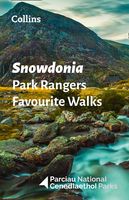
Wandelgids Park Rangers Favourite Walks Snowdonia | Collins
Compacte wandelgids met 20 wandelingen geselecteerd door park rangers en met duidelijke beschrijvingen en routekaartjes.   Walking guide to the Snowdonia National Park, with 20 best routes chosen by the park rangers. Each walk varies in length from 2 to 10 km and can be completed in less than 4 hours.   20 best routes chosen and written by National Park rangers   Walks from 2 to 10km Detailed description for each walk with highlights clearly marked on the map along with an accompanying map and photographs General information about the National Park plus basic advice on walking
11,50
Wandelgids Park Rangers Favourite Walks Yorkshire Dales | Collins
Compacte wandelgids met 20 wandelingen geselecteerd door park rangers en met duidelijke beschrijvingen en routekaartjes.   Walking guide to the Yorkshire Dales National Park, with 20 best routes chosen by the park rangers. Each walk varies in length from 2 to 10 km and can be completed in less than 4 hours.   20 best routes chosen and written by National Park rangers   Walks from 2 to 10km Detailed description for each walk with highlights clearly marked on the map along with an accompanying map and photographs General information about the National Park plus basic advice on walking
11,50
Wandelgids Park Rangers Favourite Walks South Downs | Collins
Compacte wandelgids met 20 wandelingen geselecteerd door park rangers en met duidelijke beschrijvingen en routekaartjes.   Walking guide to the South Downs National Park, with 20 best routes chosen by the park rangers. Each walk varies in length from 2 to 10 km and can be completed in less than 4 hours.   20 best routes chosen and written by National Park rangers   Walks from 2 to 10km Detailed description for each walk with highlights clearly marked on the map along with an accompanying map and photographs General information about the National Park plus basic advice on walking
11,50
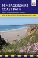
Wandelgids Pembrokeshire Coast Path | Trailblazer Guides
🥾 Pembrokeshire Coast Path – Wandelgids van Trailblazer (Engelstalig) Volg een van de mooiste kustpaden van Groot-Brittannië met deze uitgebreide Trailblazer-gids voor het Pembrokeshire Coast Path. Deze National Trail van 299 km (186 mijl) voert je langs de ruige kustlijn van het Pembrokeshire Coast National Park in Zuidwest-Wales – bekend om zijn zandstranden, vissersdorpen, vogelrijke kliffen en verborgen baaien. 🧭 Wat biedt deze gids? 236 pagina’s boordevol informatie 96 trailkaarten en 15 stadsplattegronden – met routeaanwijzingen direct op de kaart 60 kleurenfoto’s en een kleurrijke 4 pagina’s tellende bloemenherkenningsgids 14 etappekaarten en 2 overzichtskaarten Volledige informatie over accommodaties, eetgelegenheden en openbaar vervoer langs het pad GPS-waypoints te downloaden voor digitale navigatie De unieke cartografie van Trailblazer maakt het verschil: de kaarten bevatten niet alleen het pad, maar ook wandelinstructies, bezienswaardigheden, horeca en …
21,95
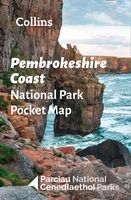
Wegenkaart - landkaart National Park Pocket Map Pembrokeshire Coast | Collins
Duidelijke pocket wandelkaart met belangrijke toeristische informatie, bezienswaardigheden, campeerplekken e.d. Handy little full colour map and guide of Pembrokeshire Coast National Park. Detailed mapping and visitor information to the National Park along with a selection of photographs. Map at a scale of 1:133,000 (2.1 miles to 1 inch or 1.33 km to 1cm).   This small map with additional text and photographs gives a great overview of the Pembrokeshire Coast National Park, and is the perfect companion for exploring this beautiful area of West Wales.   Clear, detailed mapping Key park, tourist and travel information Ideal for planning visits to the National Park Index to help locate and plan your trip
7,95
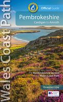
Wandelgids Wales Coast Path: Pembrokeshire | Northern Eye Books
Official Guide: Wales Coast Path: Pembrokeshire   One of seven Official Guides to the Wales Coast Path   The 186 mile/300km long Pembrokeshire section of the Wales Coast Path runs through some of Wales’ most varied and dramatic coastal scenery — high, rugged cliffs and long sandy bays, Pembroke Castle, St David’s cathedral and St Govan’s remote cliff-wrapped chapel, with several large offshore islands. Pembrokeshire is also Britain’s only coastal National Park.   This Official Guide splits the route into 14 convenient day sections, each of about 10-17 miles / 16-27 kilometres. It contains everything local and long-distance walkers need to enjoy the path and includes:   An overview of Pembrokeshire with dedicated history and wildlife sections Fourteen day-walk sections with detailed route descriptions and full, enhanced Ordnance Survey mapping Distance charts, section overviews, background information and interpretation of places of interest Stunning professional photographs throughout…
22,50

Klanten-reviews van Wandelgids Park Rangers Favourite Walks Pembrokeshire Coast | Collins

Er zijn nog geen beoordelingen voor dit productBen jij de eerste die een review plaatst?

Meer over Wandelgids Park Rangers Favourite Walks Pembrokeshire Coast | Collins

Productomschrijving

The perfect companions for exploring the National Parks. Walking guide to the Pembrokeshire Coast National Park, with 20 best routes chosen by the park rangers. Each walk varies in length from 2 to 10 km and can be completed in less than 4 hours.   20 best routes chosen and written by National Park rangers Walks from 2 to 10kmDetailed description for each walk with highlights clearly marked on the map along with an accompanying map and photographsGeneral information about the National Park plus basic advice on walking This and the Pembrokeshire Coast National Park Pocket Map (ISBN: 9780008439163) are the perfect companions for exploring this superb walking area of West Wales.

Verken gerelateerde categorieën

Webshop.nl maakt gebruik van cookies. Ga je verder op onze website, ga dan akkoord met het plaatsen van cookies en de verwerking van deze data door ons en vermelde partners.