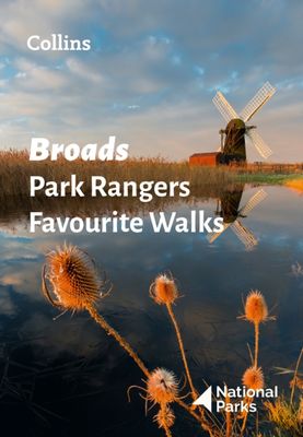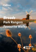
Wandelgids Park Rangers Favourite Walks Broads | Collins

0
The perfect companions for exploring the National Parks. Walking guide to the Broads National Park, with 20 best routes chosen by the park rangers. Each walk varies in length from 2 to 10 km and can be completed in less than 4 hours.   20 best routes chosen and written by National Park rangers Walks from 2 to 10kmDetailed description for each walk...

Verkopers met dit product

Verkoper
Bezorging
Prijs
DeZwerver.nl logo
DeZwerver.nl
2,95
11,50

Anderen bekeken ook

Wandelgids Park Rangers Favourite Walks Northumberland | Collins
The perfect companions for exploring the National Parks. Walking guide to the Northumberland National Park, with 20 best routes chosen by the park rangers. Each walk varies in length from 2 to 10 km and can be completed in less than 4 hours.   20 best routes chosen and written by National Park rangers Walks from 2 to 10kmDetailed description for each walk with highlights clearly marked on the map along with an accompanying map and photographsGeneral information about the National Park plus basic advice on walking This and the Northumberland National Park Pocket Map (ISBN: 9780008462703) are the perfect companions for exploring this superb walking area of the North East.  
11,50
Wandelgids Park Rangers Favourite Walks Peak District | Collins
The perfect companions for exploring the National Parks. Walking guide to the Peak District National Park, with 20 best routes chosen by the park rangers. Each walk varies in length from 2 to 10 km and can be completed in less than 4 hours.   20 best routes chosen and written by National Park rangers Walks from 2 to 10kmDetailed description for each walk with highlights clearly marked on the map along with an accompanying map and photographsGeneral information about the National Park plus basic advice on walking This and the Peak District National Park Pocket Map (ISBN: 9780008439217) are the perfect companions for exploring this superb walking area of England.  
11,50
Wandelgids Park Rangers Favourite Walks Pembrokeshire Coast | Collins
The perfect companions for exploring the National Parks. Walking guide to the Pembrokeshire Coast National Park, with 20 best routes chosen by the park rangers. Each walk varies in length from 2 to 10 km and can be completed in less than 4 hours.   20 best routes chosen and written by National Park rangers Walks from 2 to 10kmDetailed description for each walk with highlights clearly marked on the map along with an accompanying map and photographsGeneral information about the National Park plus basic advice on walking This and the Pembrokeshire Coast National Park Pocket Map (ISBN: 9780008439163) are the perfect companions for exploring this superb walking area of West Wales.
11,50
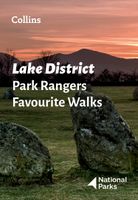
Wandelgids Park Rangers Favourite Walks Lake District | Collins
Walking guide to the Lake District National Park, with 20 best routes chosen by the park rangers. Each walk varies in length from 2 to 10 km and can be completed in less than 4 hours.   20 best routes chosen and written by National Park rangers   Walks from 2 to 10km Detailed description for each walk with highlights clearly marked on the map along with an accompanying map and photographs General information about the National Park plus basic advice on walking This and the Lake District National Park Pocket Map (ISBN: 9780008462673) are the perfect companions for exploring this superb walking area of Northwest England.
11,50
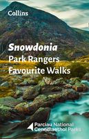
Wandelgids Park Rangers Favourite Walks Snowdonia | Collins
Compacte wandelgids met 20 wandelingen geselecteerd door park rangers en met duidelijke beschrijvingen en routekaartjes.   Walking guide to the Snowdonia National Park, with 20 best routes chosen by the park rangers. Each walk varies in length from 2 to 10 km and can be completed in less than 4 hours.   20 best routes chosen and written by National Park rangers   Walks from 2 to 10km Detailed description for each walk with highlights clearly marked on the map along with an accompanying map and photographs General information about the National Park plus basic advice on walking
11,50
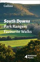
Wandelgids Park Rangers Favourite Walks South Downs | Collins
Compacte wandelgids met 20 wandelingen geselecteerd door park rangers en met duidelijke beschrijvingen en routekaartjes.   Walking guide to the South Downs National Park, with 20 best routes chosen by the park rangers. Each walk varies in length from 2 to 10 km and can be completed in less than 4 hours.   20 best routes chosen and written by National Park rangers   Walks from 2 to 10km Detailed description for each walk with highlights clearly marked on the map along with an accompanying map and photographs General information about the National Park plus basic advice on walking
11,50
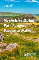
Wandelgids Park Rangers Favourite Walks Yorkshire Dales | Collins
Compacte wandelgids met 20 wandelingen geselecteerd door park rangers en met duidelijke beschrijvingen en routekaartjes.   Walking guide to the Yorkshire Dales National Park, with 20 best routes chosen by the park rangers. Each walk varies in length from 2 to 10 km and can be completed in less than 4 hours.   20 best routes chosen and written by National Park rangers   Walks from 2 to 10km Detailed description for each walk with highlights clearly marked on the map along with an accompanying map and photographs General information about the National Park plus basic advice on walking
11,50
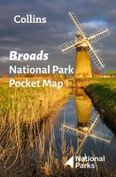
Wegenkaart - landkaart National Park Pocket Map Broads | Collins
Handige kleine kaart van dit Nationaal Park. De kaart geeft een goed en helder overzicht van het gebied met alle plaatsen, doorgaande wandelpaden (alhoewel grof van schaal), bezienswaardigheden etc. Met een register en aanvullende tekst onder de kaart is het een mooi overzicht wat je waar kunt gaan doen. Handy little full colour map of Broads National Park. Detailed mapping and visitor information to the National Park along with a selection of photographs.The perfect way to explore this beautiful area of East Anglia. This small map gives a great overview of the Broads National Park.• Clear, detailed mapping• Key park, tourist and travel information• Ideal for planning visits to the National Park• Index to help locate and plan your trip
7,95
Wegenkaart - landkaart 04 Mpumalanga, Kruger National Park & Panorama Route | MapStudio
Toeristische wegenkaart met veel aanduidingen van interessante punten. Heldere kaart, goed leesbaar. speciaal stukje Africa: Mpumalanga, Kruger National Park and Panorama Route Road Map covers the entire Kruger National Park, includes a detailed exploring map of Mpumalanga and the Panorama Route, plans of camps in the Kruger National Park and is up-to-date with all research compiled and updated in Africa   Detailed streetmaps and site maps with text and photography of Pilgrims Rest, Mashishing (Lydenburg), Dullstroom, Sudwala Caves, eMakhazeni (Belfast), eNtokozweni (Machadodorp), White River, Sabie, eMgwenya (Waterval Boven), Hazyview, Mbombela (Nelspruit) and Barberton   Easy-to-use map symbols showing hotel, lodges, rest camps, campsites, concession areas, bush camps, private rest camps and lodges, caravan facilities, caves, lookout points, waterholes, hides and much more. Information on hiking, trekking, walking and fly-fishing areas. Along with an alphabetised index, enlarged map…
16,95
Wandelkaart The Broads | Heron Maps
A full colour map of the Broads suitable for both waterways and leisure users.   This map gives detailed coverage of the Broads with emphasis on the waterways and information useful and relevant to users of the waterways without neglecting other leisure users. The map detail is complimented by information panels and photographs.   Our cruising and tourist map of the Broads is at 1:50000 with detailed town plans at 1:12500 for Wroxham and Hoveton, Stalham, Horning, Potter Heigham, Norwich, Brundall, Beccles, Loddon, Great Yarmouth, Reedham and Oulton Broad.   A double side map with the map on one side and boating and vistor information of the other. The map shows navigation information, visitor moorings, boatyards, boat hire centres, facilities for the boat user and shops. Tourist information includes places of interest, pubs, nature reserves, windmills, churches, long distance paths, public toilets and caravan and camp sites. The reverse side has detailed boating information including…
9,95

Klanten-reviews van Wandelgids Park Rangers Favourite Walks Broads | Collins

Er zijn nog geen beoordelingen voor dit productBen jij de eerste die een review plaatst?

Meer over Wandelgids Park Rangers Favourite Walks Broads | Collins

Productomschrijving

The perfect companions for exploring the National Parks. Walking guide to the Broads National Park, with 20 best routes chosen by the park rangers. Each walk varies in length from 2 to 10 km and can be completed in less than 4 hours.   20 best routes chosen and written by National Park rangers Walks from 2 to 10kmDetailed description for each walk with highlights clearly marked on the map along with an accompanying map and photographsGeneral information about the National Park plus basic advice on walking This and the Broads National Park Pocket Map (ISBN: 9780008439156) are the perfect companions for exploring this superb walking area of East Anglia.

Productinformatie

    Verken gerelateerde categorieën

    Webshop.nl maakt gebruik van cookies. Ga je verder op onze website, ga dan akkoord met het plaatsen van cookies en de verwerking van deze data door ons en vermelde partners.