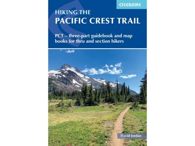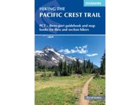
Wandelgids Pacific Crest Trail Hiking - 3-part guidebook and map books | Cicerone

0
A comprehensive three-book set providing all the information needed to prepare for and hike the Pacific Crest Trail (PCT), a 2650-mile hike through California, Oregon and Washington. Designed to be compact and lightweight the set is separated into three books, an introduction to the trail (130g) and two map books (200g and 170g).   The introductor...

Verkopers met dit product

Verkoper
Bezorging
Prijs
DeZwerver.nl logo
DeZwerver.nl
2,95
41,95

Anderen bekeken ook

Wandelgids Pacific Crest Trail Hiking - 3-part guidebook and map books | Cicerone
A comprehensive three-book set providing all the information needed to prepare for and hike the Pacific Crest Trail (PCT), a 2650-mile hike through California, Oregon and Washington. Designed to be compact and lightweight the set is separated into three books, an introduction to the trail (130g) and two map books (200g and 170g).   The introductory book covers all at-home planning and preparation for hiking the PCT.   Detailed explanation of the trail structure, timings and how to approach the PCT Suggested itineraries for 110-, 120-, 130- and 140-day thru-hikes and an easy-going start option to aid with planning Advice on equipment and permits required on trail A background of the trail’s history A look at the wildlife, flora and fauna encountered on the trail The two map books are designed to be used on the trail, one covering the southern stages from the Mexico border to northern California at Interstate 5, the other detailing the northern stages in Oregon and Washington to the Can…
41,95
Wandelgids - Fietsgids Hiking and Cycling the California Missions Trail - Californie | Cicerone
Guidebook to hiking or cycling the 800 mile (1289km) California Missions Trail between San Francisco Bay and San Diego. The pilgrimage trail takes in 21 historic Spanish missions and can be completed in 50-60 walking days or 2-3 weeks cycling. With 1:100,000 mapping, route description, and details of accommodation and facilities for each stage. Ancient footpaths became connecting routes between the Spanish missions, pueblos, and presidios in the period 1769 to 1823. Over time these routes became automobile roadways and were marked with bells starting in 1906 to promote and preserve the El Camino Real. Today, the California Missions Trail follows a pedestrian route through urban cities and historic towns, through forest paths and country lanes, to each of the twenty-one historic Spanish missions. The 800-mile California Missions Trail leads walkers and cyclists through some of the most scenic and historic sites of one of America's most beautiful states. The 21 missions, founded 200-250…
26,50
Wandelgids Hiking in Hong Kong | Cicerone
Although Hong Kong is often thought of as intrinsically urban, just a short distance from the big cities are lush mountains and attractive and varied countryside. This guide presents the highlights of this hiking-friendly territory, detailing 21 graded day walks and four short treks: Hong Kong Trail (presented in 3 day stages), Lantau Trail (5 days), MacLehose Trail (5 days) and Wilson Trail (5 days). The day walks - of 5 to 22.5km - cover Hong Kong, Kowloon, the New Territories and the islands and range from easy hikes suitable for families to challenging ascents of Hong Kong's highest peaks. The territory's compact nature and excellent public transport infrastructure make it easy to access the routes.   The guide has all you need to explore Hong Kong's excellent network of trails. Route description is accompanied by clear mapping and there are comprehensive notes - including Chinese place names - to help visitors navigate the public transport system. Alongside practicalities such as…
24,95
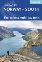
Wandelgids Hiking in Norway-South | Cicerone
This guide describes 10 shorter hut-to-hut treks showcasing southern Norway's wild natural beauty, with highlights including Galdhøpiggen - Norway's highest peak at 2469m - and the iconic Pulpit Rock and Kjeragbolten on the Lysefjord. The routes range from 3 to 8 days (although many can be adapted or combined to create longer or shorter routes) and cover Jotunheimen, Rondane, Dovrefjell, Trollheimen and Ryfylke. They are suitable for experienced hikers with a good level of fitness and can be walked from mid-July to the end of September.   Clear route description and mapping are provided for each hike. Stages are graded according to difficulty: although all of the routes follow waymarked trails, some cross remote and challenging terrain which may include exposed sections calling for a sure foot and a good head for heights. However, in many instances, alternatives are provided avoiding the most demanding sections. The guide also offers comprehensive advice on public transport access and…
23,95
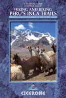
Wandelgids Peru - Hiking and Biking Peru's Inca Trails | Cicerone
The eastern slope of the Peruvian Andes is one of the most dramatic and diverse places on the planet, dropping from over 6000m (20,000ft) to just 200m above sea level. This dramatic drop in elevation produces a wide range of constantly changing climactic and vegetative zones – it is often possible to hike from the base of a glacier down to the jungle in just a day or two. Combined with the countless Inca sites and ubiquitous Inca roads, this makes the Sacred Valley one of the best trekking and mountain biking destinations in the world.    Machu Picchu is well known as one of the Seven Wonders of the World, and the Inca Trail trek that leads there is nearly as famous. What is less known, however, is the vast choice of other epic adventure trips that exist in the region – treks through soaring Andean glaciers and Incan ruins, bike rides through stunning alpine and jungle scenery. Nearly every route in this book uses an Inca road or visits an Inca ruin – and most do both. The majority of…
22,95
Wandelgids Aconcagua and the Southern Andes - A Trekker's Guidebook | Cicerone
The definitive guidebook to climbing Aconcagua in South America. At 6962m, Aconcagua is the highest peak outside the Himalayas and is accessible to both trekkers and mountaineers. The book covers two popular trekking routes: the Normal (Horcones Valley) route and the Vacas Valley (Polish Glacier) route. It also includes trekking routes up Tupungato, the Maipo Volcano, and other acclimatisation treks, with suggestions for things to see and do around Mendoza and Santiago City.   The guide provides a wealth of practical and indispensable information for those taking on the challenge of Aconcagua. There is information on travel to South America and to the start of the trek, and essential know-how on preparing for high-altitude mountaineering, including advice on equipment, coping with altitude, and strategies for acclimatisation. It gives expert advice on permits, food and water, hiring guides and mules, and staying healthy.   With maps and colour photos and supplemented by background inf…
23,95
Wandelgids Switzerland's Jura Crest Trail | Cicerone
Uitstekende wandelgids van de Jura Crest Trail, ook wel bekend als de Jura High Route. Goed beschreven met veel praktische informatie om de route te kunnen lopen, inclusief redelijke kaarten. This guide presents Switzerland's Jura Crest Trail. Also known as the Jura High Route (Swiss national route 5), this 310km long-distance route traverses the sub-alpine mountains of the Swiss Jura from Dielsdorf near Zurich to Nyon on the shores of Lac Léman (Lake Geneva), running roughly parallel to the Swiss-French border. With over 13,500m of ascent, the trail demands a moderate level of fitness and can be comfortably completed in around a fortnight. The Jura Crest Trail is easily accessed from Zurich and Geneva. The region boasts excellent walking infrastructure and facilities, and although the trail crosses the mountains, you are seldom too far from civilisation. The guide contains all the information you need to plan and walk the route. You'll find advice on transport and comprehensive deta…
23,95
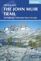
Wandelgids The John Muir Trail | Cicerone
Een uitstekende beschrijving van het beroemde lange afstandspad in Californie. Guidebook to walking the John Muir Trail through California's High Sierra from Yosemite (El Capitan and Half Dome) to the summit of Mount Witney. The 216 mile hike is split into 21 daily stages, with full information on preparation, permits, wilderness, bears, water and trekking skills. Part of the Pacific Crest Trail. The John Muir Trail (JMT) is one of the world’s most spectacular treks and is North America’s best known mid-distance walking trail. It runs for 216 miles through the high Sierra Nevada mountains of California, from Yosemite Valley to the summit of Mount Whitney (14, 496ft), the highest peak in the USA outside Alaska. The walking trail, which is named after the great 19th-century Scottish naturalist, conservationist and writer John Muir, is entirely through the unspoilt wilderness of the American West and passes through three national parks: Yosemite, Kings Canyon and Sequoia National Parks. …
25,95
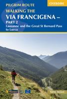
Wandelgids - Pelgrimsroute Via Francigena part 2 | Cicerone
Guidebook to the Via Francigena pilgrim route from Lausanne to Lucca. Starting at Lake Geneva (Lac Léman), the 725km route crosses the Alps at historic Great Saint Bernard Pass, descends the Po Valley, then climbs to cross the Cisa Pass into Tuscany. Described in 32 stages, with information on facilities and pilgrim hostels.   Seasons Suitable for walking in spring, summer and autumn. The Great Saint Bernard Pass is fully open to hikers only in August and September.   Centres Lausanne, Martigny, Great Saint Bernard Pass, Aosta, Ivrea, Vercelli, Pavia, Piacenza, Pontremoli, Pietrasanta, Lucca.   Difficulty Each stage is graded for difficulty (1-4). A few mountainous stages include steep and slippery slopes. No special gear is required to walk the Via Francigena in season, but off-season crossings of the Great Saint Bernard Pass require winter mountain gear and careful attention to changing mountain conditions.   Must See Dazzling Lake Geneva, the 1500-year-old Abbey of Sai…
24,95

Klanten-reviews van Wandelgids Pacific Crest Trail Hiking - 3-part guidebook and map books | Cicerone

Er zijn nog geen beoordelingen voor dit productBen jij de eerste die een review plaatst?

Meer over Wandelgids Pacific Crest Trail Hiking - 3-part guidebook and map books | Cicerone

Productomschrijving

A comprehensive three-book set providing all the information needed to prepare for and hike the Pacific Crest Trail (PCT), a 2650-mile hike through California, Oregon and Washington. Designed to be compact and lightweight the set is separated into three books, an introduction to the trail (130g) and two map books (200g and 170g).   The introductory book covers all at-home planning and preparation for hiking the PCT.   Detailed explanation of the trail structure, timings and how to approach the PCT Suggested itineraries for 110-, 120-, 130- and 140-day thru-hikes and an easy-going start option to aid with planning Advice on equipment and permits required on trail A background of the trail’s history A look at the wildlife, flora and fauna encountered on the trail The two map books are designed to be used on the trail, one covering the southern stages from the Mexico border to northern California at Interstate 5, the other detailing the northern stages in Oregon and Washington to the Canadian border.   Presented as 100 1–3-day stages for easy planning of either day, section or thru-hikes Where possible stages begin/end at trailheads for easy access to the route 1:100,000 topographic maps for the whole trail that can be used to supplement or replace digital mapping apps Each stage contains a waymarked route description with mileages, mapping, profiles, and locations of water sources and campsites Resupply tables are included detailing where food, mail drops and laundrettes are available close to the trail

Productinformatie

    Verken gerelateerde categorieën

    Webshop.nl maakt gebruik van cookies. Ga je verder op onze website, ga dan akkoord met het plaatsen van cookies en de verwerking van deze data door ons en vermelde partners.