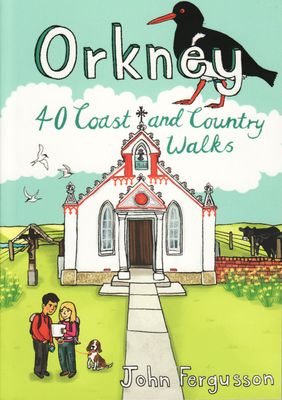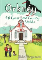
Wandelgids Orkney | Pocket Mountains

0
Handige compacte wandelgids met 40 dagwandelingen. Deze gids bevat kleine kaartjes en leuke uitgebreide informatie over wat er langs de route te zien is. Goede wandelkaarten zijn echter we noodzakelijk voor deze tochten: de Ordnance Survey explorer maps of Landanger maps zijn zeer geschikt.   The 40 walks in this guide range from a short stroll to...

Verkopers met dit product

Verkoper
Bezorging
Prijs
DeZwerver.nl logo
DeZwerver.nl
2,95
10,95

Anderen bekeken ook

Wandelgids Trekking the Dolomites Av1 | Knife Edge Outdoor
Superhandige wandelgids voor de Alta Via 1 in de Dolomieten. Met deze gids heb je verder niks nodig: alle benodigde Tabacco wandelkaarten zitten in deze gids! The only guidebook exclusively for the AV1.Everything you need to know to plan and walk Italy's most popular long distance route.Real maps inside (Tabacco 1:25,000): the finest maps available for the Dolomites. This makes navigation easy and there is no need to carry additional maps. Also includes:* Numbered waypoints linking maps to text* Unique Itinerary Planner: plan a bespoke itinerary to match your ability and vacation schedule. All difficult calculations of time, distance and altitude gain are done for you* 7 Proposed Itineraries of between 6 and 11 days* Everything the trekker needs to know to plan the route: route descriptions, costs, budget, difficulty, weather, how to get there, and more* Full accommodation listings: spectacularly situated mountain huts* Section on Camping* Exciting variants to the main route* Informat…
19,95
Wandelgids Lake District National Park | Ordnance Survey
Explore the spectacular scenery of the Lake District without scaling the high fells on these accessible walks that everybody can enjoy, covering the whole of the National Park. Wander the tranquil shores of Lakeland and drink in dazzling views on a day out for the whole family.   Lake District Short Walks Made Easy include:   - Make a leisurely circuit of beautiful Buttermere and the woodlands and meadows surrounding it, with a backdrop of rugged high fells - Follow a stretch of the Ullswater Way beside one of Lakeland’s most spectacular bodies of water (with optional detour to stunning Aira Force waterfall) – and catch one of the iconic ‘Steamers’ back - Walk in William Wordsworth’s footsteps from Grasmere village through oak woodlands and around the shores of Grasmere, visiting the poet’s grave en route - Start at imposing Wray Castle, glimpse Belham Tarn and enjoy stunning views of Windermere, England’s largest natural lake - Stroll along a stretch of the England Coast Path to the …
10,95
Wandelgids The Swiss Alps | Cicerone
  The Swiss Alps are home to the highest and most spectacular mountains in Western Europe. This stunning guidebook describes each mountain area throughout Switzerland – the peaks, passes, valleys and bases – to help you identify the best destinations to plan your trip.   Questions such as ‘Where to walk, climb or ski?’, ‘What multi-day treks are available’ and ‘Where do they go?’, ‘Where are the mountain huts, what are their facilities, which peaks do they serve?’ And where are the most suitable valley bases?’ – all these and more are addressed in detail in this essential guidebook.   The Swiss Alps does not give detailed route directions but information is given about all the guides and maps available for every region.   The Swiss Alps by Kev Reynolds is the third book in Cicerone’s World Mountain Ranges series, which include The Pyrenees and Scotland.   descriptions of all the Swiss Alps, area-by-area from the Chablais Alps in the south west to the Silvretta in the north east classi…
34,95
Wandelgids Cotswolds | Ordnance Survey
Explore ten easy-paced, family-friendly short walks across the Cotswolds Area of Outstanding Natural Beauty. Originating from a Saxon term meaning ‘wooded hollows, amid gentle hills’, the AONB straddles six counties, and is best known for its honey-coloured stone cottages, lush rolling hills, and deeply-cut wooded valleys. Walks explore quieter corners of the region, covering fine gardens, rivers, parkland, and charming villages.       What to expect from Cotswolds Short Walks Made Easy:   • For quintessential Cotswold views, follow the trail from Broadway, escaping the crowds up a gently sloping hill to a sleepy hamlet and tempting tearooms   • Take a stroll down the magnificent Broad Ride in Cirencester Park, briefly enjoying the beautiful Roman town of Cirencester   • Have your camera ready to snap the country’s most photographed cottages at Arlington Row, whilst on an outing from Bibury   • Admiring formal gardens at the stately homes of Sudeley Castle and Blenheim Palace, you can…
12,95
Wandelgids Alta Via 2 - Trekking in the Dolomites | Cicerone
Uitstekende wandelgids van een gerenommeerde Engelse uitgever. De tochten zijn met zorg beschreven en voorzien van allerhande nuttige informatie. Guidebook describing Alta Via 2, a challenging hut-to-hut trek through the Italian Dolomites. Stretching 174km from Bressanone (Brixen) to Feltre, the route involves some aided and exposed sections (although several can be bypassed) calling for a sure foot and a good head for heights. It can be walked in under a fortnight - although it is also possible to walk shorter chunks should you only have limited time, and the guide highlights potential exit routes and transport options. Also included are summaries of Alte Vie 3-6, which are more demanding and include remote terrain and stretches of via ferrata for which climbing experience is essential. On Alte Vie 3-6 some nights will be spent in unmanned bivouac huts, meaning trekkers must carry their own kit, although it is possible to walk shorter hut-to-hut sections. The easiest of the Alta Via …
23,95
Wandelgids Thames Path | Trailblazer Guides
This book follows the Thames Path National Trail from the river's source in Gloucestershire to the Thames Barrier in London. Officially 184 miles (294km) in length (although the actual distance you walk will depend on a number of decisions you make en route), the path meanders, accompanied by its watery muse, through pristine and tranquil countryside, past historic sites and buildings, via pub, lock, weir, and the occasional scattering of waterfowl, to a city, once the fulcrum of an empire, and now the heart of modern day England. The river, responsible for the metropolis' very being, tells tales, inspires artists, accommodates swans, geese, and water voles, reflects the silhouettes of red kites and kingfishers, provides employment, entices adventure, and allows time for carefree pilgrims to procrastinate and think. Following its banks is a grand way to go for a ramble. The path begins, as the river does, in a meadow in the Cotswolds; its upper reaches lonely and wild, the meadows and…
19,95
Wandelgids The Mourne Mountains | Knife Edge Outdoor
The only guidebook for the Mourne Mountains written by a County Down local hiker: 30 handpicked routes. The only guidebook for the Mourne Mountains with Real 1:25,000 Maps: this makes navigation easy and saves you money: no need to carry additional maps. Also includes: -Game of Thrones film locations -Numbered waypoints linking maps to text -Quick Reference Route List: enabling you to plan an itinerary to match your ability and schedule. All difficult calculations of time, distance and altitude gain are done for you -Everything the hiker needs to know to plan routes: route descriptions, difficulty, weather, how to get there, and more -Accommodation section -Information on Wildlife, Plants & Geology -History of the Mourne Wall -List of Irish Place Names -Edge to edge colour: the most modern and beautiful Mournes guidebook The Mourne range comprises the highest mountains in Northern Ireland. It is a stunning wilderness which is popular with local walkers but is relatively unknown to tho…
19,50
Wandelgids Camino de Santiago - Jakobsweg - Sint Jacobs route | Rother Bergverlag
With over 1000 years of history, the Way of St. James is one of the classic long distance walks. This historical route along almost 1000 kilometres from the Pyrenees to Santiago de Compostela offers unique cultural, scenic and nature experiences. Since the Holy Year of 2010 the Way of St. James has gained even more in popularity and attracts more and more people from very different backgrounds, faiths and generations. It does not matter what the reason might be for setting out on the path to Santiago de Compostela - in the end you are confident that you have had a quite special experience. The Rother walking guide describes in a total of 42 stages the whole of the Camino francés from Saint-Jean-Pied-de-Port via Roncesvalles, as well as the Aragon route from the Somport pass via Jaca to Santiago de Compostela, including possible secondary routes and the extension to Finisterre or Muxía. Thus the Way of St. James leads through a wealth of diverse landscapes, continuously interrupted by …
17,50
Wandelgids Walking in the Thames Valley | Cicerone
Walking in the Thames Valley offers 25 challenging circular walks around the River Thames and River Kennet in the south of England, taking in the Southern Chilterns, the Berkshire and North Hampshire Downs, Southern Oxfordshire and the eastern edge of Wiltshire. All routes are within easy reach of Reading, Newbury, Abingdon and London. While some walks visit Iron Age hill forts, others pass more modern features such as Wilton Windmill and the Kennet and Avon Canal. Some follow sections of the Ridgeway, while others meander along the banks of the Thames. What they all have in common is that they take the keen rambler to some of the best parts of the Thames Valley – a patchwork of open chalk grassland, broadleaved woodland and farmland and home to two Areas of Outstanding Natural Beauty. • walks from 10 to 18 miles, including one 2-day route • shorter, less strenuous alternatives for many of the walks • detailed route descriptions with information on local points of interest, OS mapping…
18,50
Wandelgids The Chilterns | Pocket Mountains
Handige compacte wandelgids met 40 dagwandelingen. Deze gids bevat kleine kaartjes en leuke uitgebreide informatie over wat er langs de route te zien is. Goede wandelkaarten zijn echter we noodzakelijk voor deze tochten: de Ordnance Survey explorer maps of Landanger maps zijn zeer geschikt.     With some of the most picturesque countryside in England, yet only a short hop from London, the Chiltern Hills are just waiting to be explored. The glorious views from high ridges, ancient woodlands brimming with wildlife and downs alive with wild flowers and butterflies make the Chilterns and the communities within them English to the core. The vast network of well-established paths provides a wonderful walking country with history and nature keeping you company at every step.   If you are planning to get away from it all in the Chilterns, this collection of 40 moderate walks is your perfect guide.
10,95

Klanten-reviews van Wandelgids Orkney | Pocket Mountains

Er zijn nog geen beoordelingen voor dit productBen jij de eerste die een review plaatst?

Meer over Wandelgids Orkney | Pocket Mountains

Productomschrijving

Handige compacte wandelgids met 40 dagwandelingen. Deze gids bevat kleine kaartjes en leuke uitgebreide informatie over wat er langs de route te zien is. Goede wandelkaarten zijn echter we noodzakelijk voor deze tochten: de Ordnance Survey explorer maps of Landanger maps zijn zeer geschikt.   The 40 walks in this guide range from a short stroll to hikes of several hours, but most can be completed in half a day or less. The majority are circular, several are lollipop-shaped and some require you to return by the same route. They all, however, end up back where they started, so you will not find yourself miles from your car. Each route is prefaced by an indication of the distance involved and the time it is likely to take. The latter is estimated on the time it took the author to walk the route (averaging around 3.5km per hour) before adding a little for tea, toilet and tourism stops. The timings should be regarded as a rough guide, and if you have to catch a bus or boat at the end of the walk, leave plenty of extra time!   Only on a couple of routes will you be asked to set off across the heather without a path to follow, and never without your immediate destination being in view in clear visibility. That said, walking in Orkney should not be underestimated and good visibility cannot be relied upon. The sketch maps are to help in planning your trip and are not sufficiently detailed to navigate by. It is advisable to carry the relevant Ordnance Survey map. Any compass directions are approximate, and lefts and rights are relative to the direction of travel. Where a walk involves crossing to a tidal island, it will be mentioned in the notes. Always ensure you get reliable advice on the state of the tides before crossing. If you get it wrong, you could have a cold, wet and lonely few hours before getting back across.

Verken gerelateerde categorieën

Webshop.nl maakt gebruik van cookies. Ga je verder op onze website, ga dan akkoord met het plaatsen van cookies en de verwerking van deze data door ons en vermelde partners.