webshop.nl
Categorieën
  Sluiten

Meer Pocket Mountains

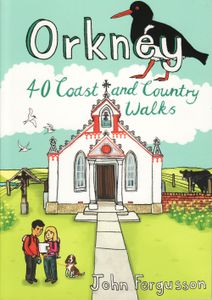
Wandelgids Orkney | Pocket Mountains

Handige compacte wandelgids met 40 dagwandelingen. Deze gids bevat kleine kaartjes en leuke uitgebreide informatie over wat er langs de route te zien is. Goede wandelkaarten zijn echter we noodzakelijk voor deze tochten: de Ordnance Survey explorer maps of Landanger maps zijn zeer geschikt.   The 40 walks in this guide range from a short stroll to ...
10,95

Webshops met dit product

Webshop
Bezorging
Prijs

Anderen bekeken ook

Wandelgids Orkney | Pocket Mountains
Handige compacte wandelgids met 40 dagwandelingen. Deze gids bevat kleine kaartjes en leuke uitgebreide informatie over wat er langs de route te zien is. Goede wandelkaarten zijn echter we noodzakelijk voor deze tochten: de Ordnance Survey explorer maps of Landanger maps zijn zeer geschikt.   The 40 walks in this guide range from a short stroll to hikes of several hours, but most can be completed in half a day or less. The majority are circular, several are lollipop-shaped and some require you to return by the same route. They all, however, end up back where they started, so you will not find yourself miles from your car. Each route is prefaced by an indication of the distance involved and the time it is likely to take. The latter is estimated on the time it took the author to walk the route (averaging around 3.5km per hour) before adding a little for tea, toilet and tourism stops. The timings should be regarded as a rough guide, and if you have to catch a bus or boat at the end of the…
10,95
Wandelgids Wye Valley | Pocket Mountains
This guide contains forty circular routes, covering an area somewhat broader than the AONB but within similar north-south boundaries. This collection of walks is split into five areas: Hereford Lowlands and the Woolhope Dome; Archenfield and the Monnow and Trothy Valleys; The Wye Gorge; The Forest of Dean; The Trellech to Chepstow Plateau. In part, the areas reflect the diverse geology and ecology of the landscape, but they are in no way essentially distinct or separate. Each has its own particular attractions and character, but there is much that is shared between all five areas.   Most of the routes are intended as comfortable walks or strolls, manageable by all willing to put one foot in front of another, at most requiring half a day to complete. Occasionally, the cumulative ascent may leave unseasoned legs a little stiffer, but in general the walking is on well-worn paths, lanes and tracks, which should require minimal time and effort for route-finding. However, the sketch maps serve an…
10,95
Wandelgids Walk! Sierra de Aracena | Discovery Walking Guides
Introducing you to the beautiful region of Sierra de Aracena, this guidebook has 27 detailed walking routes backed by useful information. Every route has 1:40,000 scale colour mapping from Tour & Trail Map, plus GPS Waypoints for pinpoint navigational accuracy. A hundred kilometres northwest of Seville lies a region of truly unspoilt rural Spain. Once a province of Portugal the Sierra de Aracena encapsulates almost everything that we look for as the idyllic walking destination; rural beauty in flora and fauna, breathtaking landscapes, unspoilt towns and villages linked by old donkey trails. All it lacks are high mountains.   The Spanish have known about this isolated region for sometime and arrive at weekends and in mid-summer, but on weekdays and out of season it returns to peaceful tranquility. Few 'outsiders' know of this delightful region and you can be the first to read about it in English. We first discovered the region five years ago, when we thought it too isolated to justify a…
16,50
Reisgids Exploring the Nc500 | Extremis Publishing Limited
Travelling anti-clockwise, David M. Addison seeks his kicks on Scotland's equivalent of Route 66. Otherwise known as NC500, the route takes you through five hundred miles of some of Scotland's most spectacular scenery. No wonder it has been voted as one of the world's five most scenic road journeys. There are many mays of exploring the NC500. You can drive it, cycle it, motorbike it or even walk it, even if you are not one of The Proclaimers! And there are as many activities, places of interest and sights to be seen along the way as there are miles. This is a personal account of the author's exploration of the NC500 as well as some detours from it, such as to the Black Isle, Strathpeffer and Dingwall. Whatever your reason or reasons for exploring the NC500 may be, you should read this book before you go, or take it with you as a vade mecum. It will enhance your appreciation of the NC500 as you learn about the history behind the turbulent past of the many castles; hear folk tales, myths…
18,50
Wandelgids Wales Coast Path: Snowdonia and Ceredigion | Northern Eye B
Official Guide: Wales Coast Path: Snowdonia & Ceredigion Coast One of seven Official Guides to the Wales Coast Path This Official Guide to the Snowdonia & Ceredigion Coast section of the Wales Coast Path contains everything local and long-distance walkers need to enjoy the path.   Cardigan Bay probably offers a more diverse walking experience than any other section of the Wales Coast Path. The stretch covered in this book – from Porthmadog in the north to Cardigan in the south – largely covers two contrasting Welsh counties.   The first 97 kilometres pass through Gwynedd, along the western edge of the Snowdonia National Park. Here, just before the rivers that rise in the highest of the Welsh mountains reach the sea, they fan out to form broad estuaries that provide rich pickings for waders and other birdlife. The estuaries of the Dwyryd, the Mawddach and the Dyfi are the largest of these. Between them are some very large dune systems, including Morfa Harlech and Morfa Dyffryn – home to…
23,95
Wandelgids Walk! Lanzarote | Discovery Walking Guides
Engelstalige wandelgids Lanzarote, met uitgebreide beschrijvingen van wandelroutes, routekaartjes, praktische informatie zoals bussen en accommodatie. Walk! Lanzarote 5th edition builds on the reputation of our earlier editions with more walks and comprehensive updating so that it caters for the needs of the increasing number of people who would like to combine some walking with a holiday on the Fire island. Walk Lanzarote explodes the myth that there is nowhere worth walking on the island as we range through strolling on coastal promenades, walking across alpine style meadows, striding over the lava sea, dropping into volcanoes, sitting on high mountain seats - quite simply you will be amazed at the wide variety of stunning landscapes the Fire island has to offer the adventurous leisure walker.   new extended coastal route from Arrieta to Los Cocoteros to Costa Teguise, new Playa Blanca to Las Brenas to Yaiza on the GR131, which also updates our Yaiza to Las Brenas circular, newly rev…
18,50
Wandelgids Alta Via 2 - Trekking in the Dolomites | Cicerone
Uitstekende wandelgids van een gerenommeerde Engelse uitgever. De tochten zijn met zorg beschreven en voorzien van allerhande nuttige informatie. Guidebook describing Alta Via 2, a challenging hut-to-hut trek through the Italian Dolomites. Stretching 174km from Bressanone (Brixen) to Feltre, the route involves some aided and exposed sections (although several can be bypassed) calling for a sure foot and a good head for heights. It can be walked in under a fortnight - although it is also possible to walk shorter chunks should you only have limited time, and the guide highlights potential exit routes and transport options. Also included are summaries of Alte Vie 3-6, which are more demanding and include remote terrain and stretches of via ferrata for which climbing experience is essential. On Alte Vie 3-6 some nights will be spent in unmanned bivouac huts, meaning trekkers must carry their own kit, although it is possible to walk shorter hut-to-hut sections. The easiest of the Alta Via r…
23,95

Klanten-reviews van Wandelgids Orkney | Pocket Mountains

Er zijn nog geen beoordelingen voor dit productBen jij de eerste die een review plaatst?

Meer over Wandelgids Orkney | Pocket Mountains

Productomschrijving

Handige compacte wandelgids met 40 dagwandelingen. Deze gids bevat kleine kaartjes en leuke uitgebreide informatie over wat er langs de route te zien is. Goede wandelkaarten zijn echter we noodzakelijk voor deze tochten: de Ordnance Survey explorer maps of Landanger maps zijn zeer geschikt.   The 40 walks in this guide range from a short stroll to hikes of several hours, but most can be completed in half a day or less. The majority are circular, several are lollipop-shaped and some require you to return by the same route. They all, however, end up back where they started, so you will not find yourself miles from your car. Each route is prefaced by an indication of the distance involved and the time it is likely to take. The latter is estimated on the time it took the author to walk the route (averaging around 3.5km per hour) before adding a little for tea, toilet and tourism stops. The timings should be regarded as a rough guide, and if you have to catch a bus or boat at the end of the walk, leave plenty of extra time!   Only on a couple of routes will you be asked to set off across the heather without a path to follow, and never without your immediate destination being in view in clear visibility. That said, walking in Orkney should not be underestimated and good visibility cannot be relied upon. The sketch maps are to help in planning your trip and are not sufficiently detailed to navigate by. It is advisable to carry the relevant Ordnance Survey map. Any compass directions are approximate, and lefts and rights are relative to the direction of travel. Where a walk involves crossing to a tidal island, it will be mentioned in the notes. Always ensure you get reliable advice on the state of the tides before crossing. If you get it wrong, you could have a cold, wet and lonely few hours before getting back across.

Productspecificaties

Artikelnummer(s)
Brand
Pocket Mountains
Webshop.nl maakt gebruik van cookies. Ga je verder op onze website, ga dan akkoord met het plaatsen van cookies en de verwerking van deze data door ons en vermelde partners.