webshop.nl

Wandelgids Oban and North Argyll | Hallewell Publications

0
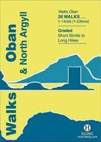
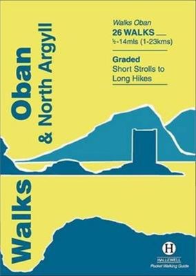
Rewalked and updated in 2018, Walks Oban & North Argyll covers the area around the popular coastal town of Oban, the offshore islands which can be reached from the town, and inland as far as Bridge of Orchy. The coastal area and islands are fairly gentle in character, but there are some fine, challenging hill walks inland. The 26 walks featured ra...

Webshops met dit product

Webshop
Bezorging
Prijs
DeZwerver.nl logo
DeZwerver.nl
niet bekend
5,95

Anderen bekeken ook

Wandelgids Exmoor | Hallewell Publications
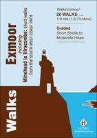
Rewalked and revised in 2021, Walks Exmoor features walks in the Exmoor National Park - a beautiful area including moorland, farmland, wooded valleys and stunning coastal scenery. (The major settlements - Minehead, Ilfracombe and Barnstaple - are all just outside the area.) The 20 walks in the guide range from 1 to 9 miles (1.6 14.4km). The bulk of the routes are in the northern coastal strip (the guide contains a number of short walks from the South West Coast Path), including the path from Lynmouth to the stunning Valley of Rocks and a group of linked walks on Bossington Hill (by Minehead). Elsewhere there is a fine riverside walk to the ancient footbridge of Tarr Steps. Walks Exmoor is part of a popular series of A6 pocket walking guides which describe routes which are suitable for walkers of all abilities and to suit all tastes. Route descriptions are accompanied by 2-colour sketch maps. The guides are illustrated with line illustrations, and will provide walkers with a good intro…
5,95
Wandelgids Fife | Hallewell Publications
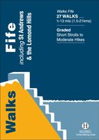
Rewalked and updated in 2021, Walks Fife including St Andrews & the Lomond Hills covers the county of Fife, which lies between the estuaries of the Rivers Forth and Tay. There are a lot of coastal walks (along sections of the Fife Coastal Path), plus walks in and around the historic town of St Andrews and some good hill walks in the Lomond Hills. The 27 walks featured range from 0.5 miles to 13 miles (1.5-21km). Routes include: West and East Lomond, Bishop Hill and St Andrews to Crail. Now on its 3rd edition, Walks Fife is part of a popular series of A6 pocket walking guides which describe routes which are suitable for walkers of all abilities and to suit all tastes. Route descriptions are accompanied by 2-colour sketch maps. The guides are illustrated with line illustrations, and will provide walkers with a good introduction to what each area covered has to offer.  
5,95
Wandelgids North Dartmoor | Hallewell Publications
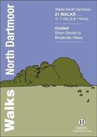
Rewalked and updated in 2020, Walks North Dartmoor features walks in and around the northern half of the Dartmoor National Park - an area famous for its rolling moorland, ponies and dramatic tors (weathered granite outcrops rising from the moorland). This guide covers the area between the town of Okehampton, in the north, and an east-west line just north of Tavistock. (For the southern half of the area, see Walks South Dartmoor.) The 21 walks in the guide range from 1.75 to 7 miles (2.8 11km). There are some fine low-level and woodland walks (notably the walk by the River Teign to Castle Drogo), but the bulk of the routes lead onto the moor, passing splendid features such as Hound Tor and Haytor Rocks. Walks North Dartmoor is part of a popular series of A6 pocket walking guides which describe routes which are suitable for walkers of all abilities and to suit all tastes. Route descriptions are accompanied by 2-colour sketch maps. The guides are illustrated with line illustrations, and …
5,95
Wandelgids North York Moors: Western Area | Hallewell Publications
Rewalked and updated in 2022, Walks North York Moors (Western Area) features walks in the North York Moors National Park - an area of picturesque moorland intersected by narrow dales, butted up against the coast in the north-east corner of Yorkshire. This guide covers the western half of the area - as far east as the villages of Danby and Rosedale Abbey (for routes around Whitby and the east of the area, see Walks North York Moors (Eastern Area)). The 24 walks in the guide range from 1.5 to 8 miles (2.5 13km). Routes include the ascent of distinctive Roseberry Topping, the path to the famous White Horse near Thirsk, and from Helmsley to the ruin of Rievaulx Abbey. Walks North York Moors (Western Area) is part of a popular series of A6 pocket walking guides which describe routes which are suitable for walkers of all abilities and to suit all tastes. Route descriptions are accompanied by 2-colour sketch maps. The guides are illustrated with line illustrations, and will provide walkers w…
5,95
Wandelgids Oban and North Argyll | Pocket Mountains
This guidebook covers a large swathe of Mid and North Argyll, sweeping inland from the fractured western seaboard between Crinan and Appin to Arrochar and Bridge of Orchy on the region’s eastern periphery. Between these four points lies a landscape awash with sea lochs, with Inveraray roughly at the geographical centre. There are no large urban areas here and Oban is the largest settlement. Although the road network and public transport infrastructure are good, many routes feel off the beaten track. This is not only down to the low scattered population but also to the indented coast and its many islands, the sea lochs encroaching deep inland, the elongated freshwater lochs and the mountainous interior – making road travel much more convoluted than direct ‘as-the-crow-flies’ distances would suggest. As well as many great sea lochs, tumbling rivers and iconic mountains, Oban and North Argyll also boasts ancient, wildlife-rich woodlands and several fine gardens. Add to this the Crinan Ca…
10,95
Wandelgids Isle of Mull, Coll and Tiree | Hallewell Publications
Rewalked and revised in 2015, Walks Isle of Mull, Coll & Tiree including Iona & Ulva includes walks on the Inner Hebridean island of Mull and the nearby islands. Mull is typified by spectacular coastal scenery and fine hill climbs, while the other islands are lower and gentler in character. The 29 walks featured range from 1 mile to 10.5 miles (1.6-17km). Routes on Mull include: Ben More, Carsaig Arches and two walks from Tobermory. The guide also features walks on the marvellous island of Ulva, two fine walks on Iona plus routes on the rugged island of Coll and the wide sand beaches of Tiree. Now on its 3rd edition, this guide is part of a popular series of A6 pocket walking guides which describe routes which are suitable for walkers of all abilities and to suit all tastes. Route descriptions are accompanied by 2-colour sketch maps. The guides are illustrated with line illustrations, and will provide walkers with a good introduction to what each area covered has to offer.  
5,95
Wandelgids Hawes and Wensleydale | Hallewell Publications
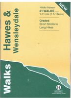
Rewalked and updated in 2016, Walks Hawes & Wensleydale covers the Northern part of the Yorkshire Dales National Park - an area of rolling green hills, dramatic limestone features and quaint villages. The guide features walks in Wensleydale, which includes the popular towns of Hawes and Leyburn. Although there are no high peaks in the area, there are some fine hill walks, as well as paths passing the area's numerous waterfalls. The 21 walks featured range from 1 mile to 11 miles (1.5-18km). Routes include: Aysgill Force, Hardraw Force & Sedbusk, Semer Water, Aysgarth to Castle Bolton and Leyburn Shawl. The guide is part of a popular series of A6 pocket walking guides which describe routes which are suitable for walkers of all abilities and to suit all tastes. Route descriptions are accompanied by 2-colour sketch maps. The guides are illustrated with line illustrations, and will provide walkers with a good introduction to what each area covered has to offer.  
5,95
Wandelgids East Lothian | Hallewell Publications
Rewalked and updated in 2017, Walks East Lothian including Haddington, North Berwick & Dunbar covers the county of East Lothian, which lies to the east of Edinburgh. Walks include a number of coastal paths along the Firth of Forth and the North Sea, some paths through the county's fertile farmland plus some hill walks on the edge of the Lammermuir Hills. The 21 walks featured range from 0.5 miles to 11 miles (1-18km). Routes include: Dunbar Clifftop Trail, Traprain Law, Haddington Riverside and Gullane to North Berwick. Part of a regularly updated popular series of A6 pocket walking guides which describe routes which are suitable for walkers of all abilities and to suit all tastes. Route descriptions are accompanied by 2-colour sketch maps. The guides are illustrated with line illustrations, and will provide walkers with a good introduction to what each area covered has to offer.  
5,95
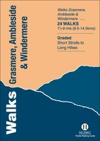
Wandelgids Grasmere, Ambleside and Windermere | Hallewell Publications
Rewalked and revised in 2021, Walks Grasmere, Ambleside & Windermere features walks in The Lake District - the famous area of spectacular peaks and lakes in the north-west of England. This guide covers the central part of the area, which contains many of the most popular towns and villages in the area; not only those mentioned in the title, but also Hawkshead and Rydal. The guide contains walks from all the main centres and around the northern half of Lake Windermere and Grasmere. The 23 walks featured range from 1.5 miles to 9 miles (2.5-14.5km). Routes include: Helm Crag, Alcock Tarn, Great Langdale, Ambleside to Troutbeck, Orrest Head and Tilberthwaite. Last rewalked and updated 2014 - Walks Grasmere is part of a popular series of A6 pocket walking guides which describe routes which are suitable for walkers of all abilities and to suit all tastes. Route descriptions are accompanied by 2-colour sketch maps. The guides are illustrated with line illustrations, and will provide walkers…
5,95
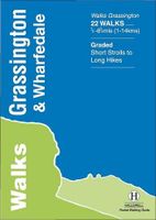
Wandelgids Grassington and Wharfedale | Hallewell Publications
The Yorkshire Dales National Park - an area of rolling green hills, dramatic limestone features and quaint villages - has five main dales (valleys). Walks Grassington & Wharfedale covers Wharfedale - containing the villages of Grassington and Kettlewell - plus the town of Skipton. In the north the walks run by the riverside or climb onto the grassy hills; in the south the rock changes from limestone to sandstone and there are routes through the narrow wooded valley north of Castle Bolton or onto the heather moors to either side. The 22 walks featured range from 0.5 miles to 8.5 miles (1-14km). Routes include: Buckden Loop, a circuit from Kettlewell via Starbotton and Moor End, Grassington to Burnsall, Bolton Abbey & The Strid and Skipton Woods. Part of a popular series of A6 pocket walking guides which describe routes which are suitable for walkers of all abilities and to suit all tastes. Route descriptions are accompanied by 2-colour sketch maps. The guides are illustrated with line …
5,95

Klanten-reviews van Wandelgids Oban and North Argyll | Hallewell Publications

Er zijn nog geen beoordelingen voor dit productBen jij de eerste die een review plaatst?

Meer over Wandelgids Oban and North Argyll | Hallewell Publications

Productomschrijving

Rewalked and updated in 2018, Walks Oban & North Argyll covers the area around the popular coastal town of Oban, the offshore islands which can be reached from the town, and inland as far as Bridge of Orchy. The coastal area and islands are fairly gentle in character, but there are some fine, challenging hill walks inland. The 26 walks featured range from 0.5 miles to 14 miles (1-23km). Routes include: Oban to Gallanach, two routes on Lismore, Ben Cruachan and Bridge of Orchy to Tyndrum. Part of a popular series of A6 pocket walking guides which describe routes which are suitable for walkers of all abilities and to suit all tastes. Route descriptions are accompanied by 2-colour sketch maps. The guides are illustrated with line illustrations, and will provide walkers with a good introduction to what each area covered has to offer.  

Verken gerelateerde categorieën

Webshop.nl maakt gebruik van cookies. Ga je verder op onze website, ga dan akkoord met het plaatsen van cookies en de verwerking van deze data door ons en vermelde partners.