webshop.nl

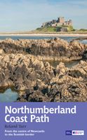
Wandelgids Northumberland Coast Path | Aurum Press

0
Goede beschrijving van de aantrekkelijke route. Kaartmateriaal van Ordnance Survey - de Engelse topografische dienst op een schaal van 1:25.000. Praktische info voor overnachten ed. niet altijd uitgebreid, maar die is op de site van de Ramblers (de engelse wandelorganisatie) te vinden. The Northumberland coastline stretches from the outskirts of N...

Webshops met dit product

Webshop
Bezorging
Prijs
DeZwerver.nl logo
DeZwerver.nl
niet bekend
20,95

Anderen bekeken ook

Wandelkaart Northumberland Coast Path and Berwickshire Coastal Path | Harvey Maps
Mooie, duidelijke kaart van de Northumberland Coast Path en het vervolg daarop de Berwickshire Coastal Path in Noord-Engeland en Schotland. Geplastificeerd met veel extra informatie en uitsnedes van de route.    The Northumberland Coast Path stretches for 103km (64m) from Cresswell in the south to Berwick-upon-Tweed in the north. The Berwickshire Coastal Path stretches for 48km (28m) and continues this route from Berwick-upon-Tweed to Cockburnspath. These routes are part of the North Sea Trail and offer some of the finest coastal walking in the country with rugged coastline, stunning cliff scenery and panoramic views.   XT40 - These maps are a leap forward in technical excellence. They are tough, durable, light and 100% waterproof - virtually indestructible in normal use.   They are light to carry, and compact - not the great bulky package you get with a laminated map.   The map is detailed, with the routes clearly marked. It also contains general information, useful telephone numbers…
25,95
Wandelgids Wales Coast Path: Tenby-Swansea | Aurum Press
Wales Coast Path National Trail Guide is een wandelgids voor meerdaagse wandeltochten - De opzet van deze gidsen is heel duidelijk met kaartmateriaal van Ordnance Survey waarop de tocht is ingetekend.   2012 saw the opening of the entire Welsh coastline as an official long-distance footpath. Now, to complement its existing National Trail Guide to the Pembrokeshire Coast Path, which makes up the section of the Path from Fishguard to just beyond Tenby, Aurum publishes a completely new guide to the other most scenic and popular stretch of the Wales coast – the section eastwards from Tenby to Swansea.   Starting in the superbly picturesque tourism centre of Tenby itself, Chris Moss’s guide follows the coast through Laugharne, famous as the birthplace of Dylan Thomas, Pendine Sands, whose vast level beach was the historic venue for the early attempts on the world land-speed record by buccaneering drivers like Parry-Thomas and Sir Henry Segrave, before winding right round the beautiful Gowe…
19,50
Wandelgids Thames Path | Aurum Press
Een mooie wandelgids met een goede beschrijving en hele duidelijke kaarten met ingetekende route. The official guide to the riverside path from its Gloucestershire source all the way to the outskirts of London. With the London Thames now covered by Aurum's separate new guide, a companion volume can concentrate on the appeal of the full 150 miles of the country Thames, which winds all the way from its Gloucestershire source near Cirencester to Hampton Court on the edge of the London conurbation. This new edition has a wealth of new information about the many sights and places of interest along the way, from Wittenham Clumps that Paul Nash used to paint to Heston Blumenthal's Fat Duck restaurant at Bray, as well as full walking tours of historic Oxford and Windsor & Eton. There are sections on Stanley Spencer at Cookham, and Cliveden and the Cliveden Set, as well as on handsome and interesting towns like Henley and Abingdon. There is also a new section on the wildlife and natural histor…
20,95
Wandelgids Hadrian's Wall Path | Aurum Press
Beschrijving van Hadrian's Wall Path. Historische en culturele aspecten komen vrij uitgebreid aan bod, praktische informatie is wel summier. Kaartmateriaal van Ordnance Survey is zonder meer uitstekend! Since it opened in 2003 Hadrian's Wall Path has become one of Britain's most popular long-distance paths. Its 84 miles are a convenient week's walking, shadowing for the most part the historic line of Hadrian's Wall in its spectacular progress across the superbly wild landscape of the north of England. Starting in what used to be Tyneside's shipbuilding heart, and joining Newcastle in the east with Carlisle in the west, it takes you via the extraordinary Roman forts of Vindolanda and Housesteads, close to handsome towns like Hexham and Corbridge, to finish on the lonely shores of the Solway Firth with views of Scotland. Comprehensive and engrossing, this official guide, published in conjunction with Natural England, is the only companion you need. Ordnance Survey mapping for the entire…
20,95
Wandelgids 10 The South West Coast Path National Trail Guide | Aurum Press
Goede beschrijving van een deel van het beroemde South West Coast path in Cornwall. Men heeft gebruik gemaakt van zeer gedetailleerde kaarten van Ordnance Survey. The South West Coast Path follows Britain's stunning coastline for 630 miles around the southern tip of Britain. This volume covers the 172 miles of the National Trail along the south Cornwall and Devon coast from Falmouth to the mouth of the Exe. It takes in some of Britain's most popular beaches and resorts, as well as arresting clifftop scenery, romantic coves and the spectacular 'drowned' estuaries of the Fal, the Yealm and the Dart. Whether you want golden sands, the steep streets of picturesque fishing villages, or a sight of the rare cirl bunting, this book is all you need as your guide to this wonderful walk. This new edition has been fully revised and updated for 2015 and completely resdesigned to feature many more colour photographs and much added information on the history, wildlife and cultural asociations of the…
20,95
Reisgids British Breaks Newcastle and Northumbria | Rough Guides
Discover the best of Newcastle & Northumbria with this compact, practical, entertaining Pocket Rough Guide with a free eBook. This slim, trim treasure trove of trustworthy travel information is ideal for travellers on short trips, and covers all the key sights such as BALTIC, Hadrian's Wall and Chillingham Castle, restaurants, shops, cafes and bars, plus inspired ideas for day-trips, with honest independent recommendations from expert authors. The Pocket Rough Guide Newcastle & Northumbria covers: Grainger Town, Quayside and Gateshead, Ouseburn & Jesmond, Tyneside and the coast, The Northumberland Coast, The Northumberland interior, Durham and around and Further Afield Inside this travel guide you will find: RECOMMENDATIONS FOR EVERY TYPE OF TRAVELLER Experiences selected for every kind of trip to Newcastle & Northumbria, from off-the-beaten-track adventures in Tyneside to family activities in child-friendly places, like Grainger Town or or chilled-out breaks in popular tourist are…
12,50
Wandelgids Peddars Way and Norfolk Coast Path | Aurum Press
Gedetailleerde routebeschrijving. De kaartjes zijn uitstekend (1:25.000 in kleur). Met goede achtergrondinformatie over de streek, maar de informatie omtrent accommodatie onderweg is zeer beperkt. Kijk daarvoor op de site van de engelse wandelvereninging: de Ramblers Organisation The Peddars Way and Norfolk Coast Path together form the 93-mile (149-km) National Trail that starts near Knettishall in the Brecklands on the Norfolk-Suffolk border and runs north-west to meet the shores of the Wash near Hunstanton before turning east to follow the beautiful North Norfolk coastline to Cromer. The first part of the route, The Peddars Way, follows the route of a Roman road, running arrow-straight along the chalk ridge of north-west Norfolk; the Norfolk Coast Path, in contrast, follows the seawall along the beaches and around the muddy creeks that form a coastline that is home to some of the most famous and spectacular nature reserves in the country. This is the complete, official guide to the …
19,95
Wandelgids 8 The South West Coast Path | Aurum Press
Goede beschrijving van een deel van het beroemde South West Coast path in Cornwall. Men heeft gebruik gemaakt van zeer gedetailleerde kaarten van Ordnance Survey. Part one of the official four-part series covering Britain's longest National Trail in detail. Contains easy to follow Ordnance Survey mapping for individual sections, detailed route descriptions for the National Trail and shorter, circular walks off it. Full colour throughout. The South West Coast Path is the spectacular 630-mile (1008-km) National Trail around the tip of Britain. This volume features the section of the Path from Minehead to Padstow, a distance of 163 miles (262 km). The Trail traces the beautiful coastline, through Exmoor National Park, Clovelly and Tintagel, following Natural England's acorn waymarks. This is the complete, official guide for the long distance walker or the weekend stroller. All you need is this one book. National Trail Guides are the official guidebooks to the fifteen National Trails in E…
20,95
Reisgids 111 places in Northumberland You Shouldn't miss | Emons
Northumberland is the 'Land of the Far Horizon' and England's most northerly county. It was once a place of industrial innovation and manufacturing, literally fuelled by the coal brought up from its depths. Now Northumberland is a quieter place, loved by residents and visitors alike for its rolling hills and long, sandy beaches, as well as its charming towns and villages. With this book in hand, meet Grace Darling, a Victorian heroine who took to storm-tossed seas to help rescue survivors of a terrible shipwreck; visit Amble, the 'Friendliest Port', and discover its connection to the Mauretania, once the fastest passenger ship to sail the Atlantic; and take in Turner's View, an atmospheric stretch of coastline that was a lifelong inspiration to Britain's greatest landscape painter. You can also take a walk to the top of Cheviot, the county's highest mountain and what was once a massive and very active volcano; and then top it off in the tranquil setting of St Cuthbert's Island, where …
19,95
Reisgids Northumberland | Sacristy Press
Northumberland, one of the most sparsely-populated counties in England, with unique features like the Holy Island of Lindisfarne and Hadrian’s Wall, was also a crucible of European civilization and remains a treasury of culture. Giving birth to railways worldwide through George Stephenson, it saw the beginnings of hydraulics, hydro-electricity and turbines and, with Joseph Swan, witnessed the earliest light from electric incandescent lamps; it was a laboratory of invention. Northumberland has, however, changed dramatically over the course of the last century: deep coal-mining, shipbuilding and much heavy engineering have gone, but new industries have flowered. So, the largest man-made lake in northwest Europe, lying within the largest man-made forest is set within the north west of the county, bringing water in abundance and supporting entirely new leisure and tourist activities. The lower Tyne has been transformed both architecturally, and culturally. This unique guide to England’s m…
41,50

Klanten-reviews van Wandelgids Northumberland Coast Path | Aurum Press

Er zijn nog geen beoordelingen voor dit productBen jij de eerste die een review plaatst?

Meer over Wandelgids Northumberland Coast Path | Aurum Press

Productomschrijving

Goede beschrijving van de aantrekkelijke route. Kaartmateriaal van Ordnance Survey - de Engelse topografische dienst op een schaal van 1:25.000. Praktische info voor overnachten ed. niet altijd uitgebreid, maar die is op de site van de Ramblers (de engelse wandelorganisatie) te vinden.

The Northumberland coastline stretches from the outskirts of Newcastle up to the Scottish border at Berwick-upon-Tweed – a popular holiday destination for its wild and sweeping landscape of endless beaches of pale sand, succession of spectacular castles like Bamburgh and Dunstanburgh, congenial resorts like Alnmouth, and unique offshore attractions like Holy Island and the Farne Islands. Now, Roland Tarr’s new Trail Guide maps out the walker’s route along the entire coast, starting from the centre of Newcastle and including an extension beyond Berwick to the seabird crags of St Abb’s Head.  

Along the way the guide covers the remarkable industrial heritage of this coastline – the coalmining town of Ashington that gave birth to both the Ashington Group of Pitmen Painters and the Charlton brothers – and its fabulous wildlife, with seals and puffins off the shore. From a handsome Tyneside city to a distinguished border town straddling the Tweed, this is a superbly bracing walking country for the ever-increasing number of tourists who discover Northumberland every year.

Verken gerelateerde categorieën

Webshop.nl maakt gebruik van cookies. Ga je verder op onze website, ga dan akkoord met het plaatsen van cookies en de verwerking van deze data door ons en vermelde partners.