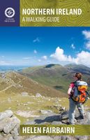
Wandelgids Northern Ireland : The Unmissable Hikes | Knife Edge Outdoor

0
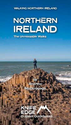
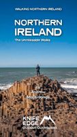
The definitive guidebook for walking in Northern Ireland: 36 epic walks hand-picked by a County Down local. The only guidebook for Northern Ireland with real OSNI maps inside: this makes navigation easy. The Causeway Coast, the Glens of Antrim, the Mourne Mountains, the Sperrins and much more.   Also includes: New walks in the Mournes which were ...

Verkopers met dit product

Verkoper
Bezorging
Prijs
DeZwerver.nl logo
DeZwerver.nl
2,95
21,50

Anderen bekeken ook

Wandelgids Northern Ireland : The Unmissable Hikes | Knife Edge Outdoor
The definitive guidebook for walking in Northern Ireland: 36 epic walks hand-picked by a County Down local. The only guidebook for Northern Ireland with real OSNI maps inside: this makes navigation easy. The Causeway Coast, the Glens of Antrim, the Mourne Mountains, the Sperrins and much more.   Also includes: New walks in the Mournes which were not included in our previous Mourne Mountain book: including the Mournes Grand Traverse, our newly designed 55km challenge circuit which has been divided into two stages. Game of Thrones film locations List of Irish place names Numbered waypoints linking maps to text
21,50
Wandelgids The Mourne Mountains | Knife Edge Outdoor
The only guidebook for the Mourne Mountains written by a County Down local hiker: 30 handpicked routes. The only guidebook for the Mourne Mountains with Real 1:25,000 Maps: this makes navigation easy and saves you money: no need to carry additional maps. Also includes: -Game of Thrones film locations -Numbered waypoints linking maps to text -Quick Reference Route List: enabling you to plan an itinerary to match your ability and schedule. All difficult calculations of time, distance and altitude gain are done for you -Everything the hiker needs to know to plan routes: route descriptions, difficulty, weather, how to get there, and more -Accommodation section -Information on Wildlife, Plants & Geology -History of the Mourne Wall -List of Irish Place Names -Edge to edge colour: the most modern and beautiful Mournes guidebook The Mourne range comprises the highest mountains in Northern Ireland. It is a stunning wilderness which is popular with local walkers but is relatively unknown to tho…
19,50
Wandelgids Northern Ireland | Pocket Mountains
Handige compacte wandelgids met 40 dagwandelingen. Deze gids bevat kleine kaartjes en leuke uitgebreide informatie over wat er langs de route te zien is. From the famous interlocking basalt columns of the Giant’s Causeway, part of a 200km-long wild Atlantic coastline littered with castles, lighthouses, wildflowers and birdlife, to the rugged granite summits of the mighty Mourne Mountains which dominate the County Down skyline, Northern Ireland is packed with a magnificent variety of unforgettable walking opportunities. In this guide you will find routes along windblown clifftop paths, through oakwood forests, over old smuggling routes and across high mountain ridges. On the way you’ll discover a land steeped in hundreds of years of history and ancient legend with a remarkable range of wildlife habitats and interesting geology.
10,95
Reisgids Green Britain & Northern Ireland | Rough Guides
Een kleinere versie van de grotere versies van de Rough Guides. Als altijd weer vol met goede informatie over cultuur en praktische zaken. Achterin kleine plattegronden.   Practical travel guide to Green Britain & Northern Ireland with a free eBook featuring points-of-interest structured lists of all sights and off-the-beaten-track treasures, with detailed colour-coded maps, practical details about what to see and to do in Green Britain & Northern Ireland. The Rough Guide to Green Britain & Northern Ireland also includes details on how to get there and around, pre-departure information, as well as top time-saving tips, like a visual list of things not to miss in Green Britain & Northern Ireland, expert author picks and itineraries to help you plan your trip. This guide book has been fully updated post-COVID-19.     The Rough Guide to Green Britain & Northern Ireland covers: London & the Southeast, the Southwest, Central England, Northern England, Wales, Scotland and Northern Irela…
13,95
Wandelkaart The Mournes | Ordnance Survey Ireland
From the rugged granite peaks of the mountains to the picturesque coastline below, the Mournes region is an Area of Outstanding Natural Beauty. This guide map has information about climbing, rambling or relaxing in the area.   The 1:25,000 scale paper map is for outdoor enthusiasts and provides a detailed guide for many outdoor activities and highlights local amenities and services such as filling stations and bus stops. The map includes Slieve Croob, the Murlough Nature Reserve and Castlewellan Forest Park.   A map for everyone, from the experienced hill walker or rock climber to the casual rambler, from the bird watcher or fisherman to the family out for a picnic.   The Mournes in detail - tracks, cliffs, climbs, the Wall, etc. Contouring at 10 -metre intervals showing clearly the impressive relief of the uplands...sweeping down to the sea via the scenic drives and forests to boating and fishing.   OSNI activity maps are double sided and printed on water resistant paper.   Features:…
14,95
Wandelkaart 04 Discoverer Coleraine | Ordnance Survey Northern Ireland
Zeer gedetailleerde topografische kaart met een aantal toegevoegde toeristische symbolen voor bijv. Bezienswaardigheden en campings. Met hoogtelijnen, mooi kleurgebruik en ingetekende lange-afstands-wandelroutes.   OSNI has replaced the One-Inch maps with a completely new series at 1:50 000 scale. The series is numbered on an all-Ireland basis and Ordnance Survey of Northern Ireland is responsible for the design and publication of the sheets that cover Northern Ireland and adjoining parts of the Republic of Ireland. The layout incorporates a number of overlaps. This map is derived from the latest large scale material, supplemented by new aerial photographs and ground surveys. It is the country's most detailed small-scale map and as well as showing all the features that were on the One-Inch map.
19,50
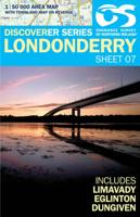
Wandelkaart 07 Discoverer Londonderry | Ordnance Survey Northern Ireland
Zeer gedetailleerde topografische kaart met een aantal toegevoegde toeristische symbolen voor bijv. Bezienswaardigheden en campings. Met hoogtelijnen, mooi kleurgebruik en ingetekende lange-afstands-wandelroutes.   OSNI has replaced the One-Inch maps with a completely new series at 1:50 000 scale. The series is numbered on an all-Ireland basis and Ordnance Survey of Northern Ireland is responsible for the design and publication of the sheets that cover Northern Ireland and adjoining parts of the Republic of Ireland. The layout incorporates a number of overlaps. This map is derived from the latest large scale material, supplemented by new aerial photographs and ground surveys. It is the country's most detailed small-scale map and as well as showing all the features that were on the One-Inch map.
19,50
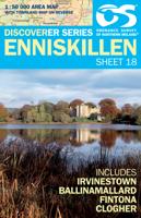
Wandelkaart 18 Discoverer Enniskillen | Ordnance Survey Northern Ireland
Zeer gedetailleerde topografische kaart met een aantal toegevoegde toeristische symbolen voor bijv. Bezienswaardigheden en campings. Met hoogtelijnen, mooi kleurgebruik en ingetekende lange-afstands-wandelroutes.   OSNI has replaced the One-Inch maps with a completely new series at 1:50 000 scale. The series is numbered on an all-Ireland basis and Ordnance Survey of Northern Ireland is responsible for the design and publication of the sheets that cover Northern Ireland and adjoining parts of the Republic of Ireland. The layout incorporates a number of overlaps. This map is derived from the latest large scale material, supplemented by new aerial photographs and ground surveys. It is the country's most detailed small-scale map and as well as showing all the features that were on the One-Inch map.
19,50
Wandelkaart 12 Discoverer Strabane | Ordnance Survey Northern Ireland
Zeer gedetailleerde topografische kaart met een aantal toegevoegde toeristische symbolen voor bijv. Bezienswaardigheden en campings. Met hoogtelijnen, mooi kleurgebruik en ingetekende lange-afstands-wandelroutes.   OSNI has replaced the One-Inch maps with a completely new series at 1:50 000 scale. The series is numbered on an all-Ireland basis and Ordnance Survey of Northern Ireland is responsible for the design and publication of the sheets that cover Northern Ireland and adjoining parts of the Republic of Ireland. The layout incorporates a number of overlaps. This map is derived from the latest large scale material, supplemented by new aerial photographs and ground surveys. It is the country's most detailed small-scale map and as well as showing all the features that were on the One-Inch map.
19,50

Klanten-reviews van Wandelgids Northern Ireland : The Unmissable Hikes | Knife Edge Outdoor

Er zijn nog geen beoordelingen voor dit productBen jij de eerste die een review plaatst?

Meer over Wandelgids Northern Ireland : The Unmissable Hikes | Knife Edge Outdoor

Productomschrijving

The definitive guidebook for walking in Northern Ireland: 36 epic walks hand-picked by a County Down local. The only guidebook for Northern Ireland with real OSNI maps inside: this makes navigation easy. The Causeway Coast, the Glens of Antrim, the Mourne Mountains, the Sperrins and much more.   Also includes:
  • New walks in the Mournes which were not included in our previous Mourne Mountain book: including the Mournes Grand Traverse, our newly designed 55km challenge circuit which has been divided into two stages.
  • Game of Thrones film locations
  • List of Irish place names
  • Numbered waypoints linking maps to text

Productinformatie

    Verken gerelateerde categorieën

    Webshop.nl maakt gebruik van cookies. Ga je verder op onze website, ga dan akkoord met het plaatsen van cookies en de verwerking van deze data door ons en vermelde partners.