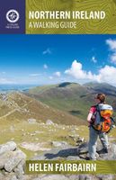
Wandelgids Northern Ireland | The Collins Press

0
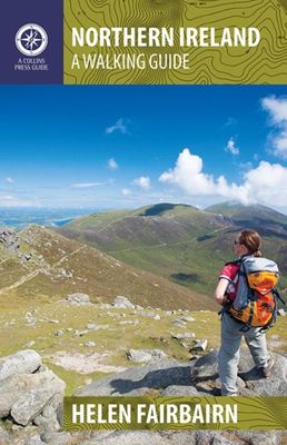
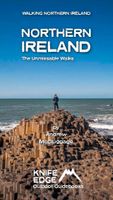
This guide covers best walking routes from the mountains of Mourne to the Giant's Causeway and from Fermanagh's 'lake district' to the rolling Sperrins. The routes range from two hour strolls to eight hour challenges and each has a sketch map, quick reference summary and detailed access information highlighted....

Verkopers met dit product

Verkoper
Bezorging
Prijs
DeZwerver.nl logo
DeZwerver.nl
2,95
22,50

Anderen bekeken ook

Wandelgids Dublin & Wicklow | The Collins Press
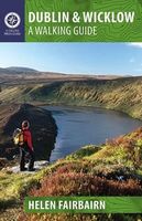
Duidelijke wandelgids van dit specifieke deel van Ierland. Goede praktische informatie en zeker voor de GPS wandelaar handig met vermelde waypoints. Kaarten zijn schetsmatig, maar er wordt verwezen naar de benodigde topografische kaarten van Ierland.  This guidebook describes the best walking routes in Dublin and Wicklow. From mountain landscape to scenic coastal paths, from woodland trails to challenging hill-walks, there are routes here for everyone. Trips vary from two-hour strolls to eight-hour treks, and are illustrated with sketch maps and colour photographs. This is an area of great scenic variety with countless hidden gems to discover - sheer cliffs, dramatic corries, secluded lakes and charming forests. As well as inspiring you to visit the region's natural attractions, the guide provides a host of practical and background information. Each route is prefaced with a quick-reference summary, and descriptions include detailed access notes and navigational guidance. Points of int…
22,50
Wandelgids The Burren & the Aran Islands | The Collins Press
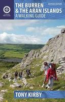
Duidelijke wandelgids van dit specifieke deel van Ierland. Goede praktische informatie en zeker voor de GPS wandelaar handig met vermelde waypoints. Kaarten zijn schetsmatig, maar er wordt verwezen naar de benodigde topografische kaarten van Ierland.  The Burren and the Aran Islands, with their unique combination of flora, fauna and landscape, are explored by large numbers of walkers annually. This is a revised guide to some of the best walking routes in the region, with lucid descriptions and additional information to enhance the walkers' enjoyment and appreciation of the place. From the rugged interior to spectacular coastal scenery, from challenging upland walks to shorter road and waterside excursions, this selection has something for everyone. Every part of the region is covered. Walks vary from two-hour strolls to the longer Burren Way, a six-hour walk from Lisdoonvarna to Ballyvaughan.   The author has put his considerable experience and detailed knowledge of the area to great …
22,50
Wandelgids Ireland's Best Walks | The Collins Press
Duidelijke wandelgids van Ierland:  Goede praktische informatie en zeker voor de GPS wandelaar handig met vermelde waypoints. Kaarten zijn schetsmatig, maar er wordt verwezen naar de benodigde topografische kaarten van Ierland.  In a country richly endowed with wild mountain ranges, secluded valleys and untamed coastlines, the best natural landscapes can only be explored on foot. Here are over sixty of the greatest one-day walking routes in Ireland, varying from short strolls to full-day treks. Every part of the Republic and Northern Ireland is featured. From rugged peaks and chiselled ridge lines to towering sea cliffs and sheltered loughs, these routes take you past all the country’s finest scenery. Many of the routes are hill-walks, with clear descriptions of the country’s classic mountain ascents. Even seasoned hillwalkers will find challenging outings.   Each walk is illustrated with sketch maps and colour photos and is prefaced with a quick-reference summary and access notes. Ro…
22,50
Wandelgids Northern Ireland | Pocket Mountains
Handige compacte wandelgids met 40 dagwandelingen. Deze gids bevat kleine kaartjes en leuke uitgebreide informatie over wat er langs de route te zien is. From the famous interlocking basalt columns of the Giant’s Causeway, part of a 200km-long wild Atlantic coastline littered with castles, lighthouses, wildflowers and birdlife, to the rugged granite summits of the mighty Mourne Mountains which dominate the County Down skyline, Northern Ireland is packed with a magnificent variety of unforgettable walking opportunities. In this guide you will find routes along windblown clifftop paths, through oakwood forests, over old smuggling routes and across high mountain ridges. On the way you’ll discover a land steeped in hundreds of years of history and ancient legend with a remarkable range of wildlife habitats and interesting geology.
10,95
Fotoboek Ireland | Amber Books
Become a visual explorer through more than 200 stunning images that celebrate the beautiful country, culture, and history of Ireland. Ireland holds a special place in people's hearts--even for many who haven't been there. To some the appeal is its natural beauty, to others it's the history; to some it's the country's strong folk tradition, to others it feels like a mystical place. This beautiful guide celebrates the island's most evocative and beautiful places, whether in nature or man-made, from the miles of near-empty beaches to the Mourne Mountains in County Down, from the pretty fishing towns of County Cork to Dublin's elegant Georgian streets. Featuring images from both the Republic of Ireland and Northern Ireland, Ireland ranges widely across landscapes and history, from rugged cliffs and rolling hills to mysterious stone circles, magnificent cathedrals and ruined abbeys; and from medieval forts and castles to grand Victorian follies and villages abandoned during the Potato Fam…
13,95
Wandelgids The Beara & Sheep´s Head Peninsulas | The Collins Press
Duidelijke wandelgids van dit specifieke deel van Ierland. Goede praktische informatie en zeker voor de GPS wandelaar handig met vermelde waypoints. Kaarten zijn schetsmatig, maar er wordt verwezen naar de benodigde topografische kaarten van Ierland.  The Beara and Sheep’s Head Peninsulas lie in the southwest of Ireland, pointed fingers of land wedged between the Kenmare River, Bantry Bay and Dunmanus Bay. They are peaceful, unspoiled peninsulas where the wild and largely untamed nature of the landscape immediately casts its magical spell. There is no better way to explore and experience this stunning landscape than on foot.   This guidebook describes some of the best walking routes in the area: from Dursey Island and Bear Island to the Caha and Shehy Mountains, from the forest trails of Glengarriff to the lakes of Glaninchiquin,and from the tip of the Sheep’s Head to the ridges of Peakeen and Seefin. The routes range from short hikes to longer treks, coastal and inland, something to …
22,50
Wandelgids Walking in the Auvergne | Cicerone
Uitgebreide wandelgids van de Auvergne: goede beschrijvingen, veel keuze, kaarten wat minder goed. This handy guidebook offers the finest day walks in five different areas of the Auvergne, an often-forgotten region in central France perfect for accessible day walking in a unique and spectacular landscape. Towns such as Vichy, Clermont-Ferrand and Puy-en-Velay also offer delightful places to base yourself for that perfect walking holiday. The ridges, rocky peaks and verdant valleys of the Cantal supervolcano dominate south-western Auvergne. The centre of the region hosts the unique chain of 'puys' with their pudding bowl forms and the pristine crater lakes of the Sancy massif. In the north, the Montagne Bourbonnaise preserves a pastoral way of life which is quintessentially French while the Haute Loire's rivers and medieval abbeys reward those venturing further off the beaten track. Notes on the geology and history of points of interest passed en route help you to get the most out of y…
19,95
Wandelgids The Mournes Walks | O'Brien Press
Wandelgids met beschrijvingen van 32 wandelroutes in de Mournes, met achtergrond en natuurinformatie en handgetekende kaarten. Thirty-two walks explore the Mournes, taking in rugged coast, high mountains, forest parks and low-level farmlands. The routes lie within the Mourne Area of Outstanding Natural Beauty, and include Slieve Croob and the north-east coastline. They sweep down to the sea, they rise in huge heathery humps, surrounded by farmlands divided into tiny, stone-walled fields. Explore the Mournes in the company of walking expert Paddy Dillon, taking in rugged coast, high mountains and forest parks. Follow the mighty Mourne Wall on its meanderings and visit the quiet corners where the history, heritage, wildlife and stillness of the area can be enjoyed.   The Walks: Covers all parts of the Mournes - the High and Low Mournes as well as the Kingdom of Mourne; the Silent Valley circuit; the Mourne Coastal Path; the old smuggling route of the Brandy Pad; Warrenpoint and Rostrevo…
11,50
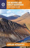
Wandelgids The Mourne and Cooley Mountains | The Collins Press
The Mourne and Cooley Mountains are quite simply a hiker’s paradise.   These exhilarating walks will take you to the highest point in Northern Ireland, to scenic Slieve Foye and the ancient summit of Slieve Gullion.    On routes steeped in the legend of the Táin Bó Cúailgne, trek through picturesque woodlands. Discover the highest passage tomb in Ireland, use an old smugglers’ route and walk alongside tranquil reservoirs. The more ambitious will relish the Mourne Wall and Mourne Seven Sevens challenges, and some summits include optional scrambles to the top of dramatic granite tors or rocky outcrops.  Each graded route is illustrated with photographs and specially drawn maps. Snippets on the rich flora, fauna, geology, history, heritage and folklore of each area are included throughout.  So, get your walking boots on and discover the impressive landscape that inspired C.S. Lewis’ magical world of Narnia and served as the backdrop for Game of Thrones.
22,50
Wandelgids Europe's High Points - summits of 50 European countries | Cicerone
Voor de verzamelaar: de enige gids die alle hoogste punten per land beschrijft en beklimmingen biedt met goede informatie.A guide to reaching the summit of every country in Europe - driving, walking and climbing routes to the tops of 50 countries in Europe. Detailed route descriptions, sketch maps - advice on transport, seasons, grading and gear. From afternoon strolls in Malta to three-day mountaineering ascents on classic Alpine routes such as Mont Blanc. Activitiesstrolling, hiking and climbing!Difficultyfrom simple sightseeing (eg Vatican City) to serious Alpine climbs (Mont Blanc) - all routes clearly graded and equipment required givenMust Seefor the authors, it was Hvannadalshnukur in Iceland but each reader will have their personal favourite.. Scafell Pike (England)? Mount Elbrus (Russia)? Rysy (Poland)?Heading to the highest point of any European country is an experience not to be missed. Europe offers the hiker a wealth of adventure and a huge variety of dazzling scenery and …
22,95

Klanten-reviews van Wandelgids Northern Ireland | The Collins Press

Er zijn nog geen beoordelingen voor dit productBen jij de eerste die een review plaatst?

Meer over Wandelgids Northern Ireland | The Collins Press

Productomschrijving

This guide covers best walking routes from the mountains of Mourne to the Giant's Causeway and from Fermanagh's 'lake district' to the rolling Sperrins. The routes range from two hour strolls to eight hour challenges and each has a sketch map, quick reference summary and detailed access information highlighted.

Productinformatie

    Verken gerelateerde categorieën

    Webshop.nl maakt gebruik van cookies. Ga je verder op onze website, ga dan akkoord met het plaatsen van cookies en de verwerking van deze data door ons en vermelde partners.