webshop.nl
Categorieën
  Sluiten

Meer Pocket Mountains

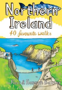
Wandelgids Northern Ireland | Pocket Mountains

0
Handige compacte wandelgids met 40 dagwandelingen. Deze gids bevat kleine kaartjes en leuke uitgebreide informatie over wat er langs de route te zien is. From the famous interlocking basalt columns of the Giant’s Causeway, part of a 200km-long wild Atlantic coastline littered with castles, lighthouses, wildflowers and birdlife, to the rugged granit...

Webshops met dit product

Webshop
Bezorging
Prijs

Anderen bekeken ook

Wandelgids Northern Ireland | Pocket Mountains
Handige compacte wandelgids met 40 dagwandelingen. Deze gids bevat kleine kaartjes en leuke uitgebreide informatie over wat er langs de route te zien is. From the famous interlocking basalt columns of the Giant’s Causeway, part of a 200km-long wild Atlantic coastline littered with castles, lighthouses, wildflowers and birdlife, to the rugged granite summits of the mighty Mourne Mountains which dominate the County Down skyline, Northern Ireland is packed with a magnificent variety of unforgettable walking opportunities. In this guide you will find routes along windblown clifftop paths, through oakwood forests, over old smuggling routes and across high mountain ridges. On the way you’ll discover a land steeped in hundreds of years of history and ancient legend with a remarkable range of wildlife habitats and interesting geology.
10,95
Wandelgids The Mourne Mountains | Knife Edge Outdoor
The only guidebook for the Mourne Mountains written by a County Down local hiker: 30 handpicked routes. The only guidebook for the Mourne Mountains with Real 1:25,000 Maps: this makes navigation easy and saves you money: no need to carry additional maps. Also includes: -Game of Thrones film locations -Numbered waypoints linking maps to text -Quick Reference Route List: enabling you to plan an itinerary to match your ability and schedule. All difficult calculations of time, distance and altitude gain are done for you -Everything the hiker needs to know to plan routes: route descriptions, difficulty, weather, how to get there, and more -Accommodation section -Information on Wildlife, Plants & Geology -History of the Mourne Wall -List of Irish Place Names -Edge to edge colour: the most modern and beautiful Mournes guidebook The Mourne range comprises the highest mountains in Northern Ireland. It is a stunning wilderness which is popular with local walkers but is relatively unknown to thos…
19,50
Wandelgids Wye Valley | Pocket Mountains
This guide contains forty circular routes, covering an area somewhat broader than the AONB but within similar north-south boundaries. This collection of walks is split into five areas: Hereford Lowlands and the Woolhope Dome; Archenfield and the Monnow and Trothy Valleys; The Wye Gorge; The Forest of Dean; The Trellech to Chepstow Plateau. In part, the areas reflect the diverse geology and ecology of the landscape, but they are in no way essentially distinct or separate. Each has its own particular attractions and character, but there is much that is shared between all five areas.   Most of the routes are intended as comfortable walks or strolls, manageable by all willing to put one foot in front of another, at most requiring half a day to complete. Occasionally, the cumulative ascent may leave unseasoned legs a little stiffer, but in general the walking is on well-worn paths, lanes and tracks, which should require minimal time and effort for route-finding. However, the sketch maps serve an…
10,95
Wandelgids 83 Pathfinder Guides North Coast 500 and Northern Highlands
Enhance your North Coast 500 tour with the only walking guidebook featuring routes based on or accessible from Scotland’s ultimate road trip. Discover Britain’s remotest sandy beaches, Scotland’s most northerly munro, some of the oldest rocks on Earth and more with 28 breathtaking walks accessed from the North Coast 500 as well as 32 unmissable stop-off-and-stroll recommendations.   Featured North Coast 500 and Northern Highlands walks include:   - Circle Loch Coulin where Beinn Eighe and Liathach are reflected in the still waters - Wander the astounding landscape of Knockan Crag, where some of the oldest rocks on Earth can be seen - Climb Ben Hope, Scotland’s most northerly munro, towering above the Flow Country - See the waterfalls and rocks walls of the Big Burn as you ascend Ben Bhraggie for views over the Dornoch Firth - Explore the landscape and history of the Applecross peninsula with sublime views of Raasay - Take a moorland and clifftop route to the vast golden sands of Sandwo…
18,50
Wandelgids The Mourne and Cooley Mountains | The Collins Press
The Mourne and Cooley Mountains are quite simply a hiker’s paradise.   These exhilarating walks will take you to the highest point in Northern Ireland, to scenic Slieve Foye and the ancient summit of Slieve Gullion.    On routes steeped in the legend of the Táin Bó Cúailgne, trek through picturesque woodlands. Discover the highest passage tomb in Ireland, use an old smugglers’ route and walk alongside tranquil reservoirs. The more ambitious will relish the Mourne Wall and Mourne Seven Sevens challenges, and some summits include optional scrambles to the top of dramatic granite tors or rocky outcrops.  Each graded route is illustrated with photographs and specially drawn maps. Snippets on the rich flora, fauna, geology, history, heritage and folklore of each area are included throughout.  So, get your walking boots on and discover the impressive landscape that inspired C.S. Lewis’ magical world of Narnia and served as the backdrop for Game of Thrones.
22,50

Klanten-reviews van Wandelgids Northern Ireland | Pocket Mountains

Er zijn nog geen beoordelingen voor dit productBen jij de eerste die een review plaatst?

Meer over Wandelgids Northern Ireland | Pocket Mountains

Productomschrijving

Handige compacte wandelgids met 40 dagwandelingen. Deze gids bevat kleine kaartjes en leuke uitgebreide informatie over wat er langs de route te zien is. From the famous interlocking basalt columns of the Giant’s Causeway, part of a 200km-long wild Atlantic coastline littered with castles, lighthouses, wildflowers and birdlife, to the rugged granite summits of the mighty Mourne Mountains which dominate the County Down skyline, Northern Ireland is packed with a magnificent variety of unforgettable walking opportunities. In this guide you will find routes along windblown clifftop paths, through oakwood forests, over old smuggling routes and across high mountain ridges. On the way you’ll discover a land steeped in hundreds of years of history and ancient legend with a remarkable range of wildlife habitats and interesting geology.

Productspecificaties

Artikelnummer(s)
Brand
Pocket Mountains
Webshop.nl maakt gebruik van cookies. Ga je verder op onze website, ga dan akkoord met het plaatsen van cookies en de verwerking van deze data door ons en vermelde partners.