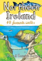
Wandelgids Northern Ireland | Pocket Mountains

0
Handige compacte wandelgids met 40 dagwandelingen. Deze gids bevat kleine kaartjes en leuke uitgebreide informatie over wat er langs de route te zien is. From the famous interlocking basalt columns of the Giant’s Causeway, part of a 200km-long wild Atlantic coastline littered with castles, lighthouses, wildflowers and birdlife, to the rugged grani...

Verkopers met dit product

Verkoper
Bezorging
Prijs
DeZwerver.nl logo
DeZwerver.nl
2,95
10,95

Anderen bekeken ook

Wandelgids Northern Ireland | Pocket Mountains
Handige compacte wandelgids met 40 dagwandelingen. Deze gids bevat kleine kaartjes en leuke uitgebreide informatie over wat er langs de route te zien is. From the famous interlocking basalt columns of the Giant’s Causeway, part of a 200km-long wild Atlantic coastline littered with castles, lighthouses, wildflowers and birdlife, to the rugged granite summits of the mighty Mourne Mountains which dominate the County Down skyline, Northern Ireland is packed with a magnificent variety of unforgettable walking opportunities. In this guide you will find routes along windblown clifftop paths, through oakwood forests, over old smuggling routes and across high mountain ridges. On the way you’ll discover a land steeped in hundreds of years of history and ancient legend with a remarkable range of wildlife habitats and interesting geology.
10,95
Wandelgids Northern Ireland : The Unmissable Hikes | Knife Edge Outdoor
The definitive guidebook for walking in Northern Ireland: 36 epic walks hand-picked by a County Down local. The only guidebook for Northern Ireland with real OSNI maps inside: this makes navigation easy. The Causeway Coast, the Glens of Antrim, the Mourne Mountains, the Sperrins and much more.   Also includes: New walks in the Mournes which were not included in our previous Mourne Mountain book: including the Mournes Grand Traverse, our newly designed 55km challenge circuit which has been divided into two stages. Game of Thrones film locations List of Irish place names Numbered waypoints linking maps to text
21,50
Reisgids Green Britain & Northern Ireland | Rough Guides
Een kleinere versie van de grotere versies van de Rough Guides. Als altijd weer vol met goede informatie over cultuur en praktische zaken. Achterin kleine plattegronden.   Practical travel guide to Green Britain & Northern Ireland with a free eBook featuring points-of-interest structured lists of all sights and off-the-beaten-track treasures, with detailed colour-coded maps, practical details about what to see and to do in Green Britain & Northern Ireland. The Rough Guide to Green Britain & Northern Ireland also includes details on how to get there and around, pre-departure information, as well as top time-saving tips, like a visual list of things not to miss in Green Britain & Northern Ireland, expert author picks and itineraries to help you plan your trip. This guide book has been fully updated post-COVID-19.     The Rough Guide to Green Britain & Northern Ireland covers: London & the Southeast, the Southwest, Central England, Northern England, Wales, Scotland and Northern Irela…
13,95
Wandelgids Southern Highlands | Pocket Mountains
Mooi uitgevoerde wandelgids in een handzaam formaat: 15 x 10 cm. De wandelingen zijn duidelijk beschreven, soms een beetje summier. This Pocket Mountains guide to the Southern Highlands of Scotland covers Glenlyon to Rannoch, Kinross to Callander, The Arrochar Alps, The Trossachs to the Mamlorn Hills, Hills of Crianlarich and Tyndrum -40 circular routes with 45 full colour maps -Each route is circular and takes into account the environmental impact of the walker -The routes vary in difficulty from easy half-day walks to longer, more challenging hikes -Original full colour maps for each route -Stunning colour photography throughout - Covers all the Munros (peaks over 3000 feet) and the best Corbetts (peaks over 2500 feet) in the area) - Designed in durable pocket format to take into the hills - Notes on history, geology and wildlife accompany each section of the book  
10,95
Wandelgids Harris | Pocket Mountains
The Isle of Harris is home to some wonderful walking country, from the rugged ridges and glens of the Harris Hills to the astonishingly beautiful white sand beaches of the island's west coast, while the remarkably complex eastern coastline is punctuated with sea lochs, headlands, coves and bays. These environments are also full of historical interest and spectacular wildlife. These 25 walking routes explore the island's range of landscapes, including strolls along the west coast beaches, half-day walks on rocky coastal paths, day-long mountain ridge traverses and wild country backpacking routes.  
10,95
Wandelgids Yorkshire Dales | Pocket Mountains
Handige compacte wandelgids met 40 dagwandelingen. Deze gids bevat kleine kaartjes en leuke uitgebreide informatie over wat er langs de route te zien is. Goede wandelkaarten zijn echter we noodzakelijk voor deze tochten: de Ordnance Survey explorer maps of Landanger maps zijn zeer geschikt.     The Yorkshire Dales combine a wild limestone landscape of high rolling moorland gouged by dramatic caves and cascading waterfalls with peaceful farmland carpeted in wildflowers and dotted with ruined abbeys, ancient stone walls and barns, and timeless villages waiting to be discovered.The 40 moderate walks in this collection from award winning publisher Pocket Mountains highlight the very best the area has to offer and include adventures in Wharfedale, Malhamdale, Nidderdale, Ribblesdale, Wensleydale, Swaledale and Dentdale. Many routes make use of sections of established long-distance trails such as the Pennine Way and the Dales Way.  
10,95
Wandelgids Southern Uplands | Pocket Mountains
Mooi uitgevoerde wandelgids in een handzaam formaat: 15 x 10 cm. De wandelingen zijn duidelijk beschreven, soms een beetje summier. This Pocket Mountains guide to the Southern Uplands of Scotland contains 40 hill walks, trademark photography and inventive circular routes. Each route is accompanied by a full colour photograph, contoured map and additional facts about the history, geology and wildlife. Coverage of The Galloway Hills, Lowther and Moffat Hills, Clyde and Tweed, Edinburgh and Lothian, Cheviot and Langholm Hills.  
10,95
Wandelgids Norfolk | Pocket Mountains
Handige compacte wandelgids met 40 dagwandelingen. Deze gids bevat kleine kaartjes en leuke uitgebreide informatie over wat er langs de route te zien is. Goede wandelkaarten zijn echter we noodzakelijk voor deze tochten: de Ordnance Survey explorer maps of Landanger maps zijn zeer geschikt.   Pinpointing favourite treks, rambles and family trips, these 40 walks visit Norfolk in all its variety. From wild and windswept coast, Fens and Breckland to sheltered inland woods, broads and valleys, they offer geographical impact and a strong sense of history. Treading in the footsteps of warriors, drovers, pilgrims, weavers and reedcutters, this selection links to the county's extensive network of long-distance routes.   You'll find Norfolk at its most photogenic, with swallowtail butterflies and wherry boats, windpumps, seals and sailing boats, round tower churches and medieval architecture. From coast road to historic villages, towns and cities, many of the walks start near public transport.
10,95

Klanten-reviews van Wandelgids Northern Ireland | Pocket Mountains

Er zijn nog geen beoordelingen voor dit productBen jij de eerste die een review plaatst?

Meer over Wandelgids Northern Ireland | Pocket Mountains

Productomschrijving

Handige compacte wandelgids met 40 dagwandelingen. Deze gids bevat kleine kaartjes en leuke uitgebreide informatie over wat er langs de route te zien is.

From the famous interlocking basalt columns of the Giant’s Causeway, part of a 200km-long wild Atlantic coastline littered with castles, lighthouses, wildflowers and birdlife, to the rugged granite summits of the mighty Mourne Mountains which dominate the County Down skyline, Northern Ireland is packed with a magnificent variety of unforgettable walking opportunities. In this guide you will find routes along windblown clifftop paths, through oakwood forests, over old smuggling routes and across high mountain ridges. On the way you’ll discover a land steeped in hundreds of years of history and ancient legend with a remarkable range of wildlife habitats and interesting geology.

Productinformatie

    Verken gerelateerde categorieën

    Webshop.nl maakt gebruik van cookies. Ga je verder op onze website, ga dan akkoord met het plaatsen van cookies en de verwerking van deze data door ons en vermelde partners.