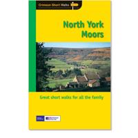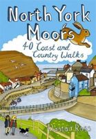
Wandelgids North York Moors | Pocket Mountains

0
Handige compacte wandelgids met 40 dagwandelingen. Deze gids bevat kleine kaartjes en leuke uitgebreide informatie over wat er langs de route te zien is. Goede wandelkaarten zijn echter we noodzakelijk voor deze tochten: de Ordnance Survey explorer maps of Landanger maps zijn zeer geschikt.   Designated a national park in 1952, the North York Moor...

Verkopers met dit product

Webshop
Bezorging
Prijs
DeZwerver.nl logo
DeZwerver.nl
niet bekend
10,95

Anderen bekeken ook

Wandelgids North York Moors: Western Area | Hallewell Publications
Rewalked and updated in 2022, Walks North York Moors (Western Area) features walks in the North York Moors National Park - an area of picturesque moorland intersected by narrow dales, butted up against the coast in the north-east corner of Yorkshire. This guide covers the western half of the area - as far east as the villages of Danby and Rosedale Abbey (for routes around Whitby and the east of the area, see Walks North York Moors (Eastern Area)). The 24 walks in the guide range from 1.5 to 8 miles (2.5 13km). Routes include the ascent of distinctive Roseberry Topping, the path to the famous White Horse near Thirsk, and from Helmsley to the ruin of Rievaulx Abbey. Walks North York Moors (Western Area) is part of a popular series of A6 pocket walking guides which describe routes which are suitable for walkers of all abilities and to suit all tastes. Route descriptions are accompanied by 2-colour sketch maps. The guides are illustrated with line illustrations, and will provide walkers w…
5,95
Fietskaart 10 Cycling guides North York Moors | Goldeneye
Scheur- en watervast foetskaart van de North York Moors  met ingetekende fietsroutes.   Our maps are double-sided, printed on an A2 sheet with a concertina fold. This allows for easy folding and folding, and an ease of access to the mapping. The material is rain and tear-resistant. Our early maps were designed at the scale of 2 miles to 1 inch/1:126,720. The later designs along with digitalisation are 1: 100,000. We were encouraged by the Cycle Touring Club to convert our cartography toward the cycle market (to replace the out-of-print Bartholomew series). As time and the series progressed we have added more data: The National Cycle Network routes, Regional Routes, and Traffic-Free Family Routes, as and when they are developed. These routes are in addition to the Circular Routes Goldeneye Commissioned at the outset of our publishing schedule. We are also adding to new editions; bike shops, cycle hire, and tea rooms, along with the tourist attractions already featured. Our plan is to m…
14,95
Wandelgids North York Moors: Eastern Area | Hallewell Publications
Rewalked and undated in 2022, this guide features walks in Eastern part of the North York Moors National Park (OS Sheet OL27), including sections of the Cleveland Way along the coast around Whitby and Robin Hood's Bay, and woodland and moorland walks around Eskdale and north of Pickering. Walks range from 1 mile to 9 miles (1.6-14.5kms). Routes include Falling Foss, Robin Hood's Bay to Ravenscar and Hole of Horcum.Part of a popular series of A6 pocket walking guides which describe routes which are suitable for walkers of all abilities and to suit all tastes. Route descriptions are accompanied by 2-colour sketch maps. The guides are illustrated with line illustrations, and will provide walkers with a good introduction to what each area covered has to offer.    
5,95
Wandelgids Devon | Pocket Mountains
Handige compacte wandelgids met 40 dagwandelingen. Deze gids bevat kleine kaartjes en leuke uitgebreide informatie over wat er langs de route te zien is. Goede wandelkaarten zijn echter wel aan te raden voor deze tochten: de Ordnance Survey explorer maps of Landranger maps zijn zeer geschikt. From the crumbly rhubarb-and-cream-coloured cliffs of the Jurassic Coast in the southeast to the surf-stroked craggy coves in the north, across the wilderness and woodland of Dartmoor and Exmoor, and through the verdant valleys and great green grazing lands of the dairy belt - Devon is a county of exquisite contrasts and natural wonder. Whether you're looking for an easy afternoon stroll along the shore, a riverside ramble to an atmospheric country pub or a tor-topping trek on the moors, there's something to suit every boot in Patrick Kinsella's inspiring collection of 40 Devon coast and country walks. Plaatsen in het boekje Axminster, Baggy Point, Beer, Berry Camp, Bigbury-on-Sea, Bishop’s Walk,…
10,95
Reisgids Slow Travel North York Moors - Yorkshire Wolds | Bradt Travel Guides
Een bijzondere serie van Bradt guides, waarin een gedeelte van Engeland of Schotland uitgebreid beschreven wordt. Met veel aandacht voor kleine details die je niet al gauw elders zult vinden. Naast de beschrijvende informatie vind je ook een schat aan praktische informatie als accommodatie-adressen of leuke pubs. Een aanrader! Yorkshire resident, outdoors enthusiast and travel writer Mike Bagshaw has thoroughly updated this new third edition of Bradt’s North York Moors & Yorkshire Wolds, part of Bradt’s award-winning series of Slow travel series of guides to UK regions. It remains the only standalone guide to this region of contrasts. Walkers, cyclists, wildlife-lovers, families, foodies and culture vultures will find everything they need to plan and enjoy time here.   From magnificent cliffs and beaches along Yorkshire’s Heritage Coast and rolling hills in the North York Moors (one of the original nine National Parks of England and Wales) to the Wolds’ tranquil chalk grasslands, t…
22,50
Wandelgids Day Walks the North York Moors | Vertebrate Publishing
Day Walks on the North York Moors showcases 20 circular walks, between 5 and 13.7 miles (8 and 22 kilometres) in length, suitable for hillwalkers of all abilities. The routes are split into three areas - The Cleveland Hills and Hambleton Hills, Central Moors and Coastal Walks - and include walks to the most historic and beautiful areas of the Moors, including: Lord Stones, Wainstones and Clay Bank, Rievaulx Abbey, Blakey Ridge and Farndale, the Hole of Horcum, and the stunning coastline at Robin Hood's Bay and Ravenscar. The author of this guidebook, Tony Harker, is a Moors local and keen hillwalker.   Each route in this guide is described with easy-to-follow directions and details of distance, navigation information and refreshment stops, and is plotted on clear and easy to use Ordnance Survey 1:25,000 maps. The walks are illustrated with stunning photography by Adam Long. Also included is a detailed Appendix.
20,95
Wandelgids The Cotswolds | Pocket Mountains
Handige compacte wandelgids met 40 dagwandelingen. Deze gids bevat kleine kaartjes en leuke uitgebreide informatie over wat er langs de route te zien is. Goede wandelkaarten zijn echter we noodzakelijk voor deze tochten: de Ordnance Survey explorer maps of Landanger maps zijn zeer geschikt.   From upland outlooks and secret valleys to rolling pastures and honey stone villages, nature and history weave together in the Cotswolds to create a landscape that is the epitome of rural England. In these 40 walks Dominic North unlocks the secrets of the Cotswolds, from the hills and lanes in the north to the languid riverbanks and ancient woods of the south. Along the way discover sleepy villages, grand country houses and architectural curiosities, and then reach out to explore three of England's most celebrated cities, Bath, Oxford and Stratford-upon-Avon. Plaatsen in het boekje Bath, Bathampton, Batsford, Belas Knap, Bibury, Blenheim Park, Blockley, Bourton-on-the-Hill, Bourton-on-the-Water, …
10,95
Wandelgids Somerset | Pocket Mountains
Handige compacte wandelgids met 40 dagwandelingen. Deze gids bevat kleine kaartjes en leuke uitgebreide informatie over wat er langs de route te zien is. Goede wandelkaarten zijn echter wel aan te raden voor deze tochten: de Ordnance Survey explorer maps of Landranger maps zijn zeer geschikt. From the crumbly rhubarb-and-cream-coloured cliffs of the Jurassic Coast in the southeast to the surf-stroked craggy coves in the north, across the wilderness and woodland of Dartmoor and Exmoor, and through the verdant valleys and great green grazing lands of the dairy belt – Devon is a country of exquisite contrasts and natural wonder.   Whether you’re looking for an easy afternoon stroll along the shore, a riverside ramble to an atmospheric country pub or a tor-topping trek on the moors, there’s something to suit every boot in Patrick Kinsella’s inspiring collection of 40 Devon walks.   Plaatsen in het boekje Aisholt, Barle, River, Bath, Bathwick Hill, Bats Castle, Bishop’s Palace, Blagdon Hil…
10,95
Nieuw
Wandelgids Walking in Provence - West | Cicerone
This guide offers 30 circular day walks in the western half of Provence, the large sun-kissed coastal region of south-east France. Spanning from the Baronnies in the north to the Ste-Baume ridge in the south, the walks are set in the areas of the Drôme Provençale, Vaucluse and the Var. Provence’s sunshine and Mediterranean charm attract many visitors to its coast, yet the area also has much more to offer the walker. The countryside inland boasts a range of scenery from remote mountaintops to spectacular gorges. History is everywhere, in medieval villages, arcaded streets, abbeys, churches and castles.    This guide covers the western regions, with its companion volume, Walking in Provence: East, covering the rest of this fascinating and historic landscape. The walking is incredibly diverse; from the green waves of the Barronies hills in Drôme Provençale, to the unforgettable silhouette of Mont Ventoux giving way to limestone plateaux cut with ravines in the Vauclause. Further south li…
21,95
Wegenkaart - landkaart National Park Pocket Map North York Moors | Collins
Handige kleine kaart van dit Nationaal Park. De kaart geeft een goed en helder overzicht van het gebied met alle plaatsen, doorgaande wandelpaden (alhoewel grof van schaal), bezienswaardigheden etc. Met een register en aanvullende tekst onder de kaart is het een mooi overzicht wat je waar kunt gaan doen. Handy little full colour map of North York Moors National Park.Detailed mapping and visitor information to the National Park along with a selection of photographs. Map at a scale of 1:114 000 (1cm to 1.14km, 1.8 miles to 1 inch).This small map gives a great overview of the North York Moors National Park, and is the perfect companion for exploring this beautiful area of North Yorkshire.• Clear, detailed mapping• Key park, tourist and travel information• Ideal for planning visits to the National Park• Index to help locate and plan your trip• Information on the Cleveland Way, the Moor to Sea Cycle Network, walks and places of interes
7,95

Klanten-reviews van Wandelgids North York Moors | Pocket Mountains

Er zijn nog geen beoordelingen voor dit productBen jij de eerste die een review plaatst?

Meer over Wandelgids North York Moors | Pocket Mountains

Productomschrijving

Handige compacte wandelgids met 40 dagwandelingen. Deze gids bevat kleine kaartjes en leuke uitgebreide informatie over wat er langs de route te zien is. Goede wandelkaarten zijn echter we noodzakelijk voor deze tochten: de Ordnance Survey explorer maps of Landanger maps zijn zeer geschikt.   Designated a national park in 1952, the North York Moors include the largest area of heather upland in England, rising from the Vale of York and continuing to the North Sea coast where dramatic cliffs expose the geology that shaped this unique environment. This guide features 40 coast and country walks that take in the very best the moors have to offer - tranquil dales, stunning coastline, ancient woodlands, charming moorland villages and spectacular ruined castles and monasteries - as well as one of the UK's best heritage railways.

Verken gerelateerde categorieën

Webshop.nl maakt gebruik van cookies. Ga je verder op onze website, ga dan akkoord met het plaatsen van cookies en de verwerking van deze data door ons en vermelde partners.