webshop.nl
Categorieën
  Sluiten

Meer Trailblazer Guides
Meer Trailblazer Guides in Geschiedenis & politiek boeken

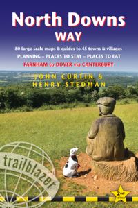
Wandelgids North Downs Way | Trailblazer Guides

A 131-mile National Trail, the North Downs Way runs from Farnham in Surrey to Dover in Kent, partly following the old Pilgrims' Way to the shrine of St Thomas à Becket at Canterbury. It winds its way through the protected landscape of the Surrey Hills and the Kent Downs, passing medieval churches, castles, Neolithic burial sites, vineyards and nume...
18,50

Webshops met dit product

Webshop
Bezorging
Prijs

Anderen bekeken ook

Wandelgids North Downs Way | Trailblazer Guides
A 131-mile National Trail, the North Downs Way runs from Farnham in Surrey to Dover in Kent, partly following the old Pilgrims' Way to the shrine of St Thomas à Becket at Canterbury. It winds its way through the protected landscape of the Surrey Hills and the Kent Downs, passing medieval churches, castles, Neolithic burial sites, vineyards and numerous WWII defences. There are literary associations with Swift, Cobbett, Dickens and Jane Austen.The guide includes:1. Unique mapping features - In many walking guides the reader has to read a route description then try to relate it to the map. Our guides are easier to use because walking directions, tricky junctions, places to stay and eat, points of interest and walking times are all written onto the maps themselves in the places to which they apply. With their uncluttered clarity, these are not general-purpose maps but fully-edited maps drawn by walkers for walkers. Downloadable GPS waypoints also included. 2. The largest scale walking map…
18,50
Wandelgids South Downs Way | Trailblazer Guides
The South Downs Way is a 100-mile footpath which follows the line of chalk hills stretching from Winchester to Eastbourne. Walking the length of the Downs is the best way to experience this beautiful landscape with its mixture of rolling hills, steep hanging woodland and windswept fields. You'll also pass through picture-postcard villages with welcoming pubs, thatched cottages and country gardens. 1. Unique mapping features - In many walking guides the reader has to read a route description then try to relate it to the map. Our guides are easier to use because walking directions, tricky junctions, places to stay and eat, points of interest and walking times are all written onto the maps themselves in the places to which they apply. With their uncluttered clarity, these are not general-purpose maps but fully-edited maps drawn by walkers for walkers. Downloadable GPS waypoints also included. 2. The largest scale walking maps available - At just under 1:20,000 (8cm or 31/8 inches to 1 mil…
20,95
Wandelgids 65 Pathfinder Guides Surrey | Ordnance Survey
Fraaie, goed verzorgde wandelgidsjes met 28 wandelingen van max. een dag, (beginnend bij korte, eindigend bij langere wandelingen). Weergegeven op duidelijke topografische kaartjes (1:25.000). Bevat verder wetenswaardigheden en praktische informatie voor onderweg. Areas covered include the North Downs Way and Box Hill, with all walks accompanied by GPS waypoints, Ordnance Survey maps and beautiful photography. The Pathfinder Guide to Surrey Walks contains 28 fantastic circular walks across the county, much of which lies only a few miles away from the heart of London but which contains some of the country's most beaufiul landscapes, including the oldest untouched area of natural woodland in the UK and the rolling contours of the North Downs. Each walk in Pathfinder Guide to Surrey Walksis accompanied by clear, large-scale Ordnance Survey route maps and GPS waypoints to help you navigate your hike with ease. Exploring one of the most popular Home Counties, Pathfinder Guide to Surrey Walk…
18,50
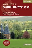
Wandelgids The North Downs Way | Cicerone
Uitstekende wandelgids van de North Downs Way, waarbij naast alle noodzakelijke informatie ook gebruik gemaakt wordt van de echte topografische kaart. inclusief gidsje met routekaarten van 1:25000 A guidebook to walking the North Downs Way National Trail, a 130 mile (208km) walk between the high downland of Farnham and the historic city of Dover on the Kent coast, with an optional visit to Canterbury. The route is described in 11 stages, and is fully illustrated with colour photographs and OS map extracts. The North Downs Way is one of the easier national trails with a modest number of steep (but short) ascents and descents and long sections with no noticeable height gain or loss. Several historic sites including Neolithic burial chambers, Roman roads and Norman churches are passed and much of the route follows The Pilgrims' Way. The area also boasts many literary connections with some of the most celebrated voices in English literature. A separate pocket-sized map booklet is included …
23,95
Wandelgids Great Glen Way | Trailblazer Guides
Goede wandelgids waarin met veel details alle etappes zijn beschreven. Tevens informatie over overnachtingen en openbaar vervoer. All-in-one, practical guide to walking the Great Glen Way long-distance footpath. The trail begins where the West Highland Way ends - at Fort William - and follows the Great Glen faultline to finish at Inverness after 79 miles (127km). The trail passes Loch Lochy, Loch Oich and Loch Ness and also follows the towpath of the Caledonian Canal.   It's a relatively easy week-long walk amongst beautiful Highland scenery but there's a high level option between Fort Augustus and Drumnadrochit that gives even better mountain views. This 2nd edition has been re-walked and fully updated. * Includes 38 detailed walking maps: the largest-scale maps available - at just under 1:20,000 (8cm or 31/8 inches to 1 mile) these are bigger than even the most detailed walking maps currently available in the shops * Unique mapping features - walking times, directions, tricky junctio…
19,95
Wandelgids West Highland Way | Trailblazer Guides
All the information you need to enjoy your hiking adventure along the West Highland Way in this fully revised 8th edition.   The West Highland Way passes through some of the most spectacular scenery in all of Britain. From the outskirts of Glasgow it winds for 96 miles (154.5km) along the wooded banks of Loch Lomond, across the wilderness of Rannoch Moor, over the mountains above Glencoe to a dramatic finish passing Ben Nevis - Britain's highest mountain - into the centre of Fort William.   4 large-scale town plans, 8 overview maps and 53 large-scale walking maps, in NEW two-colour style - at just under 1:20,000 - showing route times, places to stay, places to eat, points of interest and much more. These are not general-purpose maps but fully-edited maps drawn by walkers for walkers. Itineraries for all walkers - whether walking the route in its entirety over a week to 10 days or sampling the highlights on day walks and short break. Practical information for all budgets - camping, b…
19,95

Klanten-reviews van Wandelgids North Downs Way | Trailblazer Guides

Er zijn nog geen beoordelingen voor dit productBen jij de eerste die een review plaatst?

Meer over Wandelgids North Downs Way | Trailblazer Guides

Productomschrijving

A 131-mile National Trail, the North Downs Way runs from Farnham in Surrey to Dover in Kent, partly following the old Pilgrims' Way to the shrine of St Thomas à Becket at Canterbury. It winds its way through the protected landscape of the Surrey Hills and the Kent Downs, passing medieval churches, castles, Neolithic burial sites, vineyards and numerous WWII defences. There are literary associations with Swift, Cobbett, Dickens and Jane Austen.The guide includes:1. Unique mapping features - In many walking guides the reader has to read a route description then try to relate it to the map. Our guides are easier to use because walking directions, tricky junctions, places to stay and eat, points of interest and walking times are all written onto the maps themselves in the places to which they apply. With their uncluttered clarity, these are not general-purpose maps but fully-edited maps drawn by walkers for walkers. Downloadable GPS waypoints also included. 2. The largest scale walking maps available - At just under 1:20,000 (8cm or 31/8 inches to 1 mile) our maps are bigger than even the most detailed walking maps currently available in the shops. 3. An all-in-one guide - Trailblazer guides include practical information not usually found in walking guides to the UK: reviews of places to stay, places to eat, attractions along the way and detailed public transport information showing all access points on the path, for weekend and day walkers.

Productspecificaties

Artikelnummer(s)
Brand
Trailblazer Guides

Verken gerelateerde categorieën

Webshop.nl maakt gebruik van cookies. Ga je verder op onze website, ga dan akkoord met het plaatsen van cookies en de verwerking van deze data door ons en vermelde partners.