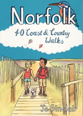
Wandelgids Norfolk | Pocket Mountains

0
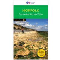
Handige compacte wandelgids met 40 dagwandelingen. Deze gids bevat kleine kaartjes en leuke uitgebreide informatie over wat er langs de route te zien is. Goede wandelkaarten zijn echter we noodzakelijk voor deze tochten: de Ordnance Survey explorer maps of Landanger maps zijn zeer geschikt.   Pinpointing favourite treks, rambles and family trips, ...

Verkopers met dit product

Verkoper
Bezorging
Prijs
DeZwerver.nl logo
DeZwerver.nl
2,95
10,95

Anderen bekeken ook

Wandelgids Walking in Norfolk | Cicerone
This guidebook describes 40 circular walks in Norfolk, including walks along the coast and walks exploring the Fens and the Broads. From 4 to 12 miles, these mostly flat walks use footpaths, bridleways and quiet country lanes, and some involve parts of long-distance paths, including the Peddars Way, Norfolk Coast Path, Boudica's Way and Weavers Way. The walks are divided into five sections: walks on the northeast coast and the Broads; walks in south Norfolk, the Yare and Waveney; walks in North Norfolk and the Coast; walks in Central Norfolk and Breckland; and walks in West Norfolk and the Fens. All routes are easy to moderate and can be done by anyone of reasonable fitness and enjoyed all year round.   Each route is described step-by-step, illustrated with 1:40K OS map extracts and packed with historical, geological and other information about the landscape the route passes through. The Fenland region of Norfolk's far west is flat and low-lying, as are the marshes and waterways of t…
20,95
Wandelgids Norfolk Coast Path - Peddars Way | Trailblazer Guides
The Norfolk Coast Path & Peddars Way cover 130-miles of walking trails. The Peddars Way runs through East Anglia from Knettishall Heath on the Norfolk/Suffolk border and follows a Roman road to Holme-next-the-Sea. From here it becomes the Norfolk Coast Path, hugging the beautiful Norfolk coastline through Holkham, Wells, Blakeney and Cley to Cromer before it rounds the shoulder of the county and continues along the superb beaches and crumbling cliffs to Mundesley, Sea Palling and Great Yarmouth, finishing just before the Suffolk border.   Includes: 77 large-scale walking maps - at just under 1: 20,000 (8cm or 3 and one eighth inches to 1 mile) our maps are bigger than even the most detailed walking maps currently available, with walking directions, tricky junctions, places to stay and eat, points of interest and walking times written onto the maps Text and maps in clear TWO-COLOUR style All standards of accommodation with reviews - campsites, B&Bs, hostels, hotels, bunkhouses Where to…
20,95
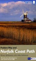
Wandelgids The Peddars Way and Norfolk Coast Path | Cicerone
Uitstekende wandelgids van de Peddars Way en de Norfolk Coast Path, waarbij naast alle noodzakelijke informatie ook gebruik gemaakt wordt van de echte topografische kaart. The Peddars Way and Norfolk Coast Path National Trail is an easy-to-follow 130-mile trail that combines the best of inland and coastal walking in Norfolk, and one that, being well waymarked, largely flat and within easy reach of public transport for most of its length, is ideal for people new to long-distance walks.   Described here in 11 stages, the route can be walked in just over a week but also easily split into day walks or over a series of weekends, with full information about access to start and finish points for each stage by public transport. This handy guidebook is illustrated throughout with extracts of OS 1:50,000 mapping and stunning photographs depicting the Trail in all seasons and describes points of interest along the way, including the Nofolk Songlines sculptures, and also facilities available in t…
18,50
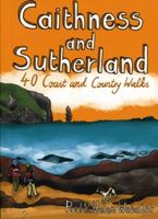
Wandelgids Caithness and Sutherland | Pocket Mountains
Handige compacte wandelgids met 40 dagwandelingen. Deze gids bevat kleine kaartjes en leuke uitgebreide informatie over wat er langs de route te zien is. Goede wandelkaarten zijn echter we noodzakelijk voor deze tochten: de Ordnance Survey explorer maps of Landanger maps zijn zeer geschikt. The county of Ayrshire is located on the Firth of Clyde on the beautiful West Coast of Scotland and is known as one of the most fertile areas of the country, famed for its cattle and crops. Although more industrial to the north, it is in the main a landscape made for walking with an abundance of open countryside and rugged little hills, golden sandy beaches and beautiful sunsets. This guide features 40 mostly moderate walks full of interest which explore all aspects of the region, from craggy cliffs and caves to historic castles, ancient forests to sandy shorelines. Sutherland and Caithness are the most northerly parts of mainland Britain. Northwest Sutherland is a landscape of sandy beaches and …
10,95
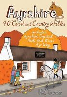
Wandelgids Ayrshire | Pocket Mountains
Handige compacte wandelgids met 40 dagwandelingen. Deze gids bevat kleine kaartjes en leuke uitgebreide informatie over wat er langs de route te zien is. Goede wandelkaarten zijn echter we noodzakelijk voor deze tochten: de Ordnance Survey explorer maps of Landanger maps zijn zeer geschikt.   The county of Ayrshire is located on the Firth of Clyde on the beautiful West Coast of Scotland and is known as one of the most fertile areas of the country, famed for its cattle and crops. Although more industrial to the north, it is in the main a landscape made for walking with an abundance of open countryside and rugged little hills, golden sandy beaches and beautiful sunsets. This guide features 40 mostly moderate walks full of interest which explore all aspects of the region, from craggy cliffs and caves to historic castles, ancient forests to sandy shorelines.
10,95
Wandelgids Devon | Pocket Mountains
Handige compacte wandelgids met 40 dagwandelingen. Deze gids bevat kleine kaartjes en leuke uitgebreide informatie over wat er langs de route te zien is. Goede wandelkaarten zijn echter wel aan te raden voor deze tochten: de Ordnance Survey explorer maps of Landranger maps zijn zeer geschikt. From the crumbly rhubarb-and-cream-coloured cliffs of the Jurassic Coast in the southeast to the surf-stroked craggy coves in the north, across the wilderness and woodland of Dartmoor and Exmoor, and through the verdant valleys and great green grazing lands of the dairy belt - Devon is a county of exquisite contrasts and natural wonder. Whether you're looking for an easy afternoon stroll along the shore, a riverside ramble to an atmospheric country pub or a tor-topping trek on the moors, there's something to suit every boot in Patrick Kinsella's inspiring collection of 40 Devon coast and country walks. Plaatsen in het boekje Axminster, Baggy Point, Beer, Berry Camp, Bigbury-on-Sea, Bishop’s Walk,…
10,95
Wandelgids Walking in Provence - East | Cicerone
This guide offers 30 circular day walks in the eastern half of Provence, the large sun-kissed coastal region of south-east France. Spanning from the red rocks in the Ésterel on the Mediterranean to high mountains inland, the walks are set in the areas of the Alpes Maritimes, the Alpes de Haute-Provence and the Mercantour. Provence’s sunshine and Mediterranean charm attract many visitors to its coast, yet the area also has much more to offer the walker. The countryside inland boasts a range of scenery from remote mountaintops to spectacular gorges. History is everywhere, in medieval villages, arcaded streets, abbeys, churches and castles.    This guide covers the eastern regions, with its companion volume, Walking in Provence: West, covering the rest of this fascinating and historic landscape. The walking is incredibly diverse, and explores the country that hugs the Côte d'Azur and Italian border. The Alpes Maritimes rise craggy and wild above towns as unique as Grasse, Cannes and Mona…
21,95
Wandelgids Loch Ness, Inverness, Black Isle and Affric | Pocket Mountains
Handige compacte wandelgids met 40 dagwandelingen. Deze gids bevat kleine kaartjes en leuke uitgebreide informatie over wat er langs de route te zien is. Goede wandelkaarten zijn echter we noodzakelijk voor deze tochten: de Ordnance Survey explorer maps of Landanger maps zijn zeer geschikt.   A guide to 40 favourite walks around Loch Ness, Inverness, Black Isle and Glen Affric. Loch Ness, with its legendary monster, is the most famous of all lochs. It holds more water than all the lakes of England and Wales combined and the countryside around it features an equally great variety of walks, with more waymarked trails and easy routes suitable for families than many other parts of the Highlands. Further north lies the magnificent Glen Affric - Scotland's most beautiful glen.   This is a wonderful area of the Highlands for walkers, having the highest mountains north of the Great Glen but also some splendid lower-level and forest walks. To the east is the fertile Black Isle, packed with cha…
10,95
Wandelgids Walking in Provence - West | Cicerone
This guide offers 30 circular day walks in the western half of Provence, the large sun-kissed coastal region of south-east France. Spanning from the Baronnies in the north to the Ste-Baume ridge in the south, the walks are set in the areas of the Drôme Provençale, Vaucluse and the Var. Provence’s sunshine and Mediterranean charm attract many visitors to its coast, yet the area also has much more to offer the walker. The countryside inland boasts a range of scenery from remote mountaintops to spectacular gorges. History is everywhere, in medieval villages, arcaded streets, abbeys, churches and castles.    This guide covers the western regions, with its companion volume, Walking in Provence: East, covering the rest of this fascinating and historic landscape. The walking is incredibly diverse; from the green waves of the Barronies hills in Drôme Provençale, to the unforgettable silhouette of Mont Ventoux giving way to limestone plateaux cut with ravines in the Vauclause. Further south li…
21,95
Wandelgids 100 outstanding British Walks | Ordnance Survey
Beschrijving van de 100 mooiste Pathfinder wandelingen in Engeland, Wales en Schotland. Uitstekende beschrijving van de route met een zeer duidelijke topografische kaart waarop de route is ingetekend.  This magnificent compendium of outstanding British walks brings together the finest selection of Pathfinder Walks in Britain s officially designated places of scenic beauty and historic interest: National Parks, Areas of Outstanding Natural Beauty, National Scenic Areas, Heritage Coast, National Trails and UNESCO World Heritage Sites. There are 100 walking gems in this collection, recommended by a group of experienced authors and guides. The walks span a range of distances and degrees of challenge and are organised by region with coverage across England, Wales and Scotland. 100 Outstanding British Walks is lavishly illustrated with stunning landscape photography and informative introductions to each of the walks. It is designed to be enjoyed at home, while the OS Maps app provides the p…
27,95

Klanten-reviews van Wandelgids Norfolk | Pocket Mountains

Er zijn nog geen beoordelingen voor dit productBen jij de eerste die een review plaatst?

Meer over Wandelgids Norfolk | Pocket Mountains

Productomschrijving

Handige compacte wandelgids met 40 dagwandelingen. Deze gids bevat kleine kaartjes en leuke uitgebreide informatie over wat er langs de route te zien is. Goede wandelkaarten zijn echter we noodzakelijk voor deze tochten: de Ordnance Survey explorer maps of Landanger maps zijn zeer geschikt.   Pinpointing favourite treks, rambles and family trips, these 40 walks visit Norfolk in all its variety. From wild and windswept coast, Fens and Breckland to sheltered inland woods, broads and valleys, they offer geographical impact and a strong sense of history. Treading in the footsteps of warriors, drovers, pilgrims, weavers and reedcutters, this selection links to the county's extensive network of long-distance routes.   You'll find Norfolk at its most photogenic, with swallowtail butterflies and wherry boats, windpumps, seals and sailing boats, round tower churches and medieval architecture. From coast road to historic villages, towns and cities, many of the walks start near public transport.

Verken gerelateerde categorieën

Webshop.nl maakt gebruik van cookies. Ga je verder op onze website, ga dan akkoord met het plaatsen van cookies en de verwerking van deze data door ons en vermelde partners.