Wandelgids Norfolk Coast Path - Peddars Way | Trailblazer Guides

0
The Norfolk Coast Path & Peddars Way cover 130-miles of walking trails. The Peddars Way runs through East Anglia from Knettishall Heath on the Norfolk/Suffolk border and follows a Roman road to Holme-next-the-Sea. From here it becomes the Norfolk Coast Path, hugging the beautiful Norfolk coastline through Holkham, Wells, Blakeney and Cley to Crome...

Verkopers met dit product

Verkoper
Bezorging
Prijs
DeZwerver.nl logo
DeZwerver.nl
2,95
20,95

Anderen bekeken ook

Wandelgids Norfolk Coast Path - Peddars Way | Trailblazer Guides
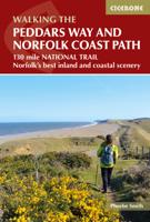
The Norfolk Coast Path & Peddars Way cover 130-miles of walking trails. The Peddars Way runs through East Anglia from Knettishall Heath on the Norfolk/Suffolk border and follows a Roman road to Holme-next-the-Sea. From here it becomes the Norfolk Coast Path, hugging the beautiful Norfolk coastline through Holkham, Wells, Blakeney and Cley to Cromer before it rounds the shoulder of the county and continues along the superb beaches and crumbling cliffs to Mundesley, Sea Palling and Great Yarmouth, finishing just before the Suffolk border.   Includes: 77 large-scale walking maps - at just under 1: 20,000 (8cm or 3 and one eighth inches to 1 mile) our maps are bigger than even the most detailed walking maps currently available, with walking directions, tricky junctions, places to stay and eat, points of interest and walking times written onto the maps Text and maps in clear TWO-COLOUR style All standards of accommodation with reviews - campsites, B&Bs, hostels, hotels, bunkhouses Where to…
20,95
Wandelgids The Peddars Way and Norfolk Coast Path | Cicerone
Uitstekende wandelgids van de Peddars Way en de Norfolk Coast Path, waarbij naast alle noodzakelijke informatie ook gebruik gemaakt wordt van de echte topografische kaart. The Peddars Way and Norfolk Coast Path National Trail is an easy-to-follow 130-mile trail that combines the best of inland and coastal walking in Norfolk, and one that, being well waymarked, largely flat and within easy reach of public transport for most of its length, is ideal for people new to long-distance walks.   Described here in 11 stages, the route can be walked in just over a week but also easily split into day walks or over a series of weekends, with full information about access to start and finish points for each stage by public transport. This handy guidebook is illustrated throughout with extracts of OS 1:50,000 mapping and stunning photographs depicting the Trail in all seasons and describes points of interest along the way, including the Nofolk Songlines sculptures, and also facilities available in t…
18,50
Wandelgids Peddars Way and Norfolk Coast Path | Aurum Press
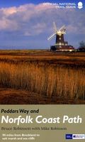
Gedetailleerde routebeschrijving. De kaartjes zijn uitstekend (1:25.000 in kleur). Met goede achtergrondinformatie over de streek, maar de informatie omtrent accommodatie onderweg is zeer beperkt. Kijk daarvoor op de site van de engelse wandelvereninging: de Ramblers Organisation The Peddars Way and Norfolk Coast Path together form the 93-mile (149-km) National Trail that starts near Knettishall in the Brecklands on the Norfolk-Suffolk border and runs north-west to meet the shores of the Wash near Hunstanton before turning east to follow the beautiful North Norfolk coastline to Cromer. The first part of the route, The Peddars Way, follows the route of a Roman road, running arrow-straight along the chalk ridge of north-west Norfolk; the Norfolk Coast Path, in contrast, follows the seawall along the beaches and around the muddy creeks that form a coastline that is home to some of the most famous and spectacular nature reserves in the country. This is the complete, official guide to the …
19,95
Wandelkaart Peddars Way & Norfolk Coast Path | Harvey Maps
Mooie, duidelijke kaart van de Peddars Way  in het oosten van Engeland. Geplastificeerd met veel extra informatie en uitsnedes van de route.   The Peddars Way and Norfolk Coast Path is considered by many to be one of the most accessible National Trails, making it a perfect trail for first time long-distance walkers, or one for the winter months due to Norfolk’s dry climate.   Linking the forests and heathland of the Brecks with the coast, Peddars Way is steeped in ancient legend. It offers a wonderfully remote-feeling adventure with some spectacular historic sites to visit along the way.   The Norfolk Coast Path is a beautiful walk among sand dunes, marshes and Nature Reserves. It goes through the North Norfolk Area of Oustanding Natural Beauty and has some of the best birdwatching in the UK.   Combining both Peddars Way and the Norfolk Coast Path is a moderate long-distance walk that takes most people 7-10 days to complete but can be easily broken into shorter walks.   This map cover…
25,95
Wandelatlas Adventure Atlas Peddars Way and Norfolk Coast Path | A-Z Map Company
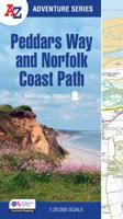
The A-Z Adventure Series uses Ordnance Survey mapping and is the perfect companion for walkers, off-road cyclists, and anyone wishing to explore the great outdoors. Together, Peddars Way and the Norfolk Coast Path form a 93 mile (150km) National Trail across west Norfolk and along its northern coast. The route is clearly shown on the map and passes through a rich landscape with fantastic scenery, places of interest, and an abundance of wildlife. This National Trail Map features detailed Ordnance Survey mapping at a scale of 1:25 000, providing complete coverage of Peddars Way and the Norfolk Coast Path. There is also a route planner included to show distances between places and the amenities available making it easy to plan your adventure. Additional features include: Information Centres Hotels/B&Bs Youth Hostels Campsites (seasonal opening) Public Houses Shops Restaurants Cafes (seasonal opening) Petrol Stations Other books available in the A-Z Adventure series include: Peak…
17,95
Wandelkaart National Trail Map Peddars Way and Norfolk Coast | Collins
Overzichtskaart op vrij grove schaal van deze LAW Lange Afstands Wandeling in Engeland. Let op: je kunt er niet op lopen. Wel met veel informatie op de kaart, goed ingetekend, een route-schema op de achterzijde en een beschrijving van een aantal bezienswaardigheden.  Perfect guide and map for planning your adventure along Peddar’s Way and the Norfolk Coast Path. This incorporates part of the newly formed England Coast Path.   Highlights of this Planning Map include:   More than 20 highlighted places of interest with detailed descriptions and attractive photographs, including: the Hunstanton striped cliffs, Blakeney Point, and Binham Priory A comprehensive index to more than 600 cities, towns and villages A clear, visible route plotted across a 2.4 miles to 1 inch (1.5 km to 1 cm) scale map Advice on safety and security when travelling along the route, as well as the countryside code and the code of conduct Part of the National Trail network, these two long-distance footpaths cover 93 …
11,50
Wandelgids Cornwall Coast Path | Trailblazer Guides
Wandelgids met uitgebreide beschrijvingen wandelingen en praktische informatie met eenvoudige kaarten van de wandelroutes. Practical, complete hiking route guide, with maps and accommodation for the 288-mile footpath that runs around the entire coastline of Cornwall, from Bude to Plymouth; Part 2 of the South-West-Coast Path, a 630-mile National Trail from Minehead to Poole. Includes * 142 large-scale walking maps in TWO-COLOUR style (3 1/8inches to 1 mile), 15 town plans, guides to 81 towns and villages, 24 stage maps and overview map. * Itineraries for all walkers - whether walking the route in its entirety over a week to 10 days or sampling the highlights on day walks and short breaks * GPS waypoints * Practical information for all budgets - camping, bunkhouses, hostels, B&Bs, pubs and hotels; where to stay, where to eat, what to see.   * Comprehensive public transport information - for all access points on the coast path * Flora and fauna - 6 page full colour, flower, butterfly, b…
20,95
Wandelgids Pembrokeshire Coast Path | Trailblazer Guides
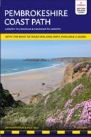
Pembrokeshire Coast Path – Wandelgids van Trailblazer (Engelstalig) Volg een van de mooiste kustpaden van Groot-Brittannië met deze uitgebreide Trailblazer-gids voor het Pembrokeshire Coast Path. Deze National Trail van 299 km (186 mijl) voert je langs de ruige kustlijn van het Pembrokeshire Coast National Park in Zuidwest-Wales – bekend om zijn zandstranden, vissersdorpen, vogelrijke kliffen en verborgen baaien. Wat biedt deze gids? 236 pagina’s boordevol informatie 96 trailkaarten en 15 stadsplattegronden – met routeaanwijzingen direct op de kaart 60 kleurenfoto’s en een kleurrijke 4 pagina’s tellende bloemenherkenningsgids 14 etappekaarten en 2 overzichtskaarten Volledige informatie over accommodaties, eetgelegenheden en openbaar vervoer langs het pad GPS-waypoints te downloaden voor digitale navigatie De unieke cartografie van Trailblazer maakt het verschil: de kaarten bevatten niet alleen het pad, maar ook wandelinstructies, bezienswaardigheden, horeca en wandel…
21,95
Wandelgids Dorset and South Devon Coast Path - South West Coast Path | Trailblazer Guides
Wandelgids van de South West Coast Path  met uitgebreide beschrijvingen wandelingen en praktische informatie met eenvoudige maar zeer accurate kaarten van de wandelroutes. This guide covers the third and last section of the South West Coast Path, from Plymouth to Poole Harbour (217 miles). This beautiful route includes 95 miles within England's only Natural World Heritage Site, the Jurassic Coast, and passes dramatic cliffs and headlands, Chesil Bank's impressive spit and Lulworth Cove, winding through idyllic seaside villages such as Beer and Lyme Regis. - 97 maps large-scale walking maps - at just under 1:20,000 - with unique mapping features: walking times, directions, tricky junctions, places to stay and eat, points of interest. These are not general-purpose maps but fully-edited maps drawn by walkers for walkers. - Itineraries for all walkers - whether walking the route in its entirety or sampling the highlights on day walks and short breaks - Practical information for all budget…
19,95
Wandelgids Cleveland Way | Trailblazer Guides
All the information you need to enjoy your hiking adventure along the Cleveland Way in this fully revised and updated 2nd edition. In the beautiful, wild countryside of the North York Moors National Park in northern England lies this fabulous trail, the Cleveland Way. The 110-mile route runs from Helmsley near Thirsk around the western edge of the park to reach the coast at Saltburn-by-the-Sea.   It then continues along the eastern edge of the park south down the coast through Whitby, Robin Hood's Bay and Scarborough to finish in Filey. Combining moorland and coast there's wonderful scenic variety to this walk, with crumbling castles and idyllic fishing villages to explore. The guide includes:48 large-scale walking maps - at just under 1:20,000 - showing route times, places to stay, places to eat, points of interest, and 8 town plans10 colour stage maps to help plan your walk, including hills and descents, and two colour overview mapsPlaces to stay with reviews - campsites, bunkhouses…
21,95

Klanten-reviews van Wandelgids Norfolk Coast Path - Peddars Way | Trailblazer Guides

Er zijn nog geen beoordelingen voor dit productBen jij de eerste die een review plaatst?

Meer over Wandelgids Norfolk Coast Path - Peddars Way | Trailblazer Guides

Productomschrijving

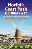
The Norfolk Coast Path & Peddars Way cover 130-miles of walking trails. The Peddars Way runs through East Anglia from Knettishall Heath on the Norfolk/Suffolk border and follows a Roman road to Holme-next-the-Sea. From here it becomes the Norfolk Coast Path, hugging the beautiful Norfolk coastline through Holkham, Wells, Blakeney and Cley to Cromer before it rounds the shoulder of the county and continues along the superb beaches and crumbling cliffs to Mundesley, Sea Palling and Great Yarmouth, finishing just before the Suffolk border.   Includes: 77 large-scale walking maps - at just under 1: 20,000 (8cm or 3 and one eighth inches to 1 mile) our maps are bigger than even the most detailed walking maps currently available, with walking directions, tricky junctions, places to stay and eat, points of interest and walking times written onto the maps Text and maps in clear TWO-COLOUR style All standards of accommodation with reviews - campsites, B&Bs, hostels, hotels, bunkhouses Where to eat with reviews - cafes, teashops, pubs, takeaways and restaurants Detailed public transport information - for all villages and towns along the paths Itineraries for all walkers - including one day Peddars Way and Norfolk Coast Path walks, car parks near the trail for weekend and day walkers Includes 40 mile extension of the National Trail from Cromer to Hopton-on-Sea Downloadable GPS waypoints with what3words refs Colour pictures - including a 6 page colour bird and flower guide Historical, cultural and geographical background information

Productinformatie

    Verken gerelateerde categorieën

    Webshop.nl maakt gebruik van cookies. Ga je verder op onze website, ga dan akkoord met het plaatsen van cookies en de verwerking van deze data door ons en vermelde partners.