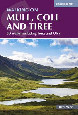
Wandelgids Mull, Coll and Tiree | Cicerone

0

Verkopers met dit product

Verkoper
Bezorging
Prijs
DeZwerver.nl logo
DeZwerver.nl
2,95
22,95

Anderen bekeken ook

Wandelgids Isle of Mull, Coll and Tiree | Hallewell Publications
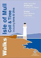
Rewalked and revised in 2015, Walks Isle of Mull, Coll & Tiree including Iona & Ulva includes walks on the Inner Hebridean island of Mull and the nearby islands. Mull is typified by spectacular coastal scenery and fine hill climbs, while the other islands are lower and gentler in character. The 29 walks featured range from 1 mile to 10.5 miles (1.6-17km). Routes on Mull include: Ben More, Carsaig Arches and two walks from Tobermory. The guide also features walks on the marvellous island of Ulva, two fine walks on Iona plus routes on the rugged island of Coll and the wide sand beaches of Tiree. Now on its 3rd edition, this guide is part of a popular series of A6 pocket walking guides which describe routes which are suitable for walkers of all abilities and to suit all tastes. Route descriptions are accompanied by 2-colour sketch maps. The guides are illustrated with line illustrations, and will provide walkers with a good introduction to what each area covered has to offer.  
5,95
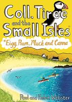
Wandelgids Coll, Tiree and the Small Isles | Pocket Mountains
Handige compacte wandelgids met 40 dagwandelingen. Deze gids bevat kleine kaartjes en leuke uitgebreide informatie over wat er langs de route te zien is. Goede wandelkaarten zijn echter we noodzakelijk voor deze tochten: de Ordnance Survey explorer maps of Landanger maps zijn zeer geschikt.     Off the west coast of Scotland, south of the Isle of Skye and north of Mull and Ardnamurchan, the islands' of Coll and Tiree are the most westerly of the Inner Hebrides and have a reputation as being amongst Scotland's sunniest places. Together with the Small Isles archipelago of Eigg, Rum, Muck and Canna to the north, these Hebridean gems provide a remarkable range and variety of walking. The 36 routes in this book explore these six magical islands rich histories and thriving wildlife as well as the fine sandy beaches, awe-inspiring cliffs and coves, wild interiors and dramatic mountain ranges which make them so special.    
10,95
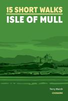
Wandelgids 15 Short Walks Isle of Mull | Cicerone
15 of the best short walks on the Isle of Mull, Ulva and Iona, including Tobermory, Aros Park, Glengorm Castle, Treshnish, and the beaches of Langamull, Kilvickeon and Tireragan.   The walks are under 3 hours in duration and between 1.5km and 10.5km, so they're perfect if you're new to walking or looking for something you can enjoy with the whole family.   Easy-to-read OS maps, clear route descriptions and lots of images All routes bar one are accessible by public transport Information on wildlife, beauty spots and refreshment stops GPX files available for download Compactly sized to fit in a jacket pocket
14,95
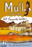
Wandelgids Mull and Iona | Pocket Mountains
Handige compacte wandelgids met 40 dagwandelingen. Deze gids bevat kleine kaartjes en leuke uitgebreide informatie over wat er langs de route te zien is. Goede wandelkaarten zijn echter we noodzakelijk voor deze tochten: de Ordnance Survey explorer maps of Landanger maps zijn zeer geschikt.   Mull is the second largest island of the Inner Hebrides. Perhaps best known for the colourful harbour of Tobermory at the northern end of the island, Mull has become very popular as a holiday destination, most particularly among wildlife enthusiasts.   In this volume you will find the best walking routes on Mull and the neighbouring islands of Iona and Ulva, both easily reached by short ferry journeys. Mull includes some of the wildest coastal scenery in the country as well as many grand mountains, pretty villages and stunning sandy beaches.
10,95
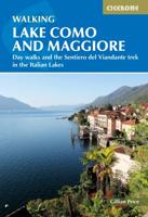
Wandelgids Lake Como and Maggiore | Cicerone
Uitstekende wandelgids van dit geweldige gebied. goed beschreven met veel praktische informatie om de route te kunnen lopen, inclusief redelijke kaarten. This guidebook describes 28 day walks and the Sentiero del Viandante trek around Lakes Como and Maggiore in Northern Italy. The day routes range from 3 to 20km in length are graded 1 to 3. The mini trek up the eastern shore of Lago di Como from Lecco to Colicocan can also be cut into one-day stages if desired.   There is something for everyone, from easy leisurely strolls for first-time walkers to strenuous climbs up panoramic peaks. The clear maps, inspirational photographs and information about accommodation and public transport options help to make this guidebook an ideal companion to exploring the exceptional scenery, views and culture of the Italian Lakes. A basic English-Italian glossary is also included.   Picturesque Lago Maggiore has been working its magic on writers and visitors for centuries. Blessed with a mild clima…
20,95
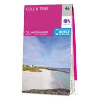
Wandelkaart - Topografische kaart 046 Landranger Coll & Tiree | Ordnance Survey
Zeer goede detailkaart met topografische ondergrond. Kleurgebruik is goed over nagedacht: bijzonder goed leesbaar en helder kaartbeeld. Hierop zijn toeristische symbolen van bezienswaardigheden ingetekend, daarnaast staan bijvoorbeeld campings en jeugdherbergen vermeld en - voor wandelaars het belangrijkst - alle right of way paden en Lange afstands Wandelpaden zijn er op te vinden. De ideale kaart voor het wandelen in Engeland, Wales of Schotland. De kaarten zijn te gebruiken met GPS (UTM OSGB36), de legenda is in het Engels, Frans en Duits.    Plaatsen op deze kaart: Kenovay, Sandaig, Balephuil, Balemartine, Hynish, Scarinish, Caolas, Coll Clabhach, Acha, Arinagour, Sorisdale, Argyll and Bute, Isles of Mull, islands of Soa, Gunna, the Treshnish Isles of Fladda.
19,50
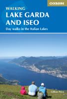
Wandelgids Walking Lake Garda and Iseo | Cicerone
Wandelgids met 20 dagtochten.. Goede omschrijvingen, veel praktische informatie. Redelijk kaartmateriaal Guidebook to 20 day walks around the majestic Italian lakes of Garda and Iseo. The routes, which range from leisurely strolls to more strenuous routes up panoramic peaks, offer something to suit all walkers. Invaluable practical information about public transport, accommodation and walking kit is included, together with a handy Italian glossary. Dorpen en Steden Malcesine, Riva del Garda, Limone, Gargnano on Lago di Garda. Iseo and Lovere on Lago d'Iseo
20,95
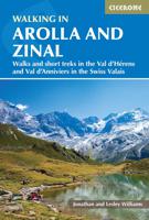
Wandelgids Walking in Arolla and Zinal | Cicerone
A guidebook to 35 day walks and 2 multi-day hikes in Switzerland’s Arolla and Zinal. Exploring the beautiful scenery of Val d’Herens and Val d’Anniviers, west of Zermatt, the routes are generally long and high but on well-maintained paths, with some calling for a good head for heights.   Day walks range from 9 to 22km (6–14 miles) and can be enjoyed in 2–10 hours. The routes are graded allowing you to choose routes suitable for your ability. Two multi-day hikes are also outlined, combining the day walks described.   1:50,000 maps are included for each walk GPX files available to download Detailed information on planning, facilities and public transport Highlights include Dent Blanche and Lac Bleu
23,95
Wandelgids The Kennet and Avon Canal | Cicerone
Uitstekende wandelgids die in etappes de route nauwkeurig beschrijft; ook de zijtakken en alternatieve routes komen aan bod. Inclusief gidsje met topografische routekaarten van 1:50000  This guidebook to walking along the Kennet & Avon Canal covers the 94 mile (152km) route from Reading to Bristol. The canal walk is split into 7 stages of fairly easy, level walking, of between 93/4 and 181/2 miles, with advice on splitting on shortening the stages if needed. The book also includes 20 easy circular walks, ranging from 4 to 9 miles, taking in the best sections of the canal and visiting sites nearby, making this two guidebooks in one. Alongside OS map extracts and detailed route descriptions, there are plenty of details on the history, heritage and wildlife encountered along the way. An itinerary planner is included for walkers who want to create longer or shorter stages, and there is useful practical information including details on accessing the walks by public transport and a list of …
21,95

Klanten-reviews van Wandelgids Mull, Coll and Tiree | Cicerone

Er zijn nog geen beoordelingen voor dit productBen jij de eerste die een review plaatst?

Meer over Wandelgids Mull, Coll and Tiree | Cicerone

Verken gerelateerde categorieën

Webshop.nl maakt gebruik van cookies. Ga je verder op onze website, ga dan akkoord met het plaatsen van cookies en de verwerking van deze data door ons en vermelde partners.