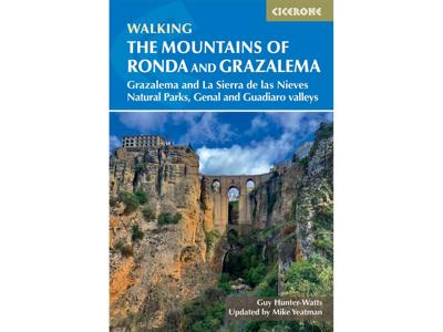
Wandelgids Mountains of Ronda and Grazalema | Cicerone

0

Verkopers met dit product

Verkoper
Bezorging
Prijs
DeZwerver.nl logo
DeZwerver.nl
2,95
24,94

Anderen bekeken ook

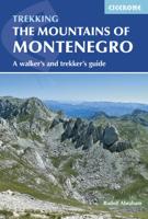
Wandelgids The Mountains of Montenegro | Cicerone
Bijzondere wandelgids van een bijzonder land in opkomst: goed beschreven, met veel informatie en details, dus zeer bruikbaar! This guidebook includes a range of day-walks and multi-day treks throughout the Dinaric Alps of Montenegro. These mountains are some of the wildest, most spectacular, and least visited in Europe. Nevertheless they are easily accessible, and many areas have well-marked trails. They present an opportunity to travel through outstandingly beautiful and remarkably unspoilt natural scenery, which sees few visitors. The guide covers the most spectacular mountain areas in Montenegro, with a selection of circular and linear routes, with variants and extensions.   The guide also includes generous background information, including mountain huts and shelters, travel to and within the country, history and language, as well as what to expect in the various mountains and National Parks the routes explore. This is the first comprehensive English-language guide to walking in th…
25,95
Wandelgids The Mountains of Romania - Roemenië | Cicerone
Guidebook to walks and multi-day treks in the Carpathian mountains of Romania. Includes routes in the Maramures and Bucovina regions, Piatra Craiului ridge, and the Retezat and Fagaras mountains. This guide describes 27 short treks of 2-6 days and 10 day walks in the mountains of Romania. Although there is a slight focus on Transylvania, most of the main massifs are included, with chapters covering the Mountains of Maramures, the Eastern Carpathians, the mountains around Brasov, the Fagara?, the region between the Olt and the Jiu, the Retezat, the mountains of Banat and the Apuseni. Also included is an ascent of Moldoveanu, Romania's highest peak at 2544m.   There is a wealth of advice to help you plan your trip and organise the logistics of your walk or trek. Some routes avail of the network of mountain huts; others offer opportunities to camp in attractive wild locations. Overviews and a route summary table make it easy to choose an appropriate excursion. Each route includes clear d…
26,50
Wandelgids The high mountains of Crete - Kreta | Cicerone
Guidebook to walking and trekking the high mountains of Crete. The largest of the Greek Islands, Crete's mountains provide breathtaking walking and wilderness to this popular island. The routes in this guidebook are graded for difficulty and range from short, easy strolls to challenging, multi-day treks and summit climbs, so there are options for walkers of all abilities.    All the mountain ranges of Crete feature high plains, gorges and ravines, but in the heart of the Lefka Ori there is something else. High above the treeline snow thaws by July to reveal a great circle of massive barren peaks, interspersed with ‘moonscape’ outcrops, or depressions, of sinkholes in black, grey or red rock. This high desert wilderness is seldom visited but covers some 960sqkm.   In central Crete, where the island is at its widest, the huge mass of Psiloritis (Mount Ida) dominates the whole region. Covering about 560sqkm this massif is different in that a single huge, partly scree-surfaced summit ridg…
26,50
Wandelgids Scotland's Best Small Mountains | Cicerone
A guidebook to 40 of the best small mountains in Scotland under 3000ft. Explore the beautiful scenery of Sutherland and the far north, Torridon, Lochaber, the Great Glen, the Cairngorms, Glencoe, Arrochar, the Trossachs and the islands (Skye, Eigg, Mull, Arran). Routes for all seasons and all abilities.   Walks range from 5-25km and can be enjoyed in 2-8 hours Highlights include Suilven, Quinag, the Pap of Glencoe, Beinn Damh, the Storr, Goatfell and the Cobbler One main ascent described for each with several alternatives for traverses, circuits and short-cuts Glossary of Gaelic words for mountain features and summary table for selecting your walk 1:50,000 OS mapping and beautiful photos are included for each route Detailed information on planning, access and profiles of the history and character of each mountains
23,95
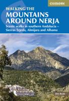
Wandelgids The Mountains Around Nerja | Cicerone
Uitstekende wandelgids van een gerenommeerde Engelse uitgever. De tochten zijn met zorg beschreven en voorzien van allerhande nuttige informatie. Aanbevolen wandelkaarten A guidebook to 32 day walks in and around the coastal town of Nerja, Spain. Exploring the mountains, gorges and white mountain villages of the Sierras Tejeda and Almijara and Alhama Natural Park in southern Andalucia, there are routes for walkers of all levels of fitness and experience.   The walks are graded by difficulty and range from 3–22km (2–14 miles) in length, covering 110–1420m of ascent and taking between 1hr 30min and 7hr 30min to complete.   Clear description of the route alongside 1:50,000 or 1:25,000 maps Highlights include ascents of La Maroma, Cisne and Navachica Packed with information on local history, geology and wildlife Each walk features detailed instructions on getting to the start, plus where to find refreshments and water sources Some routes visit sections of the 700km (430 mile) Gran Senda d…
24,95
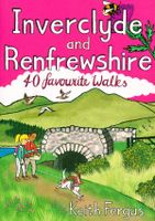
Wandelgids Inverclyde and Renfrewshire | Pocket Mountains
Bordered by the city of Glasgow to the east and the Firth of Clyde to the west, the villages and towns of Inverclyde and Renfrewshire prospered and grew during their textile manufacturing, sugar-refining and shipbuilding glory years. The factories, mills and yards may be quieter now but the natural assets which enabled much of that prosperity are still here. The 40 walks in this guide make the most of the rivers, moors, reservoirs and coastline of this often-overlooked part of Scotland, exploring some impressive industrial heritage and hidden away wildlife-rich havens along the way.
10,95
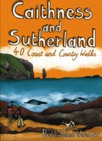
Wandelgids Caithness and Sutherland | Pocket Mountains
Handige compacte wandelgids met 40 dagwandelingen. Deze gids bevat kleine kaartjes en leuke uitgebreide informatie over wat er langs de route te zien is. Goede wandelkaarten zijn echter we noodzakelijk voor deze tochten: de Ordnance Survey explorer maps of Landanger maps zijn zeer geschikt. The county of Ayrshire is located on the Firth of Clyde on the beautiful West Coast of Scotland and is known as one of the most fertile areas of the country, famed for its cattle and crops. Although more industrial to the north, it is in the main a landscape made for walking with an abundance of open countryside and rugged little hills, golden sandy beaches and beautiful sunsets. This guide features 40 mostly moderate walks full of interest which explore all aspects of the region, from craggy cliffs and caves to historic castles, ancient forests to sandy shorelines. Sutherland and Caithness are the most northerly parts of mainland Britain. Northwest Sutherland is a landscape of sandy beaches and …
10,95
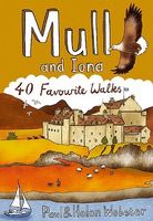
Wandelgids Mull and Iona | Pocket Mountains
Handige compacte wandelgids met 40 dagwandelingen. Deze gids bevat kleine kaartjes en leuke uitgebreide informatie over wat er langs de route te zien is. Goede wandelkaarten zijn echter we noodzakelijk voor deze tochten: de Ordnance Survey explorer maps of Landanger maps zijn zeer geschikt.   Mull is the second largest island of the Inner Hebrides. Perhaps best known for the colourful harbour of Tobermory at the northern end of the island, Mull has become very popular as a holiday destination, most particularly among wildlife enthusiasts.   In this volume you will find the best walking routes on Mull and the neighbouring islands of Iona and Ulva, both easily reached by short ferry journeys. Mull includes some of the wildest coastal scenery in the country as well as many grand mountains, pretty villages and stunning sandy beaches.
10,95
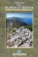
Wandelgids Islands of Croatia | Cicerone
This guidebook describes 30 day walks on the islands of the Croatian Adriatic, ranging from short, easy coastal strolls to more challenging, full day outings over rocky ridges and summits, with spectacular views of the Dalmatian coast. Featuring routes on 14 Croatian islands, including the islands of Hvar and Mljet, as well as quieter islands. From short coastal strolls to full-day outings over rocky summits (suitable for all abilities), the walks in this guide cover an island chain of outstanding beauty. From the Kvarner Gulf (south of Rijeka) to southern Dalmatia (west of Dubrovnik), the Croatian islands feature limestone ridges and toothy knolls alternating with olive groves and lush green forest, while coastlines boast sun-drenched beaches and striking cliffs.   A superb network of trails covers the islands, and the views they offer are frequently spectacular. Yet, despite being near tourist hotspots, most see hardly any use. This guide has all the information walkers need to expl…
22,95

Klanten-reviews van Wandelgids Mountains of Ronda and Grazalema | Cicerone

Er zijn nog geen beoordelingen voor dit productBen jij de eerste die een review plaatst?

Meer over Wandelgids Mountains of Ronda and Grazalema | Cicerone

Verken gerelateerde categorieën

Webshop.nl maakt gebruik van cookies. Ga je verder op onze website, ga dan akkoord met het plaatsen van cookies en de verwerking van deze data door ons en vermelde partners.