Wandelgids Mountain Walks Yr Wyddfa/Snowdon | Vertebrate Publishing

0
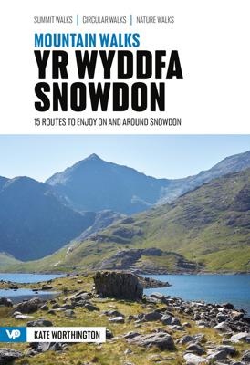
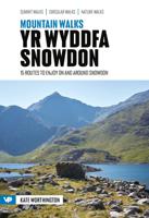
Mountain Walks Yr Wyddfa/Snowdon by Kate Worthington is a guide to walking routes to the summit of Yr Wyddfa in Eryri (Snowdonia). Alongside the summit routes, there are also lower-level alternatives for mixed weather or shorter days and those new to mountain walking.   Among the 15 inspiring routes, the classics are all included, such as the Yr W...

Verkopers met dit product

Verkoper
Bezorging
Prijs
DeZwerver.nl logo
DeZwerver.nl
2,95
20,95

Anderen bekeken ook

Wandelgids Mountain Walks Kinder | Vertebrate Publishing
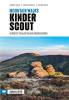
Mountain Walks Kinder Scout by Sarah Lister is a guide to walking routes up and around Kinder Scout in the Peak District. Alongside the routes up to the plateau, there are also valley walks for mixed weather days and those new to mountain walking.   Among the 15 inspiring routes, the classics are all included, such as Grindsbrook Clough from Edale, and Kinder Downfall from Hayfield, and even those who are familiar with the area will find new and imaginative route ideas to discover. Whether you aspire to walk up Kinder on a straightforward route, or you’re looking for a bigger adventure, this is the only guidebook you need.   Together with stunning photography, each route features: Ordnance Survey 1:25,000 maps; easy-to-follow, detailed directions; essential info about public transport and safety advice; details about the terrain and navigation; facilities, refreshments and points of interest; and downloadable GPX files.
20,95
Fietsgids Bikepacking Wales | Vertebrate Publishing
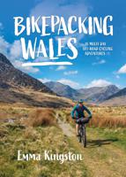
Bikepacking Wales by Emma Kingston contains 18 great multi-day mountain bike adventures.   For such a compact country, Wales has a fantastic variety of trails to explore. Explore the world-class tracks around the remote Elan Valley, traverse the long, grassy ridges of Bannau Brycheiniog (Brecon Beacons), enjoy the stunning coastal bridleways along the Gower peninsula, tackle the popular Trans Cambrian Way across Mid Wales, ride the heather-lined singletrack in the Clywdian Hills, and take a tour around the highest mountain in Wales and England – Yr Wyddfa (Snowdon) – including an optional route to its summit. The trails aren’t the only draw though; these routes take you under towering castle walls, through huge slate quarries and past some of the country’s prehistoric monuments so you can better appreciate Wales’s rich culture and heritage.   Each route includes all the information you need to help you plan your ride, including points of interest along the route, swimming spots, food …
27,95
Wandelgids Mountain Walks Yorkshire Three Peaks: | Vertebrate Publishing
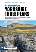
Mountain Walks Yorkshire Three Peaks by Hannah Collingridge is a guide to walking routes on and around Pen-y-ghent, Ingleborough and Whernside in the Yorkshire Dales National Park. Alongside the routes to the peaks themselves, there are also valley walks for mixed-weather days and those new to hillwalking.   The routes explore the local area, visiting local caves and beauty spots and showcasing the stunning limestone scenery; even those who are familiar with the area will find new and imaginative route ideas to discover. Whether you aspire to walk in the southern Dales on a straightforward route, or you’re looking to take on the full Three Peaks challenge, this is the only guidebook you need.   Together with stunning photography, each route features Ordnance Survey 1:25,000 maps; easy-to-follow, detailed directions; downloadable GPX files; essential information about public transport and safety advice; details about the terrain and navigation; and information about facilities, refresh…
20,95
Wandelgids Mountain walking Snowdonia | Cicerone
Uitstekende wandelgids voor dit uitdagende wandelgebied in Wales. 38 dagtochten en een tweedaagse tocht. This guidebook describes 40 day walks exploring Snowdonia. It showcases some of the best mountain walks in the area, with routes up Snowdon and Tryfan alongside other classic peaks like Y Garn, Cadair Idris and the Glyders. Routes are graded easy to strenuous and include airy and pulse-quickening scrambles such as Crib Goch and Bristly Ridge as well as the Snowdon Horseshoe, the Nantlle Ridge and a 2-day traverse of all 15 of Snowdon’s peaks over 3000ft.   Walks range in distance from 4 miles (6km) to 16 miles (26km). Clear route descriptions are accompanied by OS mapping, and for each walk there is key information about distance, grade, ascent, terrain, access and parking. With useful advice on where to stay and when to go, and an English-Welsh glossary, this book is an invaluable guide to discovering both the popular and less well-trodden corners of Snowdonia.   Snowdonia can jus…
23,50
Wandelgids 031 Pathfinder Short Walks Brecon Beacons | Ordnance Survey
Wandelgids van een deel van Wales. Deze gids bevat 20 wandelingen, geschikt voor de hele familie. De bijbehorende kaarten zijn uitstekend: men heeft de topografische kaarten van Ordnance Survey gebruikt waarop de route is ingetekend. Daarnaast praktische informatie over de wandeling en wat beschrijvingen van het gebied. et outside and get active with all the family in the gorgeous Brecon Beacons with these 20 hand-picked and lovingly illustrated short walks. Everybody can enjoy country walking amidst mountains, lakes and forests and there are even accessible routes up the Sugar Loaf, around the Usk Reservoir and to the top of Pen y Fan.   Featured Brecon Beacons Short Walks include:   - Cross the Usk Bridge and see castle ruins on the riverside walk at Castle Meadows - Discover a legendary lake at Llyn y Fan Fach - Climb grassy mountain paths to the rocky summit of the iconic Sugar Loaf - Enjoy great views from an Iron Age Fort at Mynnyd Illtud - See the dazzling Ystradfellte waterfal…
11,50
Wandelgids Walking in the Auvergne | Cicerone
Uitgebreide wandelgids van de Auvergne: goede beschrijvingen, veel keuze, kaarten wat minder goed. This handy guidebook offers the finest day walks in five different areas of the Auvergne, an often-forgotten region in central France perfect for accessible day walking in a unique and spectacular landscape. Towns such as Vichy, Clermont-Ferrand and Puy-en-Velay also offer delightful places to base yourself for that perfect walking holiday. The ridges, rocky peaks and verdant valleys of the Cantal supervolcano dominate south-western Auvergne. The centre of the region hosts the unique chain of 'puys' with their pudding bowl forms and the pristine crater lakes of the Sancy massif. In the north, the Montagne Bourbonnaise preserves a pastoral way of life which is quintessentially French while the Haute Loire's rivers and medieval abbeys reward those venturing further off the beaten track. Notes on the geology and history of points of interest passed en route help you to get the most out of y…
19,95
Wandelgids Day Walks in Snowdonia | Vertebrate Publishing
Day Walks in Snowdonia showcases 20 circular routes, between 5.5 and 12 miles (9km and 19km) in length, suitable for hillwalkers of all abilities. Additionally included in a Bonus Section are two of the UK's classic scrambles: The Bochlwyd Horseshoe and The Snowdon Horseshoe. The routes are split into three areas - Northern Snowdonia, Central Snowdonia and Southern Snowdonia - and include walks to the most iconic and beautiful peaks in the National Park, including; Snowdon, Y Glyderau, the Carneddau peaks, Moel Siabod, Cnicht, the Rhinogs, and Cadair Idris.   The author of this guidebook, Tom Hutton, is a Wales local, keen hillwalker and outdoors journalist. Each route in this guide is described with easy-to-follow directions and details of distance, navigation information, refreshment stops and public transport information, and is plotted on clear and easy to use Ordnance Survey 1:25,000 mapping. Also included is a detailed Appendix.
20,95
Wandelgids Mountain Walking in Mallorca | Cicerone
Goede wandelgids van een prachtig wandelgebied. De routes zijn goed beschreven met veel details, daarnaast de noodzakelijke praktische informatie en men maakt gebruik van goed leesbare, voldoende gedetailleerde kaarten. Met zorg uit gekozen wandelingen door één van Engelands meest gerenommeerde wandelaars!   This guidebook presents 50 half-day and day walks in Mallorca's Serra de Tramuntana, the striking limestone range that stretches along the northwestern flank of the island. Whilst the region promises breathtaking scenery and some fantastic walks, there is also some potentially challenging terrain, making guidance when choosing, planning and walking routes all the more valuable. As many involve steep ground, navigational challenge and hands-on scrambling, they are primarily geared towards those with some experience of mountain walking.    Comprehensive route description is illustrated with 1:25,000 Alpina mapping and each walk includes a statistics box to aid route selection. Usefu…
20,95
Wandelgids The high mountains of Crete - Kreta | Cicerone
Guidebook to walking and trekking the high mountains of Crete. The largest of the Greek Islands, Crete's mountains provide breathtaking walking and wilderness to this popular island. The routes in this guidebook are graded for difficulty and range from short, easy strolls to challenging, multi-day treks and summit climbs, so there are options for walkers of all abilities.    All the mountain ranges of Crete feature high plains, gorges and ravines, but in the heart of the Lefka Ori there is something else. High above the treeline snow thaws by July to reveal a great circle of massive barren peaks, interspersed with ‘moonscape’ outcrops, or depressions, of sinkholes in black, grey or red rock. This high desert wilderness is seldom visited but covers some 960sqkm.   In central Crete, where the island is at its widest, the huge mass of Psiloritis (Mount Ida) dominates the whole region. Covering about 560sqkm this massif is different in that a single huge, partly scree-surfaced summit ridg…
26,50
Wandelgids 014 Pathfinder Short Walks Snowdonia | Ordnance Survey
Wandelgids van een deel van Wales. Deze gids bevat 20 wandelingen, geschikt voor de hele familie. De bijbehorende kaarten zijn uitstekend: men heeft de topografische kaarten van Ordnance Survey gebruikt waarop de route is ingetekend. Daarnaast praktische informatie over de wandeling en wat beschrijvingen van het gebied. The Snowdonia short walks guidebook is ideal for all the family. Containing 20 splendid short walks ranging from 2 to 6 miles, this guide is perfect for newcomers to country walking and those that prefer gentler rambling. The mountains of Snowdonia are magnificent featuring row-upon-row of jagged peaks and ridges; However, there is more to Snowdonia than its mountains. The region offers the walker plenty of easy low-level walks through delightful valleys ranging from narrow and steep-sided to green and open.   The walks in this guide take in some of Snowdonia’s most famous features – castles, lakes, legends, forests, valleys and waterfalls. The only walk featured that …
11,50

Klanten-reviews van Wandelgids Mountain Walks Yr Wyddfa/Snowdon | Vertebrate Publishing

Er zijn nog geen beoordelingen voor dit productBen jij de eerste die een review plaatst?

Meer over Wandelgids Mountain Walks Yr Wyddfa/Snowdon | Vertebrate Publishing

Productomschrijving

Mountain Walks Yr Wyddfa/Snowdon by Kate Worthington is a guide to walking routes to the summit of Yr Wyddfa in Eryri (Snowdonia). Alongside the summit routes, there are also lower-level alternatives for mixed weather or shorter days and those new to mountain walking.   Among the 15 inspiring routes, the classics are all included, such as the Yr Wyddfa/Snowdon Horseshoe via the grade-1 scramble of Crib Goch, and even those who are familiar with the area will find new and imaginative route ideas to discover. Whether you aspire to climb Yr Wyddfa on a straightforward route, or you’re looking for a bigger adventure, this is the only guidebook you need.   Together with stunning photography, each route features: Ordnance Survey 1:25,000 maps; easy-to-follow, detailed directions; essential info about public transport and safety advice; details about the terrain and navigation; facilities, refreshments and points of interest; and downloadable GPX files.

Verken gerelateerde categorieën

Webshop.nl maakt gebruik van cookies. Ga je verder op onze website, ga dan akkoord met het plaatsen van cookies en de verwerking van deze data door ons en vermelde partners.