webshop.nl
Categorieën
  Sluiten

Meer Les Editions du Vieux Crayon
Meer Les Editions du Vieux Crayon in Literatuur boeken

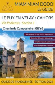
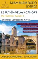
Wandelgids Miam Miam Dodo Section 1 Le Puy en Velay - Cahors GR65 Via

Toonaangevende Franstalige wandelgids met zowel de route, kaarten en praktische informatie. Met een overzicht van de eetadressen en overnachtingsadressen langs het lange afstandswandelpad GR 65 van Puy-en-Velay naar Cahors. De uitgebreid in het Frans beschreven adressen (met prijzen en condities) van restaurants, cafe's en slaapplekken, zoals kloos...
21,50

Webshops met dit product

Webshop
Bezorging
Prijs

Anderen bekeken ook

Wandelgids Miam Miam Dodo Section 1 Le Puy en Velay - Cahors GR65 Via
Toonaangevende Franstalige wandelgids met zowel de route, kaarten en praktische informatie. Met een overzicht van de eetadressen en overnachtingsadressen langs het lange afstandswandelpad GR 65 van Puy-en-Velay naar Cahors. De uitgebreid in het Frans beschreven adressen (met prijzen en condities) van restaurants, cafe's en slaapplekken, zoals kloosters, herbergen, gastverblijven en campings liggen allen binnen een straal van 5km van de wandelroute GR 65. De gids geeft ook andere praktische informatie zoals adressen van postkantoren, apotheken, banken, etc. Two guides cover the entire route of the GR®65, also called Via Podiensis, between Le Puy-en-Velay and Roncesvalles. Here is the first guide, which covers the first part of the way of Puy: from Puy-en-Velay to Cahors.   The Via Podiensis, also called "the way of Puy", is one of the 4 main roads that cross France and converge towards Spain and then Santiago de Compostela. It starts in Le Puy-en-Velay and crosses the Pyrenees through t…
21,50
Wandelgids - Pelgrimsroute Miam Miam Dodo Vezelay - Saint Jean Pied de
Toonaangevende Franstalige wandelgids met zowel de route, kaarten en praktische informatie. Met een overzicht van de eetadressen en overnachtingsadressen langs het lange afstandswandelpad naar Santiago de Compostela, deze gids beschrijft de route tussen Vezelay via 2 mogelijkheden (Bourges of Nevers)  naar Saint Jean Pied de Port in de Pyreneeen.    De uitgebreid in het Frans beschreven adressen (met prijzen en condities) van restaurants, cafe's en slaapplekken, zoals kloosters, herbergen, gastverblijven en campings liggen allen binnen een straal van 5km van de wandelroute. De gids geeft ook andere praktische informatie zoals adressen van postkantoren, apotheken, banken, etc.   At the beginning, the pilgrim has the choice between the northern branch, via Bourges, and the southern branch, via Nevers. In this book, we have decided to promote the itinerary of the associations of pilgrims to Santiago de Compostela, which is the most faithful to the historical itinerary of the Way of Vezel…
25,50
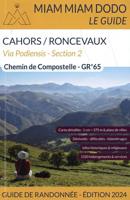
Wandelgids Miam Miam Dodo Section 2 Cahors - Ronceveaux GR65 Via Podie
Toonaangevende Franstalige wandelgids met zowel de route, kaarten en praktische informatie. Met een overzicht van de eetadressen en overnachtingsadressen langs het lange afstandswandelpad GR 65 Cahors naar Roncevaux. De uitgebreid in het Frans beschreven adressen (met prijzen en condities) van restaurants, cafe's en slaapplekken, zoals kloosters, herbergen, gastverblijven en campings liggen allen binnen een straal van 5km van de wandelroute GR 65. De gids geeft ook andere praktische informatie zoals adressen van postkantoren, apotheken, banken, bakkers en slagers, etc. Voici le document qu'utilisent désormais tous les marcheurs vers Compostelle pour la dix-septième année. Le miam-miam-dodo est entièrement mis à jour chaque année. Il apporte les précisions essentielles au randonneur : où dormir, où manger, et à quel prix ? Dans un fuseau de 4 kilomètres de part et d'autre du GR 65, entre Le Puy-en-Velay et Saint-Jean-Pied-de-Port, tout a été répertorié : accueils religieux, hôtels, gîte…
21,50
Wandelgids Camino de Santiago - Via Podiensis GR65 | Cicerone
Handzaam boekje met de routebeschrijving inclusief een heleboel praktische informatie. Uitstekende beschrijving en redelijke kaarten.   This guidebook describes in full the 735km Via Podiensis (GR65), a historic pilgrimage route through southern France from Le Puy-en-Velay to Saint-Jean-Pied-de-Port, where the trail meets the famous Camino Francés to Santiago de Compostela (Spain). Also detailed are 2 major variants: the Célé Valley (GR651) and Rocamadour (GR6 and GR46). Split into 28 stages, the full route takes 4 to 6 weeks to complete but can be divided into shorter sections - Figeac and Condom are well positioned to break the walk into three 2-week chunks. It can be adapted to suit all abilities, with regularly spaced accommodation and baggage transport available, and is best walked in spring and autumn, with May and September the most popular months. Abundant accommodation options offer a warm welcome to walkers and pilgrims and a chance to enjoy delicious home-cooked meals made …
24,95
Wandelgids - Pelgrimsroute Miam Miam Dodo Vezelay - Saint Jean Pied de
Toonaangevende Franstalige wandelgids met zowel de route, kaarten en praktische informatie. Met een overzicht van de eetadressen en overnachtingsadressen langs het lange afstandswandelpad naar Santiago de Compostela, deze gids beschrijft de route tussen Vezelay via 2 mogelijkheden (Bourges of Nevers)  naar Saint Jean Pied de Port in de Pyreneeen.    De uitgebreid in het Frans beschreven adressen (met prijzen en condities) van restaurants, cafe's en slaapplekken, zoals kloosters, herbergen, gastverblijven en campings liggen allen binnen een straal van 5km van de wandelroute. De gids geeft ook andere praktische informatie zoals adressen van postkantoren, apotheken, banken, etc.   At the beginning, the pilgrim has the choice between the northern branch, via Bourges, and the southern branch, via Nevers. In this book, we have decided to promote the itinerary of the associations of pilgrims to Santiago de Compostela, which is the most faithful to the historical itinerary of the Way of Vezel…
25,50
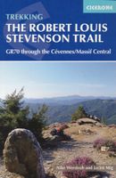
Wandelgids GR 70: The Robert Louis Stevenson Trail van Le Puy tot St-J
Uitstekende wandelgids van een gerenommeerde Engelse uitgever. De tochten zijn met zorg beschreven en voorzien van allerhande nuttige informatie. Met beperkt kaartmateriaal. Aanbevolen wandelkaarten bij deze gids 1:100.000 Wandelkaart GR 70 The Stevenson Trail | IGN - Institut Géographique National Als overzichtskaart Of Wegenkaart 156 Le Puy en Velay - Privas - Mende | IGN - Institut Géographique National Wegenkaart 163 Avignon - Nimes | IGN - Institut Géographique National  of 1:25.000 1. Wandelkaart - Topografische kaart 2835OT Le Puy-en-Velay | IGN - Institut Géographique National 2. Wandelkaart - Topografische kaart 2836OT Gerbier de Jonc | IGN - Institut Géographique National 3. Wandelkaart - Topografische kaart 2736SB Monistrol d'Allier, Solignac-sur-Loire, Cayres | IGN - Institut Géographique National 4. Wandelkaart - Topografische kaart 2737SB Langogne - Grandrieu | IGN - Institut Géographique National 5. Wandelkaart - Topografische kaart 2738SB Le Bleymard | IGN - Institut Gé…
23,95
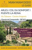
Pelgrimsroute Miam Miam Dodo ARLES TO PUENTE LA REINA | Les Editions d
Labelled by the FFRandonnée under the name GR®653, the road to Arles was once used by pilgrims coming from Provence and Italy. Starting point: the charming city of Arles in the south of France. Arrival point : Puente la Reina in Spain where you will join the Camino Francés towards Compostela. The Miam Miam Dodo Voie d'Arles is the reference guide for walking independently on the Voie d'Arles also called Via Tolosana and on the Camino Aragonés.   The way of Arles is a magnificent itinerary offering about 800 km of a rich diversity of reliefs, landscapes and climates: plains, forests, hills, mountains, etc. This route was very popular in the time of the Occitan civilization, before the Cathars were persecuted. Because of the important differences in altitude, the pilgrim must be well prepared and have a good physical condition for this journey.   The "plus ": In addition to its particularly pleasant climate, the Via Tolosana is the only itinerary of the 4 traditional routes in France…
22,50

Klanten-reviews van Wandelgids Miam Miam Dodo Section 1 Le Puy en Velay - Cahors GR65 Via

Er zijn nog geen beoordelingen voor dit productBen jij de eerste die een review plaatst?

Meer over Wandelgids Miam Miam Dodo Section 1 Le Puy en Velay - Cahors GR65 Via

Productomschrijving

Toonaangevende Franstalige wandelgids met zowel de route, kaarten en praktische informatie. Met een overzicht van de eetadressen en overnachtingsadressen langs het lange afstandswandelpad GR 65 van Puy-en-Velay naar Cahors. De uitgebreid in het Frans beschreven adressen (met prijzen en condities) van restaurants, cafe's en slaapplekken, zoals kloosters, herbergen, gastverblijven en campings liggen allen binnen een straal van 5km van de wandelroute GR 65. De gids geeft ook andere praktische informatie zoals adressen van postkantoren, apotheken, banken, etc. Two guides cover the entire route of the GR®65, also called Via Podiensis, between Le Puy-en-Velay and Roncesvalles. Here is the first guide, which covers the first part of the way of Puy: from Puy-en-Velay to Cahors.   The Via Podiensis, also called "the way of Puy", is one of the 4 main roads that cross France and converge towards Spain and then Santiago de Compostela. It starts in Le Puy-en-Velay and crosses the Pyrenees through the Roncesvalles pass. It is the most used route by pilgrims to Santiago de Compostela. The walkers cross 4 regions rich in fauna, flora and geological diversity: the volcanic Velay, the Margeride plateau, the Aubrac and the Lot valley. Not to mention the view of the wild Aubrac plateau, all these landscapes will fill your eyes!   All the information to know where to eat and where to sleep within a radius of 4km on either side of the Way: religious reception, hotels, gîtes d'étape, bed and breakfasts, campsites, restaurants, groceries, bakeries, delicatessens, pharmacies, etc... ultra-precise mapping (1cm = 375m) the altitude differences and walking times: a red-orange-green color code indicates the levels of difficulty. > Walking times are indicated (average pace 3,5km/h) a color code indicating the difficulties detailed city maps historical, practical and religious information and a tool to help you create the stages: it allows you to shape your pilgrimage according to your physical capacities, your time constraints or simply your desires. This guide is updated every year.   Pilgrim friend, bon voyage! Voici le document qu'utilisent désormais tous les marcheurs vers Compostelle pour la dix-septième année. Le miam-miam-dodo est entièrement mis à jour chaque année. Il apporte les précisions essentielles au randonneur : où dormir, où manger, et à quel prix ? Dans un fuseau de 4 kilomètres de part et d'autre du GR 65, entre Le Puy-en-Velay et Saint-Jean-Pied-de-Port, tout a été répertorié : accueils religieux, hôtels, gîtes d'étape, chambres d'hôtes, campings, cafés, restaurants, postes, boulangeries, épiceries, charcuteries, pharmacies, banques, etc.  Prix et conditions sont précisés, afin que le pèlerin sache exactement où il pose son sac, et qu'il ait le choix de ses hébergements, en fonction de ses convictions, de ses goûts et de l'épaisseur de sa bourse. Ami pèlerin, bon voyage ! Nos plans sont à l'échelle ! 1 cm = 375 m.
Productspecificaties

Artikelnummer(s)
Brand
Les Editions du Vieux Crayon

Verken gerelateerde categorieën

Webshop.nl maakt gebruik van cookies. Ga je verder op onze website, ga dan akkoord met het plaatsen van cookies en de verwerking van deze data door ons en vermelde partners.