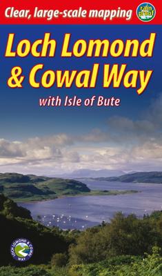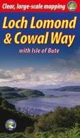
Wandelgids Loch Lomond & Cowal Way | Rucksack Readers

0
"Lavishly illustrated guidebook with route map plus practical information" - Scots Magazine The Loch Lomond & Cowal Way is one of Scotland's Great Trails. It runs for 57 miles (91 km) across the Cowal peninsula, which lies west of Glasgow and is easily reached by public transport, road and ferry. The route starts at Portavadie on Loch Fyne and end...

Verkopers met dit product

Verkoper
Bezorging
Prijs
DeZwerver.nl logo
DeZwerver.nl
2,95
19,95

Anderen bekeken ook

Nieuw
Wandelgids Moray Coast Trail | Rucksack Readers
The Mary Queen of Scots Way stretches across central Scotland from coast to coast, linking many places associated with Mary Queen of Scots. It runs for 107 miles (172 km) from Arrochar on Loch Long in the west to St Andrews on the Fife coast, and links with four of Scotland’s Great Trails: the Loch Lomond & Cowal Way, the West Highland Way, the Rob Roy Way and the Fife Coastal Path. This route, however, has no official status: there is no dedicated MQS waymarking, although the guidebook gives detailed directions and parts of it are easy to follow. Some sections are unsuitable for novice walkers unless accompanied by somebody with map and compass skills.   The Way goes through richly varied scenery, starting from a rugged sea loch, crossing Loch Lomond and traversing its National Park to the hills of central Scotland, ending on a sandy beach on the Fife coast. It passes mountains, lochs and waterfalls; castles, hill forts and aqueducts; and is broken into manageable sections which end …
19,95
Nieuw
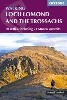
Wandelgids Walking Loch Lomond and The Trossachs | Cicerone
Uitstekende wandelgids, sommige meerdaags, voor dit uitdagende wandelgebied in Schotland. Guidebook to over 70 walking routes in the hills of Loch Lomond and the Trossachs National Park in Scotland's Southern Highlands. Including 21 Munros on less-popular routes, as well as plenty of Corbetts and Grahams. Hill summits of Ben Lomond, the Cobbler, Ben Lui and the Arrochar Alps have plenty of routes to explore. The routes in this guide range from 1 to 17 miles, and are clearly graded for distance and difficulty, as well as dividing between low-level, mid-level and mountain walks. From short, loch-side strolls suitable for all walkers, to long, challenging mountain routes with rocky scrambling, the Loch Lomond and Trossachs hills have plenty to offer.    The glens and mountains walks in this guide are divided into area: the Trossachs, Callander and Loch Lubnaig, Balquhidder and Lochearnhead, Crianlarich to Inveraran, Tyndrum, Ben Lomond, Loch Lomond West, Arrochar Alps and Glen Croe to Lo…
20,95
Nieuw
Wandelgids John Muir Way | Rucksack Readers
The John Muir Way runs for 134 miles (215 km) coast-to-coast across central Scotland, from Helensburgh on the Clyde to Dunbar on the North Sea. The route is as suitable for cyclists as for walkers, and it can be tackled as a coast-to-coast expedition or in sections - ten for walkers or five for cyclists.   The John Muir Way's appeal ranges from the Charles Rennie Mackintosh architecture of Helensburgh through the scenic grandeur of Loch Lomond, along two famous canals and past the amazing Falkirk Wheel, beside the Roman Antonine Wall, passing Linlithgow Palace, Blackness Castle and the Forth Bridges to the capital glories of Edinburgh. It goes beside the Firth of Forth to reach North Berwick, then heads inland to finish at Dunbar with its ruined castle and the John Muir birthplace.   This guidebook contains all you need to plan and enjoy your holiday on a bike or on foot:   background on John Muir's life, the canal heritage and wildlife detailed description of the route from west to…
23,95
Nieuw
Wandelgids West Highland Way | Rucksack Readers
Uitgevoerd in de vorm van een klapper, met ringband geeft deze gids een goede beschrijving van de lange afstands route. De kaarten zijn schetsmatig maar wel duidelijk. The West Highland Way is Scotland's most popular long-distance walk, running 96 miles (155 km) from Glasgow, Scotland's largest city, through its first National Park, across the western Highlands to the foot of its highest mountain, Ben Nevis. This fifth edition of the popular rucksack-friendly guidebook includes the "extra mile" into Fort William and has been fully revised for 2020. It contains all you need to plan and enjoy one of the world's finest walks. It includes detailed route description; background on Loch Lomond, history and wildlife; detailed mapping of the entire route at 1:42,500; practical information about transport and travel; lavishly illustrated with 120 colour photos; and printed on rainproof paper.
24,95
Nieuw
Wandelkaart - Topografische kaart 37 OS Explorer Map | Active Cowal East / Dunoon / Iverary | Ordnance Survey
Met zijn 4cm voor 1 km (2 ½ cm voor 1 mijl) schaal, is de OS Explorer kaartenserie de ideale en meest gedetailleerde kaartenreeks voor mensen die graag outdoor-activiteiten zoals fietsen, wandelen, paardrijden, klimmen en watersporten.   Deze kaart is nog gedetailleerder dan de 'gewone' Landranger maps. Voor- en achterzijde bedrukt! Zeker op de moors en andere natuurgebieden van onschatbare waarden met echt alle aspecten van het landschap op de kaart ingetekend. Zeer goede detailkaart met topografische ondergrond. Hierop zijn toeristische symbolen van bezienswaardigheden ingetekend, daarnaast staan bijvoorbeeld campings en jeugdherbergen vermeld en - voor wandelaars het belangrijkst - alle right of way paden en Lange afstands Wandelpaden zijn er op te vinden. De ideale kaart voor het wandelen in Engeland, Wales of Schotland.   Map sheet number OL 37 covers Cowal East, Dunoon and Inveraray. Highlights include Loch Lomond and The Trossachs National Park, Argyll Forest Park and Kyles of …
25,95
Nieuw
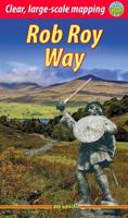
Wandelgids The Rob Roy Way | Rucksack Readers
Deze gids geeft een goede beschrijving van de lange afstands route. De kaarten zijn schetsmatig maar wel duidelijk. The Rob Roy Way is one of Scotland's Great Trails and is very popular with both walkers and cyclists. It runs through many places linked with Scotland's most famous outlaw, Rob Roy MacGregor (1671-1734). The route starts at Drymen (near Glasgow) and ends at Pitlochry in the eastern Highlands, so it takes you away from the crowds following the West Highland Way to some of Scotland's finest lochs and glens.   Its main spine runs for 79 miles (127 km) and is waymarked. There is an optional extra 17 miles if you take the wilderness extension through Glen Almond and Glen Quaich. Most walkers complete it in 6-8 days and most cyclists in 3-4 days.   The main route goes through Loch Ard forest to Aberfoyle, goes beside Lochs Venachar, Lubnaig and Tay and passes through superb scenery, with interesting aqueducts, viaducts and a 3600 year-old stone circle. The terrain is a mi…
22,50
Nieuw
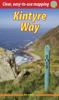
Wandelgids The Kintyre Way | Rucksack Readers
Deze gids geeft een goede beschrijving van de lange afstands route. De kaarten zijn schetsmatig maar wel duidelijk. This fully waymarked trail runs for 101 miles/162 km southward from the beautiful natural harbour of Tarbert to Macrihanish, near the Mull of Kintyre. Criss-crossing the entire peninsula, you pass castles, abbeys and prehistoric remains, sometimes walking along rugged coastline, sometimes high on forestry tracks with glorious views over Arran, the Firth of Clyde and towards Ireland. You will enjoy many wildlife sightings in this peaceful area, famous as Scotland only "mainland island".   Since it opened (2006) the route has changed in places. The 2023 edition of this essential guidebook contains all you need to plan and enjoy your holiday: 11 pages with mapping showing the whole route (1:70,000); the Way step-by-step, with summaries of distance, terrain and refreshment stops; habitats and wildlife; whisky-making in Kintyre; side-trip to the island of Gigha; and planni…
23,95
Wandelkaart - Topografische kaart 39 OS Explorer Map | Active Loch Lomond North / Tyndrum | Ordnance Survey
Met zijn 4cm voor 1 km (2 ½ cm voor 1 mijl) schaal, is de OS Explorer kaartenserie de ideale en meest gedetailleerde kaartenreeks voor mensen die graag outdoor-activiteiten zoals fietsen, wandelen, paardrijden, klimmen en watersporten.   Deze kaart is nog gedetailleerder dan de 'gewone' Landranger maps. Voor- en achterzijde bedrukt! Zeker op de moors en andere natuurgebieden van onschatbare waarden met echt alle aspecten van het landschap op de kaart ingetekend. Zeer goede detailkaart met topografische ondergrond. Hierop zijn toeristische symbolen van bezienswaardigheden ingetekend, daarnaast staan bijvoorbeeld campings en jeugdherbergen vermeld en - voor wandelaars het belangrijkst - alle right of way paden en Lange afstands Wandelpaden zijn er op te vinden. De ideale kaart voor het wandelen in Engeland, Wales of Schotland.   Map sheet number OL 39 in the OS Explorer series covers the northern area of Loch Lomond, the towns of Tyndrum, Ardlui, Crianlarich and Arrochar. Highlights of …
25,95
Wandelgids The Great Glen Way | Rucksack Readers
Uitgevoerd in de vorm van een klapper, met ringband geeft deze gids een goede beschrijving van de lange afstands route. De kaarten zijn schetsmatig maar wel duidelijk. The Great Glen Way is one of Scotland’s Great Trails and offers a superb experience for both walkers and cyclists. The Way runs for 77 miles (124 km) along Scotland’s Great Glen between Fort William and Inverness. It follows the scenic Caledonian Canal and runs beside four of the Highlands’ loveliest lochs – including Loch Ness, famous for its monster legend and for Urquhart Castle.   This new edition of our popular guidebook has been fully revised in 2019-20 after extensive fieldwork. It includes new large-scale mapping (1:38,000) with mileage markers and a kilometre grid, many updates and fresh photos, and is in our slim pocket-friendly format, still on rainproof paper.   This guidebook contains all you need to plan and enjoy the Great Glen Way – on foot or on a bike:   detailed mapping on 13 pages at 1:38,000 hi…
24,95
Wandelkaart - Topografische kaart OL38 OS Explorer Map Loch Lomond South | Ordnance Survey
Met zijn 4cm voor 1 km (2 ½ cm voor 1 mijl) schaal, is de OS Explorer kaartenserie de ideale en meest gedetailleerde kaartenreeks voor mensen die graag outdoor-activiteiten zoals fietsen, wandelen, paardrijden, klimmen en watersporten. Deze kaart is nog gedetailleerder dan de 'gewone' Landranger maps. Voor- en achterzijde bedrukt! Zeker op de moors en andere natuurgebieden van onschatbare waarden met echt alle aspecten van het landschap op de kaart ingetekend. Zeer goede detailkaart met topografische ondergrond. Hierop zijn toeristische symbolen van bezienswaardigheden ingetekend, daarnaast staan bijvoorbeeld campings en jeugdherbergen vermeld en - voor wandelaars het belangrijkst - alle right of way paden en Lange afstands Wandelpaden zijn er op te vinden. De ideale kaart voor het wandelen in Engeland, Wales of Schotland.   Map sheet number OL 38 covers Loch Lomond South, Helensburgh and Dumbarton. Highlights include the Loch Lomond and The Trossarchs National Park and the Argyll For…
19,50

Klanten-reviews van Wandelgids Loch Lomond & Cowal Way | Rucksack Readers

Er zijn nog geen beoordelingen voor dit productBen jij de eerste die een review plaatst?

Meer over Wandelgids Loch Lomond & Cowal Way | Rucksack Readers

Productomschrijving

"Lavishly illustrated guidebook with route map plus practical information" - Scots Magazine The Loch Lomond & Cowal Way is one of Scotland's Great Trails. It runs for 57 miles (91 km) across the Cowal peninsula, which lies west of Glasgow and is easily reached by public transport, road and ferry. The route starts at Portavadie on Loch Fyne and ends at Inveruglas on Loch Lomond. The trail is waymarked and undulating, with rugged terrain and glorious views over the Isle of Bute and the Firth of Clyde. The area is rich in history and heritage, with wildlife sightings including red squirrel, red deer and golden eagle. Cowal has ferries to Bute, to Kintyre and (in season) across Loch Lomond to join the West Highland Way. It’s the missing link that enables Scotland’s ultimate long-distance walk, from Kintyre all the way to Inverness. In 2018 the route’s name was extended to "Loch Lomond & Cowal Way" to reflect the fact that over 50% of it runs within the Loch Lomond & Trossachs National Park. This new edition updates the guidebook of that name and contains many new photographs.

Verken gerelateerde categorieën

Webshop.nl maakt gebruik van cookies. Ga je verder op onze website, ga dan akkoord met het plaatsen van cookies en de verwerking van deze data door ons en vermelde partners.