webshop.nl
Categorieën
  Sluiten

Meer Pocket Mountains
Meer Pocket Mountains in Thrillers & fantasy boeken

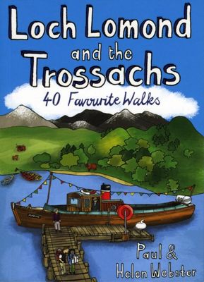
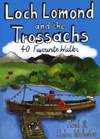
Wandelgids Loch Lomond and the Trossachs | Pocket Mountains

0
Handige compacte wandelgids met 40 dagwandelingen. Deze gids bevat kleine kaartjes en leuke uitgebreide informatie over wat er langs de route te zien is. Goede wandelkaarten zijn echter we noodzakelijk voor deze tochten: de Ordnance Survey explorer maps of Landanger maps zijn zeer geschikt.     The new Loch Lomond National Park has ensured protect...

Webshops met dit product

Webshop
Bezorging
Prijs

Anderen bekeken ook

Wandelgids Loch Lomond and the Trossachs | Pocket Mountains
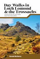
Handige compacte wandelgids met 40 dagwandelingen. Deze gids bevat kleine kaartjes en leuke uitgebreide informatie over wat er langs de route te zien is. Goede wandelkaarten zijn echter we noodzakelijk voor deze tochten: de Ordnance Survey explorer maps of Landanger maps zijn zeer geschikt.     The new Loch Lomond National Park has ensured protection for what is not only Britain's largest freshwater lake, but one of its most beautiful, celebrated in ballad and song. West of Loch Lomond are the steep Arrochar Alps towering above Loch Long together with scores of much less visited lower hills stretching down to the seaboard. To the east is the Trossachs - a delightful landscape of forests, lochs and hills that has long been known as Scotland in miniature.   This latest pocket guide features 40 of the best walks in this popular area in an attractive and accessible format.
10,95
Wandelgids Walking Loch Lomond and The Trossachs | Cicerone
Uitstekende wandelgids, sommige meerdaags, voor dit uitdagende wandelgebied in Schotland. Guidebook to over 70 walking routes in the hills of Loch Lomond and the Trossachs National Park in Scotland's Southern Highlands. Including 21 Munros on less-popular routes, as well as plenty of Corbetts and Grahams. Hill summits of Ben Lomond, the Cobbler, Ben Lui and the Arrochar Alps have plenty of routes to explore. The routes in this guide range from 1 to 17 miles, and are clearly graded for distance and difficulty, as well as dividing between low-level, mid-level and mountain walks. From short, loch-side strolls suitable for all walkers, to long, challenging mountain routes with rocky scrambling, the Loch Lomond and Trossachs hills have plenty to offer.    The glens and mountains walks in this guide are divided into area: the Trossachs, Callander and Loch Lubnaig, Balquhidder and Lochearnhead, Crianlarich to Inveraran, Tyndrum, Ben Lomond, Loch Lomond West, Arrochar Alps and Glen Croe to Loc…
20,95
Wandelkaart - Topografische kaart OL39 OS Explorer Map Loch Lomond Nor
Met zijn 4cm voor 1 km (2 ½ cm voor 1 mijl) schaal, is de OS Explorer kaartenserie de ideale en meest gedetailleerde kaartenreeks voor mensen die graag outdoor-activiteiten zoals fietsen, wandelen, paardrijden, klimmen en watersporten. Deze kaart is nog gedetailleerder dan de 'gewone' Landranger maps. Voor- en achterzijde bedrukt! Zeker op de moors en andere natuurgebieden van onschatbare waarden met echt alle aspecten van het landschap op de kaart ingetekend. Zeer goede detailkaart met topografische ondergrond. Hierop zijn toeristische symbolen van bezienswaardigheden ingetekend, daarnaast staan bijvoorbeeld campings en jeugdherbergen vermeld en - voor wandelaars het belangrijkst - alle right of way paden en Lange afstands Wandelpaden zijn er op te vinden. De ideale kaart voor het wandelen in Engeland, Wales of Schotland.   Map sheet number OL 39 in the OS Explorer series covers the northern area of Loch Lomond, the towns of Tyndrum, Ardlui, Crianlarich and Arrochar. Highlights of the…
19,50
Wandelgids Walks Loch Lomond & The Trossachs | Hallewell Publications
The area covered by this guide (much of it now a National Park) is one of the most popular walking districts in Scotland, and its hills, lochs, glens and woodlands provide an enormous range of routes within a small area.  Walks range from 0.5 miles to 15 miles (1-24km).  Routes include hill climbs such as Ben More & Stob Binnein, Ben Ledi, Ben A’an, The Cobbler and Ben Lomond, plus a number of shorter walks around the towns of Killin, Callander and Aberfoyle, routes by Lochs Katrine and Lomond and sections of the West Highland Way.  Previously published as Walks The Trossachs, the guide has been rewalked and the area covered expanded to inlcude west Loch Lomond.
5,95
Wandelgids Mountain Walks in Loch Lomond and the Trossachs | Northern
One of four books in the popular Loch Lomond and The Trossachs: Top 10 Walks series. Handy, pocket-sized, full colour walking guides written by experts. The perfect impulse buy. The other titles in the series are: Lochside Walks, Hill Walks and Easy Summits and Pub Walks. This attractive and cleverly structured guide gives walkers ten of the finest short circular mountain walks in the Loch Lomond and The Trossachs National Park in a popular pocketable format. With clear information, an overview and introduction for each walk, expertly written numbered directions, large scale Ordnance Survey maps, superb eye-grabbing panoramic photographs, and interpretation of points of interest along the way, these guides set a new standard in clarity and ease-of-use. Featured walks include: Ben Lomond & Ptarmigan Ridge, Ben Donich, The Cobbler, Beinn Ime and Beinn Narnain, Ben Vorlich, An Caisteal & Beinn a¿ Chroin, Cruach Ardrain and Beinn Tulaichean, Beinn Odhar and Meall Buidhe, Stob Binnein, Ben …
10,95
Wandelgids 23 Pathfinder Guides Loch Lomond , The Trossachs and Stirli
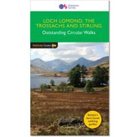
Wandelgids van een deel van Engeland, Schotland of Wales. Deze gids bevat 28 dagwandelingen, variërend van korte tochten tot pittige dagtochten. De bijbehorende kaarten zijn uitstekend: men heeft de topografische kaarten van Ordnance Survey gebruikt waarop de route is ingetekend. Daarnaast praktische informatie over de wandeling en wat beschrijvingen van het gebied. Access 160 miles of breath-taking walking amid the stunning scenery of Loch Lomond National Park and Stirlingshire. This Pathfinder guide book offers 28 great walks varying from 2 to 16 miles complete wit Ordnance Survey mapping and GPS references. Walking in Scotland is quite different from walking south of the border. In England there are only eight summits that top 3000 ft, while in Scotland there are 277, with 45 of them situated in the Southern Highlands. The Trossachs are particularly spectacular when clothed in autumn colours and provided the setting for The Lady of the Lake and Rob Roy, by Sir Walter Scott.   The Oc…
18,50
Wandelgids Mountain Walks in Loch Lomond and the Trossachs | Northern
One of four books in the popular Loch Lomond and The Trossachs: Top 10 Walks series. Handy, pocket-sized, full colour walking guides written by experts. The perfect impulse buy. The other titles in the series are: Lochside Walks, Hill Walks and Easy Summits and Pub Walks. This attractive and cleverly structured guide gives walkers ten of the finest short circular mountain walks in the Loch Lomond and The Trossachs National Park in a popular pocketable format. With clear information, an overview and introduction for each walk, expertly written numbered directions, large scale Ordnance Survey maps, superb eye-grabbing panoramic photographs, and interpretation of points of interest along the way, these guides set a new standard in clarity and ease-of-use. Featured walks include: Ben Lomond & Ptarmigan Ridge, Ben Donich, The Cobbler, Beinn Ime and Beinn Narnain, Ben Vorlich, An Caisteal & Beinn a¿ Chroin, Cruach Ardrain and Beinn Tulaichean, Beinn Odhar and Meall Buidhe, Stob Binnein, Ben …
10,95

Klanten-reviews van Wandelgids Loch Lomond and the Trossachs | Pocket Mountains

Er zijn nog geen beoordelingen voor dit productBen jij de eerste die een review plaatst?

Meer over Wandelgids Loch Lomond and the Trossachs | Pocket Mountains

Productomschrijving

Handige compacte wandelgids met 40 dagwandelingen. Deze gids bevat kleine kaartjes en leuke uitgebreide informatie over wat er langs de route te zien is. Goede wandelkaarten zijn echter we noodzakelijk voor deze tochten: de Ordnance Survey explorer maps of Landanger maps zijn zeer geschikt.     The new Loch Lomond National Park has ensured protection for what is not only Britain's largest freshwater lake, but one of its most beautiful, celebrated in ballad and song. West of Loch Lomond are the steep Arrochar Alps towering above Loch Long together with scores of much less visited lower hills stretching down to the seaboard. To the east is the Trossachs - a delightful landscape of forests, lochs and hills that has long been known as Scotland in miniature.   This latest pocket guide features 40 of the best walks in this popular area in an attractive and accessible format.

Productspecificaties

Artikelnummer(s)
Brand
Pocket Mountains

Verken gerelateerde categorieën

Webshop.nl maakt gebruik van cookies. Ga je verder op onze website, ga dan akkoord met het plaatsen van cookies en de verwerking van deze data door ons en vermelde partners.