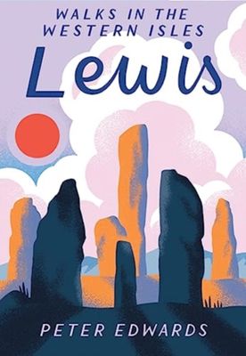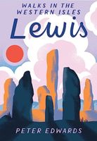
Wandelgids Lewis | Pocket Mountains

0
The Isle of Lewis is a magnificent domain of rugged hillcountry and lochan-scattered moorland, fringed by tenacious crofting townships. The coastline is a realm of rocky cliffs, sea lochs, islands and skerries while the west coast is garlanded with dazzling dune-backed beaches. History is everywhere in Lewis, with remarkable monuments to human end...

Verkopers met dit product

Webshop
Bezorging
Prijs
DeZwerver.nl logo
DeZwerver.nl
niet bekend
12,50

Anderen bekeken ook

Wandelgids Uist, Barra & Vatersay | Pocket Mountains
The elemental landscapes of Uist and Barra include some superb walking country. The dune-backed beaches, machair and croftland of the Atlantic shores contrast with the lochan-scattered moorland and rugged hillcountry of the islands' interiors, while the frayed edges of the eastern coastline, with numerous islands, skerries and sea lochs, is a place apart. Each of the islands has its own distinctive character, geography and history.   These 25 walks reflect the range of terrain in the islands and provide opportunities to experience the spectacular wildlife and the physical traces of island history.
12,50
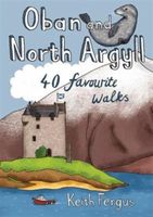
Wandelgids Oban and North Argyll | Pocket Mountains
This guidebook covers a large swathe of Mid and North Argyll, sweeping inland from the fractured western seaboard between Crinan and Appin to Arrochar and Bridge of Orchy on the region’s eastern periphery. Between these four points lies a landscape awash with sea lochs, with Inveraray roughly at the geographical centre. There are no large urban areas here and Oban is the largest settlement. Although the road network and public transport infrastructure are good, many routes feel off the beaten track. This is not only down to the low scattered population but also to the indented coast and its many islands, the sea lochs encroaching deep inland, the elongated freshwater lochs and the mountainous interior – making road travel much more convoluted than direct ‘as-the-crow-flies’ distances would suggest. As well as many great sea lochs, tumbling rivers and iconic mountains, Oban and North Argyll also boasts ancient, wildlife-rich woodlands and several fine gardens. Add to this the Crinan Ca…
10,95
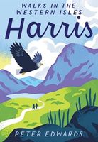
Wandelgids Harris | Pocket Mountains
The Isle of Harris is home to some wonderful walking country, from the rugged ridges and glens of the Harris Hills to the astonishingly beautiful white sand beaches of the island's west coast, while the remarkably complex eastern coastline is punctuated with sea lochs, headlands, coves and bays. These environments are also full of historical interest and spectacular wildlife. These 25 walking routes explore the island's range of landscapes, including strolls along the west coast beaches, half-day walks on rocky coastal paths, day-long mountain ridge traverses and wild country backpacking routes.  
10,95
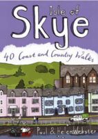
Wandelgids Isle of Skye | Pocket Mountains
The Isle of Skye (or Ant-Eilean Sgitheanach in its native Gaelic tongue) occupies an almost mythical place in the minds of many Scots. Romantic castles, magnificent sea-scapes, the alpine peaks of the Cuillin Ridge, marching pipe bands, scattered white crofters' cottages and a bloody history; the island has all these and more. This book features 40 moderate walks that take in much of this celebrated landscape, but reveal hidden gems too.   In spite of its popularity Skye is still rich in undiscovered treasures, from coastal caves and arches, ruined villages cruelly cleared of their inhabitants, to fossilised dinosaur footprints and a rich array of wildlife. Written by Skye residents Paul and Helen Webster, these walks will reveal both the wild and gentler sides of this dramatic landscape.   Plaatsen in het boekje An Aird, An Corran, Ardnish, Armadale, Arnish, Bearreraig Bay, Bioda Buidhe, Boreraig, The Braes, Broadford, Brochel Castle, Brothers' Point, Burma Road, Caisteal Maol, Calum…
10,95
Wandelgids Stirling & Falkirk : Weekend Walks | Pocket Mountains
Handige compacte wandelgids met 40 dagwandelingen. Deze gids bevat kleine kaartjes en leuke uitgebreide informatie over wat er langs de route te zien is. Goede wandelkaarten zijn echter we noodzakelijk voor deze tochten: de Ordnance Survey explorer maps of Landanger maps zijn zeer geschikt.     Between Edinurgh and Glasgow is an area resonant in romance, history and invention. The moors above Stirling and the carseland surrounding its magnificent castle set the scene for a number of landmark battles, while Falkirk played a leading role in Scotland's Industrial Revolution and is today the home of some of the country's most innovative and popular attractions. These 25 walks explore the picturesque places round Stirling and Falkirk, from the windswept drama of bare hills to the tranquill setting of canals, lochs, reservoirs and riversides.  
10,95
Wandelgids Shetland | Pocket Mountains
Handige compacte wandelgids met 40 dagwandelingen. Deze gids bevat kleine kaartjes en leuke uitgebreide informatie over wat er langs de route te zien is. Goede wandelkaarten zijn echter we noodzakelijk voor deze tochten: de Ordnance Survey explorer maps of Landanger maps zijn zeer geschikt. The most northerly of Britain's island groups, Shetland is so far removed from the rest of the UK that it usually appears as an inset on maps. Although relatively little known to those from outside the islands, Shetland is a magnificent terrain for walkers, especially those who love to really explore and get away from the beaten track. The coastal walking here includes some of the finest in the country, with superb cliffs, towering sea stacks, caves and natural arches seemingly around every corner. Added to this is Shetland's better known claim to fame for its spectacular seabird colonies, huge gannetries, moorland packed with arctic and great skuas, arctic terns in the more sheltered spots, and ev…
10,95
Wandelgids The Tay | Pocket Mountains
Handige compacte wandelgids met 40 dagwandelingen. Deze gids bevat kleine kaartjes en leuke uitgebreide informatie over wat er langs de route te zien is. Goede wandelkaarten zijn echter we noodzakelijk voor deze tochten: de Ordnance Survey explorer maps of Landanger maps zijn zeer geschikt.     As well as being Scotland's longest river, the Tay also carries the largest volume of water of any river in the UK more than the Thames and Severn combined when it reaches the Firth of Tay. From its source high up the slopes of Ben Lui near Tyndrum, the Tay makes its way through Stirlingshire and Perthshire to meet the North Sea near Dundee. As one of the best salmon rivers in Europe, every year it lures anglers from around the world and countless more come to explore the glorious hills and glens it passes.   There is no better way to discover the wildlife, architecture and history of this area of Scotland than to walk. Whatever your ability walking at high or low level, following tough terra…
10,95
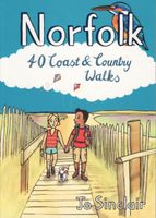
Wandelgids Norfolk | Pocket Mountains
Handige compacte wandelgids met 40 dagwandelingen. Deze gids bevat kleine kaartjes en leuke uitgebreide informatie over wat er langs de route te zien is. Goede wandelkaarten zijn echter we noodzakelijk voor deze tochten: de Ordnance Survey explorer maps of Landanger maps zijn zeer geschikt.   Pinpointing favourite treks, rambles and family trips, these 40 walks visit Norfolk in all its variety. From wild and windswept coast, Fens and Breckland to sheltered inland woods, broads and valleys, they offer geographical impact and a strong sense of history. Treading in the footsteps of warriors, drovers, pilgrims, weavers and reedcutters, this selection links to the county's extensive network of long-distance routes.   You'll find Norfolk at its most photogenic, with swallowtail butterflies and wherry boats, windpumps, seals and sailing boats, round tower churches and medieval architecture. From coast road to historic villages, towns and cities, many of the walks start near public transport.
10,95
Wandelgids Kintyre and South Argyll | Pocket Mountains
Rugged, wild, sparsely-populated and gouged by misty sea-lochs, South Argyll was once known in Old Gaelic as Airer Goidel, the 'Coast of the Gaels' and remains a place apart. The hills and glens here are steeped in history and littered with standing stones, hillforts and castles, as well as unique wildlife-rich habitats created by the warming Gulf Stream. This book explores the very best of Knapdale, Kintyre and the Cowal coast as well as the Isles of Gigha and Bute with walks to suit all abilities, many of which utilise the long-distance walking trails which criss-cross the area.  
10,95
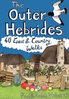
Wandelgids Outer Hebrides | Pocket Mountains
Handige compacte wandelgids met 40 dagwandelingen. Deze gids bevat kleine kaartjes en leuke uitgebreide informatie over wat er langs de route te zien is. Goede wandelkaarten zijn echter we noodzakelijk voor deze tochten: de Ordnance Survey explorer maps of Landanger maps zijn zeer geschikt. The Outer Hebrides are a place apart, an island chain stretching almost 200km from the Butt of Lewis to Barra Head with some of Britain's most mesmerising beaches, dramatic mountain ranges, wonderful wildlife, a long and fascinating history and a rich and vibrant Gaelic culture. This book features 40 mostly moderate walks, with many ideal for families, which take in magnificent sweeps of sand, soaring sea cliffs and memorable hill ascents, as well as celebrated cultural sights such as the haunting Standing Stones at Callanish and the blackhouse village of Na Gearrannan.
10,95

Klanten-reviews van Wandelgids Lewis | Pocket Mountains

Er zijn nog geen beoordelingen voor dit productBen jij de eerste die een review plaatst?

Meer over Wandelgids Lewis | Pocket Mountains

Productomschrijving

The Isle of Lewis is a magnificent domain of rugged hillcountry and lochan-scattered moorland, fringed by tenacious crofting townships. The coastline is a realm of rocky cliffs, sea lochs, islands and skerries while the west coast is garlanded with dazzling dune-backed beaches. History is everywhere in Lewis, with remarkable monuments to human endeavour - ancient and more recent - punctuating the landscape.   These 25 walks explore the island's range of environments, providing opportunities to experience its spectacular wildlife and encounter the physical traces of its history.

Verken gerelateerde categorieën

Webshop.nl maakt gebruik van cookies. Ga je verder op onze website, ga dan akkoord met het plaatsen van cookies en de verwerking van deze data door ons en vermelde partners.