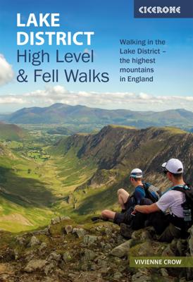
Wandelgids Lake District High Level and Fell Walks | Cicerone

0
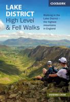
A guidebook to 30 high level day walks in the Lake District, exploring some of the best mountains, ridgewalks, fells and summits within the national park. Mostly circular except for a few linear routes that make use of public transport links, the walks are graded according to difficulty, ensuring there is something for all levels of fitness and ex...

Verkopers met dit product

Verkoper
Bezorging
Prijs
DeZwerver.nl logo
DeZwerver.nl
2,95
18,50

Anderen bekeken ook

Nieuw
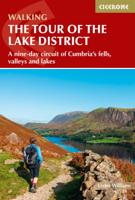
Wandelgids Tour of the Lake District | Cicerone
Engelstalige beschrijving van de mooiste wandeltocht in het Lake district. De gids voldoet aan alle verwachtingen die je kunt hebben, het enige dat je mist is een overzichtskaart. Inclusief gidsje met routekaarten van 1:25000 The Lake District National Park is England's most popular mountain region and is designated as a UNESCO World Heritage site. Suitable for most reasonably fit hillwalkers, the 145km (90 mile) Tour of the Lake District takes in the best of this beautiful region in a circular tour. The route is presented in nine stages, plus an optional 'prologue' stage from Windermere station to the start-point in Ambleside, and can be compressed into one week or extended over two weeks, giving time to visit many attractions on the way.   In addition to the main (non-waymarked) route, which links the main towns and valleys of the national park, five interchangeable high-level stages are also offered, enabling you to visit some of the region's most celebrated high peaks - including …
20,95
Wandelgids Lake District - 40 favourite walks | Pocket Mountains
These forty walks in England's glorious Lake District will take you to a range of lakes, peaks, rivers, tarns and waterfalls and introduce you to the haunts of many of the writers and poets who have loved and celebrated the area and made it such a strong cultural as well as natural attraction. Each walk has its own distinctive mood and character and is easily accomplished in an afternoon or in a long summer evening. None of them scale the highest mountains but they will take you to many lakeshores and several of the lower peaks, which regardless of their height, provide immense views and the satisfaction of reaching a summit. Plaatsen in het boekje Aira Force, Alcock Tarn, Ambleside, Bassenthwaite, Beacon Fell, Black Crag Blea Tarn, Boot, Borrowdale, Bowder Stone, Bowness, Brandelhow, Brant Fell, Buttermere, Castle Crag, Castlehead, Cinderdale Common, Colwith Force, Coniston Water, Crummock Water, Dacre, Derwent, Derwentwater, Dock Tarn, Dodd, Dove Cottage, Easedale Tarn, Elterwater, …
10,95
Nieuw
Wandelgids The Lake District Fells Langdale | Cicerone
Uitstekende wandelgids voor dit uitdagende wandelgebied. This guide describes ascents of 25 Lake District fells that can be climbed from Langdale and the Vale of Grasmere. Easily accessible from the popular bases of Grasmere and Ambleside, this area offers stunning scenery and fantastic walking, from the 'small but perfectly made' Loughrigg - ideal for a Sunday afternoon hike - to eye-catching Helm Crag ('the Lion and the Lamb'), from the lofty heights of Bowfell to the iconic Langdale Pikes. England's highest mountain, Scafell Pike, is also included in this volume.   Unlike other guidebooks which describe a single or limited number of routes to a particular destination, the aim of the Walking the Lake District Fells series is to offer all the options. These are presented as numbered sections which can be combined to create infinite possibilities - from simple ascents to longer ridge routes. You'll find the classics and popular routes alongside less traditional alternatives perfect fo…
20,95
Wandelgids Central Fells | Lake District | Frances Lincoln
One name above all others has become associated with walking in the Lake District: Alfred Wainwright, whose seven-volume Pictorial Guide to the Lakeland Fells, first published in 1955-66, has become the definitive guidebook. Wainwright's meticulously hand-drawn maps, diagrams and drawings take walkers up the 214 principal hills and mountains of the Lake District, describing the main routes of ascent from different starting points, as well as lesser-known variants, showing the summit viewpoint panoramas and the ridge routes that can be made to create longer walks. Every page combines words and illustrations to present the routes in a way that is original, visually appealing and easy to follow. This new edition of Wainwright's Walking Guide to the Lake District Fells has been comprehensively revised. Paths, maps, diagrams and route descriptions have been checked and corrected throughout. These revisions have been undertaken by writer and designer Clive Hutchby, author of The Wainwright …
23,50
Nieuw
Wandelgids The Lake District Fells Borrowdale walking guide | Cicerone
Uitstekende uitgebreide wandelgids van een bepaald deel vsn het Lake District, één van de mooiste wandelgebieden van Engeland. De routes zijn goed beschreven, met prima kaartmateriaal. Zolang je niet van de route afwijkt is deze gids voldoende om de wandelroute te lopen.  Part of the Walking the Lake District Fells series, this guidebook covers a wide range of routes to 28 Lakeland summits that can be climbed from the Borrowdale and Thirlmere valleys - both easily accessed from Keswick - with highlights including Catbells, Great Gable and Scafell Pike. Suggestions for longer ridge routes are also included. This guide describes ascents of 28 Lake District fells that can be climbed from Borrowdale and the Newlands and Thirlmere valleys, including Catbells, a perennial favourite, and the mighty Scafell Pike, Great End and Great Gable. Easily accessed from Keswick, Borrowdale is a valley of exquisite natural beauty, with the lower wooded and heather-clad slopes giving way to sweeping moor…
20,95
Wandelgids The Eastern Fells | Lake District | Frances Lincoln
One name above all others has become associated with walking in the Lake District: Alfred Wainwright, whose seven-volume Pictorial Guide to the Lakeland Fells, first published in 1955–66, has become the definitive guidebook.    Wainwright’s meticulously hand-drawn maps, diagrams and drawings take walkers up the 214 principal hills and mountains of the Lake District, describing the main routes of ascent from different starting points, as well as lesser-known variants, showing the summit viewpoint panoramas and the ridge routes that can be made to create longer walks. Every page combines words and illustrations to present the routes in a way that is original, visually appealing and easy to follow.   This new edition of Wainwright’s Walking Guide to the Lake District Fells has been comprehensively revised. Paths, maps, diagrams and route descriptions have been checked and corrected throughout. These revisions have been undertaken by writer and designer Clive Hutchby, author of The Wainwr…
23,50
Wandelgids The Far Eastern Fells | Lake District | Frances Lincoln
One name above all others has become associated with walking in the Lake District: Alfred Wainwright, whose seven-volume Pictorial Guide to the Lakeland Fells, first published in 1955–66, has become the definitive guidebook.    Wainwright’s meticulously hand-drawn maps, diagrams and drawings take walkers up the 214 principal hills and mountains of the Lake District, describing the main routes of ascent from different starting points, as well as lesser-known variants, showing the summit viewpoint panoramas and the ridge routes that can be made to create longer walks. Every page combines words and illustrations to present the routes in a way that is original, visually appealing and easy to follow.   This new edition of Wainwright’s Walking Guide to the Lake District Fells has been comprehensively revised. Paths, maps, diagrams and route descriptions have been checked and corrected throughout. These revisions have been undertaken by writer and designer Clive Hutchby, author of The Wainwr…
23,50
Wandelgids Day Walks in the Lake District | Vertebrate Publishing
Day Walks in the Lake District features 20 circular routes between 5 and 13 miles (8 and 21 kilometres) in length, suitable for hillwalkers of all abilities. The routes are split into four geographical areas - north, east, south and west - and include walks from the main tourist bases, such as Keswick and Ambleside, as well as sought after peaks, such as Scafell Pike, Great Gable, Blencathra and Helvellyn. Also included for the adventurous are the Lake District's best known scrambles - Striding Edge on Helvellyn and Sharp Edge on Blencathra - together with more accessible alternatives.   The author of this guidebook, Stephen Goodwin, is a former freelance journalist (former staff writer for The Independent), and a Lake District local. In his introductions to each route he recalls the tales of Wordsworth, Walpole and the fascinating history of Lakeland and its peaks and fells. Each route in this guide is described with easy-to-follow directions and details of distance, navigation infor…
20,95
Nieuw
Mountainbikegids Mountain Biking in the Lake District | Cicerone
Mountain biking in the Lake District describes 24 routes in the Lakes, offering some of the best MTB riding in the UK. The routes are suitable for all abilities of riders, arranged by difficulty, from Kendal to Cleator Moor in the far north-west and Keswick to Winster in the Lyth Valley.SeasonsAlthough it is recommended that a few of the routes should only be done during periods of good weather, most can be ridden all year round.CentresThrelkeld, Pooley Bridge, Cleator Moor, Muncaster, Torver, Grizedale, Hawkshead, Ambleside, Elterwater, Kendal, Staveley, High Newton, Spark Bridge, WinsterDifficultyRoutes are graded blue (medium), red (hard) and black (very hard). Novice MTBers with reasonable bike-handling skills should be able to complete the blue routes, while experts should be challenged by the red and, more so, the black routes.Must SeeThe dramatic Garburn and Gatesgarth passes; views of Coniston Water, Esthwaite Water, Grasmere, Rydal Water, Elterwater, Ulswater, Derwent Water an…
19,95
Nieuw
Wandelgids 071 Pathfinder Guides The High Fells of Lakeland | Ordnance Survey
Are you planning a holiday to the Lake District? Do you enjoy a hill-walking challenge with impressive mountain-top views? Inside Pathfinder (R) Guide to the High Fells of Lakeland are 20 majestic and challenging fell walks amid the glorious scenery of the Lake District mountains with clear and easy-to-follow route directions compiled from the author's 40 years' experience of Lakeland walking. For adventurous ramblers and walkers wanting a hill-walking challenge, this brand new Pathfinder (R) walking guide features 20 demanding day-walks in the mountains of the Lake District, from Scafell Pike (highest mountain in the Lake District), to Helvellyn, Skiddaw, Great End and Bowfell - all over 900m (nearly 3000 feet) high. Giving a detailed guide to 20 inspiring expeditions on the high fells of Lakeland, Pathfinder (R) Guide to the High Fells of Lakeland explores some of the best fell walking country in the Lake District. With views over to Buttermere, Derwentwater and Grasmere, the Lakela…
18,50

Klanten-reviews van Wandelgids Lake District High Level and Fell Walks | Cicerone

Er zijn nog geen beoordelingen voor dit productBen jij de eerste die een review plaatst?

Meer over Wandelgids Lake District High Level and Fell Walks | Cicerone

Productomschrijving

A guidebook to 30 high level day walks in the Lake District, exploring some of the best mountains, ridgewalks, fells and summits within the national park. Mostly circular except for a few linear routes that make use of public transport links, the walks are graded according to difficulty, ensuring there is something for all levels of fitness and experience. The walks range from 7 to 24km (4–15 miles) in length and can be completed in between 3 and 9 hours.   They are arranged geographically into 6 areas: Keswick, Borrowdale and Buttermere, the Western Valleys, Coniston and Langdale, Ambleside and Windermere, and Ullswater. 1:50,000 OS maps for each walkGPX files available to downloadDetailed information on terrain, refreshments and public transport for each walkInformation given on local history and archaeologyHighlights include Scafell Pike, Scafell, Helvellyn, Skiddaw, Newlands Round and the Fairfield Horseshoe   Pocket-sized guide to 30 of the best walks on the higher Lake District fells, visiting both lesser-known summits and Lakeland’s favourite mountains, including Scafell Pike, Helvellyn, Skiddaw, Blencathra, Cat Bells, Haystacks and the Fairfield Horseshoe.   Mostly circular routes, ranging from 7 to 24km (4–15 miles) and graded by difficulty Illustrated with 1:50,000 OS mapping and beautiful colour photography Easy access from popular centres such as Keswick, Ambleside, Windermere, Coniston, Borrowdale, Langdale and Ullswater Notes on parking, public transport links and refreshment opportunities


Verken gerelateerde categorieën

Webshop.nl maakt gebruik van cookies. Ga je verder op onze website, ga dan akkoord met het plaatsen van cookies en de verwerking van deze data door ons en vermelde partners.