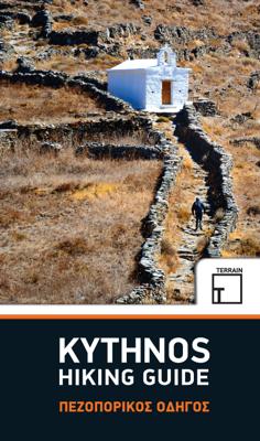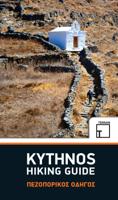
Wandelgids Kythnos hiking guide | Terrain maps

0
This guidebook for hiking trails on the Greek island of Kythnos in the Aegean, is a result of work undertaken by local Surveyor Eng. Katerina Filippa, and Nigel Tutt, an British journalist and businessman who spends a lot of his time on Kythnos, restoring two old mansion houses in the village of Dryopida and turning them into a 10-room luxury hote...

Verkopers met dit product

Verkoper
Bezorging
Prijs
DeZwerver.nl logo
DeZwerver.nl
2,95
14,50

Anderen bekeken ook

Wandelgids Kythnos hiking guide | Terrain maps
This guidebook for hiking trails on the Greek island of Kythnos in the Aegean, is a result of work undertaken by local Surveyor Eng. Katerina Filippa, and Nigel Tutt, an British journalist and businessman who spends a lot of his time on Kythnos, restoring two old mansion houses in the village of Dryopida and turning them into a 10-room luxury hotel, Hotel Galatas. The book describes 11 routes with detailed maps, trail guides and photos of the most interesting historical, cultural, industrial and scenic sites along the eleven routes.    The island offers stimulating walks through hilly land up to 300 metres high or more, nature, farming, history, archeological remains, and as a route to some of Kythnos’s numerous sandy beaches.    The individual routes offer a variety of terrain and difficulty: many follow old mule tracks across remote valleys to hidden beaches; some rise up to Byzantine castles and archeological sites on impressive headlands; and some are physically demanding and clim…
14,50
Wandelgids Samos Hiking Guide | Terrain maps
Engelstalige wandeligds voor het Griekse eiland Samos. Met 32 wandelingen voor zowel de beginnende als gevorderde wandelaars. Samos island is a hiker’s paradise! Hundreds of kilometres of forest trails and cobbled paths crossing through a beautiful countryside link many of the most interesting places of the island: traditional villages and monasteries, mountain tops and impressive ridges, remote beaches and ancient ruins. Lush landscapes and amazing ocean views alternate for a most rewarding experience. Through 32 well-designed hikes for both the casual stroller and the adventurous hiker, this hiking guidebook aims to help you discover the most authentic face of Samos island.    THIS GUIDEBOOK CONTAINS:  Detailed step-by- step descriptions of a total of 32 hikes and walks More than 150 color photos to inspire your trip An introduction to the Samian landscape, flora and fauna Maps based on the most up-to- date TERRAIN hiking map of Samos
20,95
Wandelkaart 346 Kythera - Kythira | Terrain maps
Gedetailleerde wegenkaart en wandelkaart met alle kleine wegen, wandelpaden, hoogtelijnen en toeristische informatie aangegeven. Alle tekst is tweetalig in Engels en Grieks en de waterproof kaart is geschikt voor gebruik met GPS. De uitgever: THIS IS THE BEST MAP OF KYTHERA BECAUSE: • It is the first GIS map of the island, meaning that this is the first time Kythera is mapped with a topographic precision in proportion to the map scale. • It is waterproof and rip-proof. You can fold and unfold it a thousand times, fold it in irregular ways, dunk it in the sea or leave it out in the rain. This map is indestructible! • It is remarkably detailed, at a scale twice as large as the competition’s, which makes everything crystal clear! • It is the first time the island’s entire coastline is mapped. Cartography was done with TERRAIN’s specially equipped and staffed cartographic vessel. This means that you can locate all beaches of the island, down to the tiniest cove! In fact, the special featu…
11,95
Wandelkaart 302 Kythnos | Terrain maps
Erg goede wandelkaart van Kythnos, weerbestendig en volledig. Bezienswaardigheden, campings en andere praktische zaken staan op de kaart aangegeven. GPS toepasbaar.   This is the best map of Kythnos because:   It is waterproof and rip-proof. You can fold and unfold it a thousand times, fold it in irregular ways, dunk it in the sea or leave it out in the rain. This map is indestructible!  It is the first GIS map of the island, meaning that this is the first time Kythnos is mapped with a topographic precision in proportion to the map scale.  It is remarkably detailed, at a scale twice as large as the competition’s, which makes everything crystal clear!  It is the first map depicting the island’s trails with total precision, their length measured in kilometers so you can estimate the duration of your hike, and detailed descriptions of Kythnos’ 13 best trails on the back.  It is the first time the island’s entire coastline is mapped. Cartography was done with TERRAIN’s specially equi…
11,95
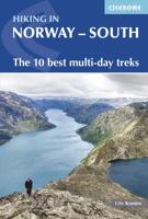
Wandelgids Hiking in Norway-South | Cicerone
This guide describes 10 shorter hut-to-hut treks showcasing southern Norway's wild natural beauty, with highlights including Galdhøpiggen - Norway's highest peak at 2469m - and the iconic Pulpit Rock and Kjeragbolten on the Lysefjord. The routes range from 3 to 8 days (although many can be adapted or combined to create longer or shorter routes) and cover Jotunheimen, Rondane, Dovrefjell, Trollheimen and Ryfylke. They are suitable for experienced hikers with a good level of fitness and can be walked from mid-July to the end of September.   Clear route description and mapping are provided for each hike. Stages are graded according to difficulty: although all of the routes follow waymarked trails, some cross remote and challenging terrain which may include exposed sections calling for a sure foot and a good head for heights. However, in many instances, alternatives are provided avoiding the most demanding sections. The guide also offers comprehensive advice on public transport access and…
23,95
Wandelgids Iceland Hiking with Reykjavik City Guide | Trailblazer Guides
Zeer goede wandelgids van IJsand met verrassend goede, schetmatige "spot-on" wandelkaartjes. Iceland offers a world of hiking opportunities like no other place on earth. The famous 55km Laugavegur Trek takes you past glaciers, volcanoes, steaming fumaroles and hot springs all set in a landscape of yellow rhyolite and black ash. This new guide gives you plenty of other options from hiking in the shadow of the largest ice-cap in Europe at Skaftafell to easier day hikes around the vibrant capital city of Reykjavik.41 detailed walking maps in the classic Trailblazer style - showing route times, gradients, where to stay Detailed Reykjavik city guide - and maps Itineraries for all walkers on 11 specially selected hikes - from day hikes around Reykjavik to more challenging 6-day treks including the 55km Laugavegur Trek Practical information for all budgets - where to stay (campsites, hostels and huts, B&Bs, lodges and hotels), where to eat, what to see Comprehensive background information - …
23,50
Wandelgids Peru - Hiking and Biking Peru's Inca Trails | Cicerone
The eastern slope of the Peruvian Andes is one of the most dramatic and diverse places on the planet, dropping from over 6000m (20,000ft) to just 200m above sea level. This dramatic drop in elevation produces a wide range of constantly changing climactic and vegetative zones – it is often possible to hike from the base of a glacier down to the jungle in just a day or two. Combined with the countless Inca sites and ubiquitous Inca roads, this makes the Sacred Valley one of the best trekking and mountain biking destinations in the world.    Machu Picchu is well known as one of the Seven Wonders of the World, and the Inca Trail trek that leads there is nearly as famous. What is less known, however, is the vast choice of other epic adventure trips that exist in the region – treks through soaring Andean glaciers and Incan ruins, bike rides through stunning alpine and jungle scenery. Nearly every route in this book uses an Inca road or visits an Inca ruin – and most do both. The majority of…
22,95
Wandelgids - Fietsgids Hiking and Cycling the California Missions Trail - Californie | Cicerone
Guidebook to hiking or cycling the 800 mile (1289km) California Missions Trail between San Francisco Bay and San Diego. The pilgrimage trail takes in 21 historic Spanish missions and can be completed in 50-60 walking days or 2-3 weeks cycling. With 1:100,000 mapping, route description, and details of accommodation and facilities for each stage. Ancient footpaths became connecting routes between the Spanish missions, pueblos, and presidios in the period 1769 to 1823. Over time these routes became automobile roadways and were marked with bells starting in 1906 to promote and preserve the El Camino Real. Today, the California Missions Trail follows a pedestrian route through urban cities and historic towns, through forest paths and country lanes, to each of the twenty-one historic Spanish missions. The 800-mile California Missions Trail leads walkers and cyclists through some of the most scenic and historic sites of one of America's most beautiful states. The 21 missions, founded 200-250…
26,50
Wandelkaart - Wegenkaart - landkaart 322 Skyros | Terrain maps
Gedetailleerde wegenkaart en wandelkaart met alle kleine wegen, wandelpaden, hoogtelijnen en toeristische informatie aangegeven. Alle tekst is tweetalig in Engels en Grieks en de waterproof kaart is geschikt voor gebruik met GPS. Skyros belongs to the island complex of the Northern Sporades, but in terms of natural environment it is divided into two: the northern part of the island is covered by a dense pine forest like all the other islands of the northern Sporades, while the southern part is characterized by the wild rocky landscapes of Mount Kochylas, more reminiscent of the Cyclades. Throughout the island there are many old walking trails, making Skyros a growing hiking destination, although - so far - the marking and maintenance of the paths remains problematic.   This fully updated hiking and touring map of Skyros by TERRAIN accurately shows all the paths and trails of the island with point-to-point distances, and of course the entire road network, beaches, archaeological sit…
12,50

Klanten-reviews van Wandelgids Kythnos hiking guide | Terrain maps

Er zijn nog geen beoordelingen voor dit productBen jij de eerste die een review plaatst?

Meer over Wandelgids Kythnos hiking guide | Terrain maps

Productomschrijving

This guidebook for hiking trails on the Greek island of Kythnos in the Aegean, is a result of work undertaken by local Surveyor Eng. Katerina Filippa, and Nigel Tutt, an British journalist and businessman who spends a lot of his time on Kythnos, restoring two old mansion houses in the village of Dryopida and turning them into a 10-room luxury hotel, Hotel Galatas. The book describes 11 routes with detailed maps, trail guides and photos of the most interesting historical, cultural, industrial and scenic sites along the eleven routes.    The island offers stimulating walks through hilly land up to 300 metres high or more, nature, farming, history, archeological remains, and as a route to some of Kythnos’s numerous sandy beaches.    The individual routes offer a variety of terrain and difficulty: many follow old mule tracks across remote valleys to hidden beaches; some rise up to Byzantine castles and archeological sites on impressive headlands; and some are physically demanding and climb steep, rough stone steps.

Productinformatie

    Verken gerelateerde categorieën

    Webshop.nl maakt gebruik van cookies. Ga je verder op onze website, ga dan akkoord met het plaatsen van cookies en de verwerking van deze data door ons en vermelde partners.