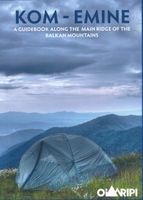
Wandelgids Kom-Emine Bulgarije E3 | Oilaripi

0
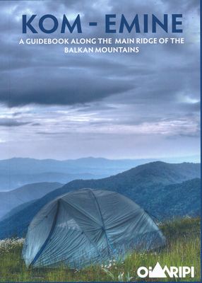
Een uitstekende wandelgids van een beroemd lange-afstands-wandelpad in Bulgarije, onderdeel van de E3 route. Goede beschrijving, mooie kaarten en praktische informatie. Onverwacht hoog nivo van de gids voor een land waar tot voor kort weinig beschikbaar was.  Kom-Emine is a long distance path in Bulgaria, part of the E3 European Long Distance Path...

Verkopers met dit product

Verkoper
Bezorging
Prijs
DeZwerver.nl logo
DeZwerver.nl
niet bekend
24,95

Anderen bekeken ook

Wandelgids Thames Path | Trailblazer Guides
This book follows the Thames Path National Trail from the river's source in Gloucestershire to the Thames Barrier in London. Officially 184 miles (294km) in length (although the actual distance you walk will depend on a number of decisions you make en route), the path meanders, accompanied by its watery muse, through pristine and tranquil countryside, past historic sites and buildings, via pub, lock, weir, and the occasional scattering of waterfowl, to a city, once the fulcrum of an empire, and now the heart of modern day England. The river, responsible for the metropolis' very being, tells tales, inspires artists, accommodates swans, geese, and water voles, reflects the silhouettes of red kites and kingfishers, provides employment, entices adventure, and allows time for carefree pilgrims to procrastinate and think. Following its banks is a grand way to go for a ramble. The path begins, as the river does, in a meadow in the Cotswolds; its upper reaches lonely and wild, the meadows and…
19,95
Wandelgids GR221 Mallorca's Long Distance Trail | Discovery Walking Guides
Gedetailleerde beschrijving van de GR 221 op Mallorca, met veel praktische informatie, hoogteprofielen, goed kaartmateriaal etc. Achterin ook nog eens veel GPS - waypoints. Bijna onmisbaar bij het lopen van de route! Walk! GR221 Mallorca's Long Distance Trail - The Dry Stone Way. If you want to get away from it all , there is no surer way than strapping on your boots, shouldering your backpack, and embarking on a long distance path; and there are few long distance paths more beguiling and more crammed with adventure than Mallorca s GR221, La Ruta de Pedra en Sec or The Dry Stone Way. Anybody who has visited Mallorca will appreciate the justice of the GR221's title. Following ancient bridleways along the length of the Tramuntana range, from Port d'Andratx in the southwest to Pollenca in the northeast, the GR221 touches on dry stone in its every manifestation, from the raw rock of the peaks and sweeping fields of karst to the tailored stones that have always been the island's building m…
18,50
Wandelgids Pembrokeshire | Northern Eye Books
OS Map Books: Wales Coast Path: Pembrokeshire Coast Path Map Atlas | Ordnance Survey ‘Explorer’ Large-scale 1:25,000 maps for the Pembrokeshire Coast in compact book format | Pocket Atlas | Walking Wales | UK Long-Distance Trails | Hiking | Adventure   One of seven handy Ordnance Survey Map Books covering the entire 870 mile/1400 kilometre-long, world-class Wales Coast Path — from Chester in the north to Chepstow in the south.   Enjoy enhanced, large scale (1:25,000) Ordnance Survey Explorer mapping in compact atlas format with all the detailed mapping you need to walk the Pembrokeshire Coast section of the Wales Coast Path.   Continuous, full colour OS mapping covering the Wales Coast Path between Cardigan and Amroth. Contains extracts from large scale Explorer maps OL 35 and OL 36. The enhanced OS 1:25,000 maps are accurate, up-to-date and reliable. Additional map symbols show tea shops, cafes, extra parking, and public toilets.   A brief introduction to Pembrokeshire Coast includes…
17,50
Wandelgids The South West Coast Path | Cicerone
Goede wandelgids van het langste gemarkeerde wandelpad van Groot Brittanië; 1015 km! Uit de bekende Cicerone serie, dus met mooie foto's en duidelijke routebeschrijvingen en kaartjes. The South West Coast Path is Britain's longest way-marked trail, measuring a staggering 1015km (630 miles). Written by the well-known outdoor writer, Paddy Dillon, the guide provides a wealth of detailed knowledge to help tackle this immense route with confidence. It describes the way-marked trail from Minehead to Poole along the north Devon, Cornish and south Devon coastline to finish at Poole Harbour. A full introduction provides the route's historical background, advice on accommodation along the route and details on travelling to and around the South West.There is detailed information on how to use this guide to make the most of your walk, whether you choose to walk the whole route in one go or decide to achieve sections at intervals.Day-by-day route summaries accompany the 45-day stages and the fina…
24,95
Wandelgids Wales Coast Path: Snowdonia and Ceredigion | Northern Eye Books
Official Guide: Wales Coast Path: Snowdonia & Ceredigion Coast One of seven Official Guides to the Wales Coast Path This Official Guide to the Snowdonia & Ceredigion Coast section of the Wales Coast Path contains everything local and long-distance walkers need to enjoy the path.   Cardigan Bay probably offers a more diverse walking experience than any other section of the Wales Coast Path. The stretch covered in this book – from Porthmadog in the north to Cardigan in the south – largely covers two contrasting Welsh counties.   The first 97 kilometres pass through Gwynedd, along the western edge of the Snowdonia National Park. Here, just before the rivers that rise in the highest of the Welsh mountains reach the sea, they fan out to form broad estuaries that provide rich pickings for waders and other birdlife. The estuaries of the Dwyryd, the Mawddach and the Dyfi are the largest of these. Between them are some very large dune systems, including Morfa Harlech and Morfa Dyffryn – home t…
23,95
Wandelgids Spain's Sendero Historico: the GR1 | Cicerone
A step by step guide to walking the 1250km long Sendero Historico (the GR1) across northern Spain. Travelling from west to east, the GR1 starts at the Puerto de Tarna, on the border of Asturias and Castilla y Leon, heads east along the southern flank of the Cantabrian Mountains and the foothills of the Pyrenees before finishing on the Mediterranean coast near L'Escala. Arguably one of Spain's best long-distance paths, it follows gently graded paths, making a long but easy walk suitable for a reasonably fit walker. The complete trail requires around 53 days to complete end to end, but the guidebook splits the route into 7 sections, each with a start or endpoint that can be easily reached by train or bus, allowing walkers to explore the route in manageable chunks. The guidebook also describes how to extend the route to Finisterre and the Atlantic using GR routes. As well as extensive notes on the history of modern Spain, from medieval times to more recent events such as the Civil War, t…
26,50
Wandelgids Camino de Santiago - Jakobsweg - Sint Jacobs route | Rother Bergverlag
With over 1000 years of history, the Way of St. James is one of the classic long distance walks. This historical route along almost 1000 kilometres from the Pyrenees to Santiago de Compostela offers unique cultural, scenic and nature experiences. Since the Holy Year of 2010 the Way of St. James has gained even more in popularity and attracts more and more people from very different backgrounds, faiths and generations. It does not matter what the reason might be for setting out on the path to Santiago de Compostela - in the end you are confident that you have had a quite special experience. The Rother walking guide describes in a total of 42 stages the whole of the Camino francés from Saint-Jean-Pied-de-Port via Roncesvalles, as well as the Aragon route from the Somport pass via Jaca to Santiago de Compostela, including possible secondary routes and the extension to Finisterre or Muxía. Thus the Way of St. James leads through a wealth of diverse landscapes, continuously interrupted by …
17,50
Wandelgids Mountain Walking in Southern Catalunya | Cicerone
First English-language guide to mountain and coastal walking near Tortosa, Southern Catalunya, Spain, in the Parc Natural dels Ports, on the Cardó and Montsia massifs and along the coast. All easily accessible from Barcelona, Valencia and Reus but unknown outside the region. 30 idyllic winter routes for walkers of all experience and abilities.Seasonsgood walking from October through to May; when strong winds or the occasional dusting of snow arrive on the high ridges the sheltered coastal slopes provide good routesCentresTortosaDifficultyfrom broad tracks to airy scrambles round huge cliffs; walks graded for routefinding, scrambling and exposure; all within capabilities of experienced hill walkers - rockclimbing skills and equipment are not neededMust SeeParc Natural dels Ports, herb-covered hillsides, high pine forest, Templar castles, picturesque hill villagesA dramatic coastal mountain region of great natural beauty, Southern Catalunya is mysteriously unknown outside Spain. In the m…
20,50
Fietskaart 14 Cycling guides Suffolk | Goldeneye
To be confronted with the variety and complexity of the cycling routes, trails and paths in Suffolk can be a bewildering experience.  For it appears that the Suffolk County Council and the three District Councils are all trying hard to promote their areas. This is indeed encouraging for the growth of cycling, but it can be confusing.  Our purpose is to provide clear, easy to use and easy to follow, cycling maps, and to illustrate these in a comprehensive form.    Suffolk must be one of the most charming of counties to explore by bicycle. When Al Churcher delivered his routes to us at Goldeneye we couldn’t keep him quiet, such was his enthusiasm and wonder at Suffolk’s country lanes and byways. He has cycled all over the UK, Canada, Mallorca, New Zealand and Sicily, but Suffolk remained a firm favourite.    The inland scenery is not spectacular for the county’s main glory lies with its attractive villages; the local architecture jealously preserved from modern depredation. There is an …
15,95
Wandelgids Trekking in Bhutan | Cicerone
Bijzondere uitgave van deze gerenommeerde wandelgidsen-uitgever: vol met dagtochten en meerdaagse trekkings in dit fascinerende koninkrijk. Praktische informatie als route, zwaarte etc en schetsmatig kaartmateriaal. A guidebook to 22 multi-day treks in the Himalayan Kingdom of Bhutan, including the Jhomolhari, Druk Path and Dagala treks. The trails vary from 2 to 23 days long. The routes are mostly in western and central Bhutan, and range from easy to strenuous depending on the length, altitude and difficulty. Includes advice on cultural awareness. Boasting soaring snow-clad peaks and tranquil valleys, and a rich Buddhist culture, Bhutan is an ideal destination for trekkers wishing to experience the magic of the Himalaya without the commercialism. Although independent trekking is not permitted, it can nonetheless prove difficult to obtain information. This guide describes 22 official treks and a handful of trek variants, with comprehensive advice about planning and preparation and ple…
27,95

Klanten-reviews van Wandelgids Kom-Emine Bulgarije E3 | Oilaripi

Er zijn nog geen beoordelingen voor dit productBen jij de eerste die een review plaatst?

Meer over Wandelgids Kom-Emine Bulgarije E3 | Oilaripi

Productomschrijving

Een uitstekende wandelgids van een beroemd lange-afstands-wandelpad in Bulgarije, onderdeel van de E3 route. Goede beschrijving, mooie kaarten en praktische informatie. Onverwacht hoog nivo van de gids voor een land waar tot voor kort weinig beschikbaar was. 

Kom-Emine is a long distance path in Bulgaria, part of the E3 European Long Distance Path, just like Camino de Santiago in Spain. This route gains more and more popularity among the travellers not only from Bulgaria but also foreign hikers from Poland, Germany, The Netherlands, Spain and France. The mountain trail heads from west and crosses the whole country eastward to the Black sea cost. It is a 650 kilometers long journey in the heart of Bulgaria that takes you to more than 100 peaks and through over 21 mountain passes. The Balkan Mountains are famous for the huge variety of flora and fauna and the innumerous sites of cultural, historical and natural heritage they treasure.   “Kom-Emine” guidebook by Zhivko Momchev is the first ever guide to the route in English language. Issued by Oilaripi Trekking Association.   Beautifully designed and user-friendly, it provides all the essential information about the route, accommodation and sights in a well structured way.   The guide is divided into 20 daily stages of the route, each of them providing:   – detailed route description with ridge and bypass options; – map of the route; – elevation chart (hiking, biking, skiing); – sights and facts; – sleeping accommodations

Verken gerelateerde categorieën

Webshop.nl maakt gebruik van cookies. Ga je verder op onze website, ga dan akkoord met het plaatsen van cookies en de verwerking van deze data door ons en vermelde partners.