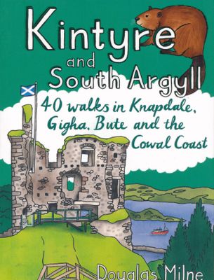
Wandelgids Kintyre and South Argyll | Pocket Mountains

0
Rugged, wild, sparsely-populated and gouged by misty sea-lochs, South Argyll was once known in Old Gaelic as Airer Goidel, the 'Coast of the Gaels' and remains a place apart. The hills and glens here are steeped in history and littered with standing stones, hillforts and castles, as well as unique wildlife-rich habitats created by the warming Gulf...

Verkopers met dit product

Verkoper
Bezorging
Prijs
DeZwerver.nl logo
DeZwerver.nl
2,95
10,95

Anderen bekeken ook

Wandelgids Kintyre and South Argyll | Pocket Mountains
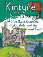
Rugged, wild, sparsely-populated and gouged by misty sea-lochs, South Argyll was once known in Old Gaelic as Airer Goidel, the 'Coast of the Gaels' and remains a place apart. The hills and glens here are steeped in history and littered with standing stones, hillforts and castles, as well as unique wildlife-rich habitats created by the warming Gulf Stream. This book explores the very best of Knapdale, Kintyre and the Cowal coast as well as the Isles of Gigha and Bute with walks to suit all abilities, many of which utilise the long-distance walking trails which criss-cross the area.  
10,95
Wandelgids Inveraray & South Argyll : Including Kintyre | Hallewell Publications
Rewalked and updated in 2022, 'Walks Inveraray & South Argyll including Kintyre' covers the stretch of Scotland's west coast from Ardfern in the north to the Mull of Kintyre in the south. This is one of the quieter corners of Scotland, and though it lacks the high peaks of the north and west there are some marvellous and varied walks. Routes featured include the paths around historic Kilmartin and Dunadd, walks by the scenic Crinan Canal, and paths from Campbeltown and the coastal villages of Tayvallich and Inveraray. 28 routes (from 0.5-16kms/0.35-10 miles) are described. The guide is part of a popular series of A6 pocket walking guides describing routes suitable for walkers of all abilities and to suit all tastes. Route descriptions are accompanied by 2-colour sketch maps. The guides are illustrated with line illustrations, and will provide walkers with a good introduction to what each area covered has to offer.  
5,95
Wandelgids Oban and North Argyll | Pocket Mountains
This guidebook covers a large swathe of Mid and North Argyll, sweeping inland from the fractured western seaboard between Crinan and Appin to Arrochar and Bridge of Orchy on the region’s eastern periphery. Between these four points lies a landscape awash with sea lochs, with Inveraray roughly at the geographical centre. There are no large urban areas here and Oban is the largest settlement. Although the road network and public transport infrastructure are good, many routes feel off the beaten track. This is not only down to the low scattered population but also to the indented coast and its many islands, the sea lochs encroaching deep inland, the elongated freshwater lochs and the mountainous interior – making road travel much more convoluted than direct ‘as-the-crow-flies’ distances would suggest. As well as many great sea lochs, tumbling rivers and iconic mountains, Oban and North Argyll also boasts ancient, wildlife-rich woodlands and several fine gardens. Add to this the Crinan Ca…
10,95
Wandelgids Weekend Walks Brighton and the South Downs | Pocket Mountains
Facing the sea and backed by rolling chalk downland, Brighton is a great place from which to explore one of England's most recognisable and best-loved landscapes. As well as the old chalk grasslands, the South Downs incorporate a variety of habitats, including deciduous, coniferous and mixed woodland, heathland, wetland, shingle beach and saltmarsh. The 40 walks in this guidebook cover the area of the Downs around Brighton, extending to Eastbourne in the east and as far as Worthing and the Findon Valley in the west, and from the Channel coast to the foot of the Downs' steep northern escarpment at the edge of the Sussex Weald.  
10,95
Wandelgids The South Pennines | Pocket Mountains
Handige compacte wandelgids met 40 dagwandelingen. Deze gids bevat kleine kaartjes en leuke uitgebreide informatie over wat er langs de route te zien is. Goede wandelkaarten zijn echter we noodzakelijk voor deze tochten: de Ordnance Survey explorer maps of Landanger maps zijn zeer geschikt.     The home of Heathcliffe and Nora Batty, the wild and wuthering South Pennines is where Yorkshire and Lancashire collide, a watershed landscape of great natural beauty which is home to proud and welcoming communities with a heritage of rugged farming and industrial hard graft. This collection of forty walks explores the steep-sided valleys, heather moorlands, craggy hills and gritsone villages which have inspired and attracted writers and artists for generations to this unspoilt upland haven just a stone's throw from some of northern England's largest towns and cities.  
10,95
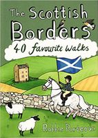
Wandelgids The Scottish Borders | Pocket Mountains
Handige compacte wandelgids met 40 dagwandelingen. Deze gids bevat kleine kaartjes en leuke uitgebreide informatie over wat er langs de route te zien is. Goede wandelkaarten zijn echter we noodzakelijk voor deze tochten: de Ordnance Survey explorer maps of Landanger maps zijn zeer geschikt.   The Scottish Borders cover a vast area, stretching from the east coast to rural Dumfriesshire and from the more populous Lothians to the border with England. Although there are no very high mountains, the Borders have always attracted walkers keen to explore the quiet moorlands, rolling hills, ancient woodland and rugged coast, as well as the romantic ruins of abbeys and castles, grand estates and rich literary heritage of the area.Ancient native tribes and Roman legions left their mark on this landscape, as did years of fierce warfare with our southern neighbours and raiding by ruthless Border Reivers. These 40 walks will introduce you to some of the fascinating history which shaped this most in…
10,95
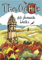
Wandelgids The Ochils | Pocket Mountains
Handige compacte wandelgids met 40 dagwandelingen. Deze gids bevat kleine kaartjes en leuke uitgebreide informatie over wat er langs de route te zien is. Goede wandelkaarten zijn echter we noodzakelijk voor deze tochten: de Ordnance Survey explorer maps of Landanger maps zijn zeer geschikt.   40 easy short walks with a very cute cartoonish style Known to the ancient people of Central Scotland as uchel – ‘the high place’ – the long upland massif of the Ochils rises between the River Forth and the Southern Highlands, with a dramatic escarpment running between the cities of Stirling and Perth. The high rounded hills are cleaved by steep-sided ravines and dotted with castles, standing stones, burial mounds, hillforts and battlesites, making the Ochils a walker’s paradise. This collection of 40 routes covers all the main summits, as well as the magnificent glens and the two rivers, the Allan and the Devon, which transect them.  
10,95
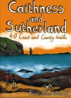
Wandelgids Caithness and Sutherland | Pocket Mountains
Handige compacte wandelgids met 40 dagwandelingen. Deze gids bevat kleine kaartjes en leuke uitgebreide informatie over wat er langs de route te zien is. Goede wandelkaarten zijn echter we noodzakelijk voor deze tochten: de Ordnance Survey explorer maps of Landanger maps zijn zeer geschikt. The county of Ayrshire is located on the Firth of Clyde on the beautiful West Coast of Scotland and is known as one of the most fertile areas of the country, famed for its cattle and crops. Although more industrial to the north, it is in the main a landscape made for walking with an abundance of open countryside and rugged little hills, golden sandy beaches and beautiful sunsets. This guide features 40 mostly moderate walks full of interest which explore all aspects of the region, from craggy cliffs and caves to historic castles, ancient forests to sandy shorelines. Sutherland and Caithness are the most northerly parts of mainland Britain. Northwest Sutherland is a landscape of sandy beaches and …
10,95
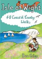
Wandelgids Isle of Wight : 40 Coast and Country Walks | Pocket Mountains
The Isle of Wight in the English Channel is England's largest island, separated from the mainland by the Solent but easily and quickly accessible from the south coast. Designated a UNESCO Biosphere Reserve, the mild climate and slower pace of life has long attracted holiday-makers and curious walkers who come to explore the island's rolling chalkland hills, peaceful woodland paths and sandy beaches and coves. The 40 walks in this volume make the most of the island's well-maintained trails - which include some of the most celebrated clifftop walks in southern England - as well as many lesser-known gems waiting to be discovered on this Treasure Island.  
9,95
Wandelgids Oban and North Argyll | Hallewell Publications
Rewalked and updated in 2018, Walks Oban & North Argyll covers the area around the popular coastal town of Oban, the offshore islands which can be reached from the town, and inland as far as Bridge of Orchy. The coastal area and islands are fairly gentle in character, but there are some fine, challenging hill walks inland. The 26 walks featured range from 0.5 miles to 14 miles (1-23km). Routes include: Oban to Gallanach, two routes on Lismore, Ben Cruachan and Bridge of Orchy to Tyndrum. Part of a popular series of A6 pocket walking guides which describe routes which are suitable for walkers of all abilities and to suit all tastes. Route descriptions are accompanied by 2-colour sketch maps. The guides are illustrated with line illustrations, and will provide walkers with a good introduction to what each area covered has to offer.  
5,95

Klanten-reviews van Wandelgids Kintyre and South Argyll | Pocket Mountains

Er zijn nog geen beoordelingen voor dit productBen jij de eerste die een review plaatst?

Meer over Wandelgids Kintyre and South Argyll | Pocket Mountains

Productomschrijving

Rugged, wild, sparsely-populated and gouged by misty sea-lochs, South Argyll was once known in Old Gaelic as Airer Goidel, the 'Coast of the Gaels' and remains a place apart. The hills and glens here are steeped in history and littered with standing stones, hillforts and castles, as well as unique wildlife-rich habitats created by the warming Gulf Stream. This book explores the very best of Knapdale, Kintyre and the Cowal coast as well as the Isles of Gigha and Bute with walks to suit all abilities, many of which utilise the long-distance walking trails which criss-cross the area.  

Productinformatie

    Verken gerelateerde categorieën

    Webshop.nl maakt gebruik van cookies. Ga je verder op onze website, ga dan akkoord met het plaatsen van cookies en de verwerking van deze data door ons en vermelde partners.