Wandelgids Killarney to Valentia Island - The Iveragh Peninsula | The Collins Press

0
Duidelijke wandelgids van dit specifieke deel van Ierland. Goede praktische informatie en zeker voor de GPS wandelaar handig met vermelde waypoints. Kaarten zijn schetsmatig, maar er wordt verwezen naar de benodigde topografische kaarten van Ierland.  The Iveragh Peninsula, the largest in southwest Ireland, stretches from Killarney to Bolus Head a...

Verkopers met dit product

Verkoper
Bezorging
Prijs
DeZwerver.nl logo
DeZwerver.nl
niet bekend
22,50

Anderen bekeken ook

Fietsgids Cycling Munster | The Collins Press
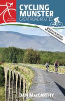
With routes spanning the province, here is everything you need to explore the highways and byways of Munster – on two wheels.   This popular guide has now been updated to include the Waterford Greenway, which officially opened in spring 2017. The route, set against the glorious backdrop of the Comeragh Mountains, runs for 46km along an old railway line between Waterford and Dungarvan, crossing three stunning viaducts and taking in charming villages along the way. Graded cycles along the greenway are outlined, from shorter jaunts to suit families, through challenges for intermediate cyclists, up to a 92km loop of the whole route for the experienced.   Each of the routes in the guide is graded by difficulty, from the gentlest, shortest circuits in Cork, through Tipperary, Limerick and Clare, to the thigh-burning Ring of Kerry, and Waterford's Copper Coast and Grand Vee. Each cycle is prefaced with summary information and illustrated with photos, a custom-drawn map and a gradient graph. …
22,50
Fietsgids Cycling Kerry | The Collins Press
Een beschrijving van een deel van The Wild Atlantic Way in 3 etappes en ook nog eens 28 dagtochten , wel alleen in Kerry. Goede beschrijvingen, veel praktische informatie maar wel slechts schetsmatige kaarten  A guidebook to the scenic bicycling routes of County Kerry, Ireland, for all cycling abilities. It includes popular routes as well as hidden gems. Each route description is illustrated with color maps, photos, a gradient graph and key facts and statistics. Information is provided on the natural landmarks and historical sites you'll see along the way. With some of Ireland's most beautiful and untamed scenery, 400km of rugged coastline and enticingly peaceful roads, what better way to explore County Kerry than by bike? These scenic cycles will guide you along popular routes and bring you to hidden gems. In a county famous for its climbs, some of the country's most spectacular ascents, summit views and descents feature, including the Conor Pass and Ballaghbeama.Each route descripti…
22,50
Wandelgids The Beara & Sheep´s Head Peninsulas | The Collins Press
Duidelijke wandelgids van dit specifieke deel van Ierland. Goede praktische informatie en zeker voor de GPS wandelaar handig met vermelde waypoints. Kaarten zijn schetsmatig, maar er wordt verwezen naar de benodigde topografische kaarten van Ierland.  The Beara and Sheep’s Head Peninsulas lie in the southwest of Ireland, pointed fingers of land wedged between the Kenmare River, Bantry Bay and Dunmanus Bay. They are peaceful, unspoiled peninsulas where the wild and largely untamed nature of the landscape immediately casts its magical spell. There is no better way to explore and experience this stunning landscape than on foot.   This guidebook describes some of the best walking routes in the area: from Dursey Island and Bear Island to the Caha and Shehy Mountains, from the forest trails of Glengarriff to the lakes of Glaninchiquin,and from the tip of the Sheep’s Head to the ridges of Peakeen and Seefin. The routes range from short hikes to longer treks, coastal and inland, something to …
22,50
Wandelgids The Burren & the Aran Islands | The Collins Press
Duidelijke wandelgids van dit specifieke deel van Ierland. Goede praktische informatie en zeker voor de GPS wandelaar handig met vermelde waypoints. Kaarten zijn schetsmatig, maar er wordt verwezen naar de benodigde topografische kaarten van Ierland.  The Burren and the Aran Islands, with their unique combination of flora, fauna and landscape, are explored by large numbers of walkers annually. This is a revised guide to some of the best walking routes in the region, with lucid descriptions and additional information to enhance the walkers' enjoyment and appreciation of the place. From the rugged interior to spectacular coastal scenery, from challenging upland walks to shorter road and waterside excursions, this selection has something for everyone. Every part of the region is covered. Walks vary from two-hour strolls to the longer Burren Way, a six-hour walk from Lisdoonvarna to Ballyvaughan.   The author has put his considerable experience and detailed knowledge of the area to great …
22,50
Wandelgids Dublin & Wicklow | The Collins Press
Duidelijke wandelgids van dit specifieke deel van Ierland. Goede praktische informatie en zeker voor de GPS wandelaar handig met vermelde waypoints. Kaarten zijn schetsmatig, maar er wordt verwezen naar de benodigde topografische kaarten van Ierland.  This guidebook describes the best walking routes in Dublin and Wicklow. From mountain landscape to scenic coastal paths, from woodland trails to challenging hill-walks, there are routes here for everyone. Trips vary from two-hour strolls to eight-hour treks, and are illustrated with sketch maps and colour photographs. This is an area of great scenic variety with countless hidden gems to discover - sheer cliffs, dramatic corries, secluded lakes and charming forests. As well as inspiring you to visit the region's natural attractions, the guide provides a host of practical and background information. Each route is prefaced with a quick-reference summary, and descriptions include detailed access notes and navigational guidance. Points of int…
22,50
Wegenkaart - landkaart Ireland - Ierland | Borch
Mooie geplasticieerde kaart van Ierland. Deze kaart biedt een goed overzicht van het land met detailkaarten.   Our soft-laminated folded map of Ireland shows: Ireland 1:700 000, Dublin 1:15 000, Cork 1:8 000, Killarney National Park 1:100 000, Wicklow Mountains 1:350 000 and Ireland administrative. Borch maps are easy to fold, durable and water-repellent with a wipeable surface. Borch Maps show hotels, museums, monuments, markets, top sights and points of interest, useful statistics, conversion charts for temperatures, weights and measurements, climate charts showing temperatures, sunshine hours, precipitation and humidity, overview maps, time zones, and much more...   Once one has torn oneself away from the bustling, cosmopolitan atmosphere of Dublin, the "Emerald Isle" more than confirms its reputation: lush green meadows and peat mores dotted with stone walls and the occasional small house; rugged cliffs and windswept hillsides populated only by sheep; long sandy beaches all to you…
11,50
Wandelgids - Reisgids The England Coast Path | Bloomsbury
The definitive guidebook to the entire 3,000-mile length of the new England Coast Path. For anyone planning a trip to the coast or a UK summer holiday, the new England Coast Path national trail is a hugely exciting prospect, and this guidebook shows you how to make the most of every single glorious mile. Environmentalists, volunteers, campaigners, land owners and politicians all came together to create this 'ninth wonder of the world', and from the opening of the path in 2020 onwards, anyone has been able to walk and wild camp along the entire 3,000-mile length of the English coast.   It's a fantastic opportunity for all walkers, campers, fans of the coast and the outdoors. Stephen Neale has spent many happy months walking, camping and surveying the path, and from that experience has written a fantastically detailed and rich guidebook covering the route itself, along with everything from the best places to swim, hunt for fossils and eat seafood to hidden away beaches and canoeing spot…
26,50
Wandelgids Oregon Hiking | Moon Travel Guides
De Amerikaanse uitgever Moon is een vergelijkbare gids met uitgever Lonely Planet > veel praktische informatie met veel diepgang! Het feit dat het een Amerikaanse uitgever is, maken deze gidsen zeer aantrekkelijk voor de staten en nabije landen afzonderlijk. De Lonely Planet haalt dat nivo niet! Misty ancient forests, rugged high deserts, and black sand beaches: wherever you turn in Oregon, adventure awaits. Pack a lunch, lace up your boots, and hit the trails with Moon Oregon Hiking. Inside you'll find:* Diverse Hiking Options: Whether you plan to take peaceful walks along the coast or challenging treks up Mount Hood, enjoy outdoor getaways ranging from easy day hikes to multi-day backpacking trips* Find Your Hike: Looking for something specific? Choose from strategic lists of the best hikes for wildflowers, waterfalls, or hiking with your dog, plus a breakdown of the best hikes by season* The Top Outdoor Experiences: Explore a Mars-like red rock landscape in the Alvord Desert, or ma…
19,95
Wandelgids 083 Pathfinder Guides North Coast 500 and Northern Highlands | Ordnance Survey
Enhance your North Coast 500 tour with the only walking guidebook featuring routes based on or accessible from Scotland’s ultimate road trip. Discover Britain’s remotest sandy beaches, Scotland’s most northerly munro, some of the oldest rocks on Earth and more with 28 breathtaking walks accessed from the North Coast 500 as well as 32 unmissable stop-off-and-stroll recommendations.   Featured North Coast 500 and Northern Highlands walks include:   - Circle Loch Coulin where Beinn Eighe and Liathach are reflected in the still waters - Wander the astounding landscape of Knockan Crag, where some of the oldest rocks on Earth can be seen - Climb Ben Hope, Scotland’s most northerly munro, towering above the Flow Country - See the waterfalls and rocks walls of the Big Burn as you ascend Ben Bhraggie for views over the Dornoch Firth - Explore the landscape and history of the Applecross peninsula with sublime views of Raasay - Take a moorland and clifftop route to the vast golden sands of Sandw…
18,50
Reisboek - Wandelgids Wild Swimming Walks Peak District | Wild Things Publishing
The best-selling Wild Swimming Walks series returns with adventures in Britain's oldest National Park. Ascend to the highest tarns and descend through a valley of secret waterfalls * Walk through woodland gorges carved by cascades * Follow bucolic river valleys dipping as you walk. Wild Swimming Walks Peak Disitrict leads you on 28 adventures in the soaring landscape of the Peak District. Find secret waterfalls, remote lakes and sparkling river pools. Complete with photos, maps and practical guidance, rich in local history and stories, this book will appeal to wild swimmers, family explorers, nature lovers and walkers alike.   JOIN THE ADVENTURE with the best-selling Wild Swimming Walks series and explore Britain’s oldest national park from the gritstone edges of the Hope Valley, to the magical streams on the moorlands of Bleaklow, through to the picturesque limestone river dales of the White Peak.   Scramble up streams and waterfalls at Black Clough Explore fairy pools and mossy…
20,95

Klanten-reviews van Wandelgids Killarney to Valentia Island - The Iveragh Peninsula | The Collins Press

Er zijn nog geen beoordelingen voor dit productBen jij de eerste die een review plaatst?

Meer over Wandelgids Killarney to Valentia Island - The Iveragh Peninsula | The Collins Press

Productomschrijving

Duidelijke wandelgids van dit specifieke deel van Ierland. Goede praktische informatie en zeker voor de GPS wandelaar handig met vermelde waypoints. Kaarten zijn schetsmatig, maar er wordt verwezen naar de benodigde topografische kaarten van Ierland. 

The Iveragh Peninsula, the largest in southwest Ireland, stretches from Killarney to Bolus Head and attracts thousands of visitors annually. The Ring of Kerry coastal road winds along its fringes and sandstone peaks soar high above. It is a landscape of raw and stunning beauty from the lakes that fill the corries to the spectacular cliff scenery along its coast. There is no better way to explore this landscape than on foot. This book helps you do just that with routes ranging from a few hours to full-day walks. Explore Valentia Island, the majestic MacGillycuddy’s Reeks and sections of The Kerry Way. Go off the beaten track and explore the coast, hills and woodlands from Killarney to Cahersiveen to Kenmare. Each route is prefaced with a reference summary and illustrated with maps and photographs. Route descriptions include GPS coordinates, navigation guidance, access notes and short variations. There is also material on the fauna, flora, folklore, history, geology and place names of each area.

Verken gerelateerde categorieën

Webshop.nl maakt gebruik van cookies. Ga je verder op onze website, ga dan akkoord met het plaatsen van cookies en de verwerking van deze data door ons en vermelde partners.