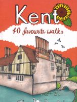
Wandelgids Kent | Pocket Mountains

0
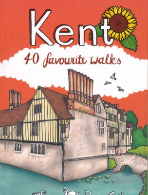
Situated between the Thames Estuary and the Straits of Dover, the borderland county of Kent is home to tidal saltmarshes, high chalk downs, riverside meadows and ancient woodlands, as well as the magnificant Canterbury Cathedral and the iconic white cliffs of Dover. With many impressive castles, gardens, cultivated estates, vineyards, orchards and...

Verkopers met dit product

Verkoper
Bezorging
Prijs
DeZwerver.nl logo
DeZwerver.nl
2,95
10,95

Anderen bekeken ook

Wandelgids Kent | Pocket Mountains
Situated between the Thames Estuary and the Straits of Dover, the borderland county of Kent is home to tidal saltmarshes, high chalk downs, riverside meadows and ancient woodlands, as well as the magnificant Canterbury Cathedral and the iconic white cliffs of Dover. With many impressive castles, gardens, cultivated estates, vineyards, orchards and hop farms, the county has long been known as 'The Garden of England'. The 40 walks in this book cater for all abilities and make good use of Kent's many footpaths and long-distance trails to explore this wonderful corner of England.  
10,95
Wandelgids East Sussex | Pocket Mountains
Sitting alongside the English Channel in the southeast corner of England, East Sussex is famed for its rolling hills and magnificent wealdland, Norman battlefields and charming medieval villages, towering chalk cliffs and hip seaside resorts. The county is also traversed by the South Downs Way long distance walking route and is home to England's newest national park, as well as miles of beautiful sandy coastline. From short forays into wildlife-rich wetlands, nature reserves and woodlands to longer riverside meanders and rollercoaster treks along spectacular sea cliffs, the forty varied walks in this guide cover the best walking this glorious county has to offer.  
10,95
Wandelgids Hampshire | Pocket Mountains
Handige compacte wandelgids met 40 dagwandelingen. Deze gids bevat kleine kaartjes en leuke uitgebreide informatie over wat er langs de route te zien is. Goede wandelkaarten zijn echter we noodzakelijk voor deze tochten: de Ordnance Survey explorer maps of Landanger maps zijn zeer geschikt.   With a network of over 4,800km of rights of way and two national parks, Hampshire offers a myriad of adventures for walkers. The jewel in the county¿s crown is the New Forest, one of Britain¿s most stunning national parks and a remarkable example of a medieval hunting forest. The South Downs, England¿s newest national park, also presents some outstanding walks in landscapes of high ecological and scenic value. The two national parks cover around 45% of Hampshire¿s area. This guide covers both of these parks and features many other superb walks across the county.
10,95
Wandelgids Exmoor | Pocket Mountains
Straddling the counties of Somerset and Devon, Exmoor is a place which never fails to stir the imagination, thanks to the coastline of stark cliffs lining the Bristol channel, the wooded valleys, tumbling streams and wild moorland. Designation as a national park in 1954 has helped Exmoor's villages and small towns keep their character and, although the moorland can undoubtedly be austere, this unassuming corner of England has an overriding softness and beguiling, timeless charm. The 40 walks in this guide make the most of more than 1000km of public rights of way and the many long-distance walks which criss-cross the landscape, offering something for every kind of walker.  
10,95
Wandelgids Essex | Pocket Mountains
Essex is full of surprises. Not only is it one of the largest counties in England by population and area, it is also home to Britain’s first city, several bustling market towns, hundreds of countryside villages and – with its many estuaries, creeks and islands – more than 900km of winding coastline. The 40 walks in this guide show Essex in all its glory while giving walkers the chance to appreciate its multiple layers: oil refineries and ports overlooking large stretches of saltmarsh, country estates drifting into industrial estates and pounding motorways flowing beneath dense forests that thrum with wildlife.  
10,95
Wandelgids Wiltshire | Pocket Mountains
Handige compacte wandelgids met 40 dagwandelingen. Deze gids bevat kleine kaartjes en leuke uitgebreide informatie over wat er langs de route te zien is. Goede wandelkaarten zijn echter we noodzakelijk voor deze tochten: de Ordnance Survey explorer maps of Landanger maps zijn zeer geschikt.   The enigmatic Neolithic standing stones at Stonehenge and Avebury first drew footsore pilgrims to this landlocked area of Southern England more than 4000 years ago. Today there are scores of waymarked footpaths, bridleways and byways which connect the rolling downland, verdant valleys, white chalk horses, ancient settlements and vibrant historic towns of the 'great green county' of Wiltshire. This guide contains 40 circular routes which make the most of that network.   Most walks can be completed inside two or three hours, though some will require half a summer's day, with a few full-day routes along the downland ridges.
10,95
Wandelgids Cambridgeshire | Pocket Mountains
Handige compacte wandelgids met 40 dagwandelingen. Deze gids bevat kleine kaartjes en leuke uitgebreide informatie over wat er langs de route te zien is. Goede wandelkaarten zijn echter we noodzakelijk voor deze tochten: de Ordnance Survey explorer maps of Landanger maps zijn zeer geschikt.   With its hallowed streets, glorious colleges and peaceful riverside walks along the Cam, Cambridge is the jewel in the crown of Cambridgeshire and a richly rewarding city to tour on foot. This is a big county, however, and it is well worth exploring the countryside beyond the glittering city. This guide takes you through the rich heritage of the county's market towns and pretty thatched-roofed villages, along old hilltop tracks and into ancient woodlands, full of interest and beauty. Cambridgeshire is also the lowest and flattest place in England and the straight roads, endless network of dykes and isoloted windmills of the fenlands have a stange minimalist magnetism which is hard to resist.
10,95
Wandelgids The Cotswolds | Pocket Mountains
Handige compacte wandelgids met 40 dagwandelingen. Deze gids bevat kleine kaartjes en leuke uitgebreide informatie over wat er langs de route te zien is. Goede wandelkaarten zijn echter we noodzakelijk voor deze tochten: de Ordnance Survey explorer maps of Landanger maps zijn zeer geschikt.   From upland outlooks and secret valleys to rolling pastures and honey stone villages, nature and history weave together in the Cotswolds to create a landscape that is the epitome of rural England. In these 40 walks Dominic North unlocks the secrets of the Cotswolds, from the hills and lanes in the north to the languid riverbanks and ancient woods of the south. Along the way discover sleepy villages, grand country houses and architectural curiosities, and then reach out to explore three of England's most celebrated cities, Bath, Oxford and Stratford-upon-Avon. Plaatsen in het boekje Bath, Bathampton, Batsford, Belas Knap, Bibury, Blenheim Park, Blockley, Bourton-on-the-Hill, Bourton-on-the-Water, …
10,95
Wandelgids Cheshire | Pocket Mountains
Handige compacte wandelgids met 40 dagwandelingen. Deze gids bevat kleine kaartjes en leuke uitgebreide informatie over wat er langs de route te zien is. Goede wandelkaarten zijn echter we noodzakelijk voor deze tochten: de Ordnance Survey explorer maps of Landanger maps zijn zeer geschikt.   Full of surprises and infused with history, Cheshire is a wonderful place to go for a walk! From the wild and open hills of the Peaks to the low-lying pastures of the Plain, Cheshire is covered in a spider's web of footpaths, bridleways, towpaths and trails and is well served by welcoming pubs and cosy cafes. There is so much to see in this corner of England and there is no better way to explore it than by lacing up your boots and setting off on foot - armed of course with this selection of 40 circular walks.
10,95
Wandelgids Weekend Walks The Surrey Hills | Pocket Mountains
Although Surrey is not far from metropolitan London, it famously has more mature woodland than any other county in England and has long been renowned for its rolling hills and valleys, ancient heathlands, beautiful waterways and charming villages.   There is a surprisingly extensive network of local paths and bridleways and, to the south of the North Downs chalk ridge, the hills are intersected by three long-distance walking trails. All these feature in this collection of 40 walks, which explore glorious parklands, country estates, ruined abbeys, impressive castles and wildlife-rich woodlands along the way.
10,95

Klanten-reviews van Wandelgids Kent | Pocket Mountains

Er zijn nog geen beoordelingen voor dit productBen jij de eerste die een review plaatst?

Meer over Wandelgids Kent | Pocket Mountains

Productomschrijving

Situated between the Thames Estuary and the Straits of Dover, the borderland county of Kent is home to tidal saltmarshes, high chalk downs, riverside meadows and ancient woodlands, as well as the magnificant Canterbury Cathedral and the iconic white cliffs of Dover. With many impressive castles, gardens, cultivated estates, vineyards, orchards and hop farms, the county has long been known as 'The Garden of England'. The 40 walks in this book cater for all abilities and make good use of Kent's many footpaths and long-distance trails to explore this wonderful corner of England.  

Productinformatie

    Verken gerelateerde categorieën

    Webshop.nl maakt gebruik van cookies. Ga je verder op onze website, ga dan akkoord met het plaatsen van cookies en de verwerking van deze data door ons en vermelde partners.