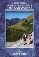
Wandelgids Karawanken - Slovenie - Walking in the Karavanke | Cicerone

0
Goede wandelgids met veel dagtochten; redelijk kaartmateriaal en goede praktische informatie. This guidebook offers 23 walking routes set across the magnificent 120km-long Karavanke mountain range, which forms a natural border between Austria and Slovenia. Commonly known as 'the way the Alps used to be', as it is yet to experience the extent of co...

Verkopers met dit product

Verkoper
Bezorging
Prijs
DeZwerver.nl logo
DeZwerver.nl
2,95
20,95

Anderen bekeken ook

Wandelgids Karawanken - Slovenie - Walking in the Karavanke | Cicerone
Goede wandelgids met veel dagtochten; redelijk kaartmateriaal en goede praktische informatie. This guidebook offers 23 walking routes set across the magnificent 120km-long Karavanke mountain range, which forms a natural border between Austria and Slovenia. Commonly known as 'the way the Alps used to be', as it is yet to experience the extent of commercial development known by the Western Alps, it is one of the longest ranges in Western Europe but it remains genuinely unspoilt and relatively unvisited by English-speaking hillwalkers. The guide's walks begin in pretty towns and villages, and most of them access the peaks from the relatively more gentle Slovenian side of the range, where forest-clad slopes lead to grassy summits where spectacular views can be enjoyed. Arranged by peak from west to east along the range, most of the summits can be reached by waymarked paths and trails. The guide gives all the practical details you need on transport, accessing the routes, accommodation and …
20,95
Wandelgids Walking in the Alps | Cicerone
Geweldig overzichtswerk van prachtige wandelroutes in de Alpen. Suggests many routes, and covers the range from the Maritime Alps of southern France to the Julian Alps of Slovenia. Walks vary from undemanding to long and tough, and everything in between. Walking is unquestionably the best method of exploring, and it is the mountain walker for whom journeys in the Alps reveal some of the finest views, the greatest contrasts. This book then is a definitive guide to the many thousands of possible routes, with a geographical span that ranges from the Maritime Alps of southern France to the Julians of Slovenia, from Italy's Gran Paradiso to the little-known Turnitzer Alps of eastern Austria, from the ice-bound giants of the Bernese Oberland to the green rolling Kitzbuheler Alps and the bizarre towers of the Dolomites of South Tirol, showing the amazing diversity of this wonderful mountain chain. There are walks to suit every taste: gentle and undemanding, long and tough, and everything in …
33,95
Wandelgids Karawanken | Rother Bergverlag
Uitstekende wandelgids met 53 dagtochten in dal en hoger gelegen delen van het gebergte. Met praktische informatie en beperkt kaartmateriaal! Wandelingen in verschillende zwaarte weergegeven in rood/blauw/zwart. Deze wandelgidsen uitgever staat hoog aangeschreven en is een begrip onder de wandelaars! Entlang der Grenze zwischen Kärnten und Slowenien erstrecken sich über eine Länge von 120 Kilometern die Karawanken. Gemeinsam mit den Steiner Alpen bilden sie ein wahres Wanderparadies. Der Rother Wanderführer »Karawanken und Steiner Alpen« stellt die schönsten Touren in der Region zwischen den Tälern von Drau und Save vor. Vom Dreiländereck nahe Villach im Westen bis zum Ursulaberg im Osten, vom Rosental und Jauntal in Kärnten bis zum Savetal im Norden Sloweniens erstreckt sich das Gebiet, das in diesem Rother Wanderführer präsentiert wird. Beeindruckende Felswände, tief eingeschnittene Schluchten, glasklare Gebirgsbäche, dazu liebliche Täler und sanfte Almen – sowohl in den Karawanken …
18,50
Wandelgids Walking in the Auvergne | Cicerone
Uitgebreide wandelgids van de Auvergne: goede beschrijvingen, veel keuze, kaarten wat minder goed. This handy guidebook offers the finest day walks in five different areas of the Auvergne, an often-forgotten region in central France perfect for accessible day walking in a unique and spectacular landscape. Towns such as Vichy, Clermont-Ferrand and Puy-en-Velay also offer delightful places to base yourself for that perfect walking holiday. The ridges, rocky peaks and verdant valleys of the Cantal supervolcano dominate south-western Auvergne. The centre of the region hosts the unique chain of 'puys' with their pudding bowl forms and the pristine crater lakes of the Sancy massif. In the north, the Montagne Bourbonnaise preserves a pastoral way of life which is quintessentially French while the Haute Loire's rivers and medieval abbeys reward those venturing further off the beaten track. Notes on the geology and history of points of interest passed en route help you to get the most out of y…
19,95
Wandelgids Walking in the Cairngorms | Cicerone
Uitstekende wandelgids, sommige meerdaags, voor dit uitdagende wandelgebied in Schotland. This guidebook contains over 100 routes for walking in the Scottish Cairngorms. It includes 18 Munro summits and smaller viewpoint hills. Walks range in length from 1 to 26 miles and are graded for difficulty.    For the adventurous there are the best of the area's rocky scrambles, and the classic through-routes including the Lairig Ghru. For those looking for a more gentle alternative, there are easy, sandy trails wandering among the tall pines and along the banks of the great rivers Spey, Nethy and Dee.    Britain's biggest mountain range is home to exceptional and varied scenery - from the ancient Caledonian forest to the granite plateau, the glacial glens and high corries where green lochans lie below great crags of the plateau rim.  Along with the main Cairngorm range between Speyside and Deeside, the guidebook covers Lochnagar. It includes practical information on snack stops, public …
20,95
Wandelgids Walking in the Briançonnais | Cicerone
Handige duidelijke wandelgids van een mooi wandelgebied. De routes zijn accuraat beschreven met praktische informatie erbij. Kaartmateriaal is redelijk, soms wat schetsmatig. In berggebieden zijn wandelkaarten wel belangrijk! Bij de routes worden de juiste kaartnummers gegeven.    This guidebook presents 40 walks exploring the area around Briançon in France. The walks are divided into 6 sections covering the valleys of Clarée, Cerveyrette, Ayes, Durance and Guisane, as well as the area around Vallouise and Montgenèvre. The walks are circular and range in distance from 4 to 21 km. Graded easy to very hard, there is a walk to suit all abilities.    Dominated on all sides by jagged peaks, and perched on a rocky spur at the nucleus of five beautiful valleys, the city of Briançon lies almost at the southernmost tip of the main Alpine range. The Briançonnais, the surrounding region to which it gives its name, is a stunning mountain wilderness packed with everything one would expect from a h…
23,95
Wandelgids Walking and trekking in the Sierra Nevada | Cicerone
Uitstekende wandelgids voor de Sierra Nevada. Goed beschreven met veel praktische informatie om de route te kunnen lopen, inclusief redelijke kaarten. Aanbevolen wandelkaarten Wandelkaart NP Sierra Nevada met Alpujarras | Editorial Penibetica 1:40.000 of Wandelkaart Sierra Nevada en Alpujarras | Editorial Alpina - 1:40.000 Wandelkaart Sierra Nevada - la integral de los 3000 | Editorial Piolet 1:25.000   This guidebook presents 33 graded walks and 5 high mountain scrambles in the striking Sierra Nevada, the highest mountain range in mainland Spain and in western Europe outside the Alps. Easily accessible from Granada and Málaga, it is a world of soaring, snow-clad peaks and deep valleys, far removed from the crowded beaches of the Costa del Sol just two hours away. The routes are spread across the national park, with attractive towns and villages such as Trevélez, Lanjarón, Hoya de la Mora and Cumbres Verdes serving as potential bases for a walking holiday.   The walks have been carefu…
20,95
Wandelgids Walking in the Engadine - Engadin | Cicerone
Uitstekende wandelgids van Engadin. Goed beschreven met veel praktische informatie om de routes te kunnen lopen, kaartmateriaal is echter wel beperkt. A guidebook to 100 of author Kev Reynold's favourite routes in the Engadine. Varying from gentle rambles to adventurous high-level routes for the experienced mountain walker. Each graded route ranges from 2 to 10 miles long, visiting forests and meadows, high mountain landscapes, lakes and passes. There's something for every walker's taste: gentle valley rambles for a family outing; craggy mid-mountain walks for the more adventurous; high-level routes that lead across glacier, snowfield and rugged passes for the experienced mountain trekker. Tucked away in the south-east corner of Switzerland, the Engadine is a region of lakes and mountains, home of the country's only national park, guardian of the Romansch language and location for some of the most sublime villages in all the Alps. These walks not only reveal breathtaking views, but ta…
23,95
Wandelgids Walking in the Aosta Valley | Cicerone
Uitstekende wandelgids van Aosta en omgeving. Goed beschreven met veel praktische informatie om de routes te kunnen lopen, inclusief redelijke kaarten. Guidebook to hiking in the Aosta Valley, a stunning, autonomous region in the Italian Alps. Describes 32 scenic routes (ranging from 4 to 20km) within both the main valley and those to the north, including the Lys valley, Valpelline, Valtournenche, and Grand St Bernard. Also provides info on the via ferrata and trail running options in the region. A stunning, autonomous region in the Italian Alps, the Aosta valley is a walker's paradise. This guidebook describes 32 varied and scenic routes both within the main valley and those to the north (including the Lys valley, Valpelline, Valtournenche and Grand St Bernard). The routes vary in difficulty and distance, offering something for walkers of all ability. 1:50K mapping together with gradient profiles complement clear and concise route descriptions. Also included is invaluable practical i…
22,95
Wandelgids Walking in the Salzkammergut - the Austrian Lake District | Cicerone
Guidebook describing 30 day walks among the lakes and mountains of Austria's Salzkammergut. Easily accessible from Salzburg, the area is sometimes described as the Austrian Lake District. Routes range from easy lakeside strolls and walks to local points of interest to more strenuous through-routes and ascents of the neighbouring peaks. Guidebook of 30 stunning day walks in the beautiful Salzkammergut lake district of Austria. Easy to get to from Linz and Salzburg, the area is studded with lakes and bristling with mountain peaks, and has a great range of waymarked trails, from lakeside strolls to challenging mountain walks. The routes in this book are within the capabilities of any reasonably fit walker, many are suitable for family hiking, and cablecars and lifts can often be used to make walks shorter or easier. Walks range from 6 to 16km and a simple grading system makes it easy to choose the right one.   Walks are centred around a number of bases, such as Bad Ischl, Fuschl am See, …
24,95

Klanten-reviews van Wandelgids Karawanken - Slovenie - Walking in the Karavanke | Cicerone

Er zijn nog geen beoordelingen voor dit productBen jij de eerste die een review plaatst?

Meer over Wandelgids Karawanken - Slovenie - Walking in the Karavanke | Cicerone

Productomschrijving

Goede wandelgids met veel dagtochten; redelijk kaartmateriaal en goede praktische informatie.

This guidebook offers 23 walking routes set across the magnificent 120km-long Karavanke mountain range, which forms a natural border between Austria and Slovenia. Commonly known as 'the way the Alps used to be', as it is yet to experience the extent of commercial development known by the Western Alps, it is one of the longest ranges in Western Europe but it remains genuinely unspoilt and relatively unvisited by English-speaking hillwalkers. The guide's walks begin in pretty towns and villages, and most of them access the peaks from the relatively more gentle Slovenian side of the range, where forest-clad slopes lead to grassy summits where spectacular views can be enjoyed. Arranged by peak from west to east along the range, most of the summits can be reached by waymarked paths and trails. The guide gives all the practical details you need on transport, accessing the routes, accommodation and available facilities, as well as insight into the historical sites passed on the way. The Karavanke offers a wealth of superb walking opportunities for walkers of all abilities, and this is an invaluable companion to discovering the range for yourself.


The magnificent 120km-long Karavanke mountain range forms a natural border between Slovenia and Austria. It is one of the longest mountain ranges in Western Europe, yet it remains relatively unvisited and unknown among English-speaking hillwalkers. Visitors tend to rush to the much better known Julian Alps, leaving these gems of mountains untouched, so they are yet to experience the extent of the commercial development known by the Western Alps.   The range divides naturally into two sections: the Western Karavanke, as far as the Košuta ridge, is more or less a single unbroken ridge, while the Eastern Karavanke are split into several massifs. The typical pattern all along the range is of precipitous rocky faces to the northern, Austrian side, while to the southern, Slovene side there are steep grassy slopes and terraces.   All the walks are graded from 1 to 3, and though not an official system this will help assess each route’s suitability to your own ability and taste. It should be noted however, that even the easiest grade (1) may be a long and tiring excursion, despite not being excessively steep or technical, so previous mountain experience is recommended. The highest graded routes are particularly strenuous, tackling high and exposed sections that require the aid of fixed steel cables and pegs.   Arranged in the book by peak from west to east along the range, the routes feature major highlights including Stol (at 2236m the highest in the range and one that forms a stunning backdrop to the beautiful Lake Bled), the majestic Košuta ridge and Golica – a mountain that displays a fine carpet of white daffodils in May.   • detailed description of 23 walking routes, covering the entire range from west to east • insight into the history of the area • practical details on transport, accessing the routes, accommodation and available facilities   Seasons Main walking season late June to early September, safely extended to include May for the wonderful bursts of spring flowers and up to mid-October for the amazing autumn colours Centres Kranjska Gora, Mojstrana, Jesenice, Tric, Solcava, Slovenj Gradec Difficulty Although the Karavanke lack the steep rock and barren heights of the nearby Julian Alps, several of the peaks are over 2000m and many just under this altitude; a number of the walks include short steep sections of rock protected with steel cable and pegs; all routes graded Must See Major peaks in the Karavanke are: Stol - the highest at 2236m and a stunning backdrop to beautiful Lake Bled; Uršlja Gora - the furthest eastern peak with its fine summit mountain; the majestic Košuta ridge Olševa with its prehistoric cave; Golica in May for the white daffodils

Productinformatie

    Verken gerelateerde categorieën

    Webshop.nl maakt gebruik van cookies. Ga je verder op onze website, ga dan akkoord met het plaatsen van cookies en de verwerking van deze data door ons en vermelde partners.