webshop.nl
Categorieën
  Sluiten

Meer Rucksack Readers

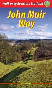
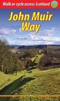
Wandelgids John Muir Way | Rucksack Readers

0
The John Muir Way runs for 134 miles (215 km) coast-to-coast across central Scotland, from Helensburgh on the Clyde to Dunbar on the North Sea. The route is as suitable for cyclists as for walkers, and it can be tackled as a coast-to-coast expedition or in sections - ten for walkers or five for cyclists.   The John Muir Way's appeal ranges from the...

Webshops met dit product

Webshop
Bezorging
Prijs

Anderen bekeken ook

Wandelgids John Muir Way | Rucksack Readers
The John Muir Way runs for 134 miles (215 km) coast-to-coast across central Scotland, from Helensburgh on the Clyde to Dunbar on the North Sea. The route is as suitable for cyclists as for walkers, and it can be tackled as a coast-to-coast expedition or in sections - ten for walkers or five for cyclists.   The John Muir Way's appeal ranges from the Charles Rennie Mackintosh architecture of Helensburgh through the scenic grandeur of Loch Lomond, along two famous canals and past the amazing Falkirk Wheel, beside the Roman Antonine Wall, passing Linlithgow Palace, Blackness Castle and the Forth Bridges to the capital glories of Edinburgh. It goes beside the Firth of Forth to reach North Berwick, then heads inland to finish at Dunbar with its ruined castle and the John Muir birthplace.   This guidebook contains all you need to plan and enjoy your holiday on a bike or on foot:   background on John Muir's life, the canal heritage and wildlife detailed description of the route from west to …
23,95
Wandelgids The John Muir Trail | Cicerone
Een uitstekende beschrijving van het beroemde lange afstandspad in Californie. Guidebook to walking the John Muir Trail through California's High Sierra from Yosemite (El Capitan and Half Dome) to the summit of Mount Witney. The 216 mile hike is split into 21 daily stages, with full information on preparation, permits, wilderness, bears, water and trekking skills. Part of the Pacific Crest Trail. The John Muir Trail (JMT) is one of the world’s most spectacular treks and is North America’s best known mid-distance walking trail. It runs for 216 miles through the high Sierra Nevada mountains of California, from Yosemite Valley to the summit of Mount Whitney (14, 496ft), the highest peak in the USA outside Alaska. The walking trail, which is named after the great 19th-century Scottish naturalist, conservationist and writer John Muir, is entirely through the unspoilt wilderness of the American West and passes through three national parks: Yosemite, Kings Canyon and Sequoia National Parks. T…
25,95
Wandelgids Forth to Farne Way | Rucksack Readers
This inspiring 70-mile pilgrim route starts from North Berwick on the Firth of Forth near Edinburgh, and continues via Whitekirk's 12th century church to Dunbar. It follows the North Sea coastline to the stunning scenery of St Abb's Head and visits Coldingham Priory, perhaps Scotland's most important Benedictine monastery. Enjoy impressive cliffs and dramatic sea stacks between visits to historic fishing villages. Cross the border and enter Berwick with its ramparts, walls and bridges across the River Tweed. The route culminates with a barefoot crossing of the Holy Island sands to Lindisfarne, where St Aidan founded a monastery in AD 635.Most people will complete the route within 5 to 8 days, staying in friendly B&Bs along the route, but it can also be done in several shorter expeditions using train and bus. This 72-page guidebook contains all you need to plan and enjoy the Forth to Farne Way: route detail in sections, with distance, terrain and refreshments where to find food and ac…
19,95
Wandelgids Causeway Coast Way | Rucksack Readers
Uitgevoerd in de vorm van een klapper, met ringband geeft deze gids een goede beschrijving van de lange afstands route. De kaarten zijn schetsmatig maar wel duidelijk. The unspoiled Causeway Coast of Antrim is one of Ireland's best-kept secrets. The World Heritage Site of the Giant's Causeway is the jewel in its crown, and its amazing geology is best enjoyed on foot. The Causeway Coast Way offers 32 miles (51 km) of waymarked, easy-going walking with welcoming B&Bs and pubs at strategic intervals. It combines well with a trip to Rathlin Island and walking the more challenging Moyle Way.   The book gives options for walking holidays that most people will complete comfortably within 4 to 6 days. This guidebook contains all that a walker needs to plan and enjoy their holiday, including route maps for Causeway Coast and Moyle Ways (1:85,000); concise, up-to-date directions for both routes; geology and legend of the Giant's Causeway; background on habitats and wildlife; feature on Rathlin I…
19,95
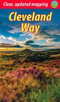
Wandelgids Cleveland Way | Rucksack Readers
“A testament to excellent research, writing and photography” - Malcolm Hodgson, Trail Manager   The Cleveland Way is one of England’s oldest and best-loved National Trails. It runs for 108 miles (174 km) around the North York Moors National Park, starting inland at Helmsley, offering panoramic views over the vales of York and Mowbray and from the Cleveland Hills. After reaching the coast at Saltburn, it heads south along the dramatic sea cliffs, with their tales of shipwrecks and smugglers, to end at Filey.   The route features ancient burial mounds, ruined castles, abbeys and Roman remains, with more recent traces of industrial history. Vast areas of heather moorland are host to a wide range of wildlife. The Cleveland Way is easily accessible by public transport and is divided into easy stages by villages of character with friendly pubs and accommodation. Above all, walkers are welcomed with warm Yorkshire hospitality.   Our new second edition has larger-scale mapping, several route u…
19,95
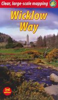
Wandelgids Wicklow Way | Rucksack Readers
Uitgevoerd in de vorm van een klapper, met ringband geeft deze gids een goede beschrijving van de lange afstands route. De kaarten zijn schetsmatig maar wel duidelijk. The Wicklow Way is Ireland’s first and most popular Waymarked Way, running between Marlay Park (Dublin) and Clonegal, 82 miles (132 km) to the south. It offers varied and scenic walking on the flanks of the rugged Wicklow mountains with loughs and waterfalls, passing historic buildings and hospitable villages. Much of the route lies over 1600 feet (500 metres) giving glorious views. Lower sections run through forests and farmland, over a mixture of tracks, roads and pathways rich in wildlife.   Our third edition is based on a research trip made in 2008, further revised in 2011, 2015, 2017 and 2019. It has many route updates, extra photographs and it explains new options for accommodation.   This guidebook contains all you need to plan and enjoy the Wicklow Way:   detailed route description, updated in 2019, with dist…
19,95

Klanten-reviews van Wandelgids John Muir Way | Rucksack Readers

Er zijn nog geen beoordelingen voor dit productBen jij de eerste die een review plaatst?

Meer over Wandelgids John Muir Way | Rucksack Readers

Productomschrijving

The John Muir Way runs for 134 miles (215 km) coast-to-coast across central Scotland, from Helensburgh on the Clyde to Dunbar on the North Sea. The route is as suitable for cyclists as for walkers, and it can be tackled as a coast-to-coast expedition or in sections - ten for walkers or five for cyclists.   The John Muir Way's appeal ranges from the Charles Rennie Mackintosh architecture of Helensburgh through the scenic grandeur of Loch Lomond, along two famous canals and past the amazing Falkirk Wheel, beside the Roman Antonine Wall, passing Linlithgow Palace, Blackness Castle and the Forth Bridges to the capital glories of Edinburgh. It goes beside the Firth of Forth to reach North Berwick, then heads inland to finish at Dunbar with its ruined castle and the John Muir birthplace.   This guidebook contains all you need to plan and enjoy your holiday on a bike or on foot:   background on John Muir's life, the canal heritage and wildlife detailed description of the route from west to east summary of each section showing distance, terrain and food/drink stops details of visitor attractions and side-trips planning information for travel by car, train, bus or plane detailed mapping of the John Muir Way on 20 pages at 1:75,000 in full colour, with 100 photographs further route options, diversions and an unofficial shortcut rainproof paper throughout.

Productspecificaties

Artikelnummer(s)
Brand
Rucksack Readers
Webshop.nl maakt gebruik van cookies. Ga je verder op onze website, ga dan akkoord met het plaatsen van cookies en de verwerking van deze data door ons en vermelde partners.