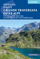
Wandelgids Italy's Grande Traversata delle Alpi GTA | Cicerone

0
Uitstekende beschrijving van de Grande Traversata della Alpi, een doorgaande meerdaagse wandeltocht door de Italiaanse ALpen aan de westkant. Goede routebeschrijving, schetsmatige kaarten, vol met nuttige en praktische informatie. A guidebook to Italy's Grande Traversata Delle Alpi (GTA) trek through the western Italian Alps. The 809km (503 mile) ...

Verkopers met dit product

Verkoper
Bezorging
Prijs
DeZwerver.nl logo
DeZwerver.nl
2,95
26,50

Anderen bekeken ook

Wandelatlas 1 Grande traversata delle Alpi - GTA Noord. | National Geographic
De GTA, Great Crossing of the Alps, is een wandelroute die de hele westelijke Alpenboog van Piemonte en Ligurië/Frankrijk verenigt en is opgedeeld in een dicht netwerk van paden en tussenstops. De totale route van de GTA vormt een route van ongeveer 1000 km, een geweldige tocht in de bergen van de noordwestelijke grens van Italië.   De bundel bevat: - 315 km parcours - 21 etappes - 8 varianten - 13.000 m hoogte - Altimetrische profielen - Gedetailleerde cartografie schaal 1: 25 000 - De geschiedenis en geografie van de route. La collaborazione tra Libreria Geografica e National Geographic per la realizzazione del volume sulla Grande Traversata delle Alpi, parte nord, che accompagna gli amanti del trekking lungo magnifici sentieri per riscoprire la bellezza delle Alpi. La Grande Traversata delle Alpi è un itinerario escursionistico che unisce tutto l'arco alpino occidentale nella regione Piemonte e si articola su una fitta rete di sentieri e di posti tappa. 1000 chilometri di sentieri,…
18,95
Wandelgids Trekking in the Alps | Cicerone
All the rich scenic diversity for which the Alps are renowned is celebrated here, while the 20 treks described include well-known classics as well as newly-created multi-day routes. The eight talented writers and photographers brought together to produce this book are among the most experienced of Alpine trekkers. Between them they have explored every corner of Europe’s premier mountain range, written dozens of guides and, in some cases, led trekking holidays there in order to share their enthusiasm for the Alps with other walkers. And that is the prime motivation for Trekking in the Alps – an inspiration and a celebration of the very best of these mountains. Best-known treks Tour of Mont Blanc; Tour of the Matterhorn; Tour of Monte Rosa; Walker’s Haute Route; Tour of the Jungfrau Region; Tour of the Vanoise; Dolomites AV 1 & 2 Longer trans-Alpine treks GR5 (Lake Geneva to Nice); Eastern Alps E5; Italian Alps GTA; Traverse of the Slovenian Alps For the Alpine adventurer Alpine Pass Ro…
28,95
Wandelatlas 3 Grande traversata delle Alpi - GTA Zuid | National Geographic
De GTA, Great Crossing of the Alps, is een wandelroute die de hele westelijke Alpenboog van Piemonte en Ligurië/Frankrijk verenigt en is opgedeeld in een dicht netwerk van paden en tussenstops. De totale route van de GTA vormt een route van ongeveer 1000 km, een geweldige tocht in de bergen van de noordwestelijke grens van Italië.   De bundel bevat: - 478 km parcours - 26 etappes - 7 varianten - 57.000 m hoogte - Altimetrische profielen - Gedetailleerde cartografie schaal 1: 25 000 - De geschiedenis en geografie van de route. Circa 1000 chilometri di sentiero, divisi in oltre 60 tappe, che attraversano le Alpi Occidentali sino a raggiungere il mare di Ventimiglia. Un saliscendi da una valle all'altra che attraversa piccoli paesi e alpeggi e permette di scoprire non solo culture alpine diverse, dai Walser ai Brigaschi, ma di ammirare molteplici paesaggi, dalle colline fino alle aree perennemente coperte di neve. Un'avventura e una sfida per gli escursionisti che inevitabilmente si inna…
18,95
Wandelgids - Pelgrimsroute Via Francigena part 2 | Cicerone
Guidebook to the Via Francigena pilgrim route from Lausanne to Lucca. Starting at Lake Geneva (Lac Léman), the 725km route crosses the Alps at historic Great Saint Bernard Pass, descends the Po Valley, then climbs to cross the Cisa Pass into Tuscany. Described in 32 stages, with information on facilities and pilgrim hostels.   Seasons Suitable for walking in spring, summer and autumn. The Great Saint Bernard Pass is fully open to hikers only in August and September.   Centres Lausanne, Martigny, Great Saint Bernard Pass, Aosta, Ivrea, Vercelli, Pavia, Piacenza, Pontremoli, Pietrasanta, Lucca.   Difficulty Each stage is graded for difficulty (1-4). A few mountainous stages include steep and slippery slopes. No special gear is required to walk the Via Francigena in season, but off-season crossings of the Great Saint Bernard Pass require winter mountain gear and careful attention to changing mountain conditions.   Must See Dazzling Lake Geneva, the 1500-year-old Abbey of Sai…
24,95
Wandelgids Grande Traversata delle Alpi Teil 2: Der Süden | Rotpunktverlag
Goede wandelgids van deze specifieke wandelroute GTA in de Italiaanse alpen. Auf der GTA lernt man spielerisch, Landschaften zu »lesen«, erkennt Spuren menschlicher Aktivitäten, wo auf den ersten Blick nur »Wildnis« zu sein scheint. Der Weitwanderweg »Grande Traversata delle Alpi/GTA«, der Anfang der 1980er-Jahre angelegt worden ist, führt durch die gesamten piemontesischen Alpen von den Walliser Alpen im Norden bis zu den ligurischen Alpen im Süden. Dabei quert er fast immer Alpentäler, deren Bevölkerung dramatisch zurückgeht. Die GTA ist inzwischen vom früheren Geheimtipp zu einem der bekanntesten Beispiele für einen »sanften Tourismus« geworden: Den Einheimischen vor Ort bringt sie direkte Verdienstmöglichkeiten, ihren Besuchern ermöglicht sie ein Verständnis der Alpen als Natur- und Kulturlandschaft, wie es in andern Alpenregionen kaum noch möglich ist. Die beiden Führer erschienen zum ersten Mal im Jahr 1986 und 1989 und liegen jetzt in vierter, vollständig überarbeiteter und ak…
27,95
Wandelatlas 2 Grande traversata delle Alpi - GTA Centro | National Geographic
De GTA, Great Crossing of the Alps, is een wandelroute die de hele westelijke Alpenboog van Piemonte en Ligurië/Frankrijk verenigt en is opgedeeld in een dicht netwerk van paden en tussenstops. De totale route van de GTA vormt een route van ongeveer 1000 km, een geweldige trekking in de bergen van de noordwestelijke grens van Italië.   De bundel bevat: - 418 km parcours - 22 etappes - 5 varianten - 58.000 m hoogte - Altimetrische profielen - Gedetailleerde cartografie schaal 1: 25 000 - De geschiedenis en geografie van de route.
18,95
Wandelgids Grande Traversata delle Alpi Teil 1: Der Norden | Rotpunktverlag
Goede wandelgids van deze specifieke wandelroute GTA in de Italiaanse alpen. 26 Etappen plus 8 Zugangsetappen vom Wallis ins Anzasca-Tal Gute Adressen für Übernachtung und Verpflegung Routenskizzen und Übersichtskarte Quereinstiege und Überbrückungen mit öffentlichen Verkehrsmitteln Vertiefende Hintergrundinformationen zu Land und Leuten Auf der GTA lernt man spielerisch, Landschaften zu »lesen«, erkennt Spuren menschlicher Aktivitäten, wo auf den ersten Blick nur »Wildnis« zu sein scheint. Der Weitwanderweg »Grande Traversata delle Alpi/GTA«, der Anfang der 1980er-Jahre angelegt worden ist, führt durch die gesamten piemontesischen Alpen von den Walliser Alpen im Norden bis zu den ligurischen Alpen im Süden. Dabei quert er fast immer Alpentäler, deren Bevölkerung dramatisch zurückgeht. Die GTA ist inzwischen vom früheren Geheimtipp zu einem der bekanntesten Beispiele für einen »sanften Tourismus« geworden: Den Einheimischen vor Ort bringt sie direkte Verdienstmöglichkeiten, ihren Bes…
26,95
Wandelgids Trekking the Karnischer Höhenweg | Cicerone
Uitstekende wandelgids van deze mooie route. goed beschreven met veel praktische informatie om de route te kunnen lopen, inclusief redelijke kaarten This guidebook describes the Karnischer Höhenweg, a 169km long-distance walk through the beautiful Carnic Alps which straddle the border between Austria and Italy. Following a high Alpine trail along the main ridge, the route is clearly waymarked and requires a reasonable level of fitness, a sense of adventure and a head for heights, but no special equipment or technical expertise. It can be walked between mid-July and the end of September and takes up to a fortnight, though it is possible to devise shorter itineraries taking in the highlights. The guide describes the full route of the Karnischer Höhenweg from Arnbach, near Sillian, to Arnoldstein, near Villach, and includes plenty of practical information to help you prepare for the walk. Each stage features comprehensive route description, clear mapping and fascinating insights into th…
22,50
Wandelgids Walking in Zermatt and Saas-Fee | Cicerone
Wandelgids met dagtochten: goed beschreven met veel praktische informatie om de route te kunnen lopen, inclusief redelijke kaarten. Enorm veel keus in een groot gebied! Guidebook describing 50 varied walks in the Valais region in the heart of the Swiss Alps. The graded day walks based around the popular resort towns of Zermatt and Saas-Fee explore the Mattertal and Saastal valleys and the surrounding mountains. Ranging from 4 to 18km, the easily accessible routes make use of the area's extensive network of well-made mountain paths and its lift system. There are walks here to suit all tastes, from low-level lake walks or easy strolls up to mountain restaurants, through to serious mountain outings on steep and rocky trails. Distance, walking time and difficulty are shown for each route, and the detailed route description is accompanied by clear mapping.   Dominated by 4000m the giants, the Matterhorn and Monte Rosa, this is a land of contrasts, with snow-capped mountains and glaciers ab…
23,95
Wandelgids The Swiss Alps | Cicerone
  The Swiss Alps are home to the highest and most spectacular mountains in Western Europe. This stunning guidebook describes each mountain area throughout Switzerland – the peaks, passes, valleys and bases – to help you identify the best destinations to plan your trip.   Questions such as ‘Where to walk, climb or ski?’, ‘What multi-day treks are available’ and ‘Where do they go?’, ‘Where are the mountain huts, what are their facilities, which peaks do they serve?’ And where are the most suitable valley bases?’ – all these and more are addressed in detail in this essential guidebook.   The Swiss Alps does not give detailed route directions but information is given about all the guides and maps available for every region.   The Swiss Alps by Kev Reynolds is the third book in Cicerone’s World Mountain Ranges series, which include The Pyrenees and Scotland.   descriptions of all the Swiss Alps, area-by-area from the Chablais Alps in the south west to the Silvretta in the north east classi…
34,95

Klanten-reviews van Wandelgids Italy's Grande Traversata delle Alpi GTA | Cicerone

Er zijn nog geen beoordelingen voor dit productBen jij de eerste die een review plaatst?

Meer over Wandelgids Italy's Grande Traversata delle Alpi GTA | Cicerone

Productomschrijving

Uitstekende beschrijving van de Grande Traversata della Alpi, een doorgaande meerdaagse wandeltocht door de Italiaanse ALpen aan de westkant. Goede routebeschrijving, schetsmatige kaarten, vol met nuttige en praktische informatie.

A guidebook to Italy's Grande Traversata Delle Alpi (GTA) trek through the western Italian Alps. The 809km (503 mile) route is presented in 55 stages with each stage ranging from 7-26km (4-16 miles). Beginning at the Nufenen pass at the Swiss border the route traverses the Lepontine, Pennine, Graian, Cottian and Maritime Alps to finish at Ventimiglia on the Mediterranean coast. With nearly 60,000m of ascent this route is suitable for fit and experienced alpine trekkers. This guidebook contains route description and 1:00,000 mapping for each stage as well as information on the region's history, culture and wildlife. Accommodation, facilities and public transport information is also given to help with trek planning. Italy's western Alps is an area of high mountain passes, sparkling lakes, clean air, and alpine meadows rich in wildflowers. With a network of paths that enabled travel long before the motor car, the region is ideally suited to exploring on foot. From Switzerland to the Mediterranean, the GTA enables the visitor to travel the old ways through the mountains, hearing the stories, sampling the regional specialties in food and wine, and experiencing the famously warm welcome of the Italian people.

Content:

Introduction
The GTA Trek
Italy’s Western Alps
Piedmont
Walking the GTA
When to Go
Getting There
Local Transport
How to Use this Guide
Dos and Don’ts
Emergencies
Waymarking and Maps
What to Take
Accommodation
Telephones
Food and Drink
Vegetation
Wildlife

GTA Route Description
Part I: The Ligurian and Maritime Alps
Part II: The Cottian Alps
Part III: The Graian Alps
Part IV: The Pennine Alps

Route Summary

Appendix I: Tourist Information
Appendix II: Main Peaks along the GTA
Appendix III: Italian–English Glossary
Appendix IV: Further Reading


Productinformatie

    Verken gerelateerde categorieën

    Webshop.nl maakt gebruik van cookies. Ga je verder op onze website, ga dan akkoord met het plaatsen van cookies en de verwerking van deze data door ons en vermelde partners.