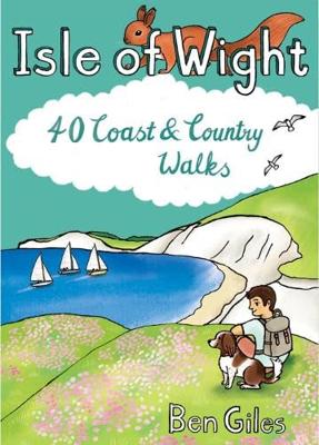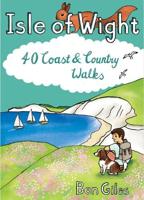
Wandelgids Isle of Wight : 40 Coast and Country Walks | Pocket Mountains

0
The Isle of Wight in the English Channel is England's largest island, separated from the mainland by the Solent but easily and quickly accessible from the south coast. Designated a UNESCO Biosphere Reserve, the mild climate and slower pace of life has long attracted holiday-makers and curious walkers who come to explore the island's rolling chalkl...

Verkopers met dit product

Verkoper
Bezorging
Prijs
DeZwerver.nl logo
DeZwerver.nl
2,95
9,95

Anderen bekeken ook

Wandelgids Isle of Wight : 40 Coast and Country Walks | Pocket Mountains
The Isle of Wight in the English Channel is England's largest island, separated from the mainland by the Solent but easily and quickly accessible from the south coast. Designated a UNESCO Biosphere Reserve, the mild climate and slower pace of life has long attracted holiday-makers and curious walkers who come to explore the island's rolling chalkland hills, peaceful woodland paths and sandy beaches and coves. The 40 walks in this volume make the most of the island's well-maintained trails - which include some of the most celebrated clifftop walks in southern England - as well as many lesser-known gems waiting to be discovered on this Treasure Island.  
9,95
Wandelgids Pembrokeshire : 40 Coast and Country Walks | Pocket Mountains
Handige compacte wandelgids met 40 dagwandelingen. Deze gids bevat kleine kaartjes en leuke uitgebreide informatie over wat er langs de route te zien is. Goede wandelkaarten zijn echter we noodzakelijk voor deze tochten: de Ordnance Survey explorer maps of Landanger maps zijn zeer geschikt.     As the home of Britain's one and only national coastal park, Pembrokeshire is rightly famed for its marine wildlife, unspoilt beaches, towering cliffs and charming harbours. Inland, however, you will also find ancient woodlands and rolling hills, as well as archaeological mysteries and crumbling castles which suggest that this peaceful part of Wales has a far more turbulent past.The 40 moderate walks in this volume from award winning publisher Pocket Mountains, explore the stunning coastline as well as the heartland of the county, with several routes making use of sections of established long-distance walking trails.  
10,95
Wandelgids Suffolk : 40 Coast and Country Walks | Pocket Mountains
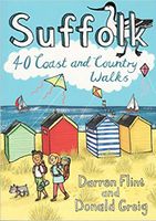
Handige compacte wandelgids met 40 dagwandelingen. Deze gids bevat kleine kaartjes en leuke uitgebreide informatie over wat er langs de route te zien is. Goede wandelkaarten zijn echter we noodzakelijk voor deze tochten: de Ordnance Survey explorer maps of Landanger maps zijn zeer geschikt.     Suffolk has long been a place of retreat, somewhere to escape to, far from everyday life. It may have its busier town centres, but in the main Suffolk remains a rural area of enormous variety , from heather covered heathland to softly rolling hills, long shingle spits to genteel coastal enclaves and kiss-me-quick seaside resorts. Whether you are looking for a morning hike or an afternoon stroll, Darren Flint and Donald Grieg's hand picked selection of 40 walks is guaranteed to fit the bill - or the boot.   Suffolk boasts 5,600km of public rights of way; take your pick, put your best foot forward and discover this most gentle of English counties.
10,95
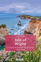
Reisgids Slow Travel Isle of Wight | Bradt Travel Guides
Een bijzondere serie van Bradt guides, waarin een gedeelte van Engeland uitgebreid beschreven wordt. Met veelv aandacht voor kleine details die je niet ao gauw elders zult vinden. Naast de beschrijvende informatie vind je ook een schat aan praktische informatie als accommodatie-adressen of leuke pubs. Een aanrader! This brand-new guide to the Isle of Wight forms part of Bradt's top-selling, award-winning series of Slow travel guides to UK regions. Written by expert author and journalist Mark Rowe, who has visited the island over 30 times since first spending childhood holidays there, it is the perfect companion to help you get the most out of your visit, replete with not just all the practical information you could need, but also all the descriptive detail, anecdote and insider tips to make time spent there truly enjoyable and memorable. The Isle of Wight is an island that is astonishingly - and unexpectedly - rich in food producers, wildlife, natural beauty, history, archaeology and …
22,50
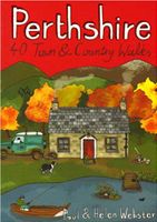
Wandelgids Perthshire : 40 Town and Country Walks | Pocket Mountains
Handige compacte wandelgids met 40 dagwandelingen. Deze gids bevat kleine kaartjes en leuke uitgebreide informatie over wat er langs de route te zien is. Goede wandelkaarten zijn echter we noodzakelijk voor deze tochten: de Ordnance Survey explorer maps of Landanger maps zijn zeer geschikt.     Perthshire is at the very heart of Scotland and one of the most popular regions for visitors, offering a variety of Highland and Lowland landscapes with some of the most scenic and accessible countryside for shorter walks as well as evidence of its rich history at every turn. "Perthshire 40 Town and Country Walks" features traditional tourist hubs, such as Pitlochry, Dunkeld and Killin (with its historical connections to the county), as well as countryside around Blairgowrie, Crieff and Aberfeldy, finishing up at the Fair City of Perth and nearby Kinross.  
10,95
Wandelgids Isle of Skye | Pocket Mountains
The Isle of Skye (or Ant-Eilean Sgitheanach in its native Gaelic tongue) occupies an almost mythical place in the minds of many Scots. Romantic castles, magnificent sea-scapes, the alpine peaks of the Cuillin Ridge, marching pipe bands, scattered white crofters' cottages and a bloody history; the island has all these and more. This book features 40 moderate walks that take in much of this celebrated landscape, but reveal hidden gems too.   In spite of its popularity Skye is still rich in undiscovered treasures, from coastal caves and arches, ruined villages cruelly cleared of their inhabitants, to fossilised dinosaur footprints and a rich array of wildlife. Written by Skye residents Paul and Helen Webster, these walks will reveal both the wild and gentler sides of this dramatic landscape.   Plaatsen in het boekje An Aird, An Corran, Ardnish, Armadale, Arnish, Bearreraig Bay, Bioda Buidhe, Boreraig, The Braes, Broadford, Brochel Castle, Brothers' Point, Burma Road, Caisteal Maol, Calum…
10,95
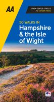
Wandelgids 50 Walks in Hampshire and the Isle of Wight | AA Publishing
Uitstekende wandelgids met een aantal dagtochten tussen de 5 en 13 kilometer. Niet heel erg lang dus, maar wel op de mooiste plekken en goed beschreven en prima kaartmateriaal.   Walking is one of Britain’s favourite leisure activities and this guide features a variety of mapped walks to suit all abilities. The book features all the practical detail you need, accompanied by fascinating background reading on the history and wildlife of the area, and clear mapping for ease of use. Every route has been colour coded according to difficulty. All walks are annotated with local points of interest and places to stop for refreshments. Each walk is given a summary of distance, time, gradient, level of difficulty, type of surface and access, landscape, dog friendliness, parking and public toilets.
19,95
Wandelkaart Isle of Wight Walking Map | Heritage House
Produced in co-operation with Visit Isle of Wight using Ordnance Survey cartography under licence, this second edition of our double-sided walking map shows all the major rights of way across the Island together with 16 colour-coded long distance walks. Fully checked on foot by a local walker, and showing all the relevant footpath numbers, these include the popular coastal path broken into six manageable sections; Yar River Trail; Worsley Trail; Warrior Trail; Bembridge Trail; Hamstead Trail; Nunwell Trail; Stenbury Trail; Freshwater Way; Tennyson Trail; and the Shepherd’s Trail.   For each walk a choice of bus stops and car parks are shown at each end of the route as well as along the way, enabling walkers to plan their journeys. The Southern Vectis bus route map is also included together with a range of other useful information including pubs and cafes, viewpoints, ferry routes, visitor attractions and walker-friendly accommodation. 
10,50
Wegenkaart - landkaart Pocket Map Isle of Wight | Collins
Handzame wegenkaart voor  Isle of Wight. Handy little full-colour map of the Isle of Wight. Detailed mapping and tourist information of the whole island.   With its stunning sea views and beautiful beaches, the Isle of Wight has a distinct identity. Discover this unique area with this handy pocket map.   Main features of this map include:   Clear mapping at a scale of 2.3 miles to 1 inch / 1.5 km to 1 cm Main tourist attractions located and described Places to stay, cafes/restaurants, golf courses are all highlighted on the map Essential travel information Index to places of interest and place names Essential for those planning a trip around the Isle of Wight.
7,95
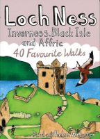
Wandelgids Loch Ness, Inverness, Black Isle and Affric | Pocket Mountains
Handige compacte wandelgids met 40 dagwandelingen. Deze gids bevat kleine kaartjes en leuke uitgebreide informatie over wat er langs de route te zien is. Goede wandelkaarten zijn echter we noodzakelijk voor deze tochten: de Ordnance Survey explorer maps of Landanger maps zijn zeer geschikt.   A guide to 40 favourite walks around Loch Ness, Inverness, Black Isle and Glen Affric. Loch Ness, with its legendary monster, is the most famous of all lochs. It holds more water than all the lakes of England and Wales combined and the countryside around it features an equally great variety of walks, with more waymarked trails and easy routes suitable for families than many other parts of the Highlands. Further north lies the magnificent Glen Affric - Scotland's most beautiful glen.   This is a wonderful area of the Highlands for walkers, having the highest mountains north of the Great Glen but also some splendid lower-level and forest walks. To the east is the fertile Black Isle, packed with cha…
10,95

Klanten-reviews van Wandelgids Isle of Wight : 40 Coast and Country Walks | Pocket Mountains

Er zijn nog geen beoordelingen voor dit productBen jij de eerste die een review plaatst?

Meer over Wandelgids Isle of Wight : 40 Coast and Country Walks | Pocket Mountains

Productomschrijving

The Isle of Wight in the English Channel is England's largest island, separated from the mainland by the Solent but easily and quickly accessible from the south coast. Designated a UNESCO Biosphere Reserve, the mild climate and slower pace of life has long attracted holiday-makers and curious walkers who come to explore the island's rolling chalkland hills, peaceful woodland paths and sandy beaches and coves. The 40 walks in this volume make the most of the island's well-maintained trails - which include some of the most celebrated clifftop walks in southern England - as well as many lesser-known gems waiting to be discovered on this Treasure Island.  

Productinformatie

    Verken gerelateerde categorieën

    Webshop.nl maakt gebruik van cookies. Ga je verder op onze website, ga dan akkoord met het plaatsen van cookies en de verwerking van deze data door ons en vermelde partners.