webshop.nl
Categorieën
  Sluiten

Meer Cicerone
Meer Cicerone in Literatuur boeken

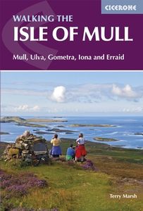
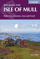
Wandelgids Isle of Mull | Cicerone

0
Uitstekende wandelgids voor dit uitdagende wandelgebied in Schotland. Met goede topografische deelkaarten. Guidebook describing over 40 walking routes on Scotland's beautiful Isle of Mull, as well as neighbouring Ulva, Gometra, Iona and Erraid. Walks range from 2 to 16 miles and from short circuits to demanding mountain traverses, but without techn...

Webshops met dit product

Webshop
Bezorging
Prijs

Anderen bekeken ook

Wandelgids Isle of Mull | Cicerone
Uitstekende wandelgids voor dit uitdagende wandelgebied in Schotland. Met goede topografische deelkaarten. Guidebook describing over 40 walking routes on Scotland's beautiful Isle of Mull, as well as neighbouring Ulva, Gometra, Iona and Erraid. Walks range from 2 to 16 miles and from short circuits to demanding mountain traverses, but without technical difficulties. The Isle of Mull is wild, rugged and great for wildlife spotting. Activities walking   Seasons walking possible throughout the year, although the winter months call for winter mountaineering skills and equipment on the higher mountains   Centres Tobermory; smaller settlements at Dervaig, Salen, the ferryport Craignure, Bunessan and Ffionphort, the ferry point for Iona; accommodation plentiful, but camp sites and budget hostels few and far between   Difficulty few technical difficulties; walks cross rough, trackless terrain requiring walkers to be properly equipped and able to use map and compass   Must See Mull's only Munro…
20,95
Wandelgids Isle of Mull, Coll and Tiree | Hallewell Publications
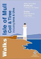
Rewalked and revised in 2015, Walks Isle of Mull, Coll & Tiree including Iona & Ulva includes walks on the Inner Hebridean island of Mull and the nearby islands. Mull is typified by spectacular coastal scenery and fine hill climbs, while the other islands are lower and gentler in character. The 29 walks featured range from 1 mile to 10.5 miles (1.6-17km). Routes on Mull include: Ben More, Carsaig Arches and two walks from Tobermory. The guide also features walks on the marvellous island of Ulva, two fine walks on Iona plus routes on the rugged island of Coll and the wide sand beaches of Tiree. Now on its 3rd edition, this guide is part of a popular series of A6 pocket walking guides which describe routes which are suitable for walkers of all abilities and to suit all tastes. Route descriptions are accompanied by 2-colour sketch maps. The guides are illustrated with line illustrations, and will provide walkers with a good introduction to what each area covered has to offer.
5,95
Wandelgids The Hebrides - De Hebriden Schotland | Cicerone
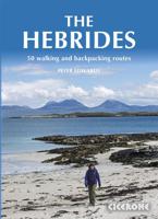
This inspirational guide offers 50 varied hiking and backpacking routes on the Scottish Hebrides islands, set out in a large guidebook to be savoured. The hikes highlight all the very best landscapes and scenery to be found on the spectacular islands of the Hebrides, a wonderland for adventurous walkers to return to time and time again. Inspirational guidebook to walking in Scotland's Hebrides islands. 50 adventurous walks on well-known and remote islands; from Syke, Mull, Rum, the Uists and Barra, Ulva, Iona, Eigg and Muck and more besides. Most of the walks provide a full day for experienced walkers, with a few multi-day adventures as well as some shorter routes. The terrain is often rough, rugged and pathless, while waymarking and public transport can, in many places, be hard to find. The challenge of wild walking, and the self-reliance needed to discover the best of the Hebrides, make the islands all the more appealing for adventurous walkers.   The walks also include Hebrides clas…
28,50
Wandelgids Isle of Mull, Coll and Tiree | Hallewell Publications
Rewalked and revised in 2015, Walks Isle of Mull, Coll & Tiree including Iona & Ulva includes walks on the Inner Hebridean island of Mull and the nearby islands. Mull is typified by spectacular coastal scenery and fine hill climbs, while the other islands are lower and gentler in character. The 29 walks featured range from 1 mile to 10.5 miles (1.6-17km). Routes on Mull include: Ben More, Carsaig Arches and two walks from Tobermory. The guide also features walks on the marvellous island of Ulva, two fine walks on Iona plus routes on the rugged island of Coll and the wide sand beaches of Tiree. Now on its 3rd edition, this guide is part of a popular series of A6 pocket walking guides which describe routes which are suitable for walkers of all abilities and to suit all tastes. Route descriptions are accompanied by 2-colour sketch maps. The guides are illustrated with line illustrations, and will provide walkers with a good introduction to what each area covered has to offer.
5,95
Wandelgids Walking The Munros Vol 1 Southern, Central and Western High
Uitstekende wandelgids van het zuiden, midden en westen van de Schotse Hooglanden. Goed beschreven met veel praktische informatie om de route te kunnen lopen, inclusief redelijke kaarten. Guidebook to walking the Munros in southern, central and western Highlands. Describes 69 challenging routes across 139 of the iconic 3000ft+ mountains covering areas such as Glencoe, Bridge of Orchy and Mull. Includes routes up Ben More, Ben Alder, Ben Lomond and Ben Nevis, the highest mountain in the British Isles. Volume 1 of two guidebooks.   Seasons The guide is intended for summer hillwalkers (usually April/May to October in Scotland). In winter conditions the routes become more serious mountaineering expeditions requiring appropriate skills, equipment and experience.   Centres Arrochar, Crianlarich, Killin, Pitlochry, Tyndrum, Glencoe, Fort William, Spean Bridge, Dalwhinnie, Braemar, Glenshee   Difficulty Most of the Munros are straightforward walks but some involve ridge walking, scr…
20,95
Wandelgids Walking on Arran | Cicerone
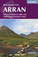
Uitstekende wandelgids voor dit uitdagende wandelgebied in Schotland. Dagtochten. The 45 walking routes in this Isle of Arran guidebook range from easy 3km (2 miles) nature trails to long arduous mountain routes with scrambles (up to 32km) providing thorough coverage of Arran, including the ascent of Goatfell and nearby Holy Isle. Most routes are 10km to 15km long but many give opportunities to create longer cross island walks. This guidebook presents a selection of 45 day walks on the popular and accessible Isle of Arran. The routes are between 2 miles (3km) and 20 miles (32km) in length, from easy waymarked forest trails to more arduous mountain walks, exposed ridge routes and scrambles. There are linear and circular walks to choose from, and opportunities to link routes together and create longer walks across the length and breadth of the island. With highlights including Goatfell, Beinn Tarsuinn, the Sannox Horseshoe, Glen Rosa and the Cock of Arran, there's something here to suit …
23,95
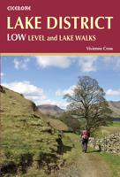
Wandelgids Lake District: Low Level and Lake Walks | Cicerone
The Lake District offers some of the best walking in the British Isles, and contained within this book are 30 of the best low-level walks within the Lake District. This is an area that is justly famed for its magnificent scenery: from serene lakes and wooded valleys to spectacular hills and hidden tarns. But you don’t have to climb its highest mountains to appreciate this beauty; some of the region’s best walking can be enjoyed in the valleys and on the low fells.   Those who are new to walking in this much beloved corner of England will find gentle strolls, such as the circuit of Buttermere, as well as walks that provide a straight forward introduction to the low fells, such as High Rigg.   With her intimate knowledge of the National Park, Vivienne Crow knows just where to go to experience the best of the Lake District. In this book, she guides walkers to well-known beauty spots as well as some hidden gems – with background information on both the human and natural history adding to t…
14,50
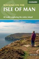
Wandelgids The Isle of Man | Cicerone
Wandelgids met 40 wandelingen op het eiland Man dat tussen Engeland en Ierland in ligt. De wandelingen variëren van zo'n 2 tot 22 km. Kaartmateriaal voldoende. Engelstalig. A guidebook to 40 walking routes on the Isle of Man. The varied selection of day walks, which range from 1 to 14 miles long (2 and 22km) take in the best scenic routes right across this delightful island. Many routes can be combined to create longer more ambitious walks.   The Isle of Man offers the walker a wonderfully diverse range of landscapes within a relatively compact island setting, and the routes reflect this diversity - scale the highest point Snaefell (620m), cross wide-open moorlands, drift over beaches and climb coastal clifftops. The assortment provides walkers with fantastic trails, along with detail on the wildlife, wild flowers, unique history and points of interest encountered. Alongside detailed route descriptions and OS 1:50,000 maps (blown up to 1:40,000 for greater clarity), there is plenty …
20,95

Klanten-reviews van Wandelgids Isle of Mull | Cicerone

Er zijn nog geen beoordelingen voor dit productBen jij de eerste die een review plaatst?

Meer over Wandelgids Isle of Mull | Cicerone

Productomschrijving

Uitstekende wandelgids voor dit uitdagende wandelgebied in Schotland. Met goede topografische deelkaarten. Guidebook describing over 40 walking routes on Scotland's beautiful Isle of Mull, as well as neighbouring Ulva, Gometra, Iona and Erraid. Walks range from 2 to 16 miles and from short circuits to demanding mountain traverses, but without technical difficulties. The Isle of Mull is wild, rugged and great for wildlife spotting. Activities walking   Seasons walking possible throughout the year, although the winter months call for winter mountaineering skills and equipment on the higher mountains   Centres Tobermory; smaller settlements at Dervaig, Salen, the ferryport Craignure, Bunessan and Ffionphort, the ferry point for Iona; accommodation plentiful, but camp sites and budget hostels few and far between   Difficulty few technical difficulties; walks cross rough, trackless terrain requiring walkers to be properly equipped and able to use map and compass   Must See Mull's only Munro, Ben More, and a fine cast of lower heights; great glens for linear walks as good as anything on mainland Scotland; spectacular coastline; wildlife

Productspecificaties

Artikelnummer(s)
Brand
Cicerone

Verken gerelateerde categorieën

Webshop.nl maakt gebruik van cookies. Ga je verder op onze website, ga dan akkoord met het plaatsen van cookies en de verwerking van deze data door ons en vermelde partners.