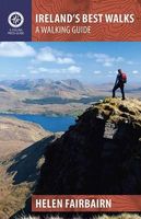
Wandelgids Ireland's Best Walks | The Collins Press

0
Duidelijke wandelgids van Ierland:  Goede praktische informatie en zeker voor de GPS wandelaar handig met vermelde waypoints. Kaarten zijn schetsmatig, maar er wordt verwezen naar de benodigde topografische kaarten van Ierland.  In a country richly endowed with wild mountain ranges, secluded valleys and untamed coastlines, the best natural landsca...

Verkopers met dit product

Webshop
Bezorging
Prijs
DeZwerver.nl logo
DeZwerver.nl
niet bekend
22,50

Anderen bekeken ook

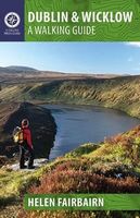
Wandelgids Dublin & Wicklow | The Collins Press
Duidelijke wandelgids van dit specifieke deel van Ierland. Goede praktische informatie en zeker voor de GPS wandelaar handig met vermelde waypoints. Kaarten zijn schetsmatig, maar er wordt verwezen naar de benodigde topografische kaarten van Ierland.  This guidebook describes the best walking routes in Dublin and Wicklow. From mountain landscape to scenic coastal paths, from woodland trails to challenging hill-walks, there are routes here for everyone. Trips vary from two-hour strolls to eight-hour treks, and are illustrated with sketch maps and colour photographs. This is an area of great scenic variety with countless hidden gems to discover - sheer cliffs, dramatic corries, secluded lakes and charming forests. As well as inspiring you to visit the region's natural attractions, the guide provides a host of practical and background information. Each route is prefaced with a quick-reference summary, and descriptions include detailed access notes and navigational guidance. Points of int…
22,50
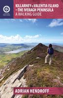
Wandelgids Killarney to Valentia Island - The Iveragh Peninsula | The Collins Press
Duidelijke wandelgids van dit specifieke deel van Ierland. Goede praktische informatie en zeker voor de GPS wandelaar handig met vermelde waypoints. Kaarten zijn schetsmatig, maar er wordt verwezen naar de benodigde topografische kaarten van Ierland.  The Iveragh Peninsula, the largest in southwest Ireland, stretches from Killarney to Bolus Head and attracts thousands of visitors annually. The Ring of Kerry coastal road winds along its fringes and sandstone peaks soar high above. It is a landscape of raw and stunning beauty from the lakes that fill the corries to the spectacular cliff scenery along its coast. There is no better way to explore this landscape than on foot. This book helps you do just that with routes ranging from a few hours to full-day walks. Explore Valentia Island, the majestic MacGillycuddy’s Reeks and sections of The Kerry Way. Go off the beaten track and explore the coast, hills and woodlands from Killarney to Cahersiveen to Kenmare. Each route is prefaced with a …
22,50
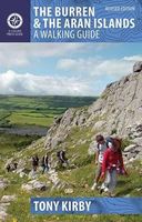
Wandelgids The Burren & the Aran Islands | The Collins Press
Duidelijke wandelgids van dit specifieke deel van Ierland. Goede praktische informatie en zeker voor de GPS wandelaar handig met vermelde waypoints. Kaarten zijn schetsmatig, maar er wordt verwezen naar de benodigde topografische kaarten van Ierland.  The Burren and the Aran Islands, with their unique combination of flora, fauna and landscape, are explored by large numbers of walkers annually. This is a revised guide to some of the best walking routes in the region, with lucid descriptions and additional information to enhance the walkers' enjoyment and appreciation of the place. From the rugged interior to spectacular coastal scenery, from challenging upland walks to shorter road and waterside excursions, this selection has something for everyone. Every part of the region is covered. Walks vary from two-hour strolls to the longer Burren Way, a six-hour walk from Lisdoonvarna to Ballyvaughan.   The author has put his considerable experience and detailed knowledge of the area to great …
22,50
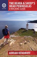
Wandelgids The Beara & Sheep´s Head Peninsulas | The Collins Press
Duidelijke wandelgids van dit specifieke deel van Ierland. Goede praktische informatie en zeker voor de GPS wandelaar handig met vermelde waypoints. Kaarten zijn schetsmatig, maar er wordt verwezen naar de benodigde topografische kaarten van Ierland.  The Beara and Sheep’s Head Peninsulas lie in the southwest of Ireland, pointed fingers of land wedged between the Kenmare River, Bantry Bay and Dunmanus Bay. They are peaceful, unspoiled peninsulas where the wild and largely untamed nature of the landscape immediately casts its magical spell. There is no better way to explore and experience this stunning landscape than on foot.   This guidebook describes some of the best walking routes in the area: from Dursey Island and Bear Island to the Caha and Shehy Mountains, from the forest trails of Glengarriff to the lakes of Glaninchiquin,and from the tip of the Sheep’s Head to the ridges of Peakeen and Seefin. The routes range from short hikes to longer treks, coastal and inland, something to …
22,50
Wandelgids Donegal, Sligo & Leitrim | The Collins Press
The northwest of Ireland provides a diversity of walks, from the wild, untamed landscape of Donegal to the gentler hills and green valleys of Sligo and Leitrim. This guidebook describes 30 walks of various difficulties, accompanied by quality photographs The northwest of Ireland provides a diversity of walks, from the wild, untamed landscape of Donegal, with its mountains, sea-cliffs and glens, to the gentler hills, green valleys and picturesque escarpments of Sligo and Leitrim. This guidebook describes 30 walks of various grades in this fascinating part of Ireland that has inspired poets, and is rich in folklore and history. Quality photographs and specially-drawn maps will inspire one to get the walking boots on and start exploring this majestic landscape. Since most routes are not signposted or way-marked, an up-to-date guidebook is essential. Walk descriptions also include material on the natural history, folklore, geology and place-names of the area.
22,50
Wandelgids Day Walks in the Yorkshire Dales | Vertebrate Publishing
Day Walks in the Yorkshire Dales is the fourth title in Vertebrate Publishing's series of compact and portable hillwalking guidebooks. This book showcases 20 circular walks in the Yorkshire Dales National Park, between 6 and 11 miles (10 and 17 kilometres) in length, suitable for hillwalkers of all abilities. The routes are split into three geographical areas - south, east, and north - and include walks to the Dales' most regarded beauty spots, such as Malham Cove, Gordale Scar, Brimham Rocks and Hardraw Force, as well as the trio of sought-after peaks Pen-y-ghent, Ingleborough and Whernside.   The author of this guidebook, Bernard Newman, is a freelance outdoor writer and photographer, and former editor of the internationally acclaimed Mountain magazine. A Yorkshire Dales local and graduate geologist, in his route descriptions he explores the incredible geology that has created the breathtaking scenery on show in the Dales. Each route in this guide is described with easy-to-follow di…
20,95
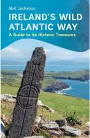
Wandelgids Ireland's Wild Atlantic Way | The Collins Press
Duidelijke wandelgids van dit specifieke deel van Ierland. Goede praktische informatie en zeker voor de GPS wandelaar handig met vermelde waypoints. Kaarten zijn schetsmatig, maar er wordt verwezen naar de benodigde topografische kaarten van Ierland.  The Wild Atlantic Way follows the magnificent west coast of Ireland, passing golden beaches, thrusting headlands and soaring sea cliffs. Renowned walking-guide author Helen Fairbairn explores the best walking routes of the region, recommending trips to uninhabited islands, coastal mountains and much more. Routes vary from two to six hours, and are illustrated with colour photos and detailed maps. Whatever your level of expertise, this comprehensive guide is all you need to discover the real wonders of the Wild Atlantic Way.
22,50
Wandelgids 2 Madeira Walks | Discovery Walking Guides
Engelstalige wandelgids Madeira, met uitgebreide beschrijvingen van wandelroutes, routekaartjes en praktische informatie zoals bussen en accommodatie. In dit tweede deel staan de wat uitdagendere routes. As a walker's paradise, Madeira has it all - majestic mountains, rugged coastline, ancient forests, a unique levada network and verdant flora; easy to see why so many walkers return year after year. In 2015 Madeira was voted the "World's Best Island Destination" by the World Travel Awards the final accolade from the previous two years when it was voted "Europe's Leading Island Destination". Quite an achievement, brought about largely by the substantial EU investment over the past decade in the improvement and development of the island's infrastructure and facilities.   One of the initiatives focused on improving and creating new walking trails which has resulted in Madeira now being regarded as one of Europe's top hiking destinations.To date, around thirty routes on Madeira have been …
19,95
Wandelgids - Pelgrimsroute Pilgrim Paths of Ireland | The Collins Press
The popularity of the Camino de Santiago has prompted renewed interest in pilgrim walks in Ireland. Our ancient network of sacred paths means there is no need to travel abroad to enjoy symbolic trails in the footsteps of generations past. Increasing numbers now follow ancient routes through captivating Irish scenery to such holy places as Glencolumbkille, Croagh Patrick, Lough Derg and Glendalough. John G. O'Dwyer has walked these pilgrim trails, from Slieve Mish in the northeast, where Christianity may have had its first dawning in Ireland, to Skellig Michael in the southwest, where the known world once ended. His well-received guide is now updated with five additional journeys of homage, including Kerry's Cnoc na dTobar and Wicklow's St Declan's Way. Each walk includes clear directions, the degree of difficulty, estimated time and a map. The paths are varied and suit a range of abilities, from casual ramblers to committed walkers.Whatever your beliefs, enjoy a sublime escape from th…
22,50
Wandelgids 100 outstanding British Walks | Ordnance Survey
Beschrijving van de 100 mooiste Pathfinder wandelingen in Engeland, Wales en Schotland. Uitstekende beschrijving van de route met een zeer duidelijke topografische kaart waarop de route is ingetekend.  This magnificent compendium of outstanding British walks brings together the finest selection of Pathfinder Walks in Britain s officially designated places of scenic beauty and historic interest: National Parks, Areas of Outstanding Natural Beauty, National Scenic Areas, Heritage Coast, National Trails and UNESCO World Heritage Sites. There are 100 walking gems in this collection, recommended by a group of experienced authors and guides. The walks span a range of distances and degrees of challenge and are organised by region with coverage across England, Wales and Scotland. 100 Outstanding British Walks is lavishly illustrated with stunning landscape photography and informative introductions to each of the walks. It is designed to be enjoyed at home, while the OS Maps app provides the p…
27,95

Klanten-reviews van Wandelgids Ireland's Best Walks | The Collins Press

Er zijn nog geen beoordelingen voor dit productBen jij de eerste die een review plaatst?

Meer over Wandelgids Ireland's Best Walks | The Collins Press

Productomschrijving

Duidelijke wandelgids van Ierland:  Goede praktische informatie en zeker voor de GPS wandelaar handig met vermelde waypoints. Kaarten zijn schetsmatig, maar er wordt verwezen naar de benodigde topografische kaarten van Ierland. 

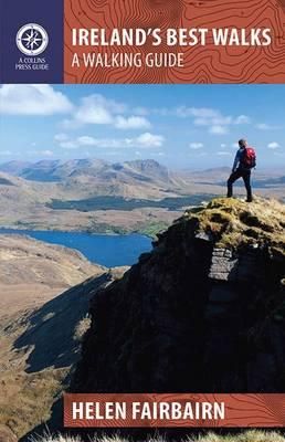
In a country richly endowed with wild mountain ranges, secluded valleys and untamed coastlines, the best natural landscapes can only be explored on foot. Here are over sixty of the greatest one-day walking routes in Ireland, varying from short strolls to full-day treks. Every part of the Republic and Northern Ireland is featured. From rugged peaks and chiselled ridge lines to towering sea cliffs and sheltered loughs, these routes take you past all the country’s finest scenery. Many of the routes are hill-walks, with clear descriptions of the country’s classic mountain ascents. Even seasoned hillwalkers will find challenging outings.   Each walk is illustrated with sketch maps and colour photos and is prefaced with a quick-reference summary and access notes. Route descriptions include clear navigational guidance to keep you on the right track.

Verken gerelateerde categorieën

Webshop.nl maakt gebruik van cookies. Ga je verder op onze website, ga dan akkoord met het plaatsen van cookies en de verwerking van deze data door ons en vermelde partners.