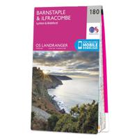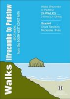
Wandelgids Ilfracombe to Padstow | Hallewell Publications

0
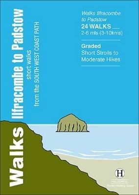
Walks Ilfracombe to Padstow features a selection of the best short walks from the section of South West Coast Path which runs between the towns of Ilfracombe in the north and Padstow in the south. The 24 walks featured range from 2 to 6 miles (3 - 10kms) and range from a short strolls to moderately testing hikes - along cliffs, through dunes, by s...

Verkopers met dit product

Webshop
Bezorging
Prijs
DeZwerver.nl logo
DeZwerver.nl
niet bekend
5,95

Anderen bekeken ook

Wandelgids Padstow to Falmouth | Hallewell Publications
Walks Padstow to Falmouth features a selection of the best short walks from the section of South West Coast Path which runs between the towns of Padstow in the north and Falmouth in the south. The 20 walks featured range from 1 to 9 miles (1.6 - 14.4kms) and range from a short strolls to moderately testing hikes - along cliffs, through dunes, by sandy beaches and muddy creeks. Highlights of the book include cliff walks from picturesque harbour at Padstow, a route from the popular town of St Ives, and a walk to Land's End - the most westerly point on the English mainland. This is a highly attractive area with a mass of good walks and the towns and villages along the coast make excellent bases for walking. Part of a popular series of A6 pocket walking guides which describe routes which are suitable for walkers of all abilities and to suit all tastes. Route descriptions are accompanied by 2-colour sketch maps. The guides are illustrated with line illustrations, and will provide walkers w…
5,95
Fietskaart 01 Cycling guides Cornwall | Goldeneye
Our maps are double-sided, printed on an A2 sheet with a concertina fold. This allows for easy folding and folding, and an ease of access to the mapping. The material is rain and tear-resistant. Our early maps were designed at the scale of 2 miles to 1 inch/1:126,720. The later designs along with digitalisation are 1: 100,000. We were encouraged by the Cycle Touring Club to convert our cartography toward the cycle market (to replace the out-of-print Bartholomew series). As time and the series progressed we have added more data: The National Cycle Network routes, Regional Routes, and Traffic-Free Family Routes, as and when they are developed. These routes are in addition to the Circular Routes Goldeneye Commissioned at the outset of our publishing schedule. We are also adding to new editions; bike shops, cycle hire, and tea rooms, along with the tourist attractions already featured. Our plan is to make available digital versions for cell phones and tablets and to update, on an annual b…
15,95
Fietskaart Cycling guides Exmoor - North Devon | Goldeneye
Scheur- en watervast foetskaart van Exmoor en Noord Devon met ingetekende fietsroutes.   Our maps are double-sided, printed on an A2 sheet with a concertina fold. This allows for easy folding and folding, and an ease of access to the mapping. The material is rain and tear-resistant. Our early maps were designed at the scale of 2 miles to 1 inch/1:126,720. The later designs along with digitalisation are 1: 100,000. We were encouraged by the Cycle Touring Club to convert our cartography toward the cycle market (to replace the out-of-print Bartholomew series). As time and the series progressed we have added more data: The National Cycle Network routes, Regional Routes, and Traffic-Free Family Routes, as and when they are developed. These routes are in addition to the Circular Routes Goldeneye Commissioned at the outset of our publishing schedule. We are also adding to new editions; bike shops, cycle hire, and tea rooms, along with the tourist attractions already featured. Our plan is to …
12,95
Wandelgids Pembrokeshire | Northern Eye Books
OS Map Books: Wales Coast Path: Pembrokeshire Coast Path Map Atlas | Ordnance Survey ‘Explorer’ Large-scale 1:25,000 maps for the Pembrokeshire Coast in compact book format | Pocket Atlas | Walking Wales | UK Long-Distance Trails | Hiking | Adventure   One of seven handy Ordnance Survey Map Books covering the entire 870 mile/1400 kilometre-long, world-class Wales Coast Path — from Chester in the north to Chepstow in the south.   Enjoy enhanced, large scale (1:25,000) Ordnance Survey Explorer mapping in compact atlas format with all the detailed mapping you need to walk the Pembrokeshire Coast section of the Wales Coast Path.   Continuous, full colour OS mapping covering the Wales Coast Path between Cardigan and Amroth. Contains extracts from large scale Explorer maps OL 35 and OL 36. The enhanced OS 1:25,000 maps are accurate, up-to-date and reliable. Additional map symbols show tea shops, cafes, extra parking, and public toilets.   A brief introduction to Pembrokeshire Coast includes…
17,50
Wandelgids Norfolk Coast Path - Peddars Way | Trailblazer Guides
The Norfolk Coast Path & Peddars Way cover 130-miles of walking trails. The Peddars Way runs through East Anglia from Knettishall Heath on the Norfolk/Suffolk border and follows a Roman road to Holme-next-the-Sea. From here it becomes the Norfolk Coast Path, hugging the beautiful Norfolk coastline through Holkham, Wells, Blakeney and Cley to Cromer before it rounds the shoulder of the county and continues along the superb beaches and crumbling cliffs to Mundesley, Sea Palling and Great Yarmouth, finishing just before the Suffolk border.   Includes: 77 large-scale walking maps - at just under 1: 20,000 (8cm or 3 and one eighth inches to 1 mile) our maps are bigger than even the most detailed walking maps currently available, with walking directions, tricky junctions, places to stay and eat, points of interest and walking times written onto the maps Text and maps in clear TWO-COLOUR style All standards of accommodation with reviews - campsites, B&Bs, hostels, hotels, bunkhouses Where to…
20,95
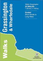
Wandelgids Grassington and Wharfedale | Hallewell Publications
The Yorkshire Dales National Park - an area of rolling green hills, dramatic limestone features and quaint villages - has five main dales (valleys). Walks Grassington & Wharfedale covers Wharfedale - containing the villages of Grassington and Kettlewell - plus the town of Skipton. In the north the walks run by the riverside or climb onto the grassy hills; in the south the rock changes from limestone to sandstone and there are routes through the narrow wooded valley north of Castle Bolton or onto the heather moors to either side. The 22 walks featured range from 0.5 miles to 8.5 miles (1-14km). Routes include: Buckden Loop, a circuit from Kettlewell via Starbotton and Moor End, Grassington to Burnsall, Bolton Abbey & The Strid and Skipton Woods. Part of a popular series of A6 pocket walking guides which describe routes which are suitable for walkers of all abilities and to suit all tastes. Route descriptions are accompanied by 2-colour sketch maps. The guides are illustrated with line …
5,95
Wandelgids Walks Isle of Man | Hallewell Publications
The Isle of Man is a Crown Dpendency in the Irish Sea, equidistant from the UK and Ireland and is a terrific walking destination. Though the island is only 32 miles/51km long, it contains a wealth of different landscapes and walking types (moorland hills, coastal cliffs, woodland, farmland, sand dunes and beaches). There is a good network of signposted paths including a 102 mile/164km coastal path (Raad ny Foillan) and handsome towns and villages besides. This new guide features walks ranging from 1.5 - 11 miles (2.5 - 18kms) - highlights include the climb up Snaefell and the sea cliffs of Bradda Head and Spanish Head. This guide is part of a popular series of A6 pocket walking guides which describe routes which are suitable for walkers of all abilities and to suit all tastes. Route descriptions are accompanied by 2-colour sketch maps. The guides are illustrated with line illustrations, and will provide walkers with a good introduction to what each area covered has to offer.
5,95
Wandelgids South Devon Coast | Northern Eye Books
Plymouth to Lyme Regis The ten walking routes featured here highlight the best short circular walks along the South Devon Coast section of the popular, 630-mile long South West Coast Path (SWCP).   Devon has been described as one of England’s most beautiful counties, its south coast encompassing everything from superb sandy beaches to soaring cliffs and tiny, secluded coves to sweeping bays. Meandering estuaries and narrow lanes wind to time-forgotten villages and fishing settlements, where flower-decked, thatched cottages and perhaps an inviting country pub cluster around an ancient church.   The five book series of ‘Top Ten Walks’ covers the whole of the SouthWest Coast Path. Each book explores the highlights along the way; showcasing its natural beauty, wildlife and heritage.   Once you’ve tasted what this section has to offer, you may be inspired to come back to tackle the complete trail.
10,95
Wandelgids Grasmere, Ambleside and Windermere | Hallewell Publications
Rewalked and revised in 2021, Walks Grasmere, Ambleside & Windermere features walks in The Lake District - the famous area of spectacular peaks and lakes in the north-west of England. This guide covers the central part of the area, which contains many of the most popular towns and villages in the area; not only those mentioned in the title, but also Hawkshead and Rydal. The guide contains walks from all the main centres and around the northern half of Lake Windermere and Grasmere. The 23 walks featured range from 1.5 miles to 9 miles (2.5-14.5km). Routes include: Helm Crag, Alcock Tarn, Great Langdale, Ambleside to Troutbeck, Orrest Head and Tilberthwaite. Last rewalked and updated 2014 - Walks Grasmere is part of a popular series of A6 pocket walking guides which describe routes which are suitable for walkers of all abilities and to suit all tastes. Route descriptions are accompanied by 2-colour sketch maps. The guides are illustrated with line illustrations, and will provide walkers…
5,95
Fietskaart 14 Cycling guides Suffolk | Goldeneye
To be confronted with the variety and complexity of the cycling routes, trails and paths in Suffolk can be a bewildering experience.  For it appears that the Suffolk County Council and the three District Councils are all trying hard to promote their areas. This is indeed encouraging for the growth of cycling, but it can be confusing.  Our purpose is to provide clear, easy to use and easy to follow, cycling maps, and to illustrate these in a comprehensive form.    Suffolk must be one of the most charming of counties to explore by bicycle. When Al Churcher delivered his routes to us at Goldeneye we couldn’t keep him quiet, such was his enthusiasm and wonder at Suffolk’s country lanes and byways. He has cycled all over the UK, Canada, Mallorca, New Zealand and Sicily, but Suffolk remained a firm favourite.    The inland scenery is not spectacular for the county’s main glory lies with its attractive villages; the local architecture jealously preserved from modern depredation. There is an …
15,95

Klanten-reviews van Wandelgids Ilfracombe to Padstow | Hallewell Publications

Er zijn nog geen beoordelingen voor dit productBen jij de eerste die een review plaatst?

Meer over Wandelgids Ilfracombe to Padstow | Hallewell Publications

Productomschrijving

Walks Ilfracombe to Padstow features a selection of the best short walks from the section of South West Coast Path which runs between the towns of Ilfracombe in the north and Padstow in the south. The 24 walks featured range from 2 to 6 miles (3 - 10kms) and range from a short strolls to moderately testing hikes - along cliffs, through dunes, by sandy beaches and muddy creeks. Highlights of the book include cliff walks around the lovely villages of Clovelly and Tintagel, with its dramatic ruined castle, and the sandy beaches at Woolacombe and Rock on the Camel Estuary. This is a highly attractive area with a mass of good walks and the towns and villages along the coast make excellent bases for walking.  

Verken gerelateerde categorieën

Webshop.nl maakt gebruik van cookies. Ga je verder op onze website, ga dan akkoord met het plaatsen van cookies en de verwerking van deze data door ons en vermelde partners.